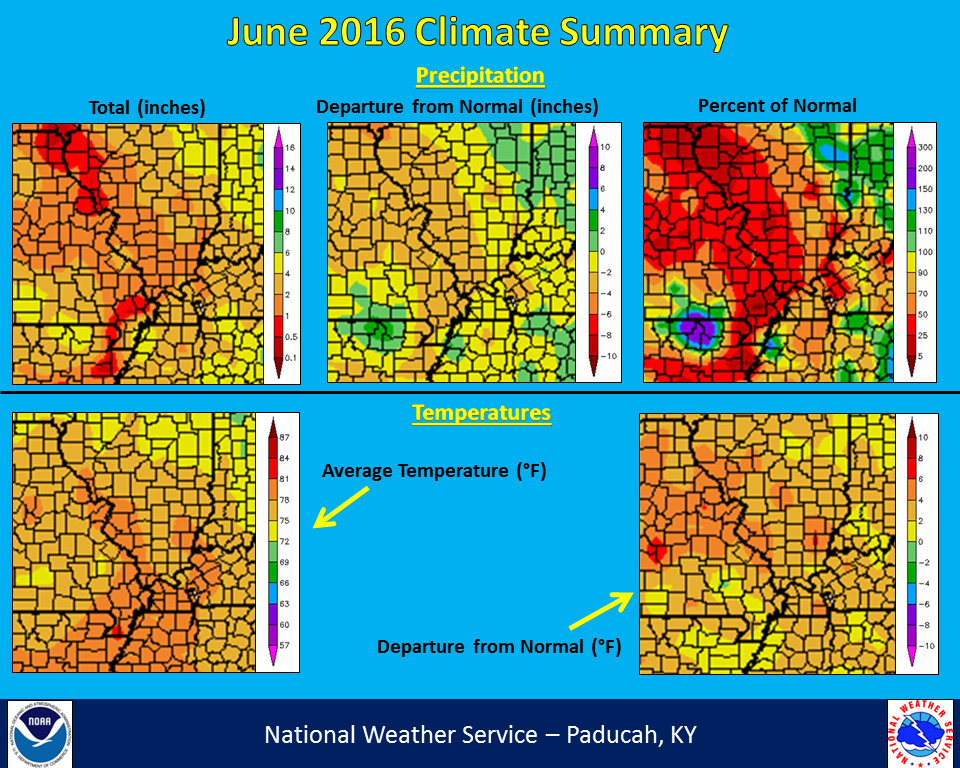
June 2016 was a warm and dry month for our region. It featured temperatures that were generally around 3 degrees above normal. June temperatures ended up being tied for 5th warmest on record in Paducah and tied for 6th warmest in Cape Girardeau. Precipitation was well below normal across much of the area, particularly across southeast MO, southern IL, and portions of western KY. These locations received 50% or less of their normal June precipitation. Cape Girardeau, MO only recorded 1.28 inches for the whole month, checking in as the 5th driest June on record. Evansville, IN was on pace to finish 2+ inches below normal until a thunderstorm dropped 2.65 inches in 1 hour during the late evening on the 26th. There were only 2 brief periods that were below normal in Paducah, from June 7-9 and again the last 2 days of the month. Temperatures were consistently above 90 degrees. From June 10th to 28th, Paducah reached at least 90 degrees 18 of the 19 days. Several locations reached 100 degrees on the 16th, including Paducah and Cape Girardeau. Lows failed to fall below 80 degrees in Paducah and Cape Girardeau on the 23rd, establishing the warmest lows on record for the month of June.
| June 2016 Review: Precipitation and Temperature Maps (click to enlarge) |
 |
| Climate Maps are from the Northeast Regional Climate Center |


