Paducah, KY
Weather Forecast Office
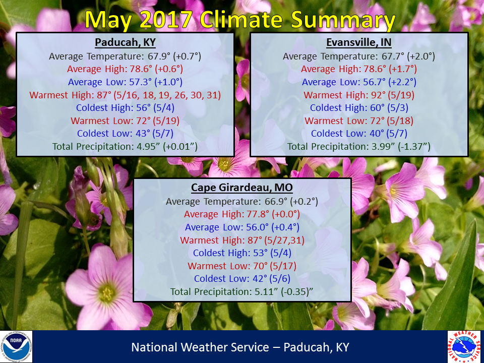
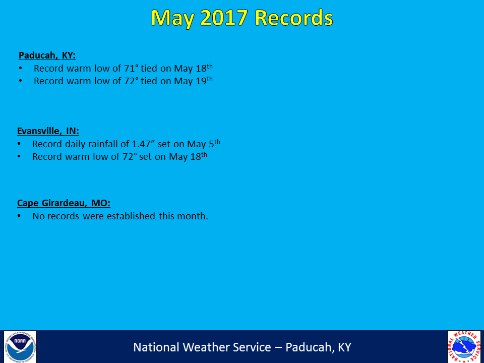
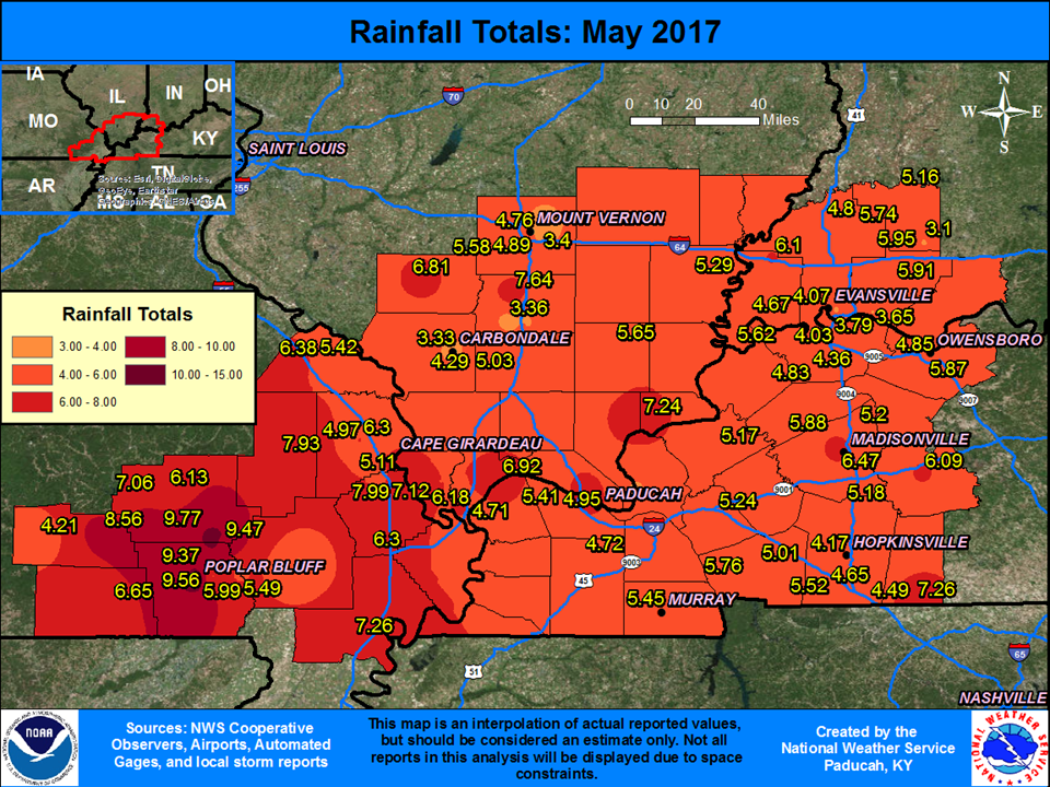
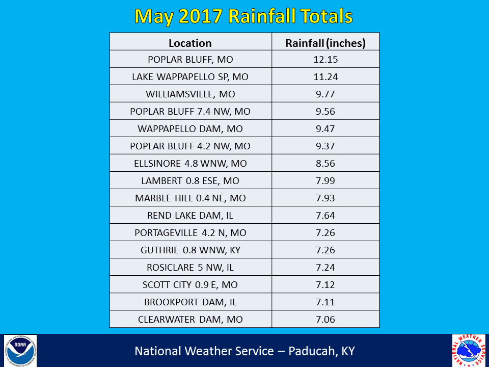
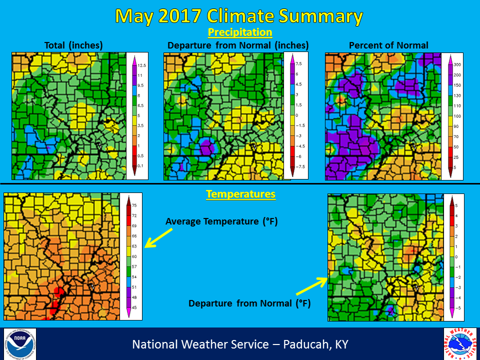
May 2017 was generally near normal for both temperatures and precipitation across a large portion of our region. However, rainfall amounts were above normal across a good chunk of southeast Missouri into portions of southern Illinois, where rainfall totals ranged from 6 to 10 inches, with some isolated higher totals. This was around 2 to 5+ inches above normal. Temperatures were right near to slightly above normal. May marked the 12th consecutive month that temperatures were above normal in Paducah, KY and Evansville, IN. Due to excessive rainfall experienced at the end of April, major to record river flooding was ongoing on many area rivers at the beginning of the month. It took some time for river levels to fall on many of the rivers, with minor flooding still occurring at a few locations along the Mississippi and Ohio Rivers at the end of the month. The most notable severe weather outbreak occurred on May 27th, with hail up to baseball sized and winds of 70-80 mph in several locations.
| May 2017 Review: Precipitation and Temperature Maps |
 |
| Climate Maps are from the Northeast Regional Climate Center |
FORECASTS
Forecast Discussion
User Defined Area Forecast
Hourly Forecasts
Fire Weather
Activity Planner
LOCAL INFORMATION
Aviation Weather
Our Office
SKYWARN
Items of Interest
Hazardous Weather Support
Local Observations
Weather History
NWS Paducah KY Weekly Partner Briefing
US Dept of Commerce
National Oceanic and Atmospheric Administration
National Weather Service
Paducah, KY
8250 Kentucky Highway 3520
West Paducah, KY 42086-9762
270-744-6440
Comments? Questions? Please Contact Us.