Three lines of strong to severe thunderstorms moved from west to east during the morning and afternoon hours of November 15, 2005. All three lines of storms contained numerous rotating thunderstorms, known as supercells. A couple of strong to violent tornadoes were spawned by these supercells, along with numerous funnel clouds and several other weaker tornadoes.
On November 15, 2005, a spring like atmosphere was in place ahead of a strong incoming cold front. Atmospheric wind profiles were extremely favorable for tornadoes. A total of 13 tornadoes touched down during the afternoon, two of which were strong to violent and long tracked. Numerous tornado warnings were issued. (Click on images for larger view)


The National Weather Service (NWS) in Paducah KY began mentioning the threat for severe weather on the afternoon on Sunday November 13th. However, the next morning, the NWS was becoming increasingly concerned about a very active weather day across the area on the 15th. The forecast discussion from the early morning hours on Monday November 14 stated "this setup has many similarities to the one that resulted in the severe weather/tornado outbreak last Saturday night and early Sunday morning (which was the day of the Evansville Tornado." The Storm Prediction Center (SPC) concurred with that line of thinking. Their 1am convective outlook on November 14th outlined our entire area in a moderate risk for severe weather, stating "the potential exists for organized severe weather outbreak with numerous total reports. Any sustained thunderstorms that develop [...] have the potential to become discrete and fast moving supercells with potential for tornadoes."
On the morning of November 15th, the SPC outlined our entire region in a rare High Risk area:

Weather map for November 15, 2005:
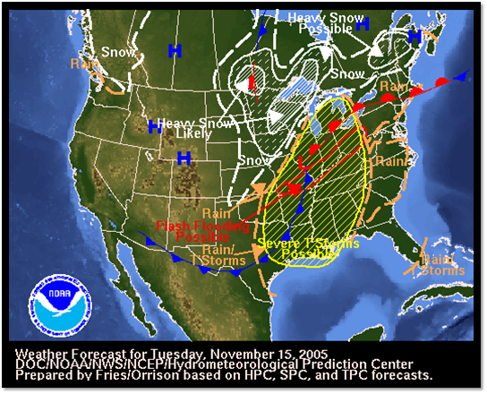
SPC stated that an increase in storm coverage/severity was anticipated during the afternoon across the area. Wind fields aloft were strong enough for supercells to develop which were capable of strong/intense tornadoes that could be long tracked. Strong/significant damaging wind gusts were also a distinct threat.
By 740am, SPC had issued a PDS (Particularly Dangerous Situation) tornado watch for a good part of our area, which was valid through 500 pm. The discussion associated with the watch issuance stated that a very moist and moderately unstable environment was already present, and that additional heating would result in the development of severe thunderstorms by mid to late morning. Strong wind fields aloft would be favorable for supercells with potentially damaging tornadoes by midday and into the afternoon with damaging winds and large hail possible as well. At 1010am, SPC issued a PDS tornado watch for the rest of our area:


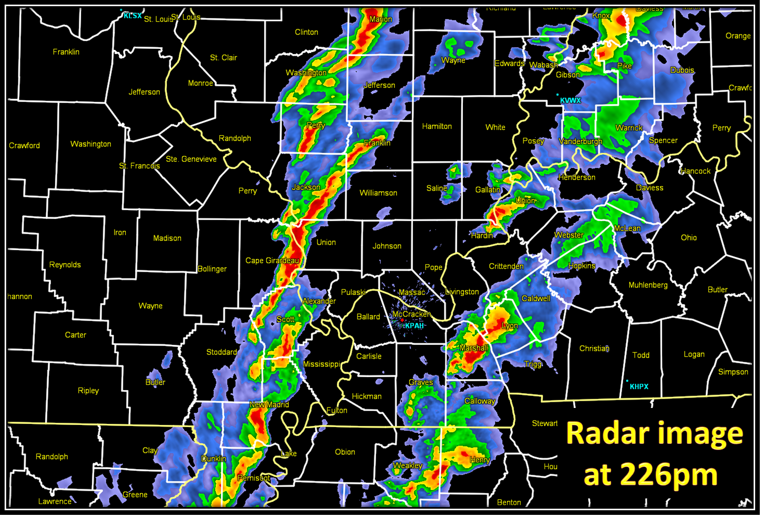
By noon, a line of storms was intensifying over our region, from Cisne, IL to Cape Girardeau and Gideon, MO and down into extreme eastern Arkansas. This line of thunderstorms was moving to the east while the individual cells were moving rapidly northeast. Meanwhile, the second line of storms further to the west, behind this initial line, would eventually intensify as well.
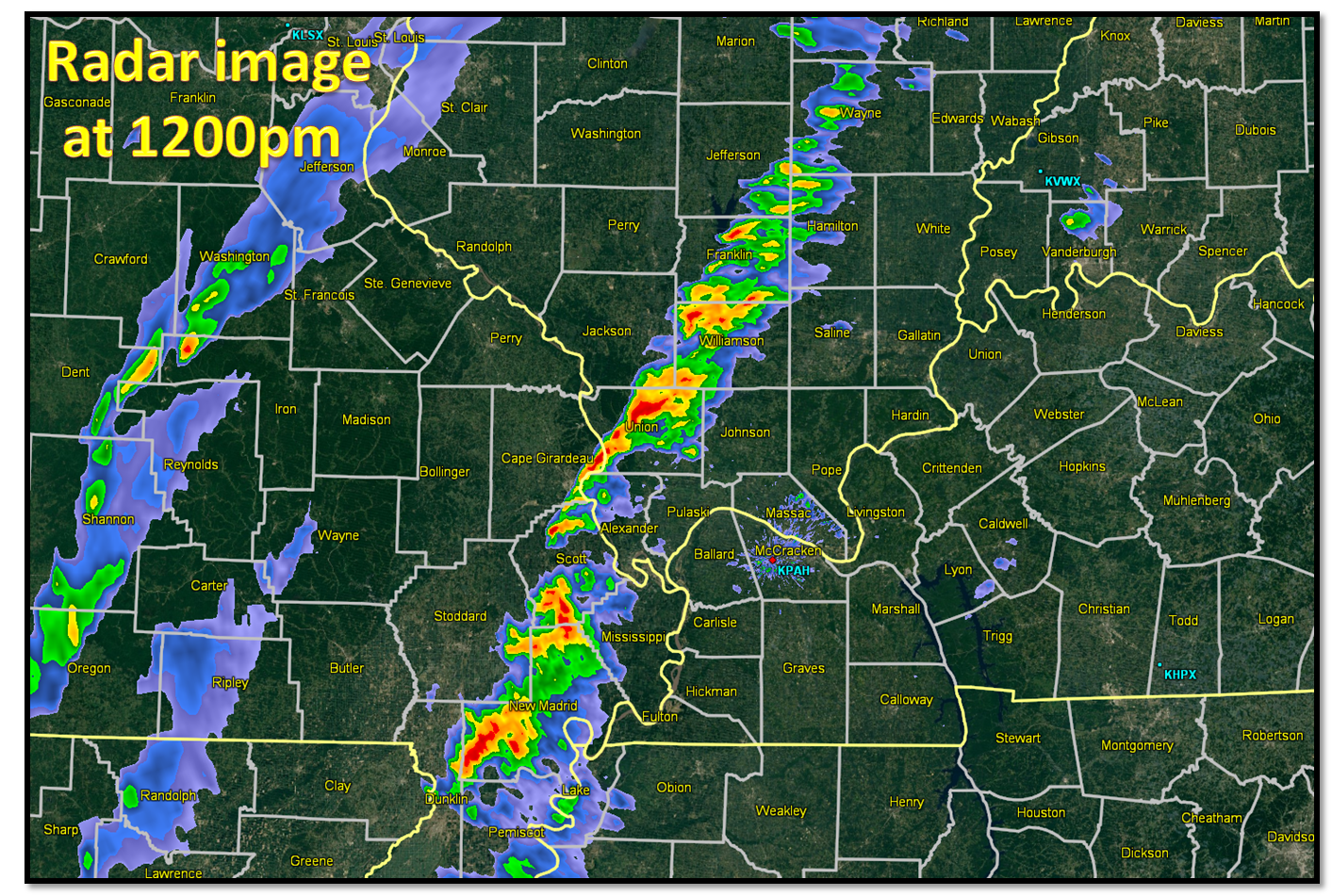
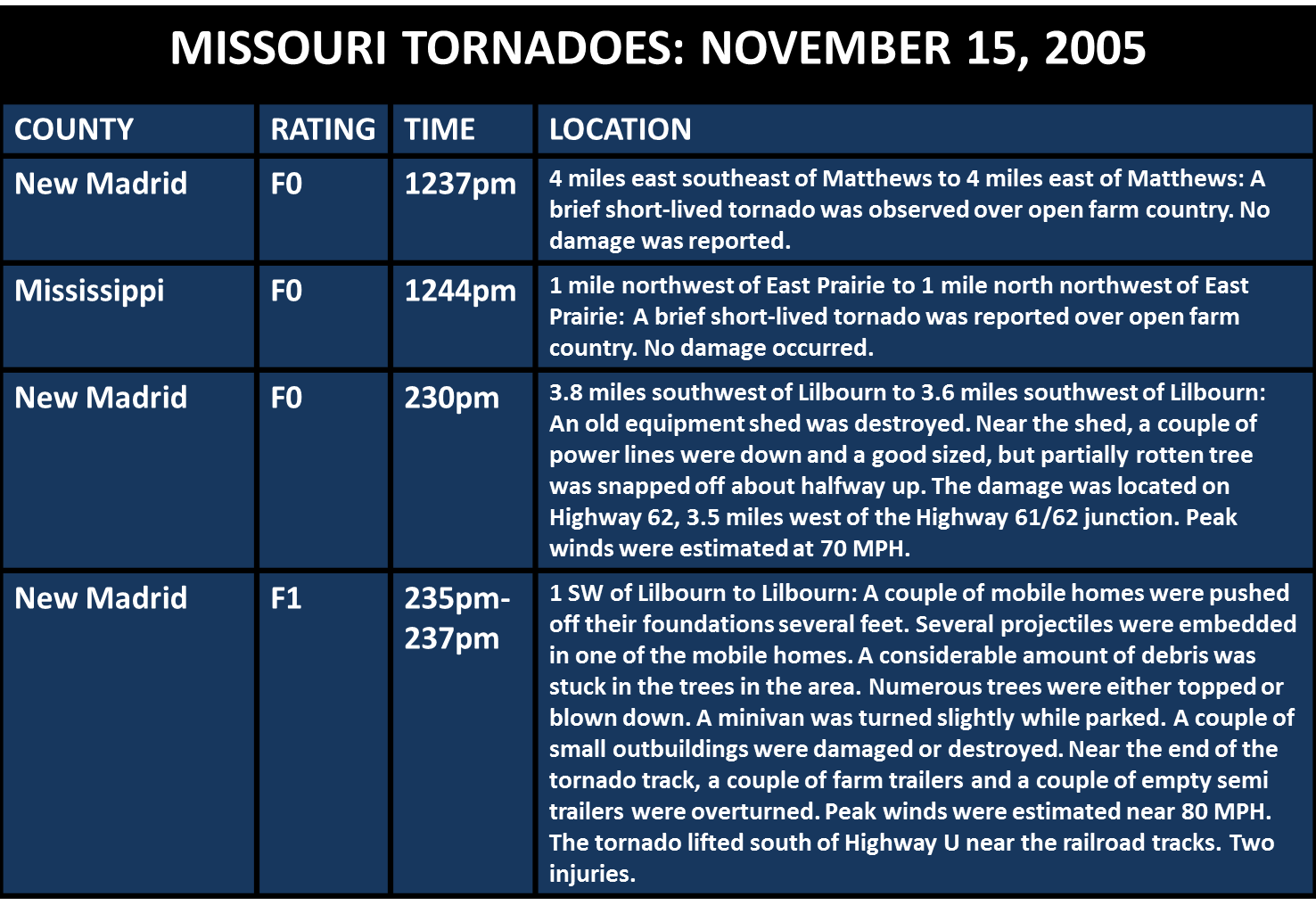
By 1230pm, the NWS was closely watching a storm in northern New Madrid County MO, which was exhibiting supercell characteristics as well as weak rotation. This storm produced a brief short lived F0 tornado at 1237pm four miles east southeast of Matthews, MO. A few minutes later, another tornado touched down over open farm country at 1244pm, one mile northwest of East Prairie, MO. The next two radar images are zoomed in on New Madrid and Mississippi counties, where the supercell storm passed over. You can clearly see the "hook" echo on the storm:

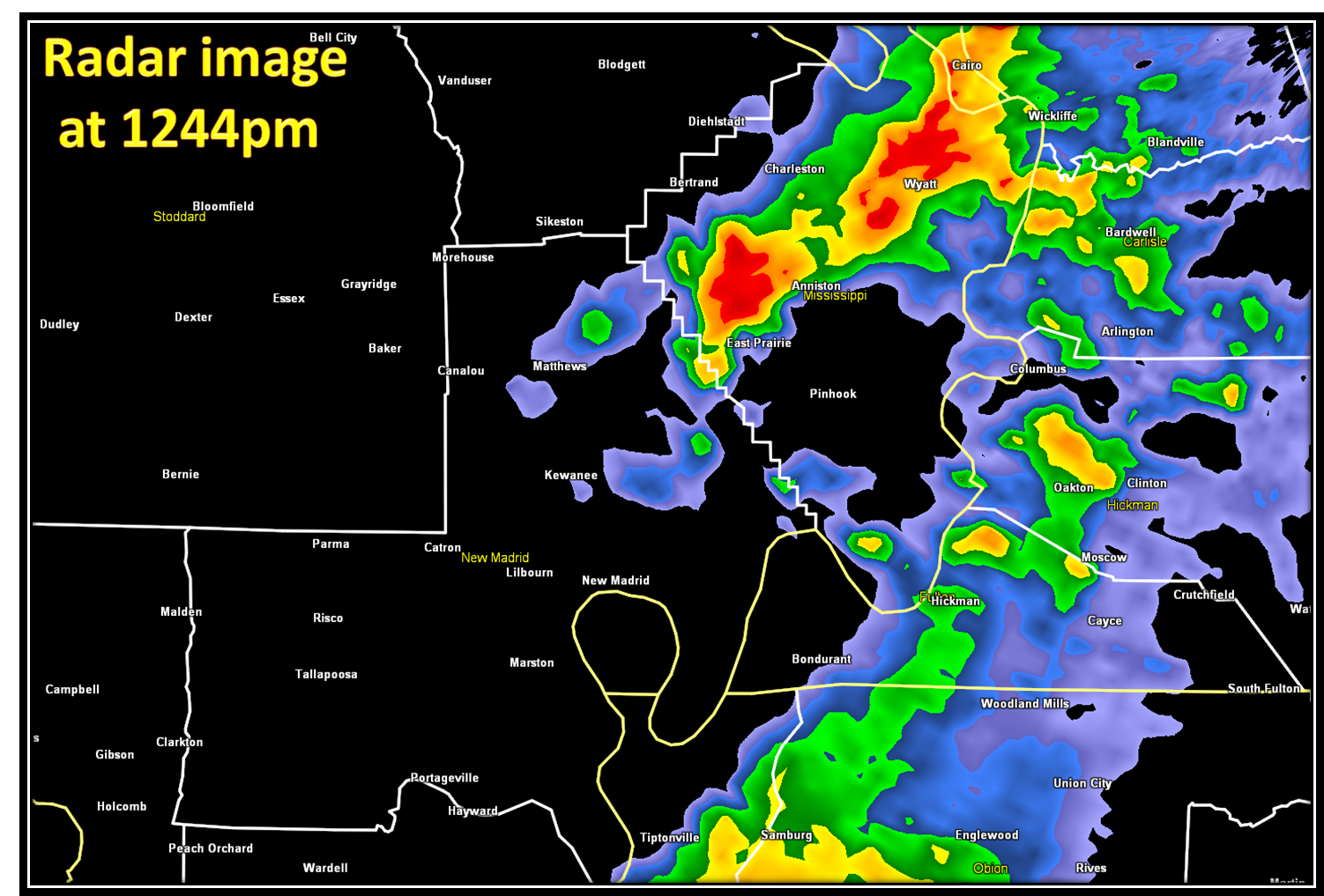
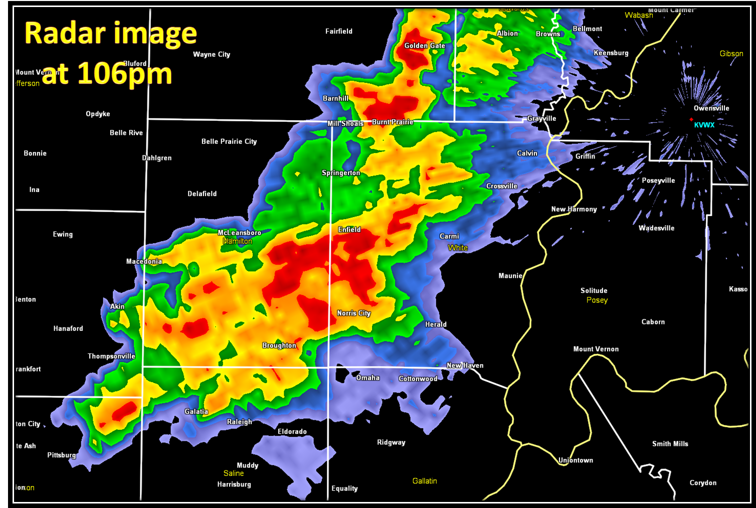
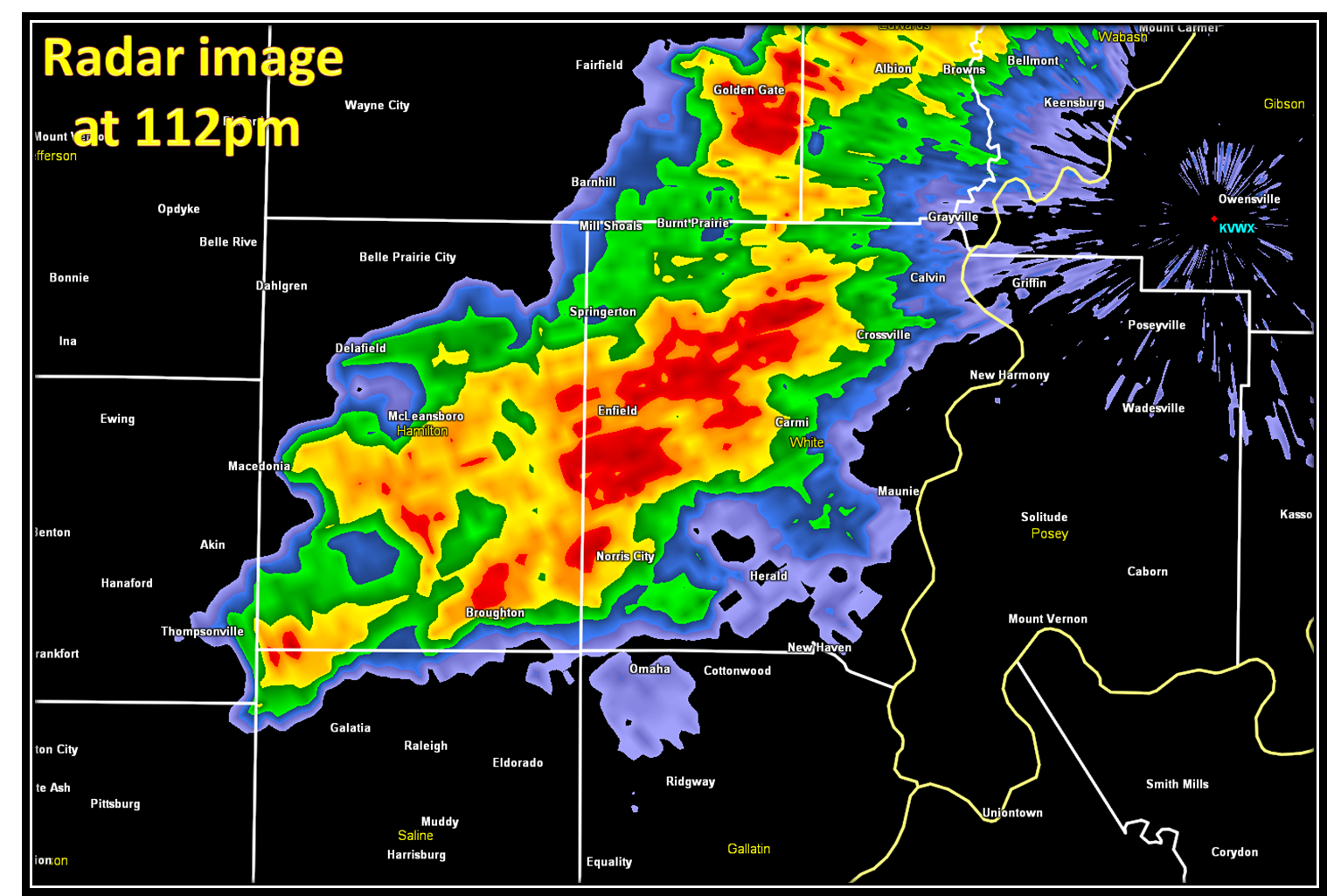
Moving ahead to the next brief tornado touchdown, which occurred at 110pm near Norris City in White County, IL. Not much rotation was noted with this storm, but the reflectivity images from the KVWX radar (shown below) do show some possible evidence of a tornadic signature:
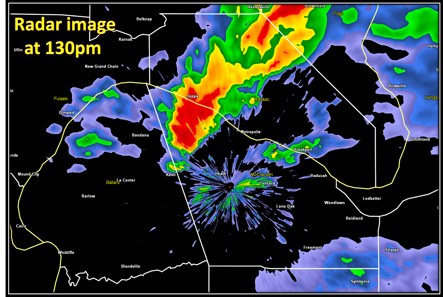
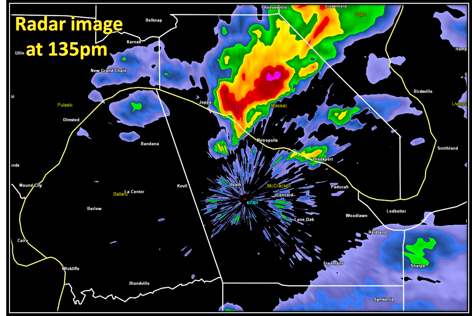
Meanwhile, further south, the supercell storm which produced the two brief F0 touchdowns in New Madrid/Mississippi counties in southeast Missouri, had moved northeast into far west Kentucky. A brief F0 tornado touched down in the small town of Rossington in McCracken County at 130pm, which is about 6.5 miles northeast of Kevil, KY. No damage was reported from this touchdown. This storm continued moving northeast and crossed the Ohio River into Massac County in far southern Illinois. Another brief tornado was spotted at 134pm, crossing the Ohio River. This storm was very close to the radar at that time:
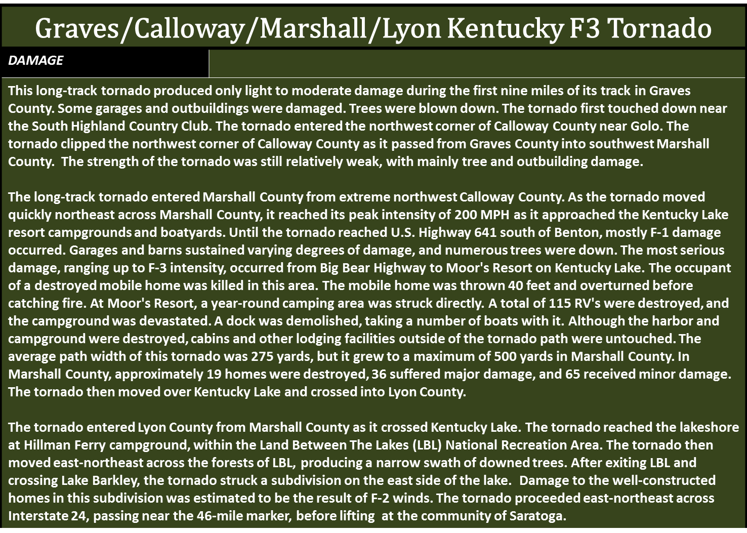
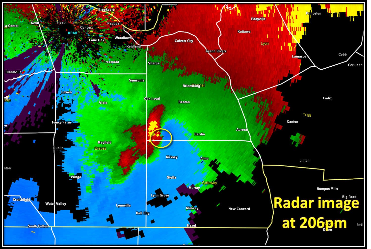
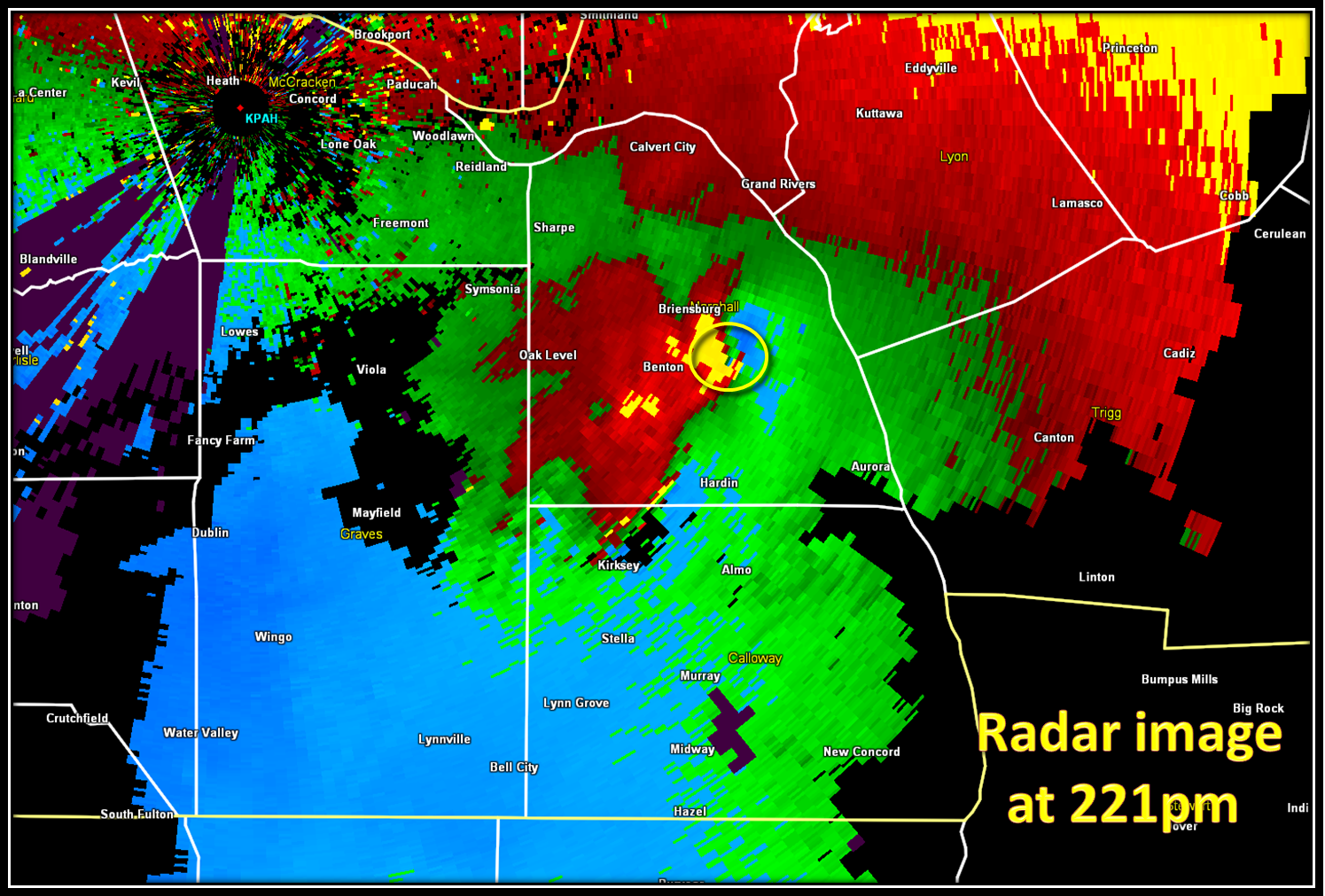
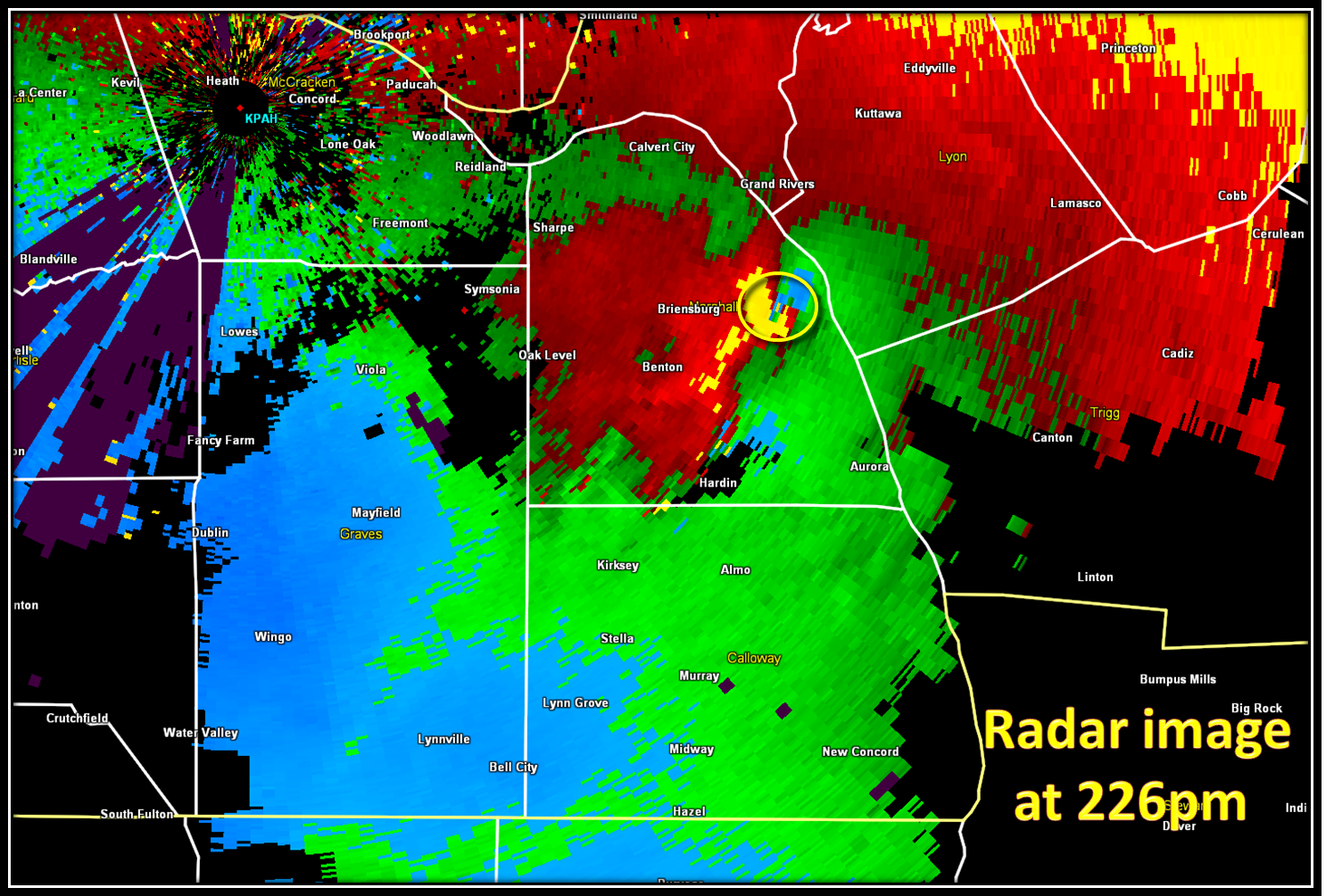
Further to the south, we were watching a storm moving northeast out of Obion County TN. As it crossed into southwestern Kentucky, the circulation strengthened. At 145pm, a tornado touched down about three miles south of Mayfield in Graves County, KY near the South Highland County Club. Some garages and outbuildings were damaged and trees were blown down.The tornado continued to move rapidly northeast at 55 mph and crossed into extreme northwest Calloway County near Golo. The tornado greatly strengthened to F3 intensity as it crossed into Marshall County. The radar images below show the rotation as it leaves Graves County KY and moves through Marshall and Lyon counties:


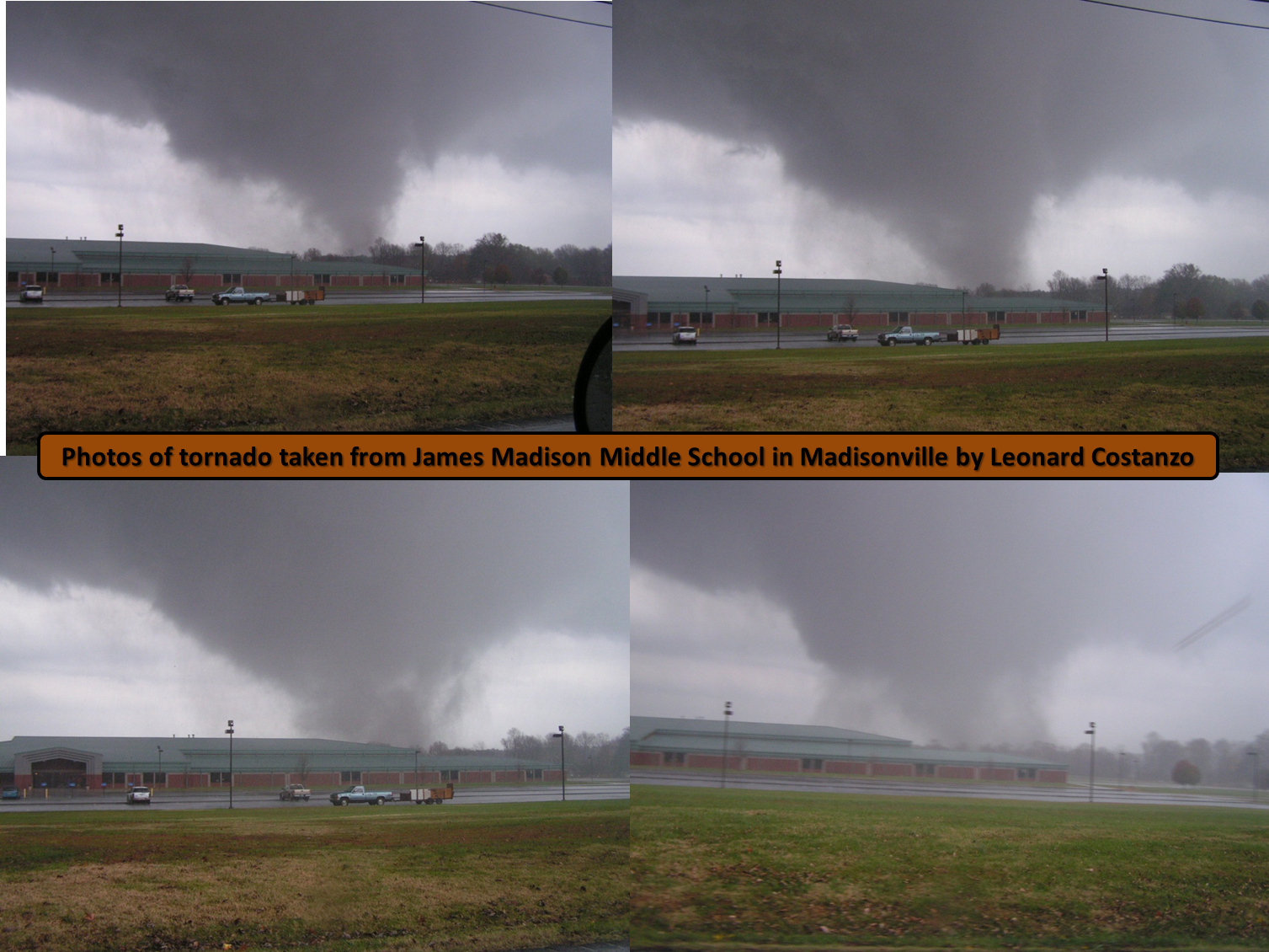
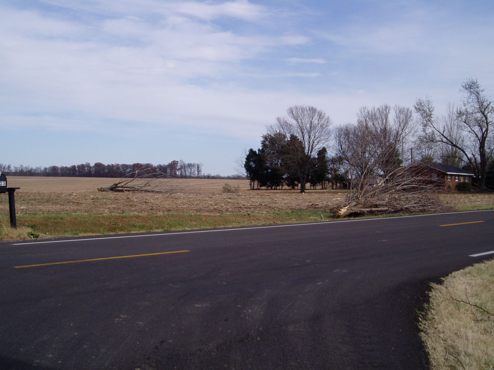
Photos from Graves, northwest Calloway and southwest Marshall Counties in KY:


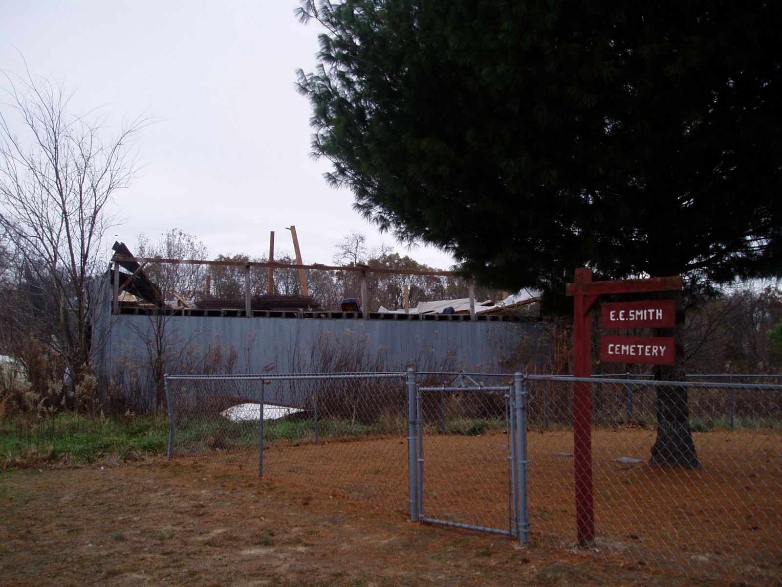
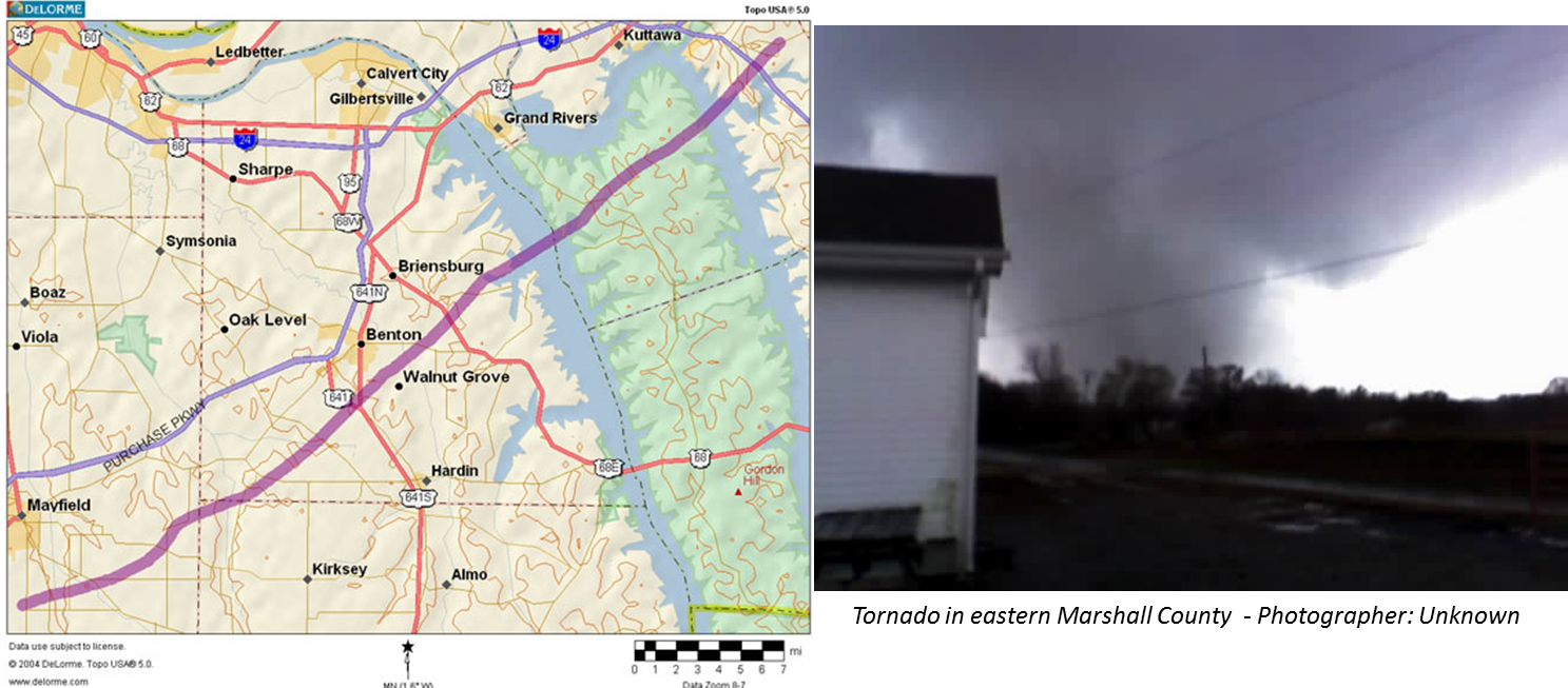
Photos from Marshall County KY:


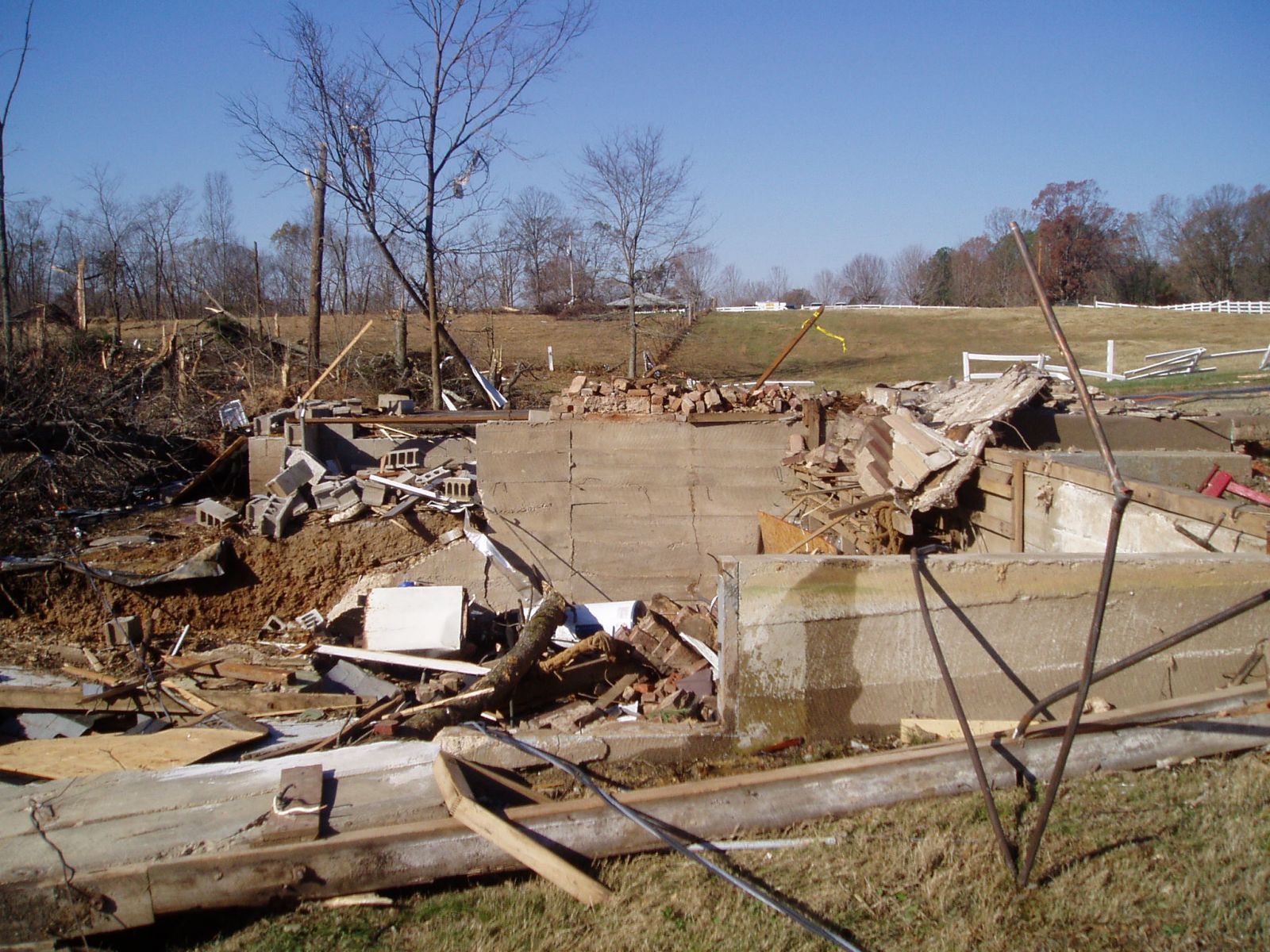
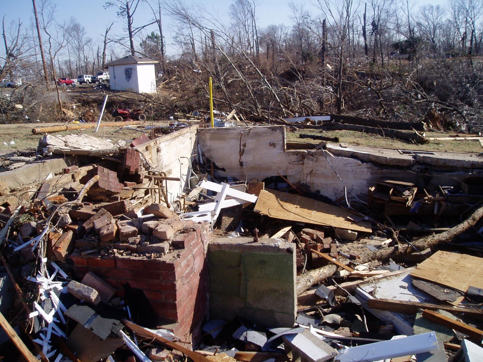
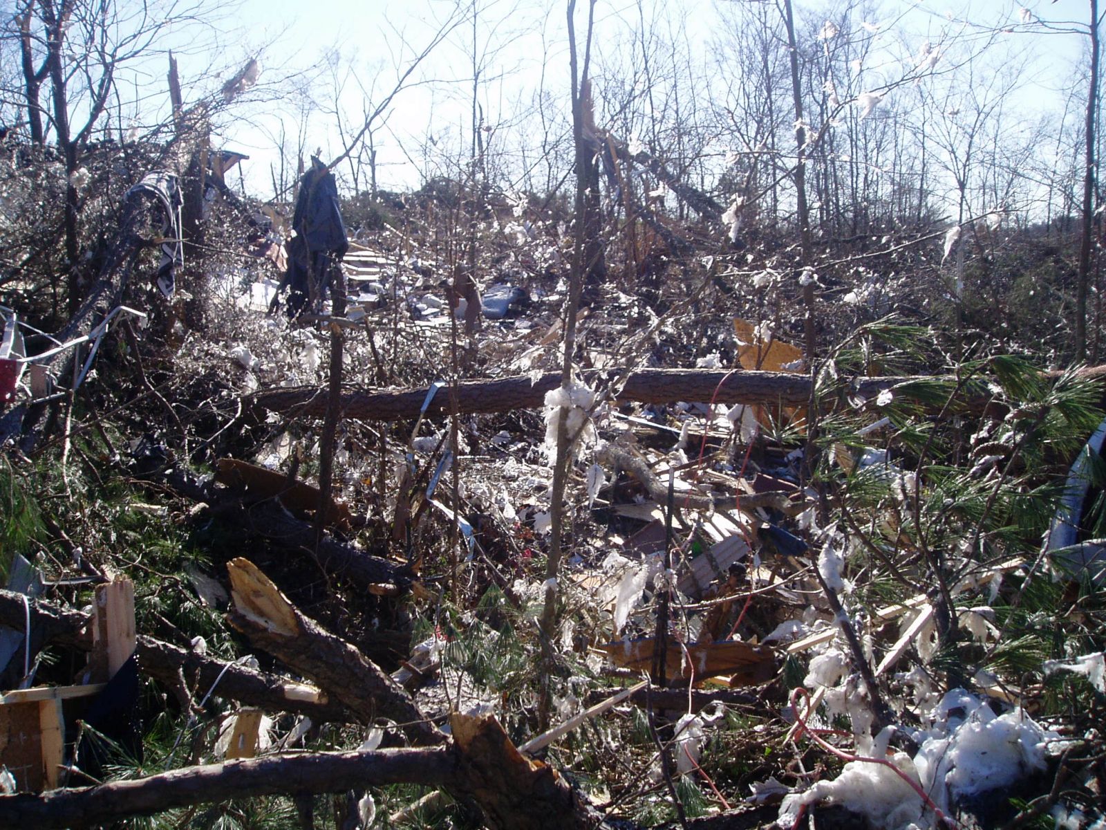


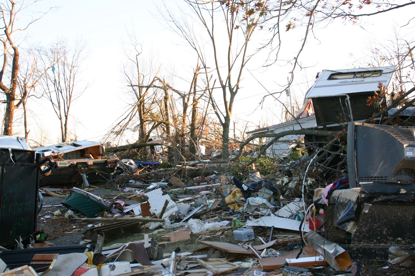

Photo from Lyon County KY:

Aerial photographs from the F3 tornado:


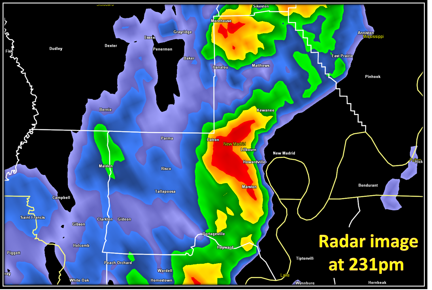
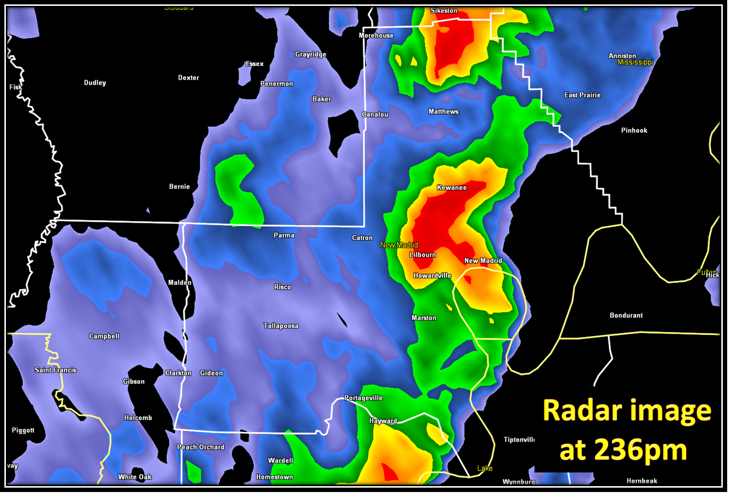
As this F3 tornado was occurring, farther to the southwest, the aforementioned secondary line of storms was strengthening over southeast Missouri:
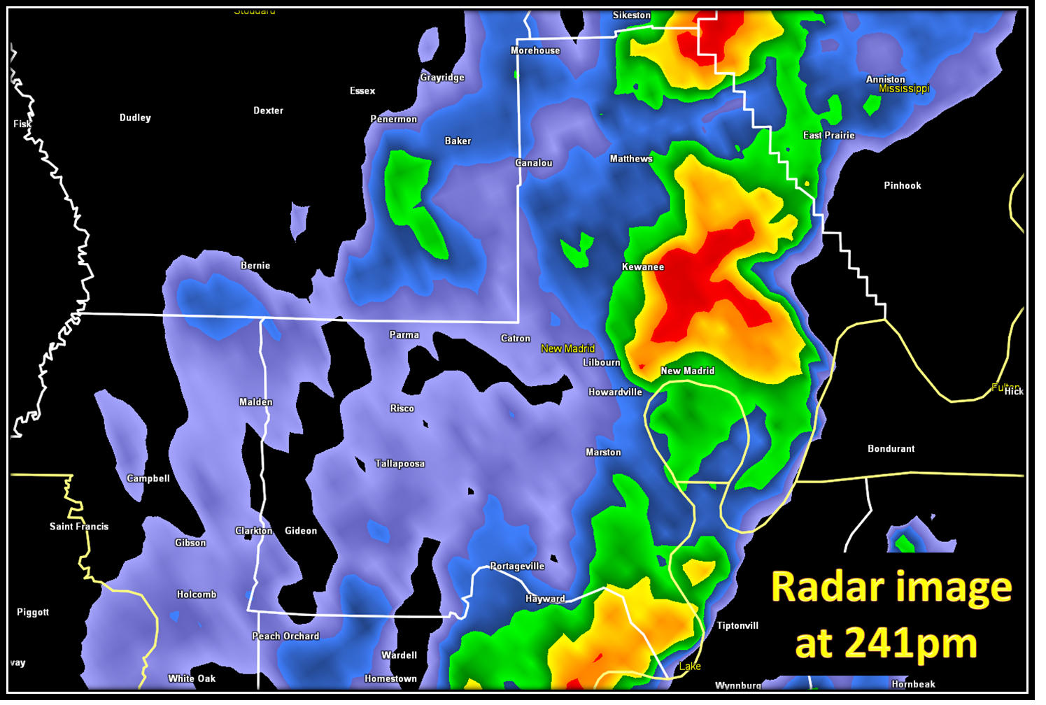
Between 230pm, and 240pm, two tornadoes (F0 and F1) touched down near Lilbourn, MO in New Madrid County. Rotation within this storm was weak.

Photos from New Madrid County:


After the two New Madrid tornadoes, no additional tornadoes occurred in southeast Missouri that afternoon. However, the supercell storm that produced the F3 tornado in western KY reintensified after leaving Lyon County, KY. The storm produced a brief F0 tornado a few miles south of Princeton KY in Caldwell County around 300pm, which downed a few trees: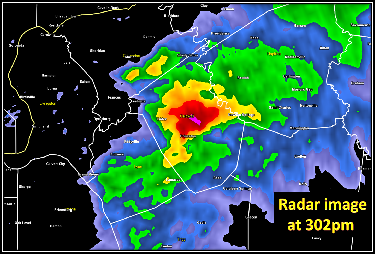
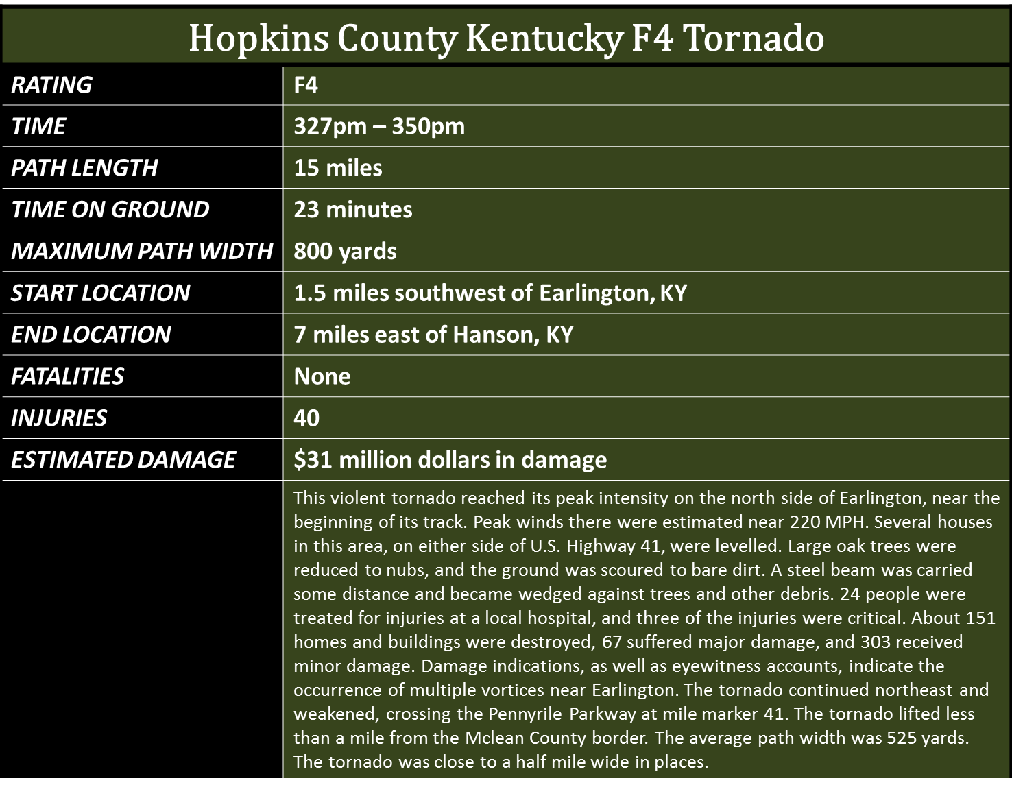
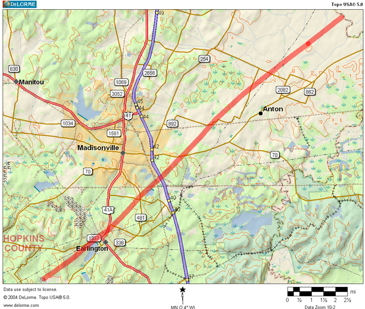
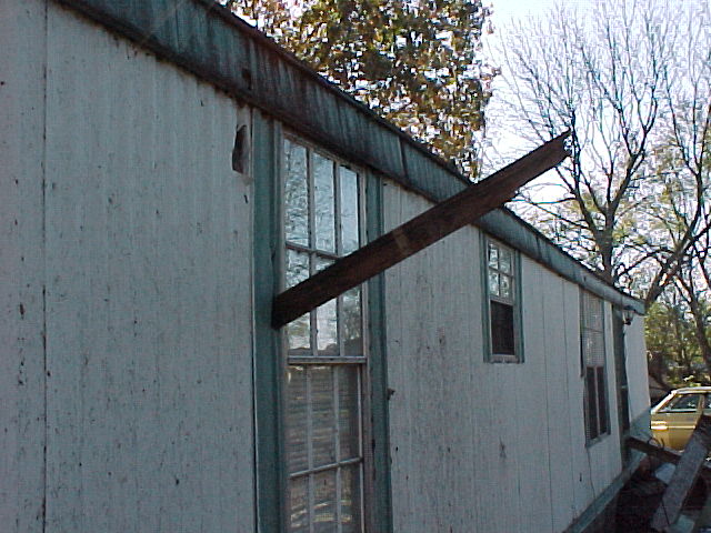
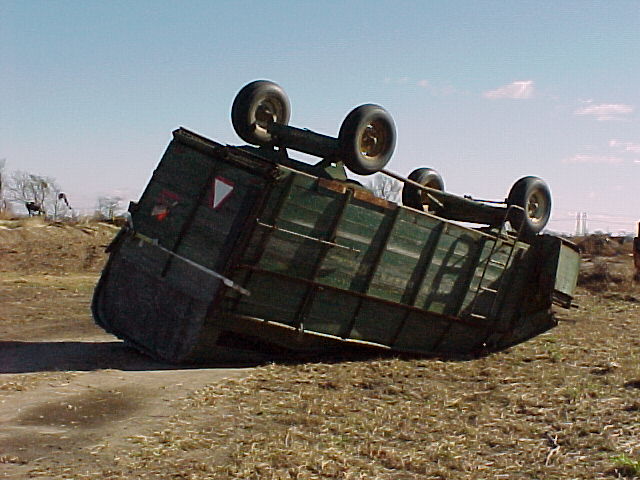
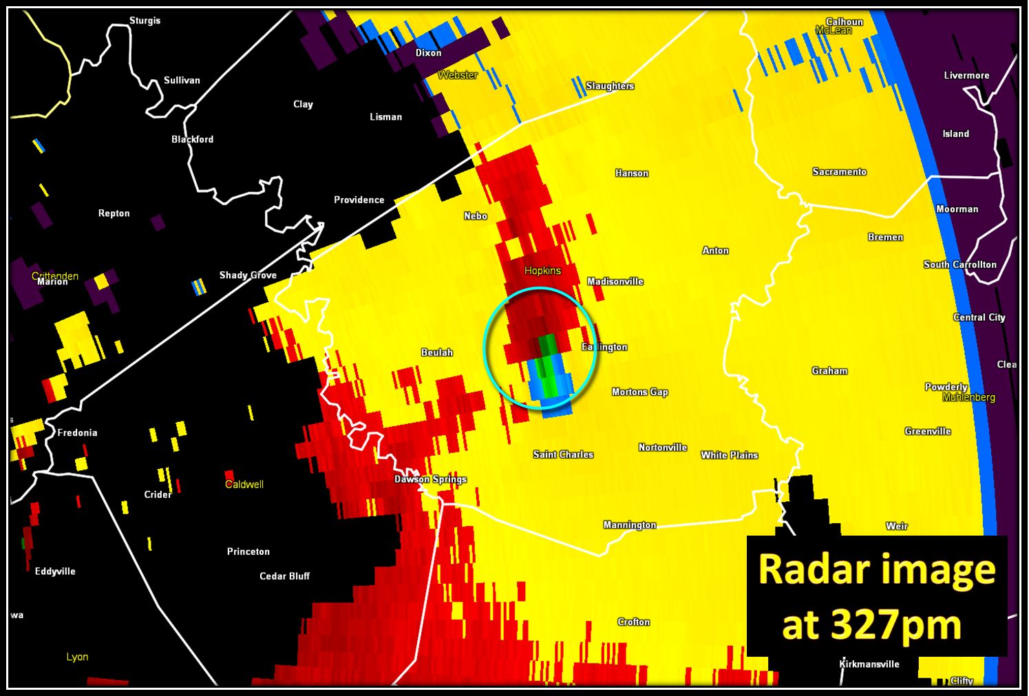
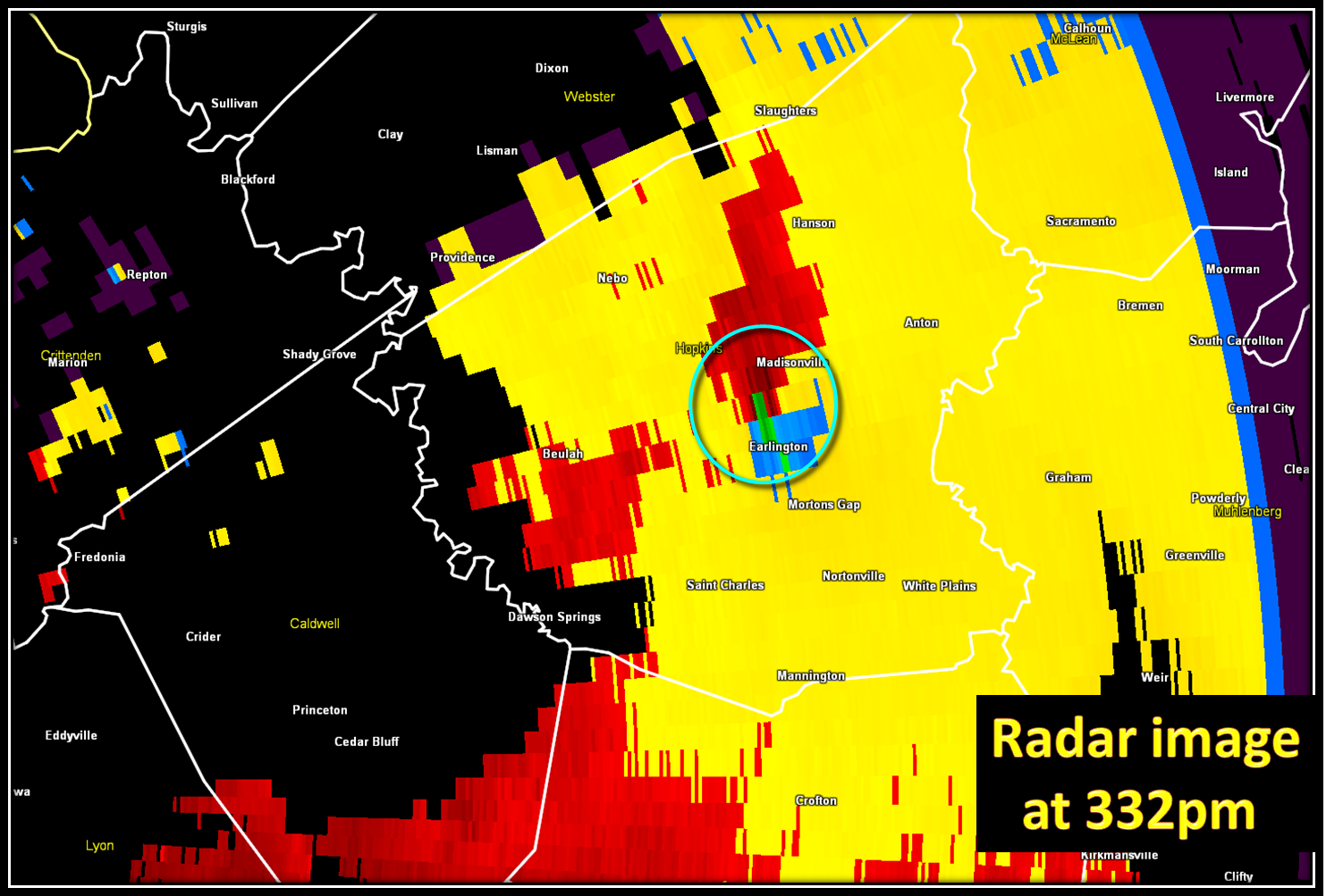
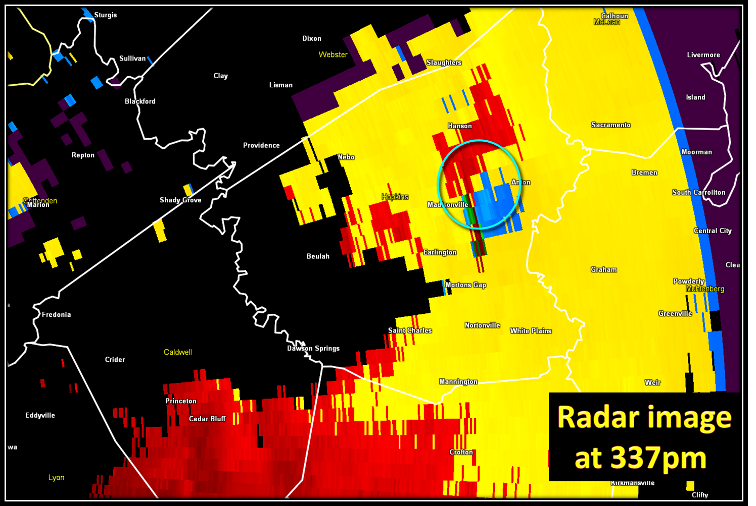
This tornado was short lived, but the parent supercell was not done producing tornadoes. It took a few minutes for the storm to reogranize over eastern Caldwell and western Hopkins counties, but by 327pm, a tornado touched down a mile and a half southwest of Earlington KY (Hopkins County KY) and then traveled northeast at 45 mph. The tornado reached its peak intensity (F4) shortly after touchdown near Earlington. The images below show the rotation as it moved through Hopkins County KY.

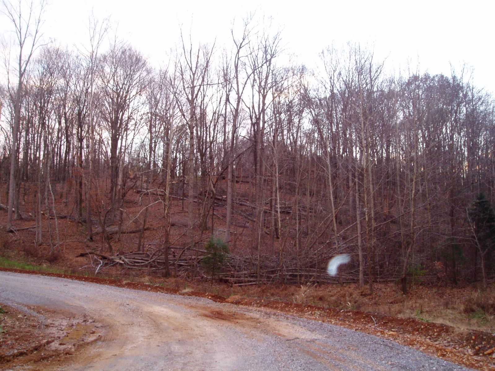
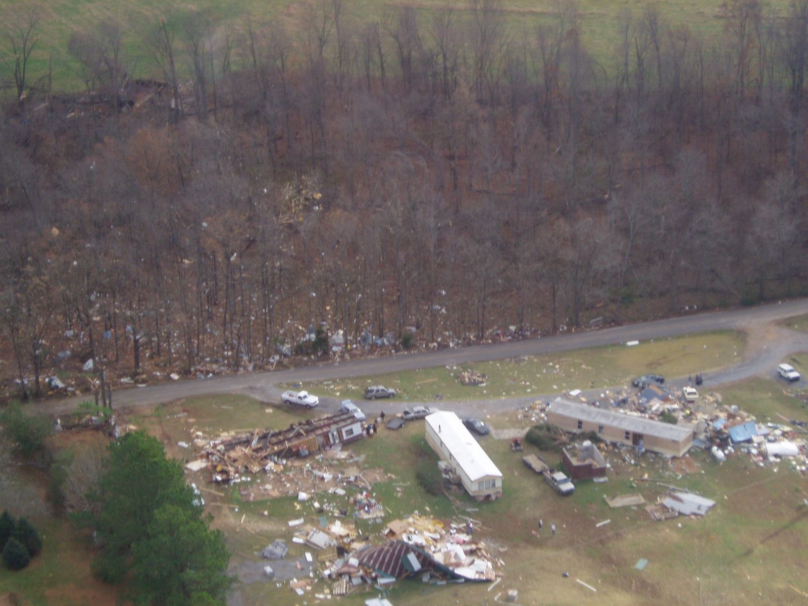
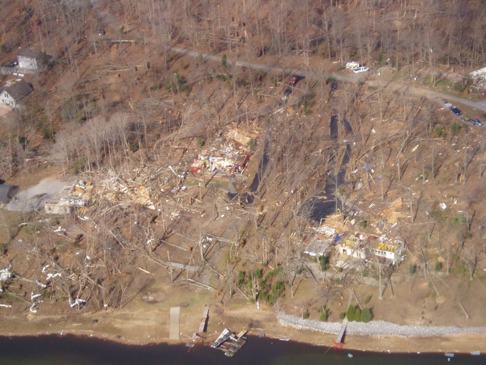
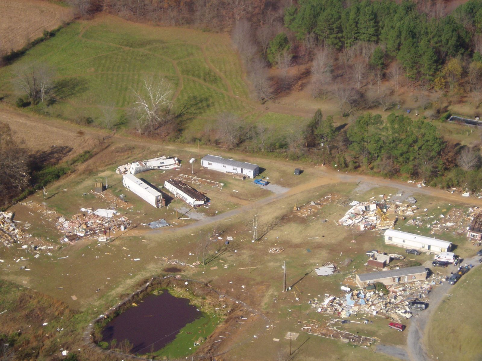
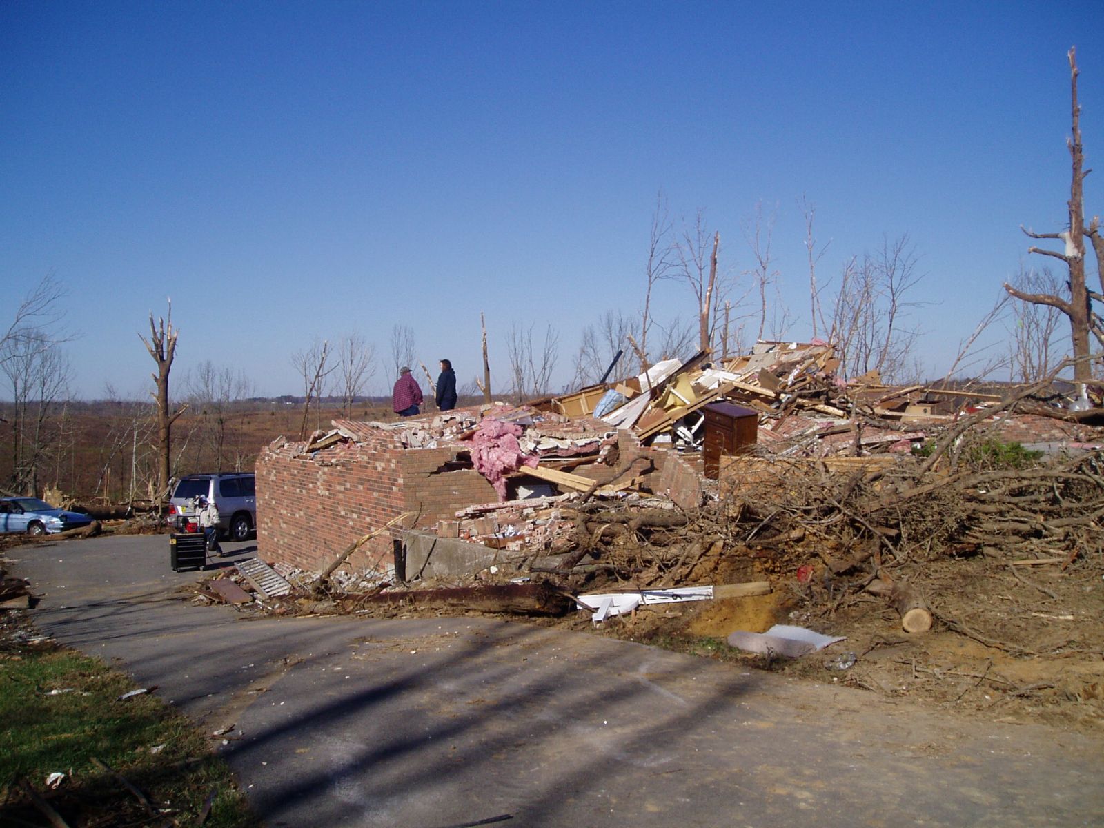
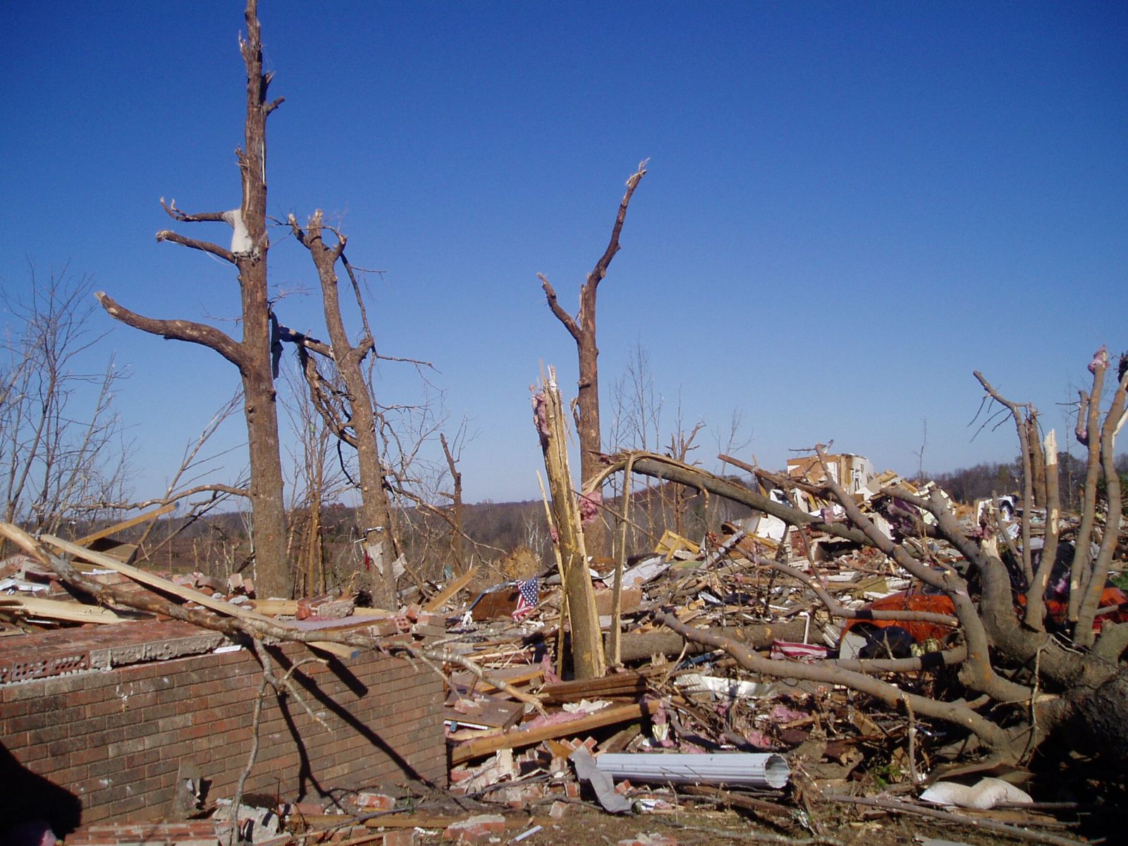
Photos from Hopkins County, KY (mainly near Earlington):

.JPG)
.JPG)

.JPG)


Just a few minutes after this monster F4 tornado was spawned, another much weaker tornado touched down in Saline County Illinois at 332pm near the small community of Harco, which is southwest of Galatia. This short lived tornado was reported by a trained spotter over reclaimed strip mine property. However, the supercell that produced the F4 tornado in western KY was not done.
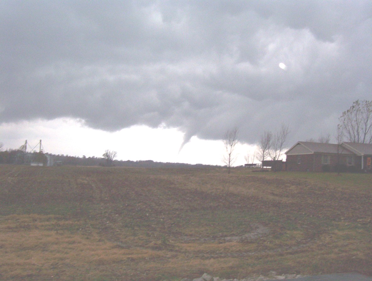
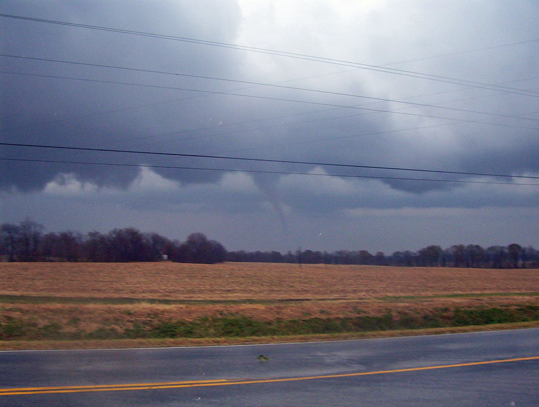
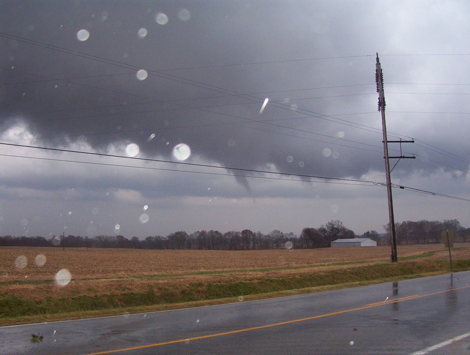
This dangerous western Kentucky supercell storm continued moving northeast into Mclean County. It reorganized and produced a F1 tornado a few miles east northeast of Calhoun, KY a few minutes after 400pm. Several minutes later, another tornado was spawned near Utica, KY in Daviess County. Emergency Management officials in Daviess County said they believed the tornado touched down in the Utica KY area between US 431 and KY81 in the vicinity of KY 1207. They assumed it touched down on farmland and no damage was reported to structures. Several pictures were taken of this funnel/tornado:


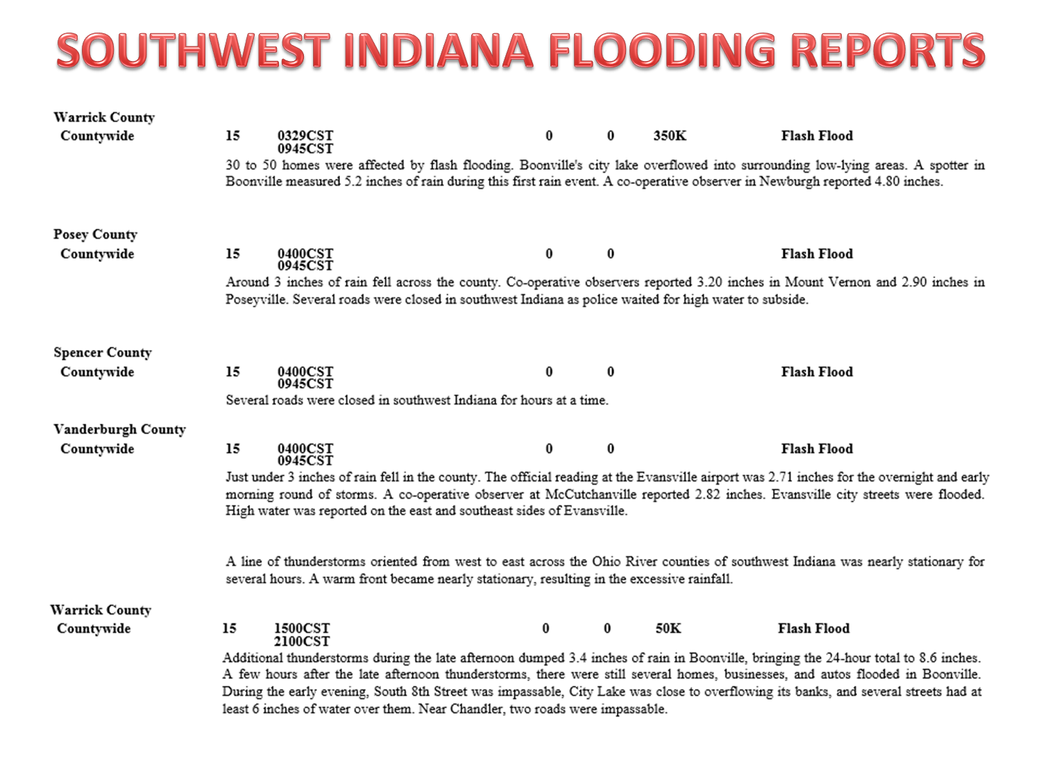
In addition to the multitude of tornadoes. flash flooding was a problem for some areas. Below is a storm total precipitation product from the event from the Paducah KY radar. The heaviest rainfall is in the red and purple swaths, which resulted in many flash flooding reports:


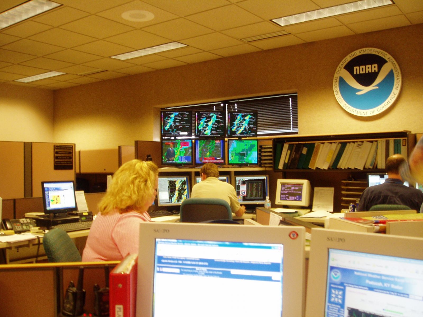
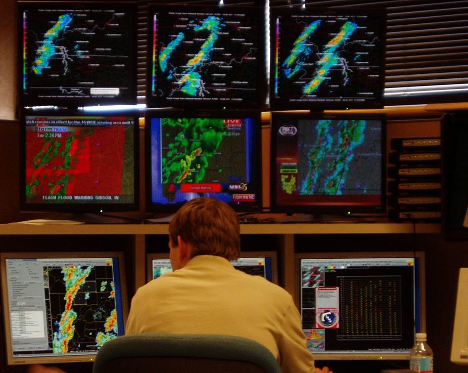
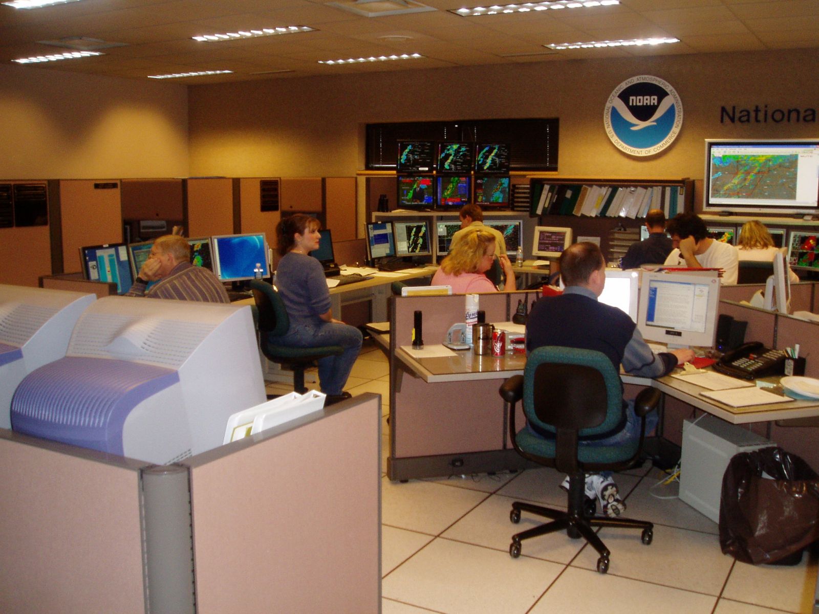
This last section will highlight our office during this event. You will see from the following photographs, how our office looks during a major severe weather outbreak:

.JPG)