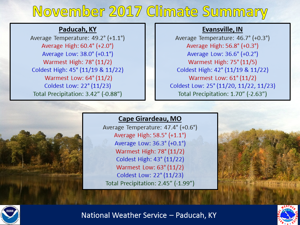
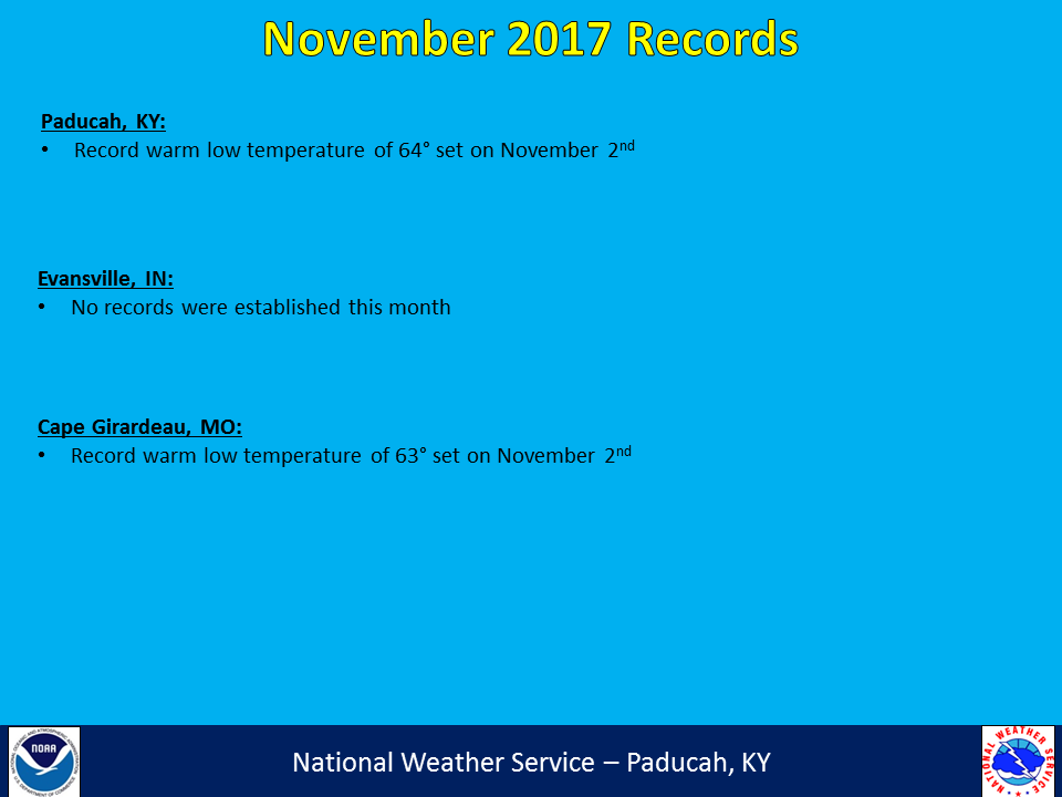
November 2017 Climate Summary: Temperatures ranged from near normal to slightly above normal. The month started off with well above normal temperatures from the 2nd to the 5th. It also ended with above normal temperatures for the last week. In between, temperatures were below normal for a large chunk of the middle of the month.
The vast majority of the region experienced drier than normal conditions for the month. Some notable locations were across portions of southeast Missouri and the Evansville Tri-State region, with several locations registering 2 to 3 inch deficits for the month. The dry conditions had been ongoing this fall season in southeast Missouri, and now moderate to severe drought has developed in this region. The most significant storm system of the month occurred on the 18th with damaging winds occurring along a line of storms pushing through the area. There were also 5 confirmed tornadoes from that event, including 2 EF-1’s.
| November 2017 Review: Precipitation and Temperature Maps (Click on image to enlarge) |
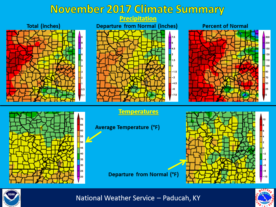 |
| Climate Maps are from the Northeast Regional Climate Center |
The graphic below is an interpolated rainfall map using actual observations. Please note that there are likely discrepancies in between observations, since the values are estimated based on nearest reports. Due to the convective nature of rainfall in the warmer months, amounts are more likely to vary over shorter distances, compared to the cooler months.
 |