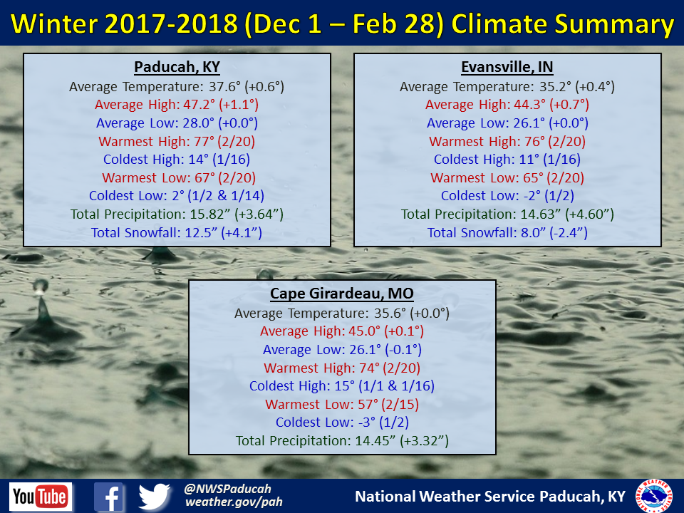
Temperatures were generally very close to normal for our region. December was generally near normal, with January below normal, and February above normal. Many locations experienced their coldest temperatures on January 2nd when readings fell a few degrees below zero in several locations including Evansville, IN and Cape Girardeau, MO. The warmest temperatures were on February 20th when temperatures soared well into the 70s across much of the region.
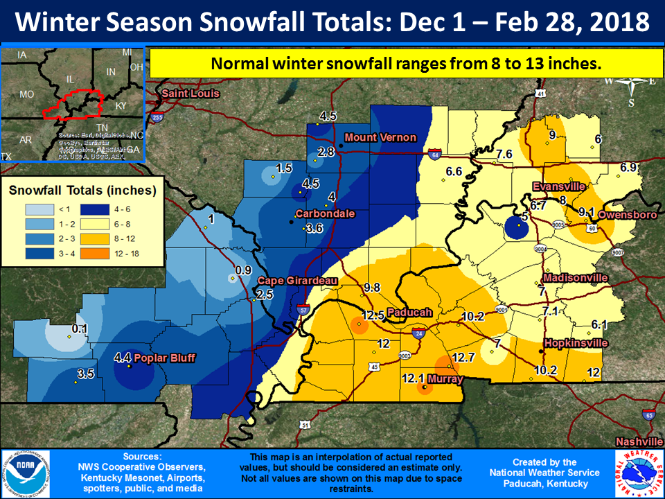
As far as precipitation, it was a wet winter season for the lower Ohio Valley, with seasonal totals ranging from 2 to 5 inches wetter than normal in many locations. This was mostly due to a very wet period between February 20th and 24th. Areas from the Missouri Ozark Foothills northeastward towards Perryville, MO and Mount Vernon, IL observed the least amount of precipitation. However, much of this region still finished near to slightly wetter than normal for the season. The highest precipitation totals were located across portions of west Kentucky, where isolated readings to 20 inches were observed.
 |
| Winter 2017-2018 Review: Precipitation and Temperature Maps (CLICK TO ENLARGE IMAGE) |
 |
| Climate Maps are from the Northeast Regional Climate Center |