
Cold temperatures will continue across much of the eastern U.S. into today. Heavy lake effect snow continues into today east of Lakes Erie and Ontario. Two Pacific cold fronts will cross the Pacific Northwest early this week followed by another atmospheric river. Heavy rain and gusty winds are expected through midweek, with the potential for renewed urban and river flooding. Read More >
Overview
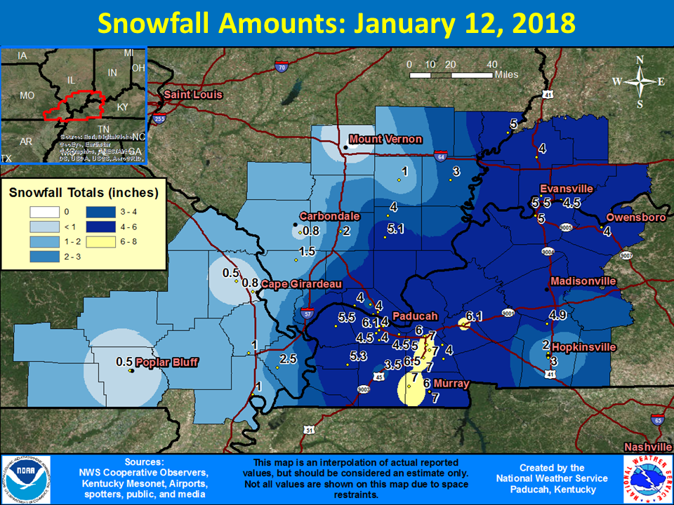
An Arctic cold front moved rapidly southeast across the lower Ohio Valley on the evening of the 11th. Rain changed to a brief period of freezing rain, then to sleet during the overnight hours. The sleet changed to snow on the 12th as the Arctic air flooded in. A vigorous disturbance in the upper levels of the atmosphere prolonged the snow through much of the day on the 12th. Snow amounts were greatest over western Kentucky, with amounts of 3 to 5 inches common. A few areas observed as much as 7 inches of combined snow and sleet accumulations.
Snow/Ice
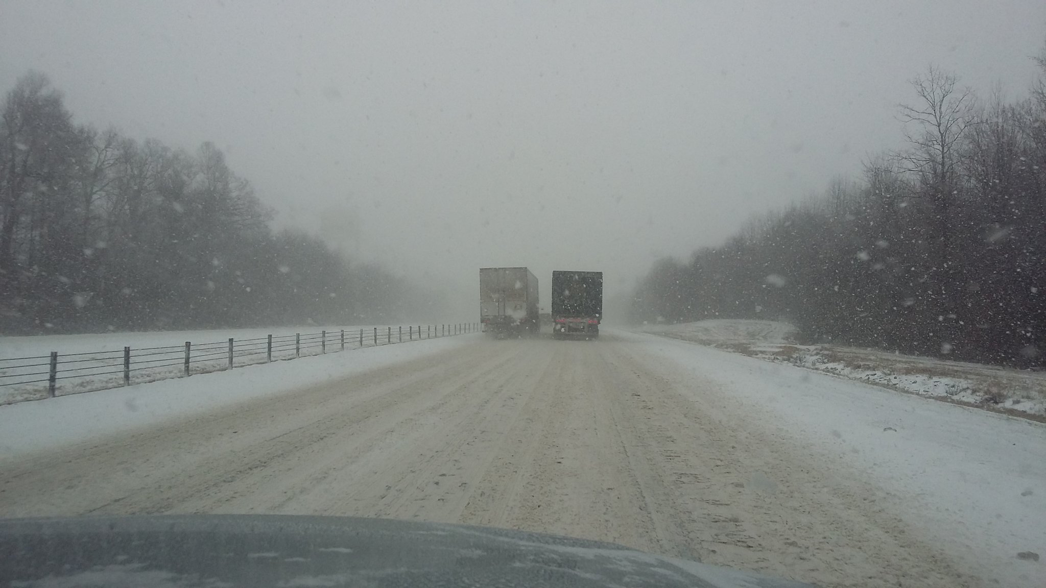
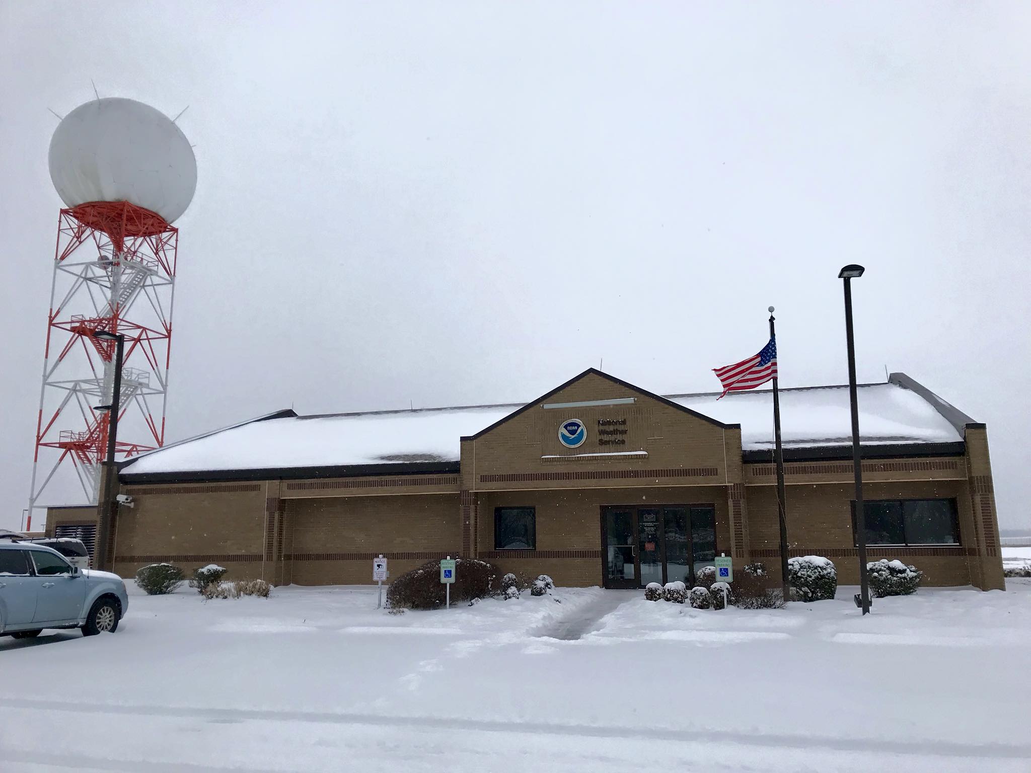
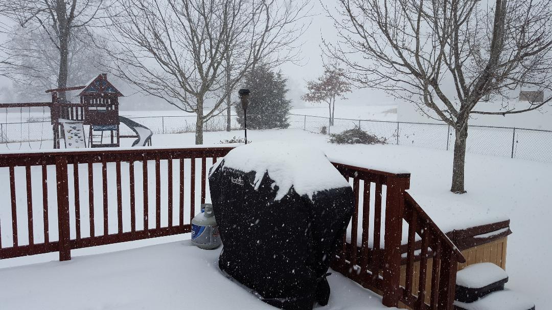
Photos:
 |
 |
 |
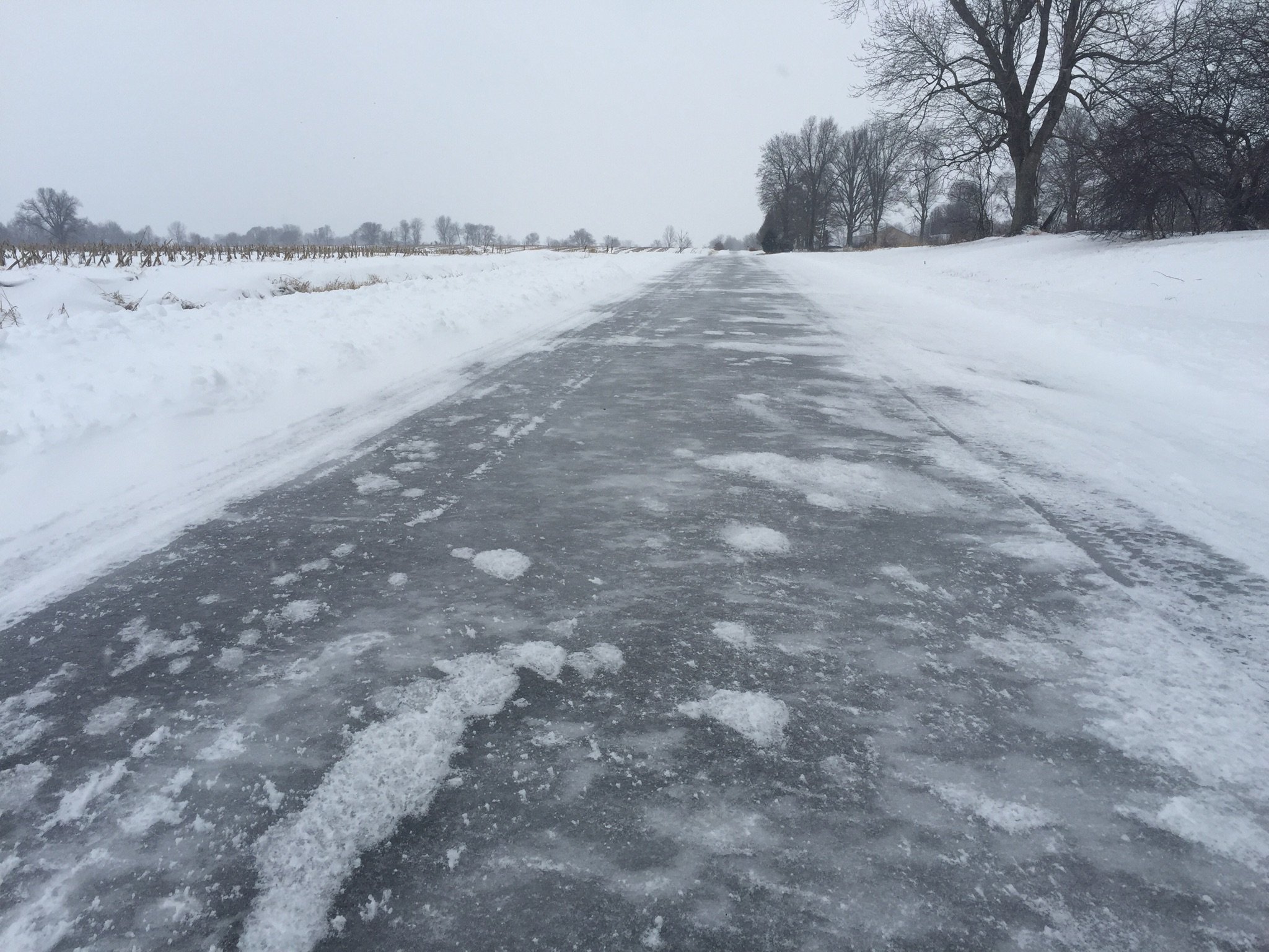 |
| I-24 near Paducah, KY via Tammy Meffert | NWS Paducah office | Snowing in Lone Oak, KY via Sean Poulos | Icy roads near Fulton, KY via Lew Jetton |
Radar:
The back edge of the precipitation moved out of southeast Missouri and southwest Illinois during the early morning hours. However, the back edge stalled near a Paducah to Evansville line for much of the day. A vigorous disturbance in the upper levels of the atmosphere moved northeast across the Tennessee Valley during the day, causing the back edge to stall. Locally heavy snowfall amounts ended up falling over parts of western Kentucky.
| Radar Loop from 7 PM January 11th to 9 PM on January 12th |
Storm Reports
PRELIMINARY LOCAL STORM REPORT...SUMMARY
NATIONAL WEATHER SERVICE PADUCAH KY
900 AM CST SAT JAN 13 2018
..TIME... ...EVENT... ...CITY LOCATION... ...LAT.LON...
..DATE... ....MAG.... ..COUNTY LOCATION..ST.. ...SOURCE....
..REMARKS..
1002 PM HEAVY SLEET PERRYVILLE 37.73N 89.87W
01/11/2018 E0.00 INCH PERRY MO BROADCAST MEDIA
HEAVY SLEET IN PERRYVILLE. ALSO IN JACKSON, MO.
1014 PM HEAVY SLEET PINCKNEYVILLE 38.08N 89.38W
01/11/2018 E0.00 INCH PERRY IL PUBLIC
1019 PM NON-TSTM WND GST BENTON 36.85N 88.36W
01/11/2018 E45.00 MPH MARSHALL KY FIRE DEPT/RESCUE
1022 PM FREEZING RAIN DE SOTO 37.82N 89.23W
01/11/2018 E0.00 INCH JACKSON IL TRAINED SPOTTER
ICE ACCUMULATION ON ELEVATED SURFACES.
1045 PM SLEET JACKSON 37.38N 89.65W
01/11/2018 E0.25 INCH CAPE GIRARDEAU MO PUBLIC
1113 PM SLEET CARBONDALE 37.72N 89.22W
01/11/2018 U0.00 INCH JACKSON IL TRAINED SPOTTER
VERY HEAVY SLEET AND IS ACCUMULATING ON THE ROADS. HIGH
WINDS OCCURRING.
1206 AM SLEET CARTERVILLE 37.76N 89.08W
01/12/2018 M0.50 INCH WILLIAMSON IL BROADCAST MEDIA
A GLAZE OF ICE UNDERNEATH.
1230 AM SLEET 3 SW DEXTER 36.76N 90.00W
01/12/2018 E0.00 INCH STODDARD MO TRAINED SPOTTER
SLEET BEGINNING TO ACCUMULATE ON ROADS AND VEHICLES.
1243 AM SLEET EAST PRAIRIE 36.78N 89.38W
01/12/2018 M0.13 INCH MISSISSIPPI MO TRAINED SPOTTER
ONE EIGHTH SLEET BUILDUP ON DECKS AND VEHICLES.
1250 AM ICE STORM PULASKI 37.22N 89.21W
01/12/2018 PULASKI IL EMERGENCY MNGR
EMERGENCY MANAGER REPORTING GLAZED AND SLICK ROADS
0111 AM SLEET CARBONDALE 37.72N 89.22W
01/12/2018 M0.50 INCH JACKSON IL TRAINED SPOTTER
MEASURED ONE HALF INCH SLEET BUILDUP.
0112 AM SLEET CAPE GIRARDEAU 37.31N 89.55W
01/12/2018 M0.25 INCH CAPE GIRARDEAU MO BROADCAST MEDIA
MEASURED ONE QUARTER INCH SLEET BUILDUP ON ROADWAYS.
0113 AM HEAVY SLEET JACKSON 37.38N 89.65W
01/12/2018 M0.50 INCH CAPE GIRARDEAU MO PUBLIC
HALF INCH OF SLEET BUILDUP. SNOW IS NOW MIXED WITH THE
SLEET.
0118 AM HEAVY SLEET 2 N GOREVILLE 37.58N 88.97W
01/12/2018 E0.00 INCH JOHNSON IL BROADCAST MEDIA
HEAVY SLEET REPORTED AT INTERSECTION OF INTERESTATES 24
AND 57 JUST NORTH OF GOREVILLE, IL. INTERSTATE COMPLETELY
COVERED WITH ESTIMATED ONE QUARTER TO ONE HALF INCH
BUILDUP.
0125 AM SLEET EAST PRAIRIE 36.78N 89.38W
01/12/2018 M0.50 INCH MISSISSIPPI MO TRAINED SPOTTER
MEASURED ONE HALF INCH BUILDUP. SNOW NOW MIXING WITH
SLEET.
0141 AM HEAVY SLEET MOUND CITY 37.09N 89.16W
01/12/2018 M0.25 INCH PULASKI IL EMERGENCY MNGR
EMERGENCY MANAGER MEASURED ONE QUARTER INCH SLEET BUILDUP
ON ROADWAYS.
0156 AM FREEZING RAIN BROOKPORT 37.12N 88.63W
01/12/2018 U0.00 INCH MASSAC IL TRAINED SPOTTER
THE BROOKPORT BRIDGE, OR IRVIN COBB BRIDGE, IS CLOSED DUE
TO ICING.
0159 AM SNOW 3 W TILINE 37.17N 88.33W
01/12/2018 M4.0 INCH LIVINGSTON KY TRAINED SPOTTER
0203 AM FREEZING RAIN EVANSVILLE 37.98N 87.54W
01/12/2018 E0.00 INCH VANDERBURGH IN EMERGENCY MNGR
EMERGENCY MANAGER REPORTING MODERATE TO HEAVY FREEZING
RAIN AND SLEET. NON-TREATED SIDEWALKS AND ROADS VERY
SLICK AND HAZARDOUS. VEHICLES HAVE HEAVY COATING OF ICE.
0207 AM SLEET FAIRDEALING 36.66N 90.62W
01/12/2018 U0.00 INCH RIPLEY MO PUBLIC
MINOR SLEET AND ICE BUILDUP REPORTED.
0230 AM SNOW EAST PRAIRIE 36.78N 89.38W
01/12/2018 M1.5 INCH MISSISSIPPI MO TRAINED SPOTTER
MEASURED 1.5 INCHES OF SNOW ON TOP OF ACCUMULATED ICE.
0234 AM HEAVY SLEET CAPE GIRARDEAU 37.31N 89.55W
01/12/2018 M0.75 INCH CAPE GIRARDEAU MO BROADCAST MEDIA
MEASURED THREE QUARTER INCH SLEET BUILDUP NEAR INTERSTATE
55. SNOW STARTING TO MIX IN WITH THE SLEET AT THIS TIME.
0254 AM SLEET WEST PADUCAH 37.08N 88.74W
01/12/2018 M0.15 INCH MCCRACKEN KY NWS EMPLOYEE
SLEET BUILDUP AT THE NWS OFFICE PADUCAH. HEAVY SLEET
FALLING AT THIS TIME.
0311 AM HEAVY SLEET DAWSON SPRINGS 37.17N 87.69W
01/12/2018 U0.00 INCH HOPKINS KY TRAINED SPOTTER
HEAVY SLEET CAUSING POWER OUTAGES NORTH OF TOWN. PHONE
OUTAGES REPORTED AS WELL.
0316 AM FREEZING RAIN HICKORY 36.82N 88.65W
01/12/2018 U0.00 INCH GRAVES KY PUBLIC
ROADS IN COMMUNITY BECOMING HAZARDOUS TO TRAVEL.
0329 AM HEAVY SLEET CARTERVILLE 37.76N 89.08W
01/12/2018 M0.25 INCH WILLIAMSON IL BROADCAST MEDIA
MEASURED ONE QUARTER INCH BUILDUP OF SLEET.
0420 AM FREEZING RAIN MURRAY 36.61N 88.32W
01/12/2018 M0.10 INCH CALLOWAY KY PUBLIC
MEASURED ONE TENTH INCH ICE BUILDUP. SLEET IS BEGINNING
TO MIX IN.
0425 AM HEAVY SLEET PULASKI 37.22N 89.21W
01/12/2018 M0.50 INCH PULASKI IL EMERGENCY MNGR
MEASURED UP TO ONE HALF INCH OF SLEET ACCUMULATION ACROSS
PORTIONS OF THE COUNTY. MANY OF THE ROADWAYS ARE COVERED
AND HAZARDOUS TO TRAVEL.
0458 AM ICE STORM BOONVILLE 38.05N 87.27W
01/12/2018 WARRICK IN UTILITY COMPANY
NEARLY 500 CUSTOMERS WITHOUT POWER IN THE BOONVILLE AREA.
0530 AM SLEET 2 S CALVERT CITY 37.00N 88.35W
01/12/2018 M0.25 INCH MARSHALL KY NWS EMPLOYEE
MODERATE SLEET FALLING WITH SLOW TRAFFIC ON I-24/69.
0537 AM SLEET BENTON 36.85N 88.36W
01/12/2018 E0.00 INCH MARSHALL KY FIRE DEPT/RESCUE
MODERATE SLEET FALLING AND ROADS COVERED.
0554 AM HEAVY SLEET HARRISBURG 37.74N 88.55W
01/12/2018 M0.25 INCH SALINE IL TRAINED SPOTTER
MEASURED ONE QUARTER INCH OF SLEET BUILDUP ON ALL OF THE
ROADWAYS. ROADS BECOMING HAZARDOUS TO TRAVEL.
0615 AM HEAVY SLEET MCLEANSBORO 38.09N 88.53W
01/12/2018 M1.00 INCH HAMILTON IL EMERGENCY MNGR
MEASURED ONE INCH SLEET ACCUMULATION.
0615 AM ICE STORM BEECH CREEK 37.18N 87.06W
01/12/2018 MUHLENBERG KY LAW ENFORCEMENT
ACCUMULATION OF ICE/SLEET BROUGHT DOWN A TREE AND FELL
ACROSS A POWER LINE. LOCAL POWER OUTAGES REPORTED.
0624 AM HEAVY SLEET CALVERT CITY 37.03N 88.35W
01/12/2018 M0.65 INCH MARSHALL KY NWS EMPLOYEE
MEASURED FREEZING RAIN AND SLEET ACCUMULATION.
0638 AM HEAVY SLEET HENDERSON 37.84N 87.58W
01/12/2018 U0.00 INCH HENDERSON KY TRAINED SPOTTER
LAYERED ICE/SLEET ACROSS ROADWAYS.
0641 AM HEAVY SLEET MURRAY 36.61N 88.32W
01/12/2018 M1.00 INCH CALLOWAY KY CO-OP OBSERVER
MEASURED ONE INCH OF SLEET ACCUMULATION ON TOP OF ONE
TENTH INCH OF ICE REPORTED IN DOWNTOWN MURRAY.
0712 AM HEAVY SLEET PADUCAH 37.07N 88.64W
01/12/2018 E0.50 INCH MCCRACKEN KY PUBLIC
NEARLY ONE HALF INCH OF ACCUMULATED ICE AND SLEET.
0810 AM SLEET 5 W FULTON 36.51N 88.97W
01/12/2018 M1.00 INCH FULTON KY TRAINED SPOTTER
COMBINATION OF SLEET AND SNOW.
0816 AM SLEET BENTON 36.85N 88.36W
01/12/2018 M0.80 INCH MARSHALL KY TRAINED SPOTTER
SOME ICE UNDERNEATH THE SLEET.
0816 AM HEAVY SLEET 4 E OAK RIDGE 37.50N 89.66W
01/12/2018 M4.25 INCH CAPE GIRARDEAU MO EMERGENCY MNGR
0816 AM HEAVY SLEET 2 N OAK RIDGE 37.53N 89.73W
01/12/2018 M4.00 INCH CAPE GIRARDEAU MO EMERGENCY MNGR
2 TO 4 INCHES OF SLEET MEASURED ACROSS NORTHERN CAPE
GIRARDEAU COUNTY WITH APPROXIMATELY 1/4 INCH ICE
UNDERNEATH.
0822 AM SLEET METROPOLIS 37.15N 88.71W
01/12/2018 M0.75 INCH MASSAC IL EMERGENCY MNGR
1/2 TO 3/4 INCH SLEET DEPTH ATOP A THIN LAYER OF ICE.
0825 AM SLEET SORGHO 37.75N 87.25W
01/12/2018 M0.25 INCH DAVIESS KY TRAINED SPOTTER
0834 AM SLEET HERRIN 37.80N 89.03W
01/12/2018 M0.50 INCH WILLIAMSON IL FIRE DEPT/RESCUE
A GLAZING OF ICE UNDERNEATH THE SLEET.
0859 AM SLEET HICKORY 36.82N 88.65W
01/12/2018 M0.75 INCH GRAVES KY PUBLIC
MEASURED .75 IN OF SLEET IN HICKORY, KY.
0900 AM ICE STORM HARRISBURG 37.74N 88.55W
01/12/2018 SALINE IL EMERGENCY MNGR
0.25 INCHES OF ICE ACCUMULATION AND 1 INCH OF SLEET.
0900 AM SLEET SIKESTON 36.88N 89.58W
01/12/2018 M1.00 INCH SCOTT MO EMERGENCY MNGR
0910 AM HEAVY SLEET BENTON 36.85N 88.36W
01/12/2018 M1.00 INCH MARSHALL KY TRAINED SPOTTER
0915 AM SLEET MURRAY 36.61N 88.32W
01/12/2018 M2.00 INCH CALLOWAY KY TRAINED SPOTTER
TRAINED SPOTTER REPORTED 2 INCHES OF SLEET IN MURRAY,
STARTING TO TRANSITION TO SNOW.
0921 AM SLEET HENDERSON 37.84N 87.58W
01/12/2018 M0.40 INCH HENDERSON KY EMERGENCY MNGR
SLEET/SNOW ACCUMULATION.
0929 AM SLEET PADUCAH 37.07N 88.64W
01/12/2018 M0.50 INCH MCCRACKEN KY PUBLIC
MEASURED .50 INCH OF SLEET IN PADUCAH
0946 AM HEAVY SNOW ROUND KNOB 37.22N 88.73W
01/12/2018 M0.5 INCH MASSAC IL TRAINED SPOTTER
1/2 INCH OF SNOWFALL IN LAST HOUR. WIND GUSTS ABOVE 30
MPH.
1008 AM SLEET EVANSVILLE 37.98N 87.54W
01/12/2018 M0.60 INCH VANDERBURGH IN PUBLIC
REPORT OF 0.6 INCH OF SLEET IN EVANSVILLE.
1029 AM HEAVY SLEET NEW MADRID 36.59N 89.55W
01/12/2018 M1.00 INCH NEW MADRID MO EMERGENCY MNGR
THIN LAYER OF ICE UNDERNEATH.
1033 AM HEAVY SLEET N COBDEN 37.53N 89.25W
01/12/2018 M1.50 INCH UNION IL EMERGENCY MNGR
1036 AM HEAVY SLEET MARION 37.73N 88.94W
01/12/2018 M2.00 INCH WILLIAMSON IL BROADCAST MEDIA
1.5 INCHES OF SLEET AND 0.5 INCHES OF SNOW. LESS THAN .05
INCHES OF ICE.
1047 AM SLEET CADIZ 36.87N 87.82W
01/12/2018 M0.75 INCH TRIGG KY TRAINED SPOTTER
0.10 INCH ICE ACCUMULATION UNDERNEATH THE SLEET.
1050 AM SNOW PETERSBURG 38.49N 87.28W
01/12/2018 M0.5 INCH PIKE IN EMERGENCY MNGR
APPROXIMATELY 0.20 INCHES OF ICE ACCUMULATION UNDERNEATH
THE SNOW/SLEET.
1051 AM SNOW 5 NW CADIZ 36.92N 87.89W
01/12/2018 M0.5 INCH TRIGG KY TRAINED SPOTTER
SPOTTER REPORTED 1.5 IN OF FREEZING RAIN/SLEET AND O.5 IN
OF SNOW.
1057 AM SNOW CARMI 38.09N 88.17W
01/12/2018 M2.0 INCH WHITE IL PUBLIC
SOME SLEET UNDERNEATH THE 2 INCH SNOW LAYER.
1100 AM SNOW ELDORADO 37.81N 88.44W
01/12/2018 M2.5 INCH SALINE IL PUBLIC
1100 AM HEAVY SLEET PRINCETON 37.11N 87.88W
01/12/2018 M1.75 INCH CALDWELL KY PUBLIC
1103 AM ICE STORM CADIZ 36.87N 87.82W
01/12/2018 TRIGG KY EMERGENCY MNGR
EMERGENCY MANAGER REPORTED 3/8 INCH OF ICE, OVER AN INCH
OF SNOW CURRENTLY ON GROUND.
1145 AM SNOW BARDWELL 36.87N 89.01W
01/12/2018 M3.8 INCH CARLISLE KY PUBLIC
COMBINATION OF SNOW AND SLEET.
1147 AM HEAVY SLEET 5 ESE EVANSVILLE 37.96N 87.46W
01/12/2018 M1.20 INCH VANDERBURGH IN TRAINED SPOTTER
SLEET AND SNOW ACCUMULATION COMBINED.
1147 AM HEAVY SLEET SHAWNEETOWN 37.71N 88.17W
01/12/2018 M2.40 INCH GALLATIN IL EMERGENCY MNGR
COMBINATION OF SLEET AND SNOW.
1152 AM SNOW HICKMAN 36.56N 89.19W
01/12/2018 M2.0 INCH FULTON KY EMERGENCY MNGR
INCLUDES SOME ICE UNDERNEATH.
1206 PM SLEET CARTERVILLE 37.76N 89.08W
01/12/2018 M0.50 INCH WILLIAMSON IL BROADCAST MEDIA
A GLAZE OF ICE UNDERNEATH THE SLEET AND SNOW.
1222 PM SNOW 5 W FULTON 36.51N 88.97W
01/12/2018 M2.8 INCH FULTON KY BROADCAST MEDIA
1226 PM SNOW FAIRDEALING 36.84N 88.22W
01/12/2018 M1.5 INCH MARSHALL KY TRAINED SPOTTER
1230 PM SNOW MORGANFIELD 37.68N 87.91W
01/12/2018 M2.0 INCH UNION KY FIRE DEPT/RESCUE
1233 PM SNOW DRAFFENVILLE 36.94N 88.34W
01/12/2018 M2.0 INCH MARSHALL KY TRAINED SPOTTER
SNOW AND SLEET COMBINED.
1236 PM SNOW WICKLIFFE 36.97N 89.08W
01/12/2018 M2.0 INCH BALLARD KY NEWSPAPER
1255 PM SNOW MURRAY 36.61N 88.32W
01/12/2018 M2.5 INCH CALLOWAY KY TRAINED SPOTTER
TRAINED SPOTTER REPORTED 2.5 INCHES OF SNOWFALL IN
MURRAY.
1258 PM SNOW BENTON 36.85N 88.36W
01/12/2018 M3.0 INCH MARSHALL KY TRAINED SPOTTER
1258 PM SNOW HENDERSON 37.84N 87.58W
01/12/2018 M2.0 INCH HENDERSON KY BROADCAST MEDIA
SNOW AND SLEET.
0100 PM SNOW ROCKPORT 37.88N 87.05W
01/12/2018 M2.2 INCH SPENCER IN TRAINED SPOTTER
SNOW AND SLEET.
0104 PM SNOW EVANSVILLE 37.98N 87.54W
01/12/2018 M1.9 INCH VANDERBURGH IN PUBLIC
REPORT OF 1.9 INCHES OF SNOW IN EVANSVILLE, IN.
0104 PM SNOW PADUCAH 37.07N 88.64W
01/12/2018 M3.5 INCH MCCRACKEN KY NWS EMPLOYEE
REPORT OF 3.5 INCHES OF SNOW AND SLEET IN PADUCAH.
0106 PM SNOW MOUNT VERNON 37.94N 87.90W
01/12/2018 M1.8 INCH POSEY IN EMERGENCY MNGR
0115 PM SNOW MADISONVILLE 37.34N 87.51W
01/12/2018 M2.5 INCH HOPKINS KY EMERGENCY MNGR
0120 PM SNOW 6 W EVANSVILLE 37.98N 87.65W
01/12/2018 M2.8 INCH VANDERBURGH IN TRAINED SPOTTER
0137 PM SLEET POPLAR BLUFF 36.76N 90.41W
01/12/2018 M0.50 INCH BUTLER MO TRAINED SPOTTER
COMBINATION OF SLEET AND SNOW.
0140 PM SNOW ST. JOHNS 36.97N 88.67W
01/12/2018 M4.0 INCH MCCRACKEN KY PUBLIC
0142 PM SNOW CAMBRIDGE SHORES 36.94N 88.23W
01/12/2018 M4.5 INCH MARSHALL KY PUBLIC
REPORT OF 4.5 INCHES OF SNOW NEAR MOORS RESORT.
0142 PM SNOW MURRAY 36.61N 88.32W
01/12/2018 M4.0 INCH CALLOWAY KY TRAINED SPOTTER
TRAINED SPOTTER MEASURED 4 INCHES OF SNOW IN DOWNTOWN
MURRAY.
0200 PM SNOW EVANSVILLE 37.98N 87.54W
01/12/2018 M2.8 INCH VANDERBURGH IN PUBLIC
REPORT OF 2.8 IN OF SNOW IN EVANSVILLE.
0213 PM SNOW EVANSVILLE 37.98N 87.54W
01/12/2018 M2.4 INCH VANDERBURGH IN BROADCAST MEDIA
MEDIA REPORTED 2.4 INCHES OF SNOW IN DOWNTOWN EVANSVILLE.
SNOW ON TOP OF 0.6 IN OF SLEET AND 0.05 IN ICE, GIVING A
TOTAL OF 3 IN.
0213 PM SNOW ROUND KNOB 37.22N 88.73W
01/12/2018 M3.0 INCH MASSAC IL PUBLIC
REPORT OF 3 INCHES OF SNOW AND 0.5 INCH SLEET.
0213 PM SNOW METROPOLIS 37.15N 88.71W
01/12/2018 M4.0 INCH MASSAC IL TRAINED SPOTTER
TRAINED SPOTTER REPORTED 4 INCHES OF SNOW AND SLEET.
0215 PM SNOW MAYFIELD 36.74N 88.65W
01/12/2018 M3.5 INCH GRAVES KY PUBLIC
3.5 INCHES OF SNOW AND SLEET IN MAYFIELD.
0219 PM SNOW NEWBURGH 37.95N 87.40W
01/12/2018 M3.2 INCH WARRICK IN BROADCAST MEDIA
0251 PM SNOW GALATIA 37.84N 88.61W
01/12/2018 E4.0 INCH SALINE IL PUBLIC
0255 PM SNOW CARMI 38.09N 88.17W
01/12/2018 M3.0 INCH WHITE IL TRAINED SPOTTER
MEASURED 3 INCHES OF SNOW ON TOP OF THREE-EIGHTS OF AN
INCH OF ICE ACCUMULATION.
0307 PM SNOW 3 W EVANSVILLE 37.98N 87.60W
01/12/2018 M2.5 INCH VANDERBURGH IN PUBLIC
0307 PM SNOW 3 W EVANSVILLE 37.98N 87.60W
01/12/2018 M2.5 INCH VANDERBURGH IN PUBLIC
0307 PM SNOW 5 SE EVANSVILLE 37.93N 87.48W
01/12/2018 M3.8 INCH VANDERBURGH IN PUBLIC
MEASURED NEAR ANGEL MOUNDS. SNOW IS STILL ACCUMULATING.
0307 PM SNOW 3 SW EVANSVILLE 37.95N 87.58W
01/12/2018 M2.5 INCH HENDERSON KY PUBLIC
0308 PM SNOW 7 NNE HOPKINSVILLE 36.95N 87.44W
01/12/2018 E2.0 INCH CHRISTIAN KY PUBLIC
0334 PM SNOW 3 SE EVANSVILLE 37.95N 87.50W
01/12/2018 M4.6 INCH VANDERBURGH IN TRAINED SPOTTER
FOUR INCHES OF SNOW ON TOP OF 0.6 INCHES OF SLEET. ALSO
MEASURED 0.05 INCH OF ICE ACCUMULATION. STILL SNOWING.
0336 PM SNOW 2 SW LONE OAK 37.02N 88.69W
01/12/2018 E4.5 INCH MCCRACKEN KY NWS EMPLOYEE
FOUR INCHES OF SNOW ON TOP OF A HALF INCH OF SLEET.
0346 PM SNOW FORT BRANCH 38.25N 87.57W
01/12/2018 M4.0 INCH GIBSON IN TRAINED SPOTTER
0405 PM SNOW HENDERSON 37.84N 87.58W
01/12/2018 M5.0 INCH HENDERSON KY TRAINED SPOTTER
0405 PM SNOW EVANSVILLE 37.98N 87.54W
01/12/2018 M4.5 INCH VANDERBURGH IN BROADCAST MEDIA
3.9 INCHES OF SNOW ON TOP OF 0.6 INCHES OF SLEET.
MEASURED IN DOWNTOWN EVANSVILLE.
0405 PM SNOW 8 NE MURRAY 36.69N 88.21W
01/12/2018 M5.5 INCH CALLOWAY KY TRAINED SPOTTER
FOUR INCHES OF SNOW ON TOP OF ONE INCH OF SLEET.
0406 PM SNOW 2 W PADUCAH 37.07N 88.67W
01/12/2018 M4.5 INCH MCCRACKEN KY PUBLIC
FOUR INCHES OF SNOW ON TOP OF A HALF INCH OF SLEET.
0408 PM SNOW EAST PRAIRIE 36.78N 89.38W
01/12/2018 M2.5 INCH MISSISSIPPI MO PUBLIC
0412 PM SNOW EVANSVILLE 37.98N 87.54W
01/12/2018 M5.0 INCH VANDERBURGH IN PUBLIC
0416 PM SNOW LONE OAK 37.04N 88.67W
01/12/2018 M4.0 INCH MCCRACKEN KY BROADCAST MEDIA
0421 PM SNOW 2 S CALVERT CITY 37.00N 88.35W
01/12/2018 M6.0 INCH MARSHALL KY NWS EMPLOYEE
0422 PM SNOW MOUNT CARMEL 38.42N 87.77W
01/12/2018 M5.0 INCH WABASH IL TRAINED SPOTTER
0445 PM SNOW OWENSBORO 37.76N 87.12W
01/12/2018 M4.0 INCH DAVIESS KY PUBLIC
0451 PM SNOW MURRAY 36.61N 88.32W
01/12/2018 M7.0 INCH CALLOWAY KY TRAINED SPOTTER
5 INCHES OF SNOW ON TOP OF 2 INCHES OF SLEET, STORM
TOTAL.
0452 PM SNOW EVANSVILLE 37.98N 87.54W
01/12/2018 M5.0 INCH VANDERBURGH IN PUBLIC
0503 PM SNOW HOPKINSVILLE 36.85N 87.49W
01/12/2018 M3.0 INCH CHRISTIAN KY TRAINED SPOTTER
0503 PM SNOW 2 N HOPKINSVILLE 36.88N 87.49W
01/12/2018 M2.0 INCH CHRISTIAN KY TRAINED SPOTTER
0522 PM SNOW NEWBURGH 37.95N 87.40W
01/12/2018 M4.5 INCH WARRICK IN BROADCAST MEDIA
DRIFTS UP TO ONE FOOT IN SPOTS.
0523 PM SNOW EDDYVILLE 37.08N 88.08W
01/12/2018 M6.1 INCH LYON KY TRAINED SPOTTER
4.8 INCHES OF SNOW ON TOP OF 1.3 INCHES OF SLEET. ALSO
MEASURED 0.05 INCH OF ICE GLAZING.
0533 PM SNOW 4 NNE EVANSVILLE 38.04N 87.52W
01/12/2018 M5.5 INCH VANDERBURGH IN PUBLIC
0553 PM SNOW BENTON 36.85N 88.36W
01/12/2018 M6.5 INCH MARSHALL KY PUBLIC
TOTAL SNOW AND SLEET ACCUMULATION.
0600 PM SNOW WEST PADUCAH 37.08N 88.74W
01/12/2018 M4.3 INCH MCCRACKEN KY OFFICIAL NWS OBS
FINAL STORM TOTAL.
0609 PM SNOW FAIRDEALING 36.84N 88.22W
01/12/2018 E4.0 INCH MARSHALL KY TRAINED SPOTTER
0653 PM SNOW 5 SE EVANSVILLE 37.93N 87.48W
01/12/2018 M5.5 INCH VANDERBURGH IN PUBLIC
FINAL STORM TOTAL.
0921 PM SNOW COLDWATER 36.65N 88.46W
01/12/2018 E7.0 INCH CALLOWAY KY PUBLIC
SNOW AND SLEET ACCUMULATION TOTAL.
0921 PM SNOW BRIENSBURG 36.90N 88.32W
01/12/2018 E7.0 INCH MARSHALL KY PUBLIC
SNOW AND SLEET ACCUMULATION TOTAL.
0921 PM SNOW PADUCAH 37.07N 88.64W
01/12/2018 M4.5 INCH MCCRACKEN KY TRAINED SPOTTER
SNOW AND SLEET TOTAL. MEASURED IN DOWNTOWN PADUCAH.
0921 PM SNOW SHARPE 36.97N 88.46W
01/12/2018 E5.0 INCH MARSHALL KY PUBLIC
0921 PM SNOW BENTON 36.85N 88.36W
01/12/2018 M7.0 INCH MARSHALL KY TRAINED SPOTTER
FINAL TOTAL.
0921 PM SNOW ROUND KNOB 37.22N 88.73W
01/12/2018 M3.5 INCH MASSAC IL TRAINED SPOTTER
THREE INCHES OF SNOW ON TOP OF A HALF INCH OF SLEET.
0921 PM SNOW REIDLAND 37.01N 88.53W
01/12/2018 M4.5 INCH MCCRACKEN KY PUBLIC
TOTAL SNOW AND SLEET.
0921 PM FREEZING RAIN CARBONDALE 37.72N 89.22W
01/12/2018 E0.10 INCH JACKSON IL PUBLIC
0921 PM SNOW CARBONDALE 37.72N 89.22W
01/12/2018 E0.8 INCH JACKSON IL PUBLIC
0.3 INCHES OF SNOW ON TOP OF 0.5 INCHES OF SLEET.
0921 PM SNOW MURRAY 36.61N 88.32W
01/12/2018 M6.0 INCH CALLOWAY KY TRAINED SPOTTER
FOUR INCHES OF SNOW ON TOP OF TWO INCHES OF SLEET.
0921 PM SNOW DRAFFENVILLE 36.94N 88.34W
01/12/2018 E7.0 INCH MARSHALL KY PUBLIC
SNOW AND SLEET ACCUMULATION TOTAL.
0940 PM SNOW ROCKPORT 37.88N 87.05W
01/12/2018 M5.9 INCH SPENCER IN TRAINED SPOTTER
STORM TOTAL AS OF 930 PM.
0940 PM SNOW JOPPA 37.21N 88.84W
01/12/2018 E4.0 INCH MASSAC IL PUBLIC
0944 PM SNOW MILBURN 36.80N 88.89W
01/12/2018 M5.3 INCH CARLISLE KY PUBLIC
4.8 INCHES OF SNOW ON TOP OF 0.5 INCH OF SLEET.
0944 PM SNOW LA CENTER 37.07N 88.97W
01/12/2018 M5.5 INCH BALLARD KY TRAINED SPOTTER
SNOW AND SLEET ACCUMULATION TOTAL.
&&
$$
RST
 |
Media use of NWS Web News Stories is encouraged! Please acknowledge the NWS as the source of any news information accessed from this site. |
|

