Overview
Scattered supercell thunderstorms developed ahead of a cold front on the 14th as it swept east across our region during the day. The supercell activity was preceded by widespread rain and thunderstorms the previous night. The overnight rain was locally heavy, causing some flooding in western Kentucky. Throughout the event, strong gradient winds associated with a strong low pressure system gusted up to 50 mph at times. The low tracked northeast across the Plains to the Great Lakes region.Tornadoes:
|
|
||||||||||
|
||||||||||
|
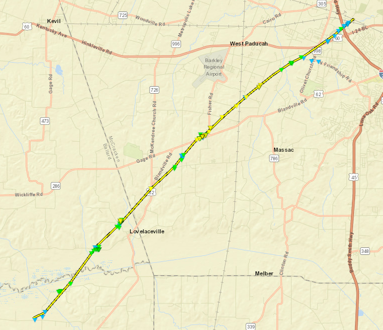
Tornado - West/southwest of Paducah Click here for a video of the tornado taken from the NWS Paducah office.
|
||||||||||||||||
|
Tornado #2- Morganfield, KY
Track Map - Click for full size 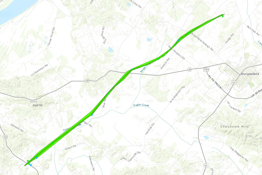 
|
||||||||||||||||
|
Tornado #3 - Smith Mills, KY
Track Map - Click for full size 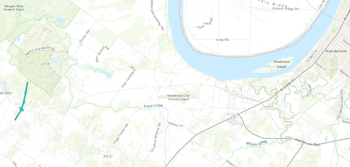
|
||||||||||||||||
|
Tornado #4- Sebree, KY
Track Map - Click for full size 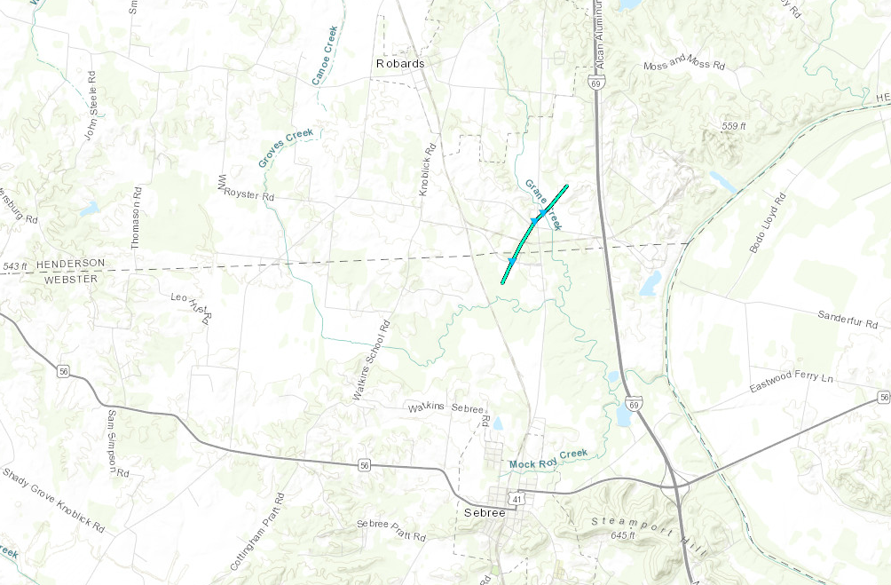
|
||||||||||||||||
|
Tornado #5- Slaughters, KY
Track Map - Click for full size 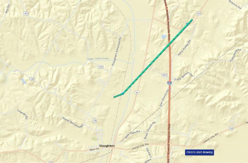
|
||||||||||||||||
|
Tornado #6 - Hickory, KY
Track Map - Click for full size 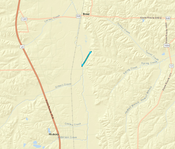
|
||||||||||||||||
The Enhanced Fujita (EF) Scale classifies tornadoes into the following categories:
| EF0 Weak 65-85 mph |
EF1 Moderate 86-110 mph |
EF2 Significant 111-135 mph |
EF3 Severe 136-165 mph |
EF4 Extreme 166-200 mph |
EF5 Catastrophic 200+ mph |
 |
|||||
Wind:
Widespread strong non-thunderstorm winds occurred from the afternoon of the 13th through the afternoon of the 14th.
Non-thunderstorm Wind Reports - March 14
Public Information Statement
National Weather Service Paducah KY
413 PM CDT Thu Mar 14 2019

...HIGHEST NON-THUNDERSTORM WIND REPORTS AS OF 4 PM THURSDAY MARCH 14...

Location                     Speed     Time/Date       Provider
Evansville IN                55 MPH    1133 AM 03/14   ASOS
Madisonville KY              54 MPH    1215 PM 03/14   AWOS
5 SE Hanson                  54 MPH    1215 PM 03/14   NONFEDAWOS
Mt Vernon IL                 52 MPH    1138 AM 03/14   AWOS
Powderly                     52 MPH    1255 PM 03/14   MESOWEST
Henderson KY 5 E             50 MPH    1100 AM 03/14   KYMN
Carmi IL                     49 MPH    0156 PM 03/14   AWOS
Marion KY 4 NE               48 MPH    1020 AM 03/14   KYMN
1 SW Heath                   47 MPH    1230 PM 03/14   CWOP
5 S Wolf Island              47 MPH    1231 PM 03/14   CWOP
Greenville KY 6 N            47 MPH    0100 PM 03/14   KYMN
Benton KY 4 N                47 MPH    0120 PM 03/14   KYMN
Marion IL                    47 MPH    0145 PM 03/14   AWOS
Sikeston Muni                47 MPH    0155 PM 03/14   AWOS
Metropolis IL                46 MPH    0135 PM 03/14   AWOS
Cairo IL                     45 MPH    0135 PM 03/14   AWOS
Greenville KY                44 MPH    1215 PM 03/14   RAWS
1 W Miner                    44 MPH    1255 PM 03/14   NONFEDAWOS
2 NW Anniston                42 MPH    1230 PM 03/14   MOCOMAGNET
Doniphan MO                  42 MPH    1253 PM 03/14   RAWS
6 ENE Hazel                  42 MPH    0130 PM 03/14   CWOP
6 SSW Delta                  41 MPH    1245 PM 03/14   MESOWEST
Elkton KY 5 SW               41 MPH    0130 PM 03/14   KYMN
Ridgway                      41 MPH    0211 PM 03/14   CWOP
Bean Ridge IL                40 MPH    1208 PM 03/14   RAWS
Piedmont MO                  40 MPH    0130 PM 03/14   RAWS

Observations are collected from a variety of sources with varying
equipment and exposures. We thank all volunteer weather observers
for their dedication. Not all data listed are considered official.
Non-thunderstorm Wind Reports - March 13
Public Information Statement
National Weather Service Paducah KY
431 PM CDT Wed Mar 13 2019

...HIGHEST WIND GUSTS AS OF 430 PM WEDNESDAY MARCH 13TH...

Location                     Speed     Time/Date       Provider
10 N Perryville MO           49 MPH    0215 PM 03/13   AWOS
Poplar Bluff MO              45 MPH    0325 PM 03/13   ASOS
Cape Girardeau MO            45 MPH    0327 PM 03/13   ASOS
Carbondale IL                41 MPH    0246 PM 03/13   ASOS
Paducah KY                   38 MPH    0329 PM 03/13   ASOS
Murray KY                    37 MPH    0355 PM 03/13   AWOS
Hickman KY 2 E               36 MPH    0310 PM 03/13   KYMN
3 SE Grand Tower             34 MPH    1235 PM 03/13   MESOWEST
Greenville KY 6 N            34 MPH    0230 PM 03/13   KYMN
Crab Orchard IL              34 MPH    0248 PM 03/13   RAWS
Piedmont MO                  34 MPH    0330 PM 03/13   RAWS
Morganfield KY 4 E           33 MPH    0120 PM 03/13   KYMN
Mayfield KY 6 SW             33 MPH    0340 PM 03/13   KYMN
Marion IL                    33 MPH    0345 PM 03/13   AWOS
Doniphan MO                  33 MPH    0353 PM 03/13   RAWS
Harrisburg IL                32 MPH    0115 PM 03/13   AWOS
Elkton KY 5 SW               32 MPH    0330 PM 03/13   KYMN
Cadiz KY 4 SW                32 MPH    0335 PM 03/13   KYMN
Hopkinsville KY 6 N          32 MPH    0400 PM 03/13   KYMN
4 SE Allegre                 31 MPH    0316 PM 03/13   CWOP
Calhoun KY 5 NW              31 MPH    0330 PM 03/13   KYMN
Owensboro KY                 31 MPH    0351 PM 03/13   AWOS
4 NNW Murray                 31 MPH    0415 PM 03/13   CWOP
Henderson KY                 30 MPH    0214 PM 03/13   AWOS
Powderly                     30 MPH    0215 PM 03/13   MESOWEST
Newburgh                     30 MPH    0301 PM 03/13   CWOP
Madisonville KY 4 S          30 MPH    0320 PM 03/13   KYMN
Chicopee MO                  30 MPH    0322 PM 03/13   RAWS
Marion KY                    30 MPH    0335 PM 03/13   AWOS
Evansville IN                30 MPH    0343 PM 03/13   ASOS
Ridgway                      30 MPH    0346 PM 03/13   CWOP
Oakland City                 30 MPH    0400 PM 03/13   CWOP
Princeton KY 2 SE            30 MPH    0400 PM 03/13   KYMN
3 WSW Christopher            30 MPH    0405 PM 03/13   CWOP

Observations are collected from a variety of sources with varying
equipment and exposures. We thank all volunteer weather observers
for their dedication. Not all data listed are considered official.
.
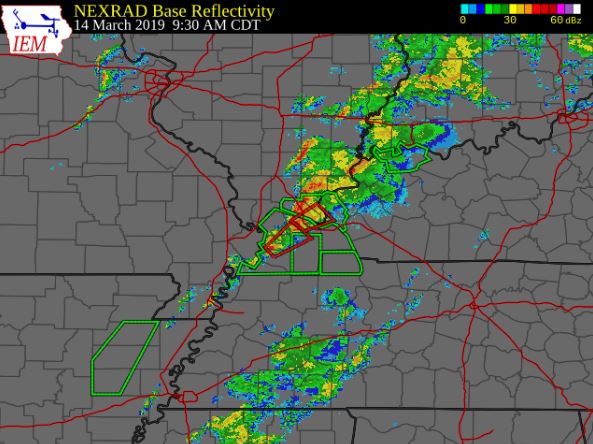
Flooding
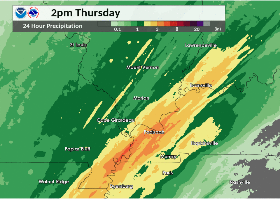
Locally very heavy rain occurred in western KY and nearby portions of southeast MO and southern IL. Most of the rain fell on the night of the 13th. Locally over three inches fell in a narrow swath from the Missouri Bootheel northeast across Paducah. The very heavy rain caused renewed flooding of creeks and small rivers. Some of the affected waterways included the Clarks River in Marshall and McCracken Counties (KY), Champion Creek near Paducah, Mayfield Creek in Graves and McCracken Counties, Red Duck Creek in Mayfield KY, and Massac Creek near Paducah. In each case, state roads were closed by the flooding. The flash flooding of Red Duck Creek in Mayfield prompted some emergency crews to respond late on the night of the 13th.
Radar-estimated rainfall for 24-hour period ending March 14 at 2 PM
Photos & Video
Click here for a video of the tornado taken from the NWS Paducah office.
Photos of the tornado damage near Paducah...
 |
 |
 |
 |
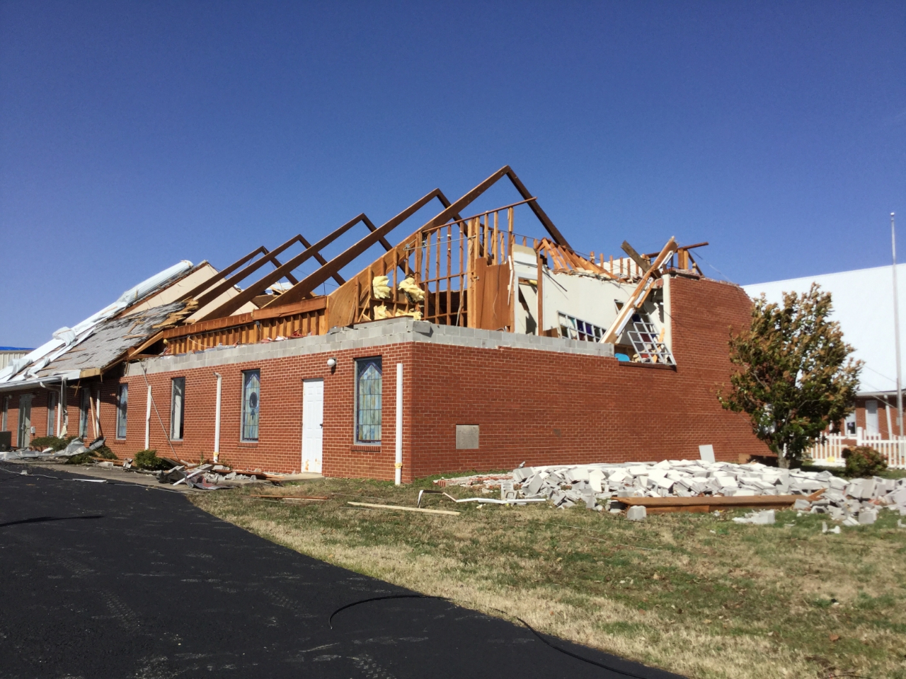
| Church damage on US Hwy 62 (NWS survey team) |
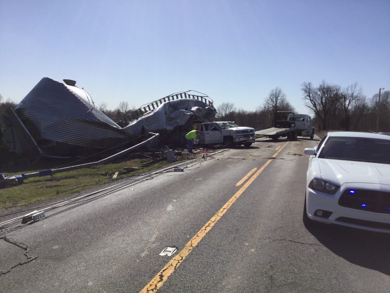
Grain bin on a truck on Hwy 62 (NWS survey team) |
House on Hwy 62 at Hwy 726 (NWS survey team) |
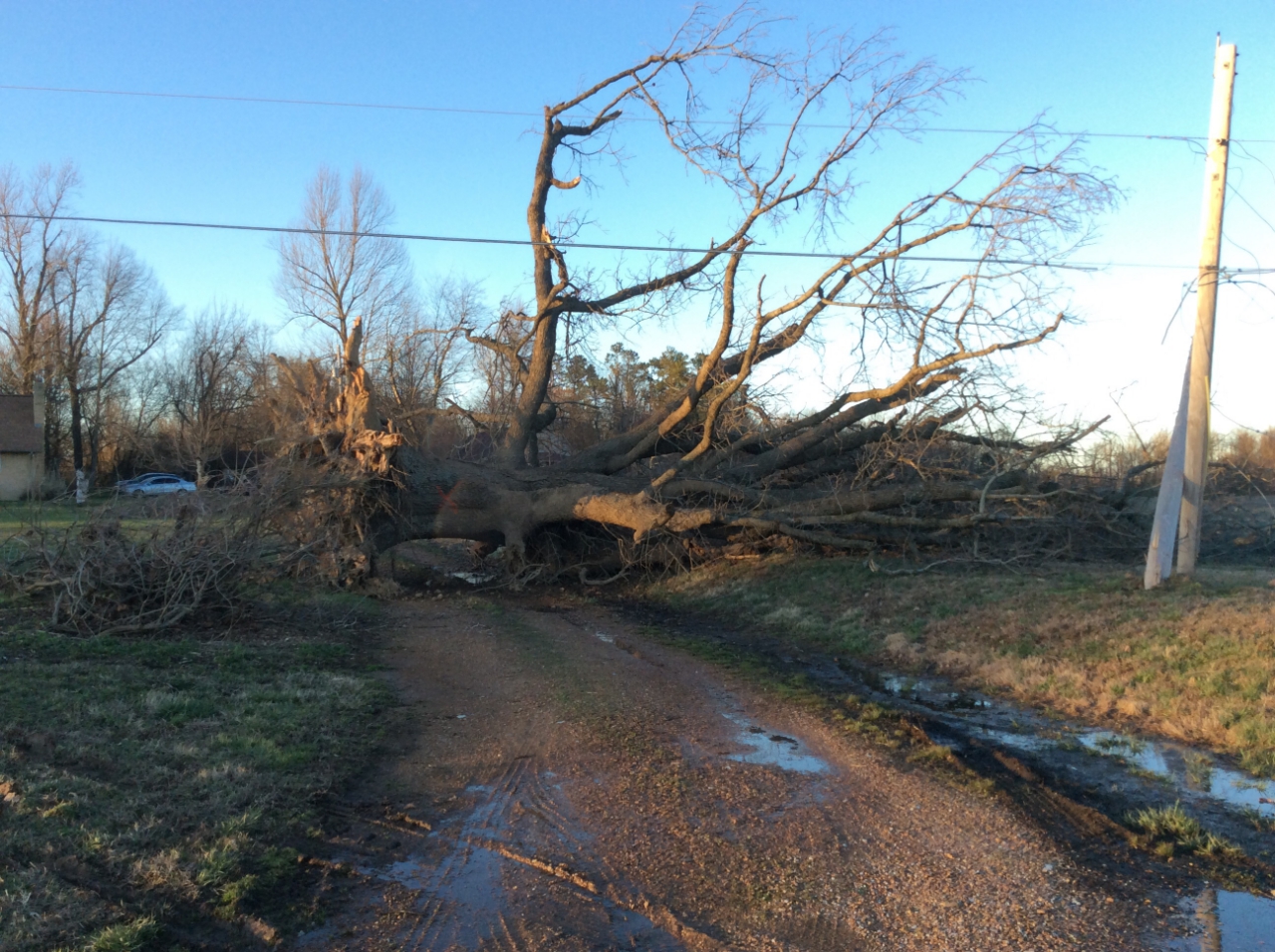
Tree damage 1.5 mi south of airport (NWS survey team) |
Storm Reports
PRELIMINARY LOCAL STORM REPORT...SUMMARY
NATIONAL WEATHER SERVICE PADUCAH KY
426 PM CDT THU MAR 14 2019

..TIME...   ...EVENT...      ...CITY LOCATION...     ...LAT.LON...
..DATE...   ....MAG....      ..COUNTY LOCATION..ST.. ...SOURCE....
            ..REMARKS..

0733 AM     FLOOD            4 NW LONE OAK           37.07N 88.72W
03/14/2019                   MCCRACKEN          KY   TRAINED SPOTTER

            WATER OVER MAXON ROAD.

0802 AM     TSTM WND DMG     1 N PINHOOK             36.76N 89.26W
03/14/2019                   MISSISSIPPI        MO   PUBLIC

            CORRECTS PREVIOUS TSTM WND DMG REPORT FROM 1
            N PINHOOK. BARN DESTROYED NEAR INTERSECTION
            OF FF HIGHWAY AND AA HIGHWAY.

0821 AM     FLASH FLOOD      3 E HENDERSON           37.85N 87.53W
03/14/2019                   HENDERSON          KY   EMERGENCY MNGR

            CORRECTS PREVIOUS FLASH FLOOD REPORT FROM 3
            E HENDERSON. WATER RESCUES UNDERWAY ON THE
            8900 BLOCK OF LARUE ROAD. UPDATE FROM
            EMERGENCY MANAGER THAT THERE HAVE NOT BEEN
            ANY INJURIES.

0914 AM     TORNADO          4 NNE LOVELACEVILLE     37.02N 88.80W
03/14/2019                   MCCRACKEN          KY   PUBLIC

            MAJOR DAMAGE REPORTED AT THE INTERSECTION OF
            US 62 AND HIGHWAY 286. TIME ESTIMATED FROM
            RADAR.
0918 AM     TORNADO          1 NW CUNNINGHAM         36.92N 88.90W
03/14/2019                   CARLISLE           KY   NWS STORM SURVEY

            *** 1 INJ ***
            EF2 TORNADO, ESTIMATED PEAK WIND 125 MPH,
            16.7 MILE PATH LENGTH, MAXIMUM PATH WIDTH
            300 YARDS. START LOCATION ONE MILE NORTHWEST
            OF CUNNINGHAM IN CARLISLE COUNTY KENTUCKY,
            JUST WEST OF HIGHWAY 1628 AND 1820
            INTERSECTION. END LOCATION 4 MILES WEST OF
            DOWNTOWN PADUCAH KENTUCKY, JUST EAST OF
            COLEMAN ROAD. END TIME WAS 934 AM CDT.

0931 AM     TORNADO          2 SE HEATH              37.07N 88.77W
03/14/2019                   MCCRACKEN          KY   NWS EMPLOYEE

            TORNADO JUST MISSED THE NWS WFO IN WEST
            PADUCAH.

0934 AM     TORNADO          3 W PADUCAH             37.08N 88.69W
03/14/2019                   MCCRACKEN          KY   TRAINED SPOTTER

            10-12 AC UNITS DAMAGED OR BLOWN AWAY AT THE
            KENTUCKY OAKS MALL. SEVERAL WINDOWS WERE
            BLOWN OUT OF VEHICLES IN THE MALL PARKING
            LOT. THE MALL ALSO SUSTAINED MINOR ROOF
            DAMAGE.

1028 AM     TORNADO          1 N MORGANFIELD         37.70N 87.91W
03/14/2019                   UNION              KY   PUBLIC

            VIDEO OF TORNADO NEAR MORGANFIELD. TIME
            ESTIMATED.

1030 AM     TSTM WND DMG     OWENSVILLE              38.27N 87.69W
03/14/2019                   GIBSON             IN   TRAINED SPOTTER

            SEVERAL LARGE LIMBS DOWN IN OWENSVILLE.

1100 AM     NON-TSTM WND DMG PINCKNEYVILLE           38.08N 89.38W
03/14/2019                   PERRY              IL   TRAINED SPOTTER

            STRONG WINDS SNAPPED OFF A FLAG POLE.

1140 AM     TSTM WND DMG     1 WSW HENDERSON         37.83N 87.60W
03/14/2019                   HENDERSON          KY   EMERGENCY MNGR

            A FEW TREES DOWN AROUND TOWN. TIME ESTIMATED
            FROM RADAR.

1150 AM     TSTM WND DMG     2 SSE EVANSVILLE        37.96N 87.53W
03/14/2019                   VANDERBURGH        IN   TRAINED SPOTTER

            UTILITY POLE DOWNED AT THE 1700 BLOCK OF
            TAYLOR AVENUE.

1159 AM     NON-TSTM WND DMG 4 W PHILPOT             37.74N 87.05W
03/14/2019                   DAVIESS            KY   EMERGENCY MNGR

            TREE FELL ON A HOUSE DUE TO HIGH WINDS.

1220 PM     FUNNEL CLOUD     5 SW ROBARDS            37.63N 87.62W
03/14/2019                   WEBSTER            KY   EMERGENCY MNGR

            FUNNEL CLOUD REPORTED BETWEEN HIGHWAY 132
            AND HIGHWAY 56 NEAR POOLE.

1225 PM     TSTM WND GST     NEWBURGH                37.95N 87.41W
03/14/2019  E70 MPH          WARRICK            IN   TRAINED SPOTTER

            ESTIMATED 60-70 MPH GUSTS WITH TREE DAMAGE.
            TIME ESTIMATED.

1254 PM     NON-TSTM WND DMG CENTRAL CITY            37.29N 87.12W
03/14/2019                   MUHLENBERG         KY   TRAINED SPOTTER

            TREES UPROOTED BY GRADIENT WINDS IN CENTRAL
            CITY.

0105 PM     TSTM WND DMG     STANLEY                 37.82N 87.25W
03/14/2019                   DAVIESS            KY   TRAINED SPOTTER

            TREES DOWN.

0105 PM     TSTM WND DMG     3 SE STANLEY            37.79N 87.21W
03/14/2019                   DAVIESS            KY   TRAINED SPOTTER

            POWER POLES BLOWN DOWN ON US 60 BETWEEN
            STANLEY AND OWENSBORO. TIME ESTIMATED.

0107 PM     FLOOD            2 ENE NEWBURGH          37.96N 87.36W
03/14/2019                   WARRICK            IN   TRAINED SPOTTER

            WATER OVER SHARON ROAD NEAR HIGHWAY 261.

0111 PM     NON-TSTM WND DMG 1 E MURRAY              36.61N 88.30W
03/14/2019                   CALLOWAY           KY   TRAINED SPOTTER

            SEVERAL TREE BRANCHES DOWN IN THE MURRAY
            AREA. SPOTTER ESTIMATED 45 MPH
            NON-THUNDERSTORM WINDS.

0315 PM     NON-TSTM WND DMG MURPHYSBORO             37.77N 89.33W
03/14/2019                   JACKSON            IL   EMERGENCY MNGR

            PART OF A METAL ROOF BLOWN OFF A BUILDING.

0406 PM     NON-TSTM WND DMG FAIRFIELD               38.38N 88.36W
03/14/2019                   WAYNE              IL   TRAINED SPOTTER

            MULTIPLE HOMES WITH SHINGLE DAMAGE. TREE
            UPROOTED ONTO POWER LINES.


&&
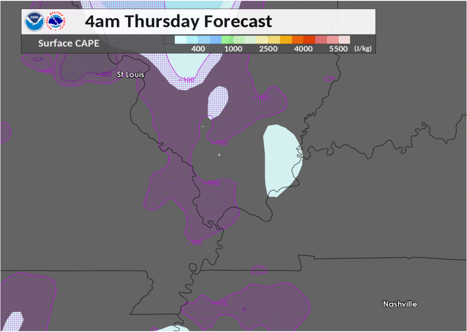
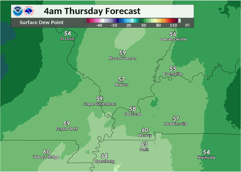
Environment
Near-storm environment summary.
 |
 |
|
| Figure 4: Sfc based cape | Figure 5: Sfc dew points |
 |
Media use of NWS Web News Stories is encouraged! Please acknowledge the NWS as the source of any news information accessed from this site. |
|