Overview
|
Several severe storms developed along and ahead of a cold front/dryline as it moved towards the Ozarks on the evening of March 23, 2016. Moisture from the Gulf of America was able to stream north into the region with the aid of a strong 850mb low level jet. Strong shear in association with synoptic winds and strong 850mb winds combine with limited instability were enough to produce a tornacic storm that moved across Barry into Stone Counties in Missouri. The very strong shear was able to overcome the limited instability as a strong storm embedded in a line of storms, moved across southern Missouri. This storm ultimatly developed an EF-1 Tornado near Shell Knob, Missouri. |
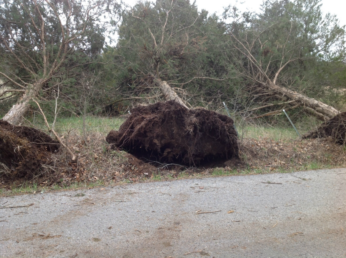
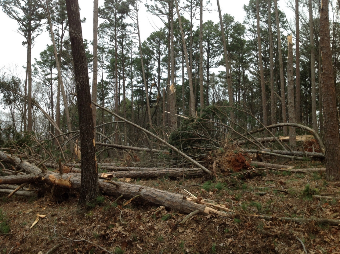
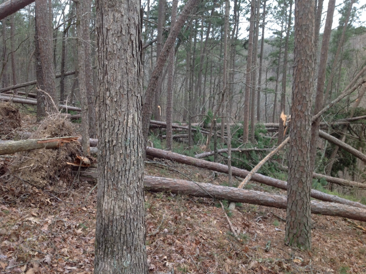
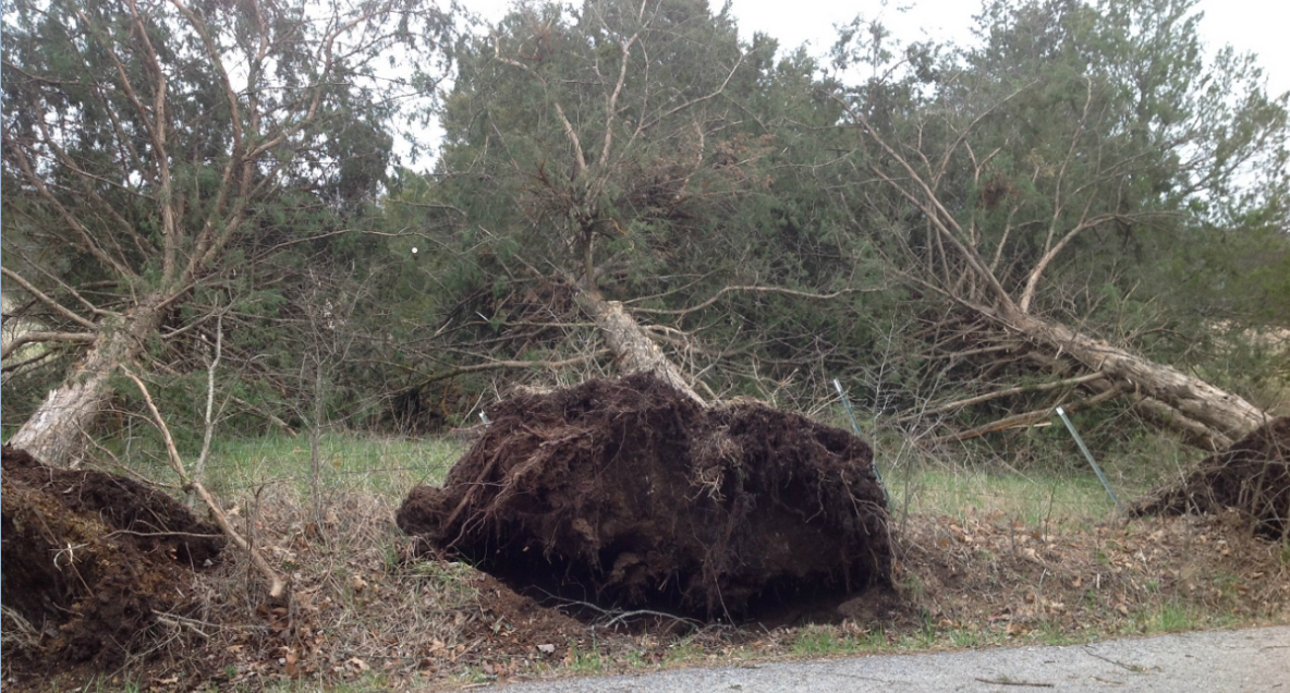 Damage from near Shell Knob |
 |
 |
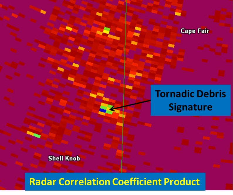 |
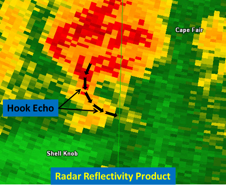
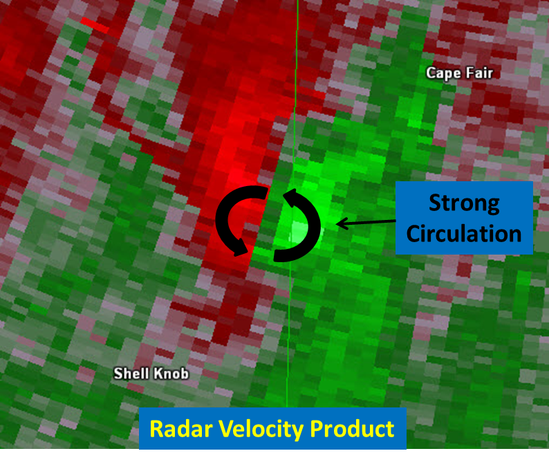
| Shell Knob Tornado - Reflectivity | Shell Knob Tornado - Storm Relative Velocity | Shell Knob Tornado - Correlation Coefficient |
Tornadoes:
|
|
||||||||||
|
||||||||||
|
Tornado - Near Shell Knob, MO
Track Map 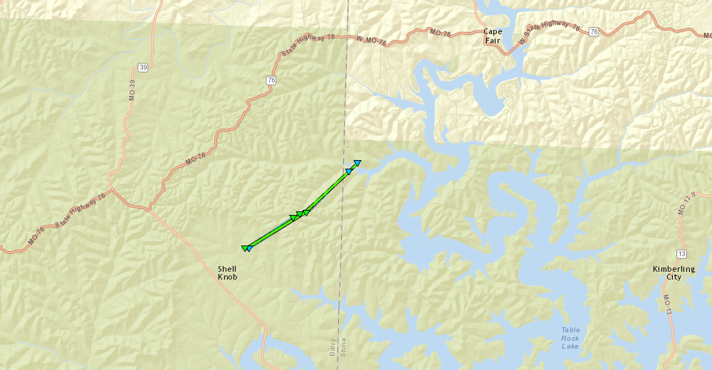 
|
||||||||||||||||
|
||||||||||||||||
The Enhanced Fujita (EF) Scale classifies tornadoes into the following categories:
| EF0 Weak 65-85 mph |
EF1 Moderate 86-110 mph |
EF2 Significant 111-135 mph |
EF3 Severe 136-165 mph |
EF4 Extreme 166-200 mph |
EF5 Catastrophic 200+ mph |
 |
|||||
Radar:

Storm Reports

 |
Media use of NWS Web News Stories is encouraged! Please acknowledge the NWS as the source of any news information accessed from this site. |
|


 Weather Story
 Weather Map
 Local Radar