Overview
|
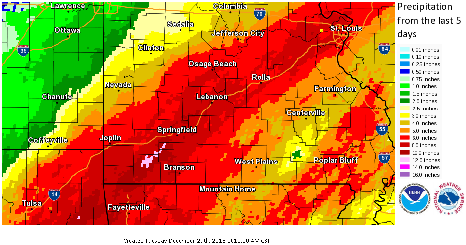
A slow moving storm system brought several waves of heavy rainfall to the region from the early morning of December 26th into the morning of December 28th. Storm total rainfall amounts of 5-12" were common across the Missouri Ozarks and extreme southeastern Kansas. The heaviest amounts occurred across southwestern Missouri near the Interstate 44 corridor where localized rainfall amounts exceeded a foot. A slow moving very dynamic storm system set up to the southwest of the Missouri Ozarks with a frontal system initially setting up across the region. Gulf moisture from the south and Pacific moisture from the southwest aided in bringing in moisture values which were nearly twice the normal values for this time of year. In addition, there was enough instability for stronger thunderstorms to develop. Because of the upper level pattern orientation, storms trained across the same areas throughout the event, particularly along the region of the interstate 44 corridor, not just in the Missouri Ozarks, but up into the St. Louis area as well.
|
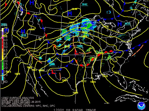 Sfc map evoluton |
Flooding
Add a written summary if needed.
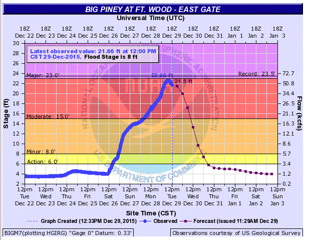
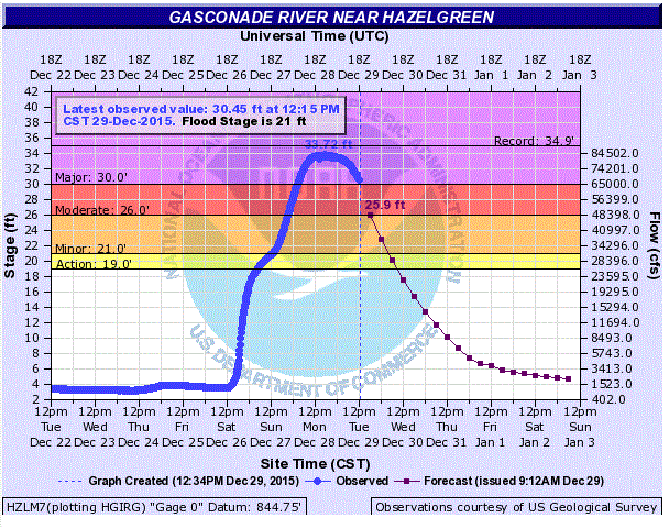
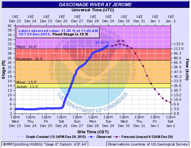
Hydrographs
 |
 |
 |
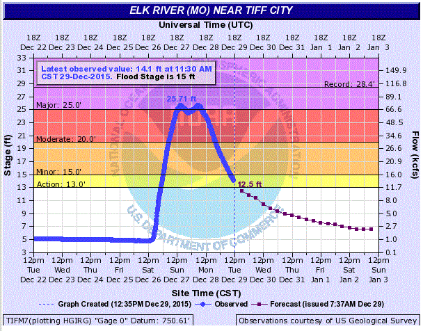 |
| Big Piney River at Eastgate | Gasconade River at Hazelgreen | Gasconade River at Jerome | Elk River at Tiff City |
 |
 |
 |
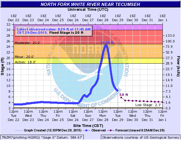 |
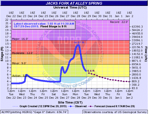
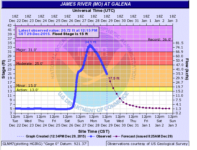
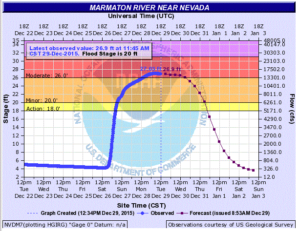
| Jacks Fork River at Alley Springs | James River at Galena | Marmaton River at Nevada | North Fork River at Tecumseh |
 |
 |
 |
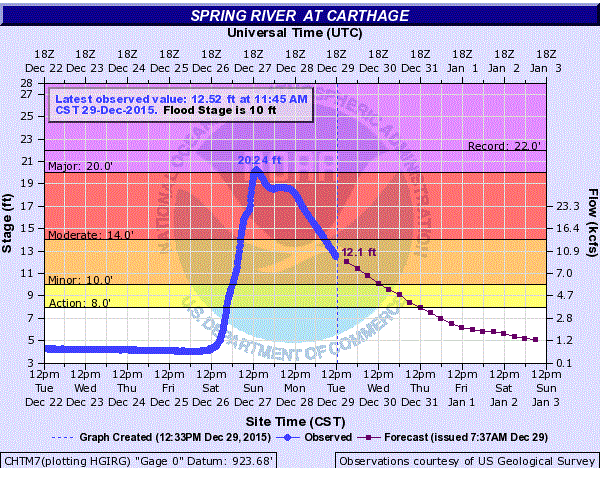 |
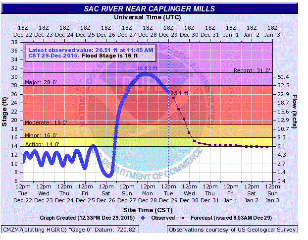
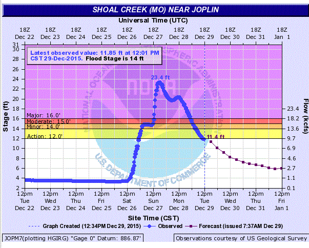
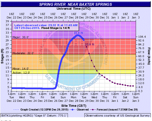
| Sac River at Caplinger Mills | Shoal Creek at Joplin | Spring River at Baxter Springs | Spring River at Carthage |
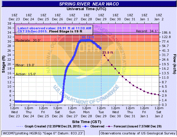 |
| Spring River at Waco |
Impacts
- 14 confirmed fatalities (all but 1 vehicle related)
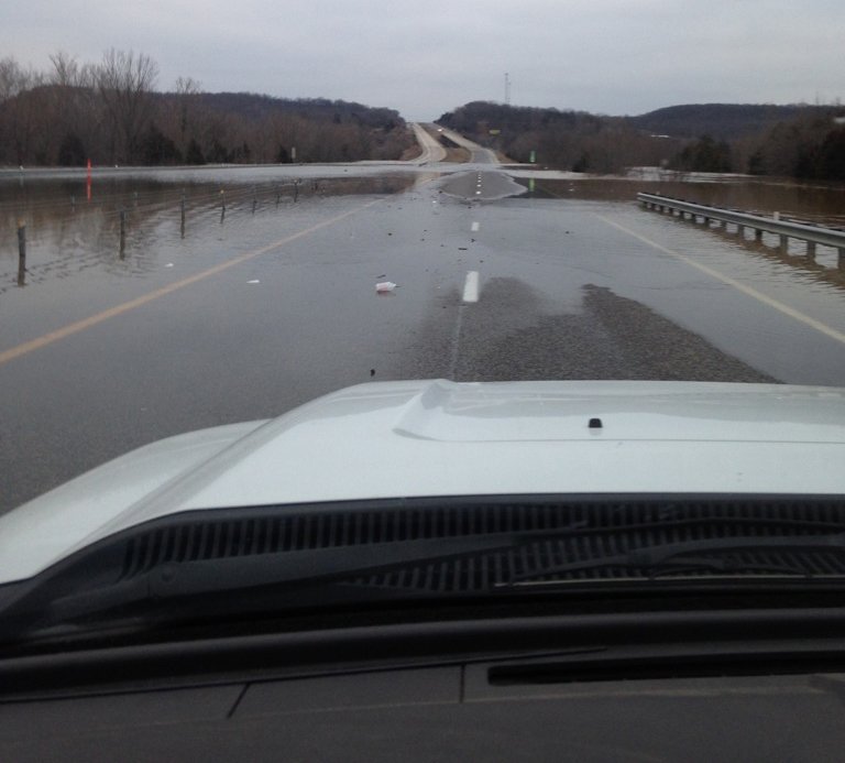
- Thousands of roads were flooded and impassible
- Hundreds of swift water rescues were conducted
- Record release out of Table Rock Dam of 72,000 CFS
- Beaver and Table Rock Lakes exceeded 100% flood pool
- 120 homes were inaccessible or flooded along Lake Taneycomo
- 11 rivers/creeks rose to record levels
- Portions of Interstate 44 and Highway 60 were closed due to flooding
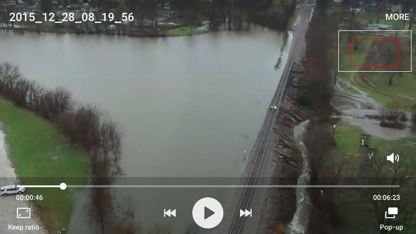
Photos & Video:
 |
 |
 |
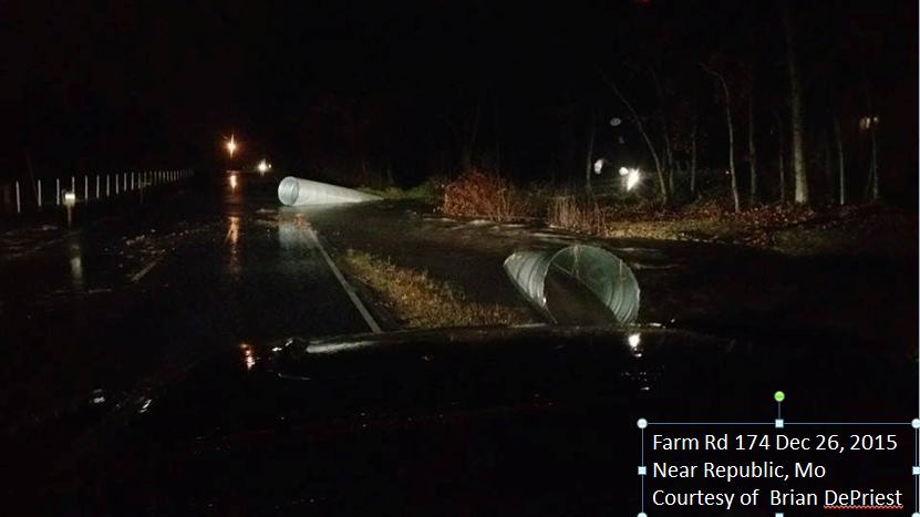 |
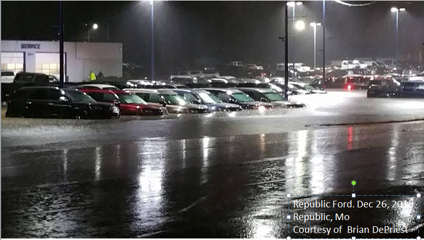
| Interstate 44 near Jerome taken during the late morning of Tuesday, December 29th. | Drone picture of a partially failing dam near Mountain Grove on Dec. 28th. | Flooded car dealership in Republic. | Flooded culverts near Republic. |
 |
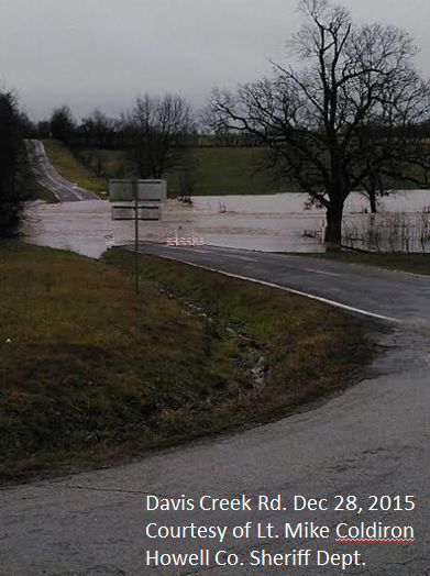 |
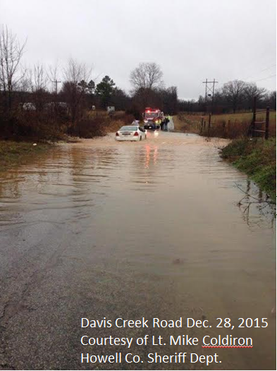
| Flooded low water crossing in Howell County | Flooded low water crossing in Howell county. |
Rain Reports
 |
Media use of NWS Web News Stories is encouraged! Please acknowledge the NWS as the source of any news information accessed from this site. |
|


 Weather Story
 Weather Map
 Local Radar