A cold front will move through the Great Lakes and Northeast U.S. today, bringing areas of snow and snow squalls which can bring rapid reductions to visibility and slick roads. A storm system will shift from the northern Gulf Coast through the Southeast U.S. today through Friday with areas of heavy to excessive rainfall and light snow further north. Heavy snow is also expected in the Rockies. Read More >
Topeka, KS
Weather Forecast Office
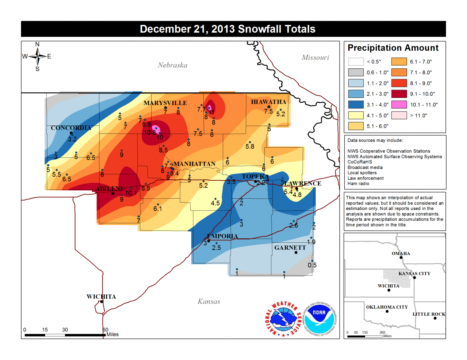
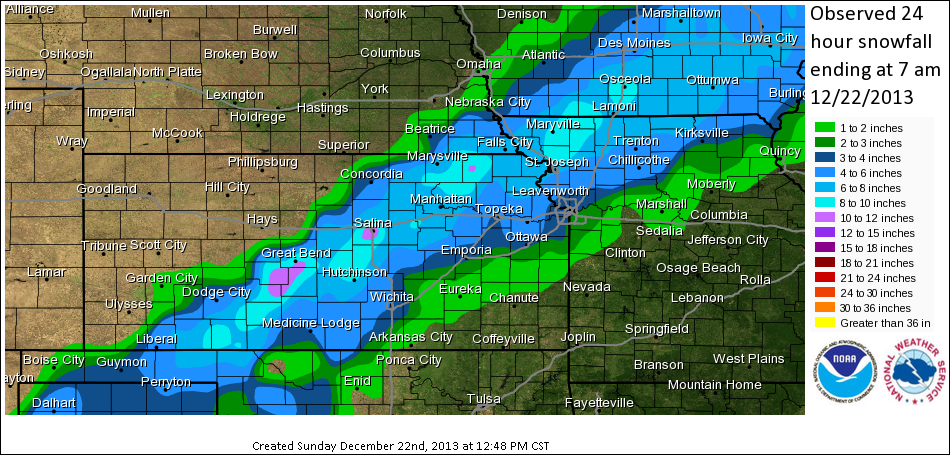
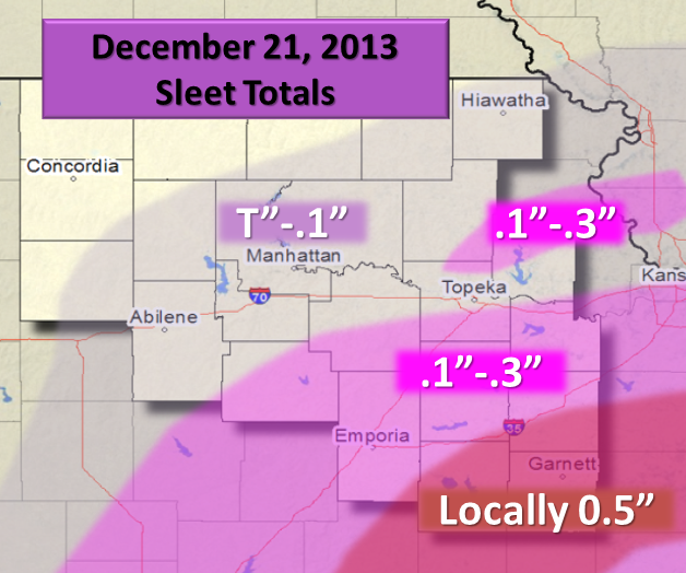
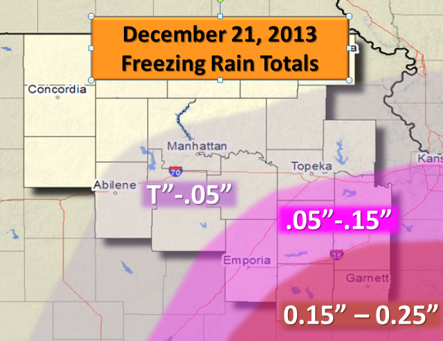
A winter storm passed through the region on December 21, brining significant amounts of freezing rain and snow to the area. A few days prior an arctic cold front brought sub freezing temperatures southward. The night before rain began to form over the cold air at the surface causing widespread freezing rain in parts of Oklahoma, Kansas, and Missouri. Some of the hardest hit areas received ice accumulations up to 0.75 inches. The ice built up on the roadways and was responsible for several accidents in southeast Kansas during the day. Then as the main system moved out over the Plains precipitation began to transition to snow which was heavy at times. The highest snow totals ranged from 11 to 15 inches in parts of central Kansas.
|
Local Snow Totals |
Regional Snow Totals |
Local Sleet Totals |
Local Ice Totals |
US Dept of Commerce
National Oceanic and Atmospheric Administration
National Weather Service
Topeka, KS
1116 NE Strait Avenue
Topeka, KS 66616-1667
785-234-2592
Comments? Questions? Please Contact Us.


