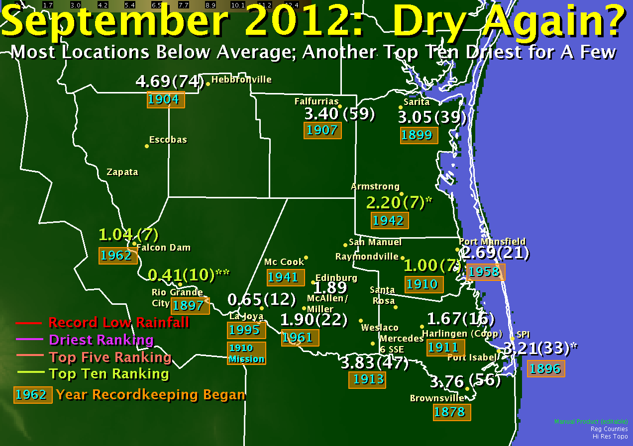
 Rainfall rankings for selected climate locations across the Rio Grande Valley. * Location missing approximately one third of data in sample. ** Location had several gaps in data years, which may have began in 1892. |
|||||||||||||||||||||||||||||||||||||||||||
| Hot, Dry Theme Extends into Start of 2012/2013 School Year |
|||||||||||||||||||||||||||||||||||||||||||
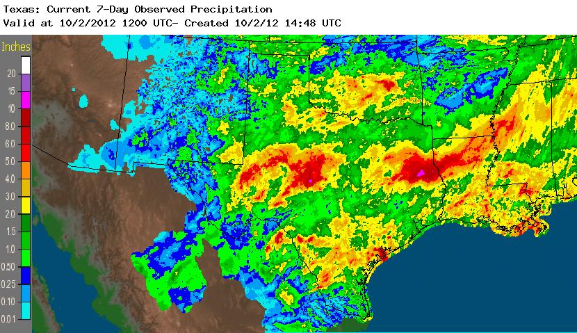 Rainfall Estimates for the State of Texas, September 2012. 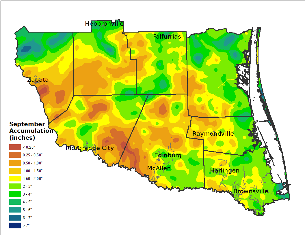 Rainfall Estimates, from bias corrected radar and ground observations, for the Rio Grande Valley, September 2012. 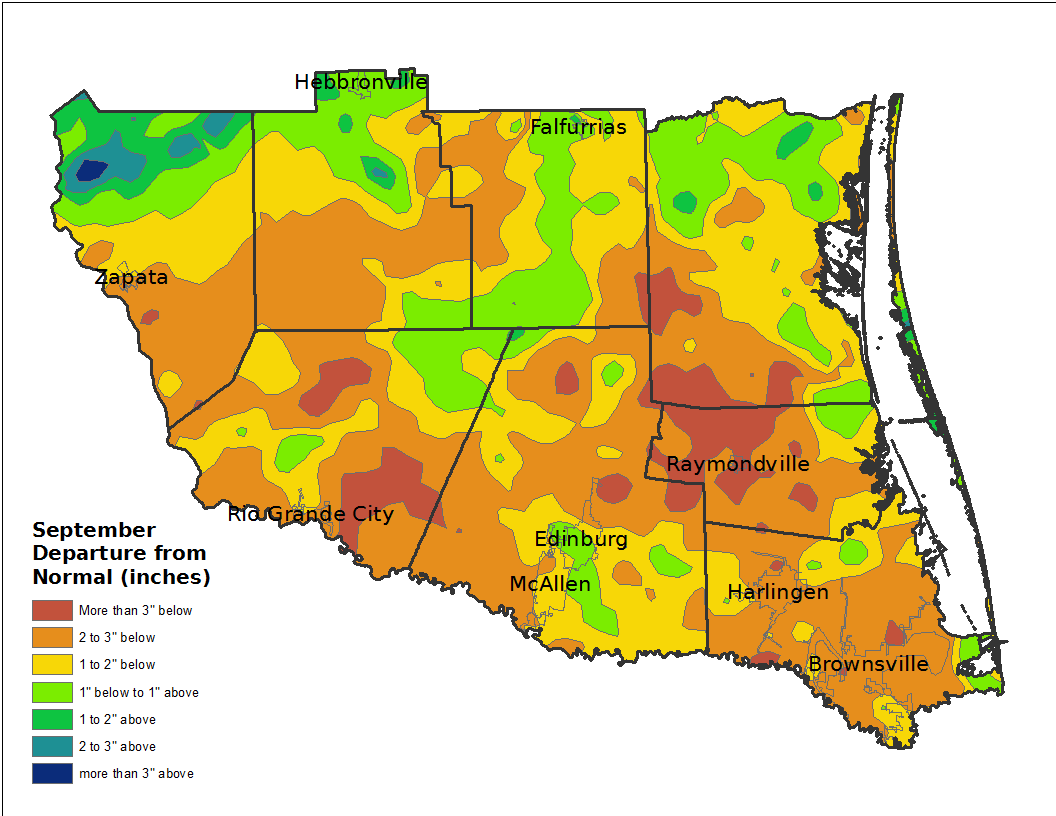 Rainfall Departure from Average (Estimates), from bias corrected radar and ground observations, for the Rio Grande Valley, September 2012. Departures are based on the 1981 to 2010 30 year sample. |
Endless summer, again? For the Rio Grande Valley, rain fell again in fits and starts. Fits and starts typically does not add up to the wettest month of the year, when rainfall averages from just under 4 inches across the Rio Grande Plains to just over 6 inches along the southeast Cameron County coast. Indeed, with the exception of ranchland from northern Jim Hogg through northern Zapata County, where the bulk of the month’s rain fell overnight on the 28th and 29th, and a sliver along the coast from South Padre Island to Boca Chica Beach, most of the Rio Grande Valley fell 2 to more than 3 inches short of these averages (left). Even Brownsville, which came close to catching up during the final three days of the month, still fell short. |
||||||||||||||||||||||||||||||||||||||||||
*Missing more than 25 percent of data or years broken up (Armstrong).
Please note that some sites do not have a complete record back to the listed starting year. |
|||||||||||||||||||||||||||||||||||||||||||
|
How Now, Drought? The drought, meanwhile, soldiers on. The latest outlook through the rest of 2012 suggest some improvement but not complete erasure, as the combined impact of the puzzle pieces of a weak El Niño and other factors such as the North Atlantic/Arctic Oscillation and regional patterns were very uncertain as the Valley moved deeper into autumn. |
 Rainfall Estimates for the State of Texas, September 2012. 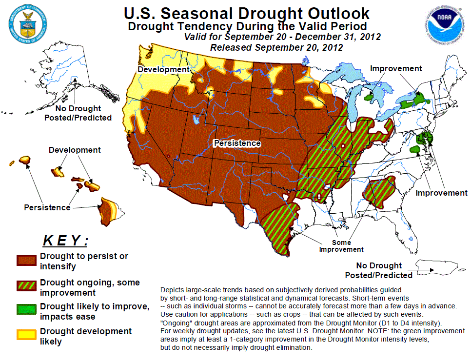 National "Droughtlook" for the end of September through December 31, 2012. |
||||||||||||||||||||||||||||||||||||||||||

