Overview
|
*This is NOT the most up-to-date information. For the latest info, please check with your local emergency services* The combination of anywhere from 0.8 to over 5 inches of rain and 2 to 5 inches of snow-water equivalent melt from June 10-13th led to unprecedented flooding across the Absarokas and Beartooths. This led to flooding rarely or never seen before across many area rivers and streams. |
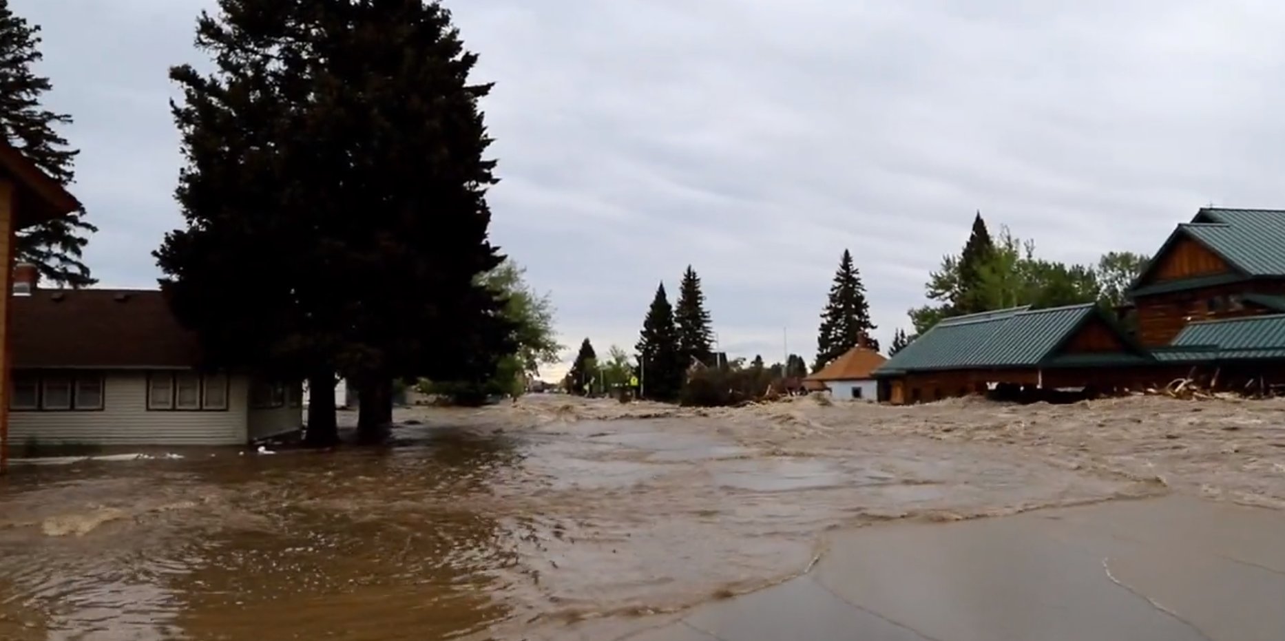 Record Flooding in Red Lodge, MT. Photo by ai6yrham on Twitter. |
Precipitation / Snow Melt
The Beartooths and Absarokas received anywhere from 0.8 inches to over 5 inches of rainfall over the course of June 10th through June 13th. This combined with anywhere from 2 to nearly 5 inches of snow melt equivalent, leading to a total water event of at least 4 to 9 inches. Below is a table showing how much snow melt and precipitation were observed at the Snotel sites.
.PNG) |
| Measured precipitation and snow-water equivalent melt at the Snotel sites from June 10th - June 13th. |
Environment / Meteorology
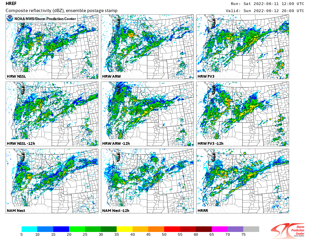
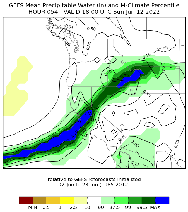
Below is a collection of radar, model, and precipitation data. The model data included suggested the potential for heavier rainfall across the region with the driving force being an atmospheric river. The contribution of the rainfall combined with rapid snowmelt exacerbated the runoff and resulted in a devastating flooding event.
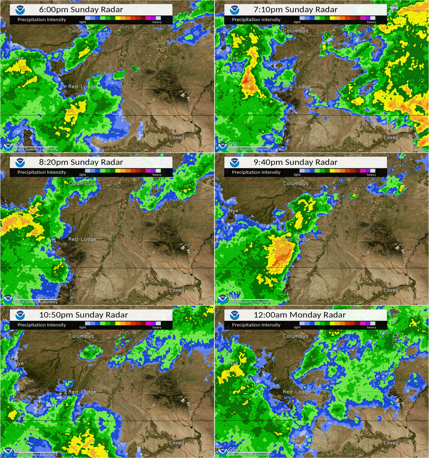 |
| Radar loop Sunday June 12th 6pm-Midnight |
 |
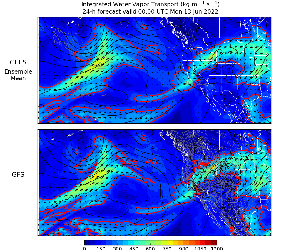 |
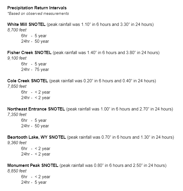
| Precipitation Return Intervals for selected SNOTEL sites. | Model depiction of forecast atmospheric river focused into the Absaroka/Beartooth Mountains |
 |
 |
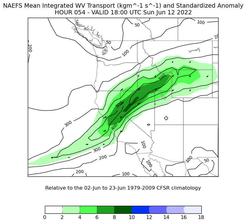 |
| Mesoscale model ensemble (Composite Reflectivity). Suggests heavier rainfall potential. | Model Precipitable Water Climatology. Shows highly anomalous PW values focused into the Absaroka/Beartooth Mountains. Model run from 12Z on June 10th. | North American Ensemble Forecast System (NAEFS) Mean Integrated Water Vapor Transport showing standardized anomaly values of 6-8 focused into the higher terrain of southwest Montana and northwest Wyoming. |
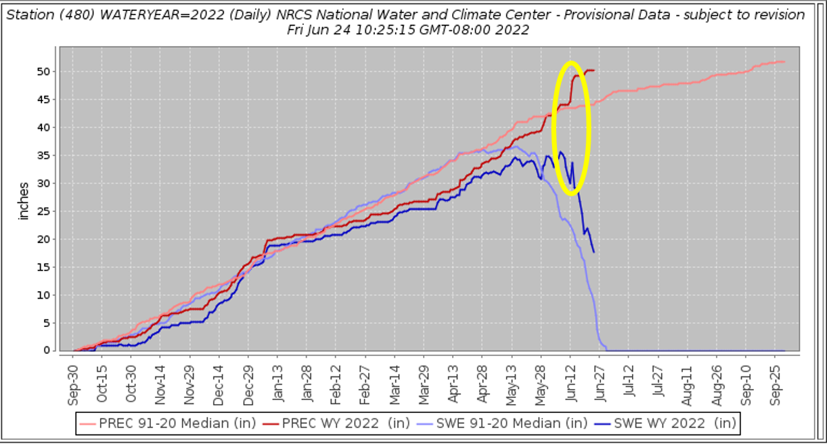 |
| From the Fisher Creek SNOTEL, 3 miles north of Cooke City, MT. Graph showing the median precipitation and snow water equivalent from 91-20 and current water year snow water equivalent and precipitation. Area highlighted shows the rapid increase in precipitation while a rapid snowmelt was occurring. This set the stage for a significant flooding event. |
Carbon County
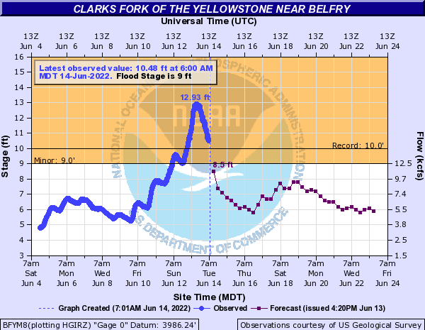
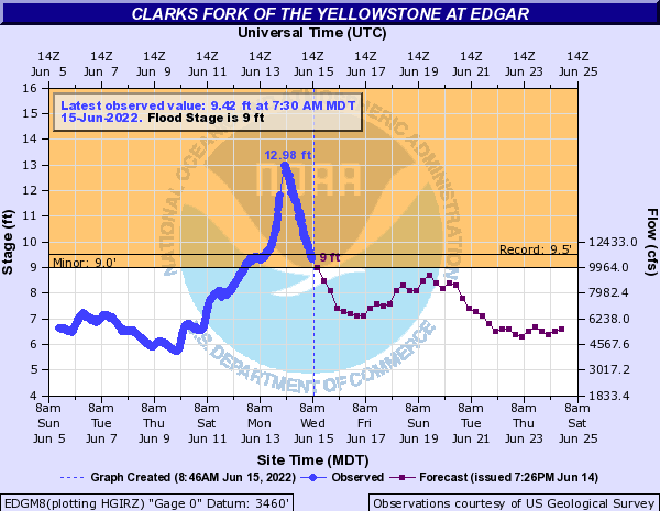
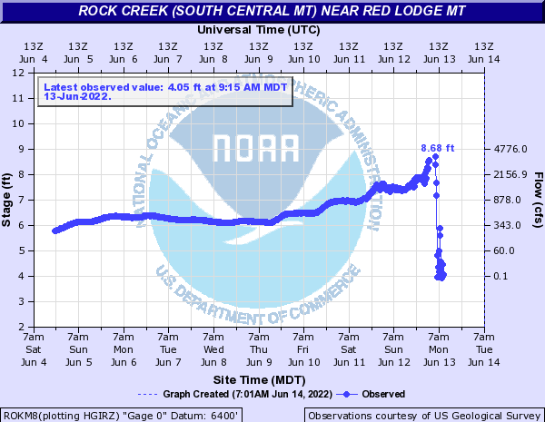
Significant flooding occurred on Rock Creek with water flowing through the town of Red Lodge. Evacuations were needed.
Areas That Were Evacuated
Road Closures
Hydrographs
 |
 |
 |
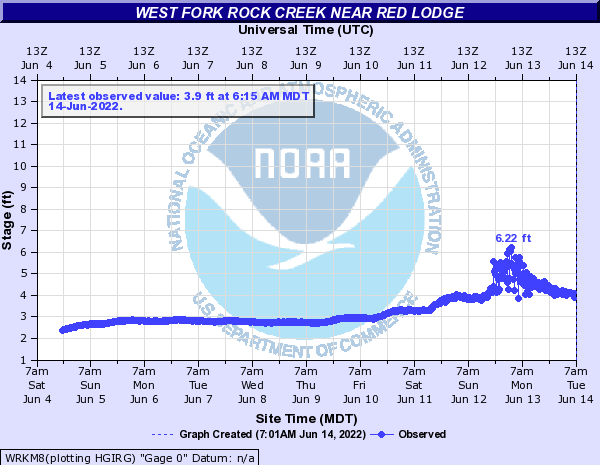 |
| Clarks Fork of the Yellowstone near Belfry crested at 12.93 feet, shattering the previous record flood stage of 9.97 feet set on 06/09/1981. | Clarks Fork of the Yellowstone at Edgar crested at 12.98 feet, shattering the previous record of 9.5 feet set on 06/01/2020. | Rock Creek near Red Lodge, MT rose to 8.68' prior to the gauge becoming damaged. | West Fork Rock Creek near Red Lodge rose to 6.22' with debris clearly impacting the gauge. |
Photos
 |
 |
 |
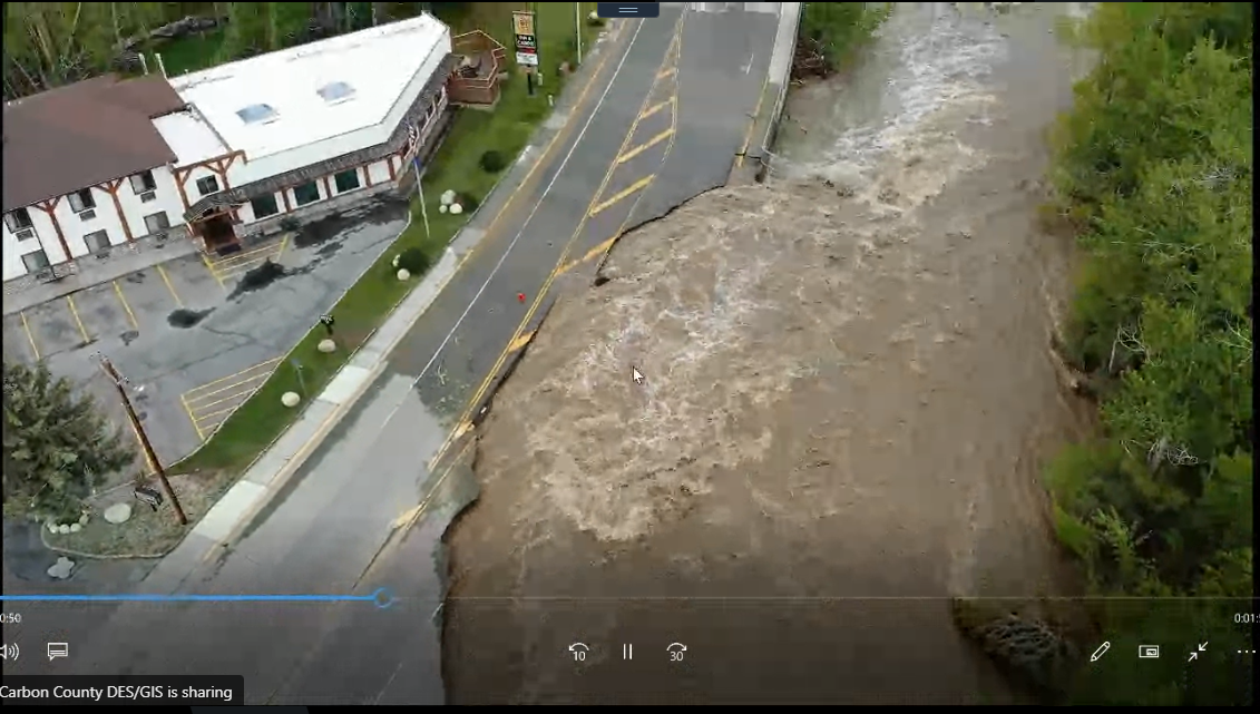 |
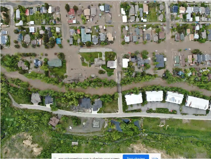
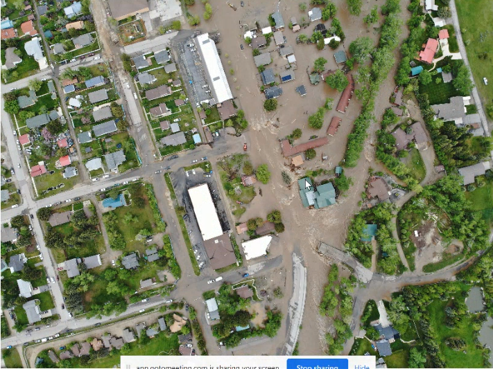
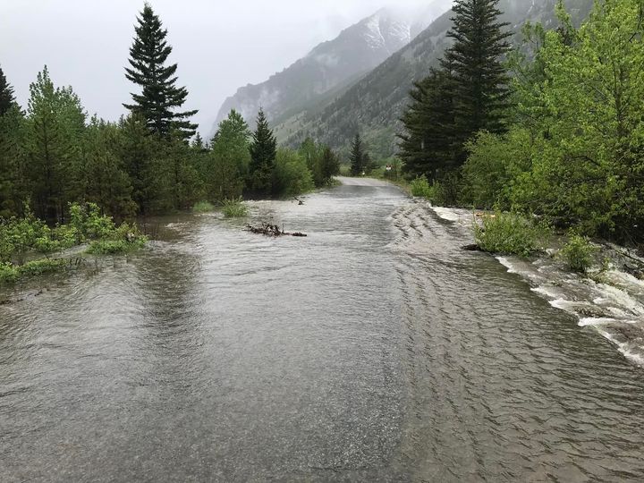
| 13th Street Bridge at Rock Creek in Red Lodge, MT. Photo by Carbon County DES. | 19th Street Bridge at Rock Creek in Red Lodge, MT. Photo by Carbon County DES. | Water over East Rosebud Road in Custer Gallatin National Forest. Photo by Heidi Meili with NBC MT. | Road washed out in Red Lodge, MT. Photo by Carbon County DES. |
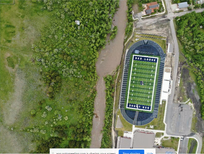 |
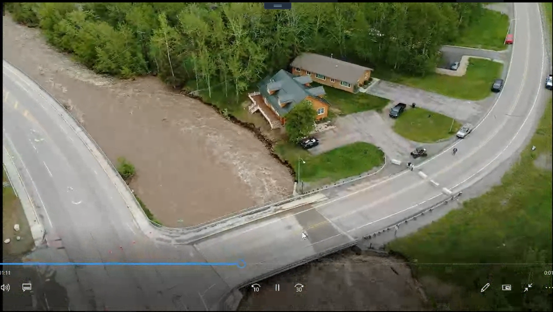 |
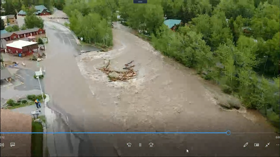 |
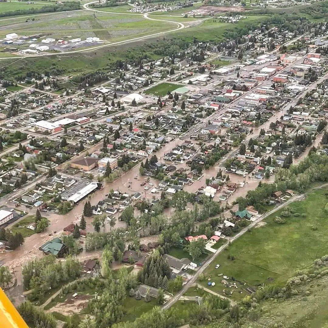 |
| Bank erosion nears the new track in Red Lodge, MT. Photo by Carbon County DES. | Erosion nears a house in Red Lodge, MT. Photo by Carbon County DES. | Historic flooding in Red Lodge, MT. Photo by Carbon County DES. | Red Lodge, MT. Photo by Drew Daniel. |
 |
 |
|
|
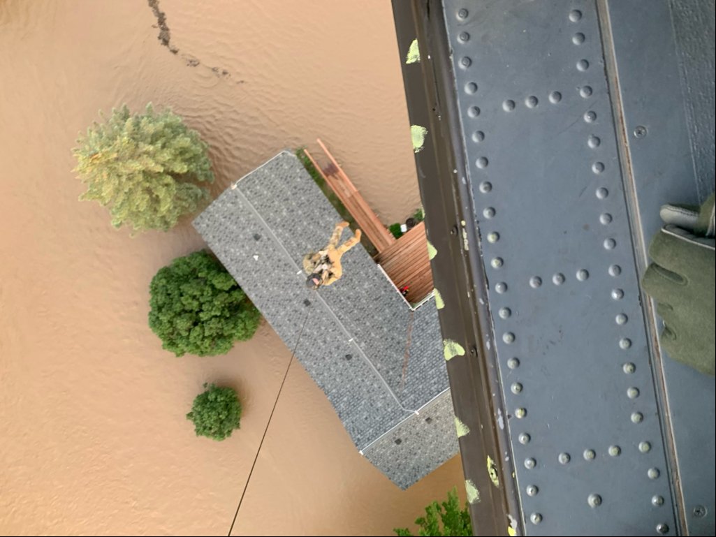
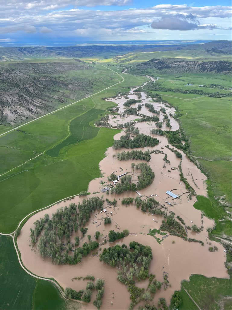
| Montana National Guard conducts water rescues in Red Lodge, MT. | Ariel view from the Montana National Guard. | Historic flooding in Red Lodge, MT. Photo by Carbon County DES. | Red Lodge, MT. Photo by Drew Daniel. |
Montana is flooding!
— Emily Taylor (@EmTay_Music) June 13, 2022
Water levels are the highest ever recorded right now. This video is of Main Street in Red Lodge, MT this morning. Several bridges are already washed out. Please pray for Montana! pic.twitter.com/IYtRQWb4HT
WATCH THIS:
— NBC Montana (@NBCMontana) June 13, 2022
Fast-moving floodwaters take over neighborhoods and roadways in Red Lodge, MT. Thank you to Andy Pax VanOrnum for safely sending this in to us.
If you are safely able to, please send us your videos and photos of flooding at https://t.co/SD32ZyPEK2 pic.twitter.com/xqlFuOekU0
Park County
Significant flooding occurred along the Yellowstone and other smaller creeks throughout Park County, including the backside of the Absarokas in the Cooke City / Silver Gate area. Extensive flooding throughout Park County washed out bridges, roads, and left communities and homes isolated. It also made drinking water unsafe in many areas.
The town of Gardiner became isolated and was surrounded by water. A Do Not Drink order for water was issued for the area after a water main broke. Cooke City and Silver Gate also were isolated and surrounded by water. The communities were isolated from each other.
Livingston Areas that were Evacuated
Hydrographs
 |
 |
 |
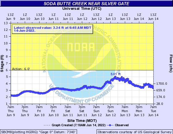 |
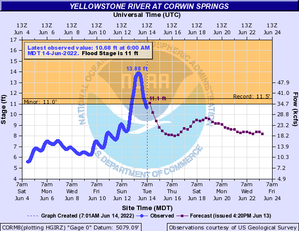
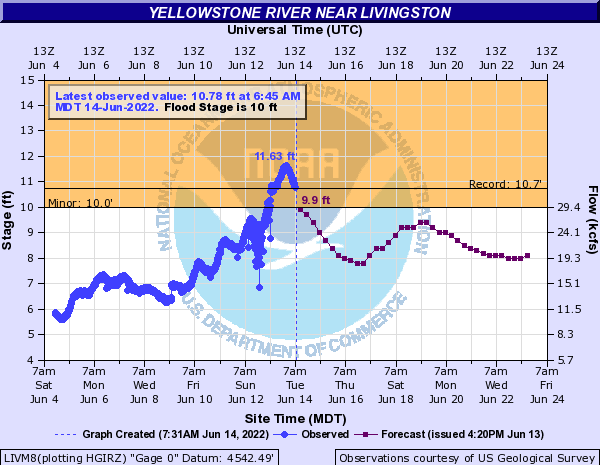
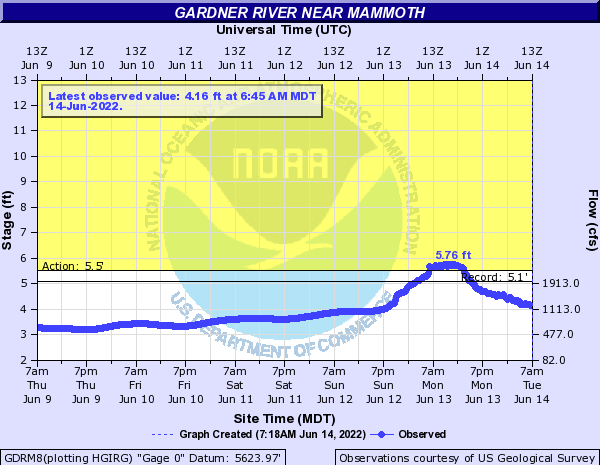
| Yellowstone River at Corwin Springs peaked at 13.88 feet, shattering the previous record of 11.5 feet set on 06/14/1918. | Yellowstone River near Livingston peaked at 11.63 feet, surpassing the previous record of 10.72 feet set on 06/06/1997. | Gardner River near Mammoth peaked at 5.76 feet, surpassing its previous record of 5.09 feet set on 06/05/2010. | Soda Butte Creek near Silver Gate remained below Action Stage. |
Photos
 |
.png) |
 |
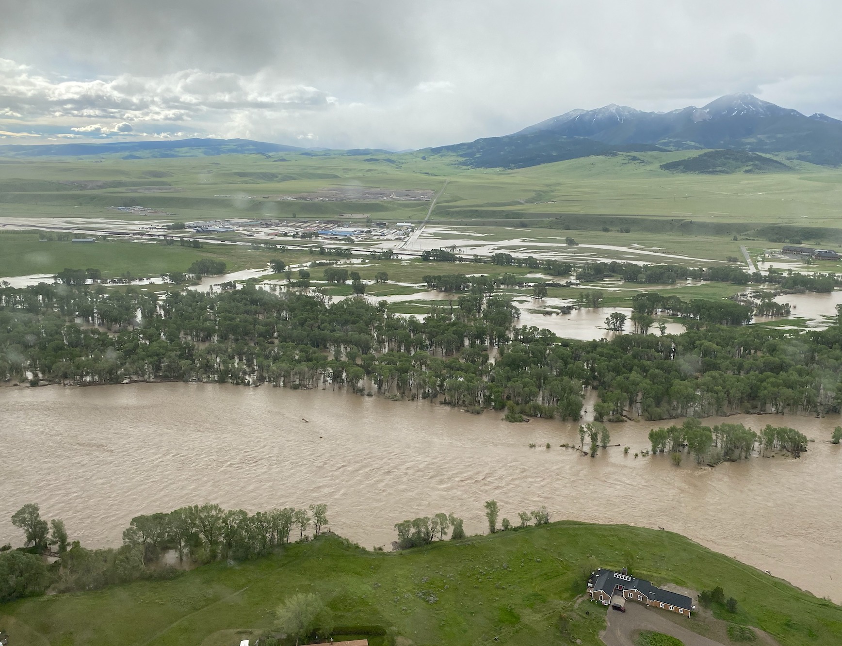 |
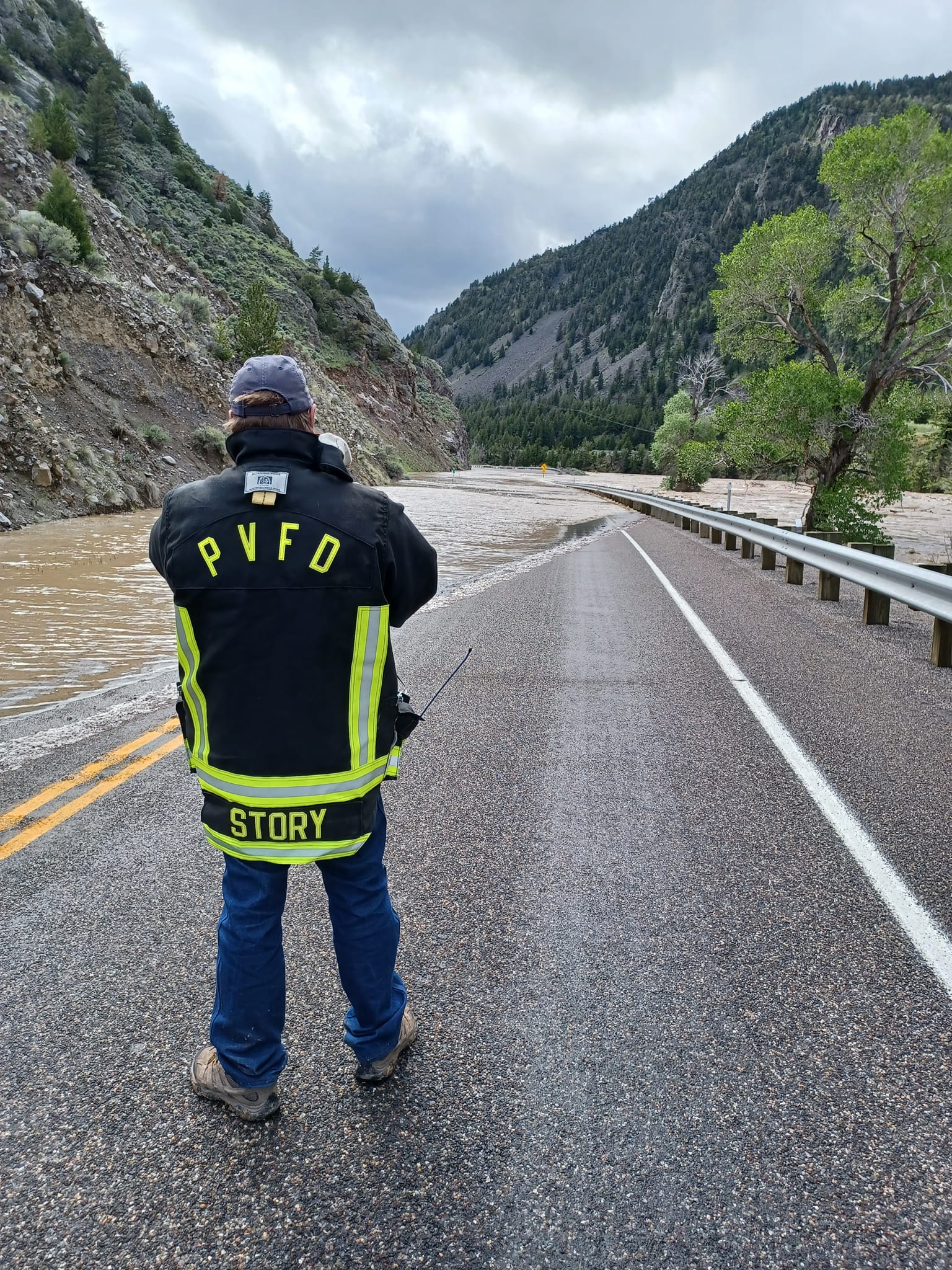
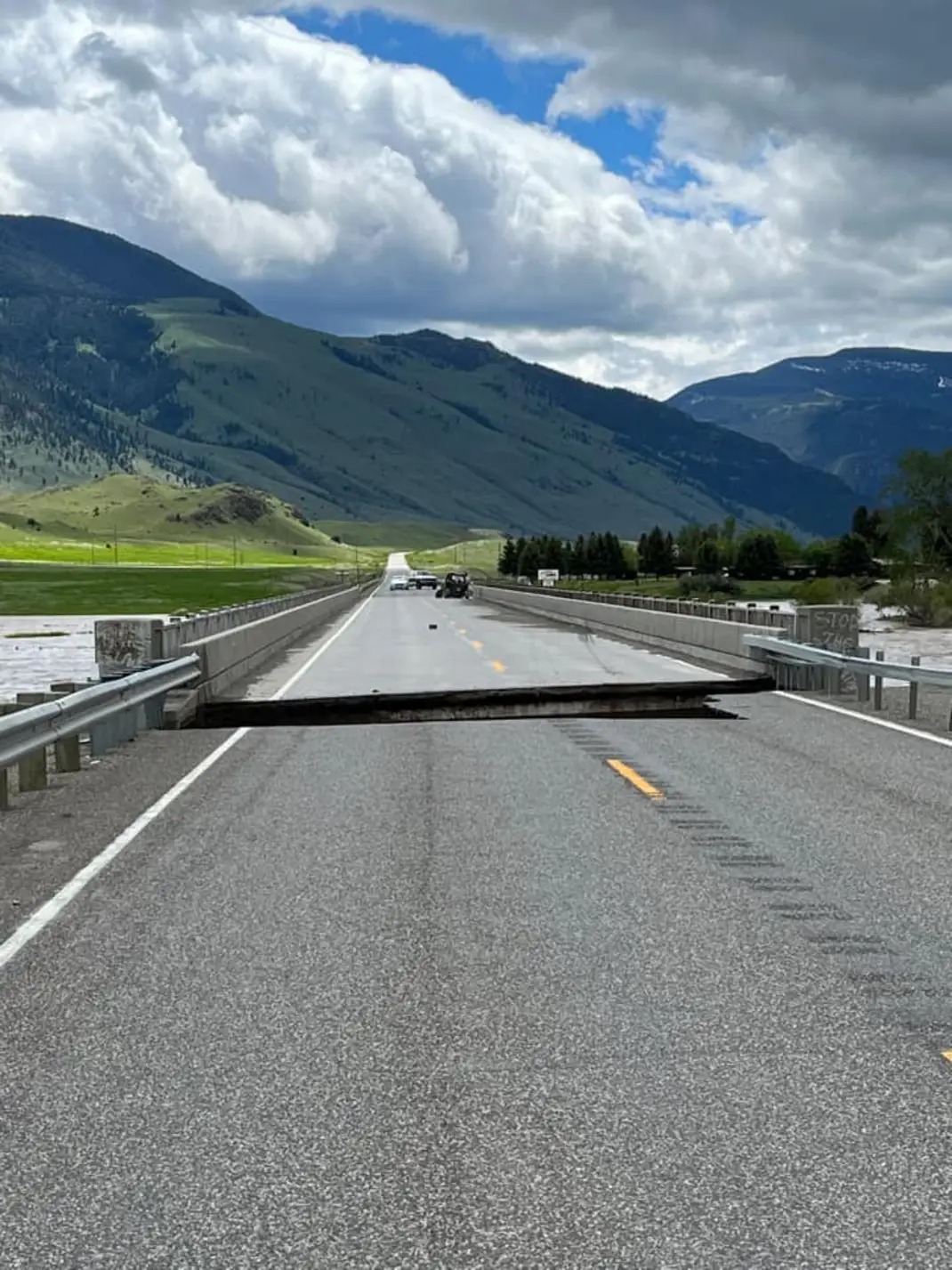
| US-89 16 miles north of Gardiner, MT. Photo by Eric Newhouse. | US-89 just south of Livingston, MT. Photo by Melody Histed. | Point of Rocks bridge in Park County severely damaged. Photo by Christy Jones. | Severe flooding occurred throughout much of Park County. Photo by Bradley Warren. |
Bridge at Carbella over the Yellowstone near Tom Miner Basin and Yankee Jim Canyon (not my video) pic.twitter.com/Ewj9JjUobR
— Mr. Hill Bear ðŸ”🻠(Pfizer Gang) (@MichaelJHilbert) June 13, 2022
Sweet Grass County
Road Closures
Hydrographs
 |
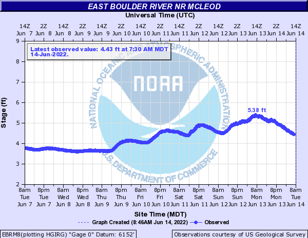 |
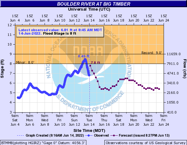
| Boulder River at Big Timber peaked at 8.49 feet, just slightly below the record of 9 feet set on 06/05/1997. | East Boulder River near McLeod. |
Stillwater County
Hydrographs
 |
 |
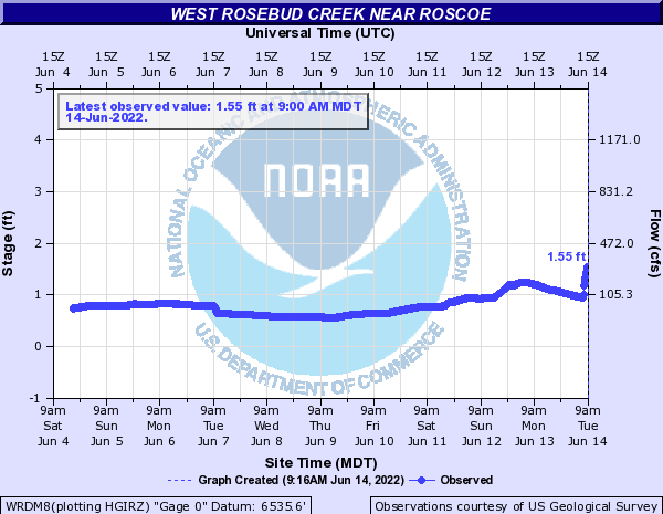 |
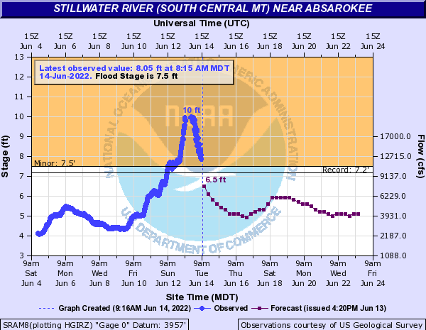
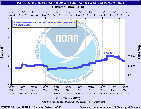
| Stillwater River near Absarokee shattered the previous record crest of 7.17 feet set on 06/02/2020 and peaked at 10 feet. | West Rosebud Creek near Emerald Lake Campground. | West Rosebud Creek near Roscoe. |
Photos
 |
 |
 |
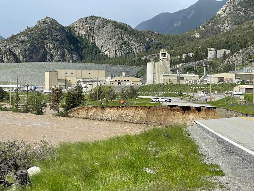 |
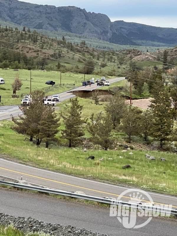
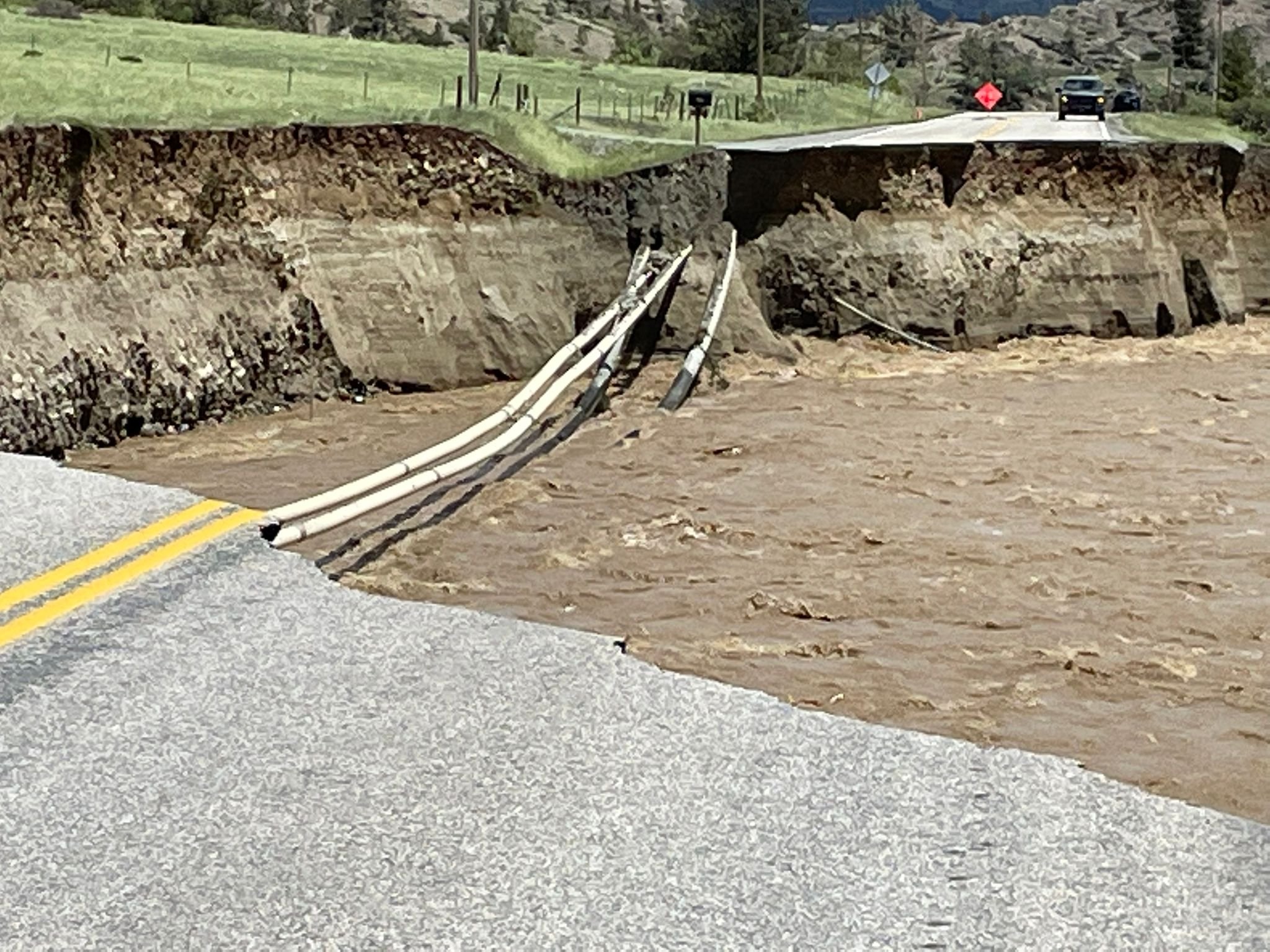
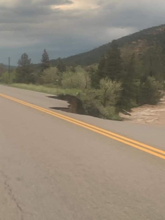
| Road washed out on the Stillwater between Nye and the mine. | Closer view of the washout. Photo by Nye Volunteer Fire Department. | Washout on Nye Road. | Road washed out near the mine in Stillwater County. Photo from Stillwater County News. |
 |
 |
 |
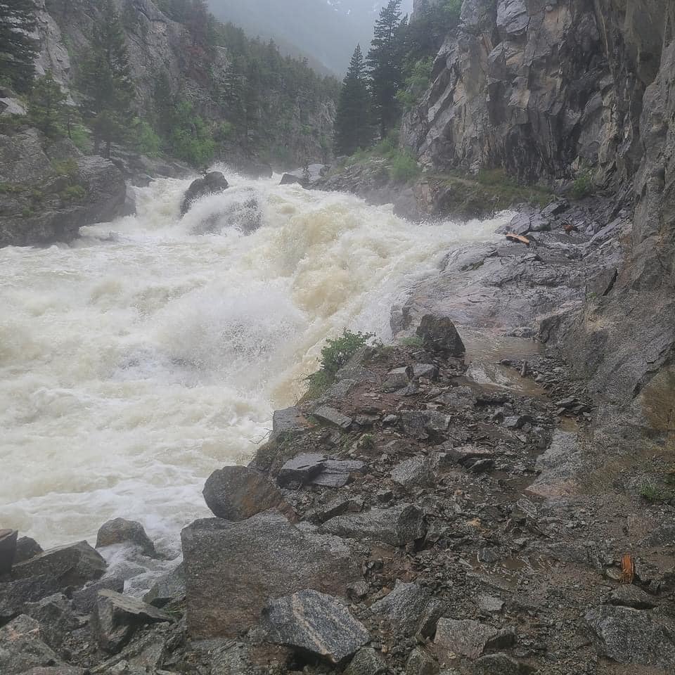 |
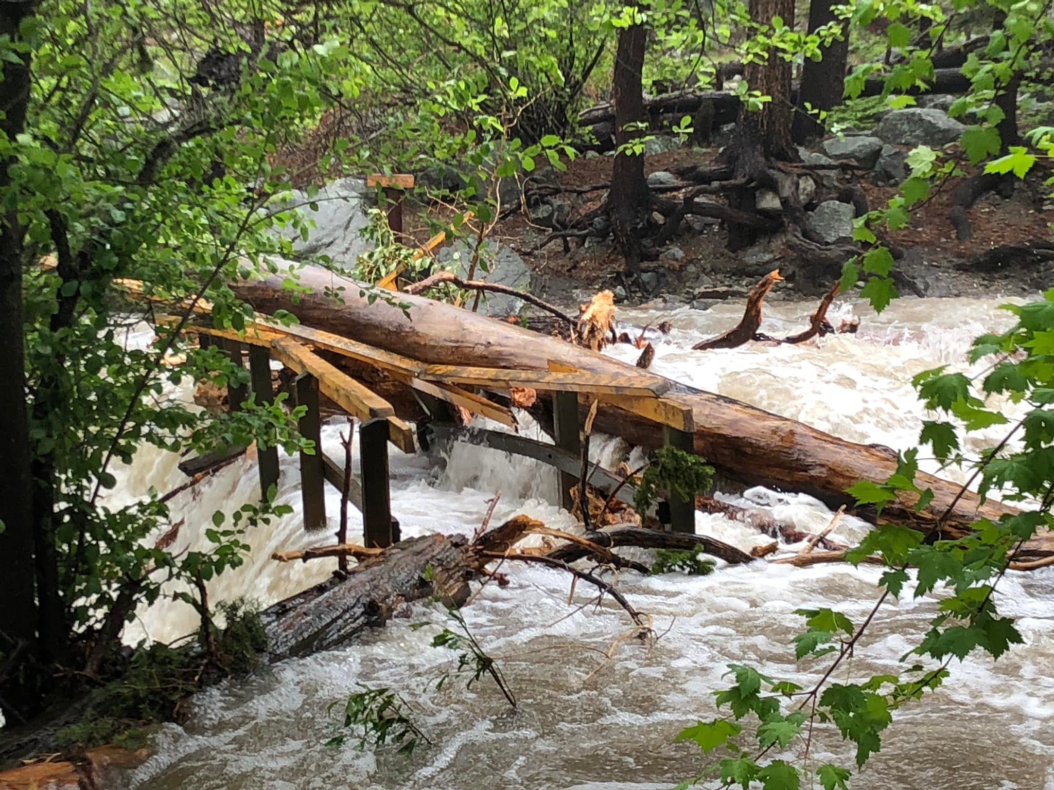
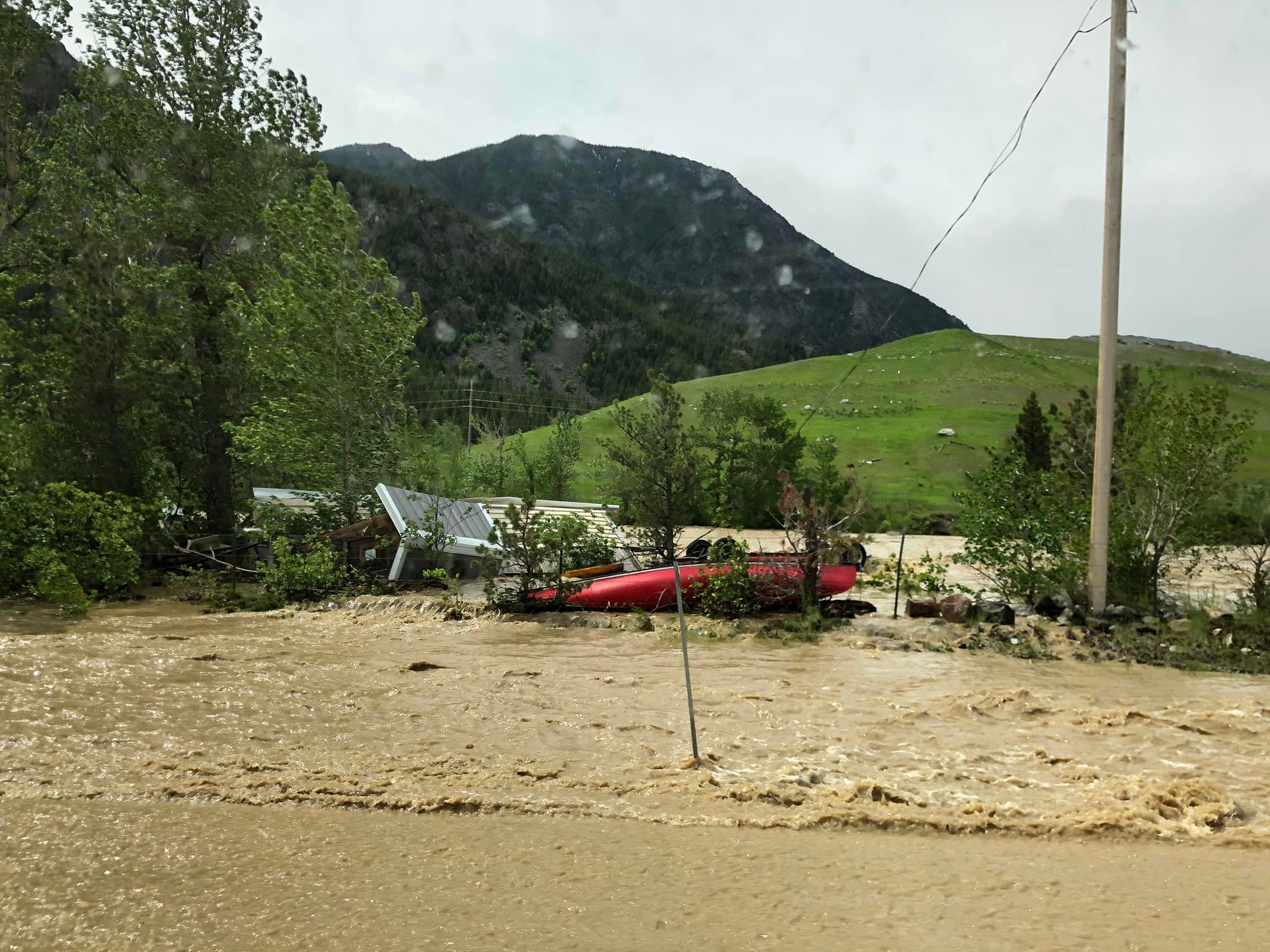
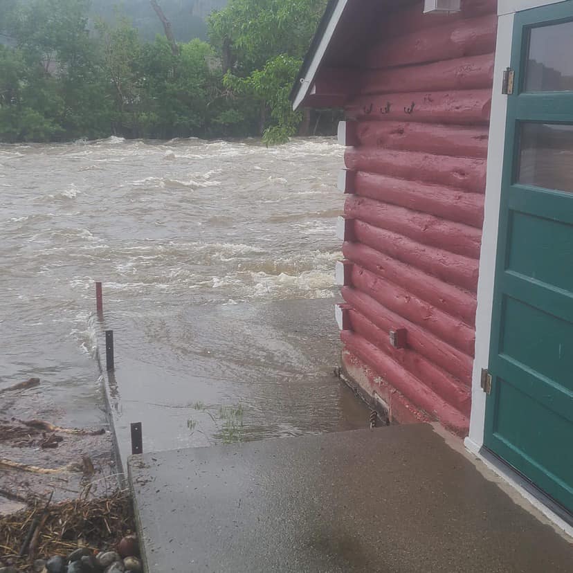
| Bridge at Woodbine to the falls crushed by debris. Photo by Justin Sheely. | Debris piling up along the Stillwater River. Photo by Justin Sheely. | Cabin along the Stillwater River. Photo by Stillwater County News. | Stillwater River. Photo from Stillwater County News. |
Yellowstone County
The mainstem of the Yellowstone River experienced historic flooding.
Hydrographs
.png) |
| Preliminary gauge data at the Yellowstone River at Billings peaked at 16.50 feet, beating the previous all-time record of 15.00 feet set on 06/12/1997. |
Sheridan County WY
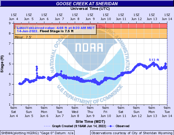
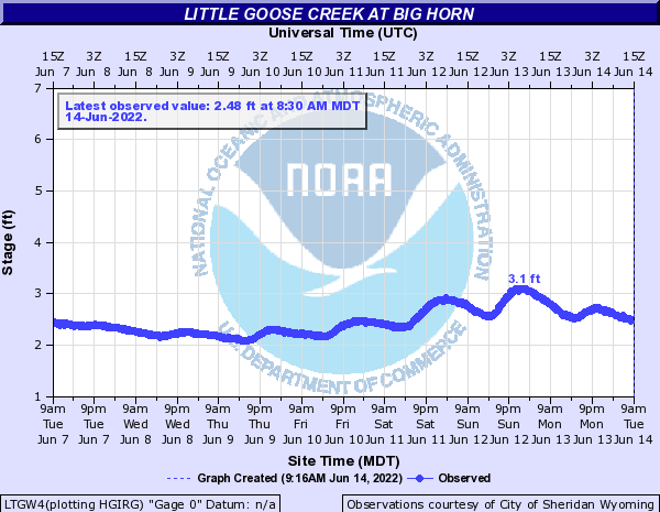
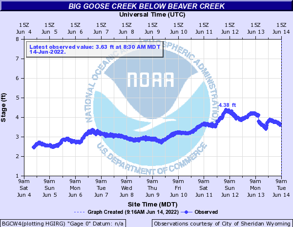
Only minor flooding impacts across Sheridan County. Mostly typical low-lying areas that flooded.
Hydrographs
 |
 |
 |
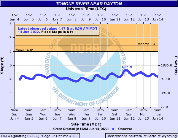 |
| Goose Creek at Sheridan remained well below flood stage. | Little Goose Creek at Big Horn remained around a foot below its crest on May 30, 2022. | Big Goose Creek below Beaver Creek. | Tongue River near Dayton remained well below flood stage. Minor flooding was seen in low-lying areas. |
 |
Media use of NWS Web News Stories is encouraged! Please acknowledge the NWS as the source of any news information accessed from this site. |
|



 Follow us on X
 Follow us on Facebook
 Follow us on YouTube
 BYZ RSS Feed