A heat wave over the Southwest will intensify this week, peaking and expanding into the Intermountain West and northern High Plains this weekend. Critical to extremely critical fire weather conditions are forecast from the Northwest and the northern Great Basin this weekend. Particularly Dangerous Situation Red Flag Warnings have been issued. Read More >
Columbia, SC
Weather Forecast Office
|
LSR Summary - Local Storm Report Summary for the event. PNS Report - Rainfall and Wind Summary for the event.
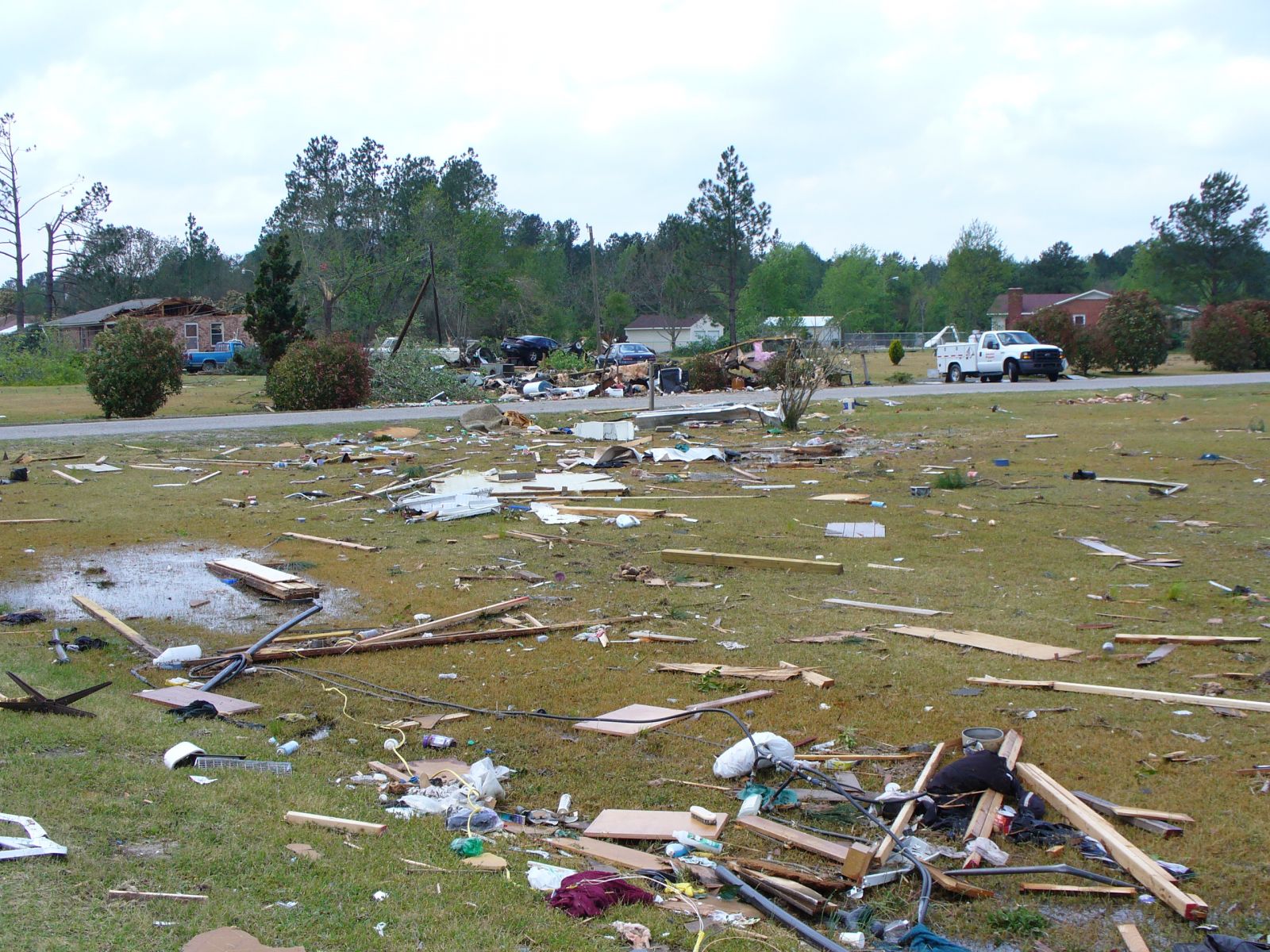
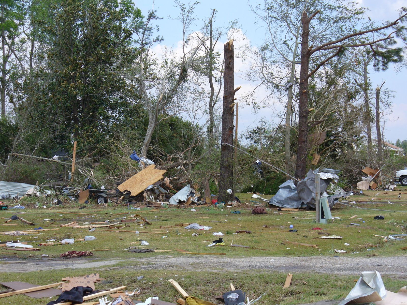
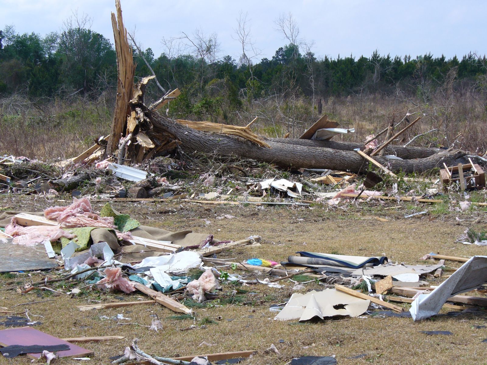
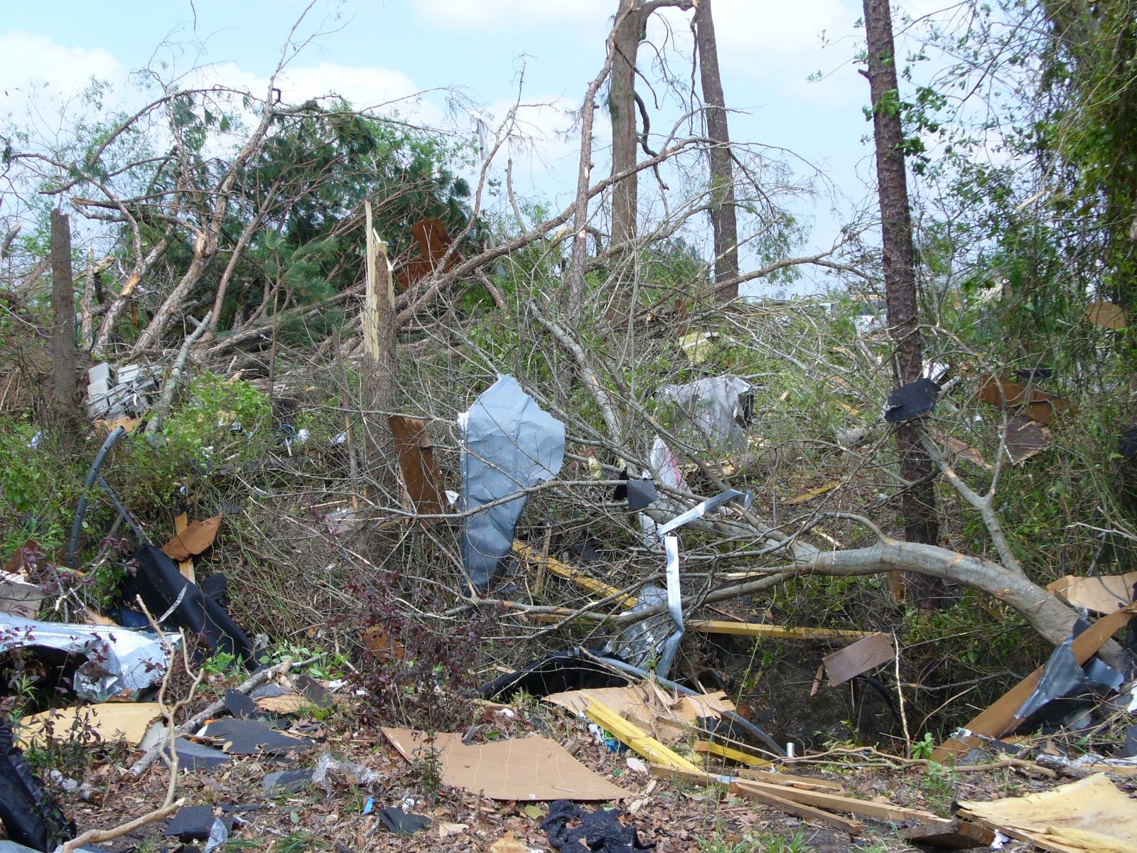
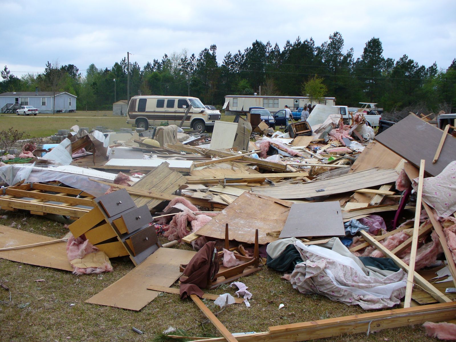
Images taken from around the NWS Columbia County Warning Area.
|
Hazards
South Carolina
Georgia
National Warnings
Tropical Weather
Weather Briefing
Provide Storm Reports
Email Alerts
Enhanced Hazardous Weather Outlook
GIS
KML/KMZ Data
Shapefile Data
Current Conditions
Observations
Satellite Images
Five Points
River and Lake Levels
River and Lake NWPS
Coop Reports
Lake Observations
Met Calculator
Mesonet Data
Radar
Columbia Radar
Nationwide
Charlotte TDWR
Forecasts
Winter
Activity Planner
Graphic Forecasts
Text Products
Aviation
Marine
Fire Weather
Air Quality
Forecast Discussion
RSS/XML
Experimental FRET
Hydrology
SC Streamflow
GA Streamflow
Drought Info
River and Lakes NWPS
Climate
Climate Plots
National
Local Climo
CoCoRaHs
Weather History Calendar
SERCC
NCEI
US Dept of Commerce
National Oceanic and Atmospheric Administration
National Weather Service
Columbia, SC
2909 Aviation Way
West Columbia, SC 29170-2102
(803) 822-8135
Comments? Questions? Please Contact Us.