Widespread life-threatening flash and urban flooding continues in south-central Texas, with considerable flooding impacts possible across central Texas. Wildfire smoke is impacting air quality across much of the Great Lakes region into southern New England and the Mid-Atlantic. Monsoonal thunderstorms may produce isolated to scattered flash flooding across the Southwest into the Great Basin. Read More >
|
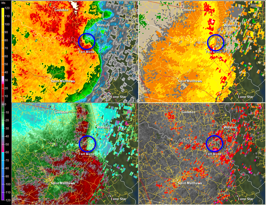
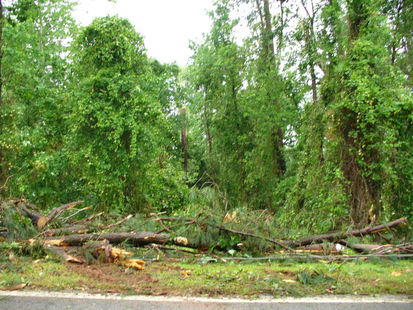
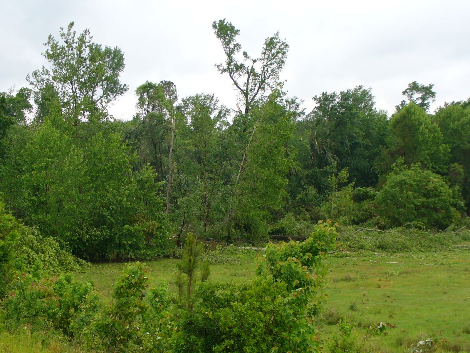
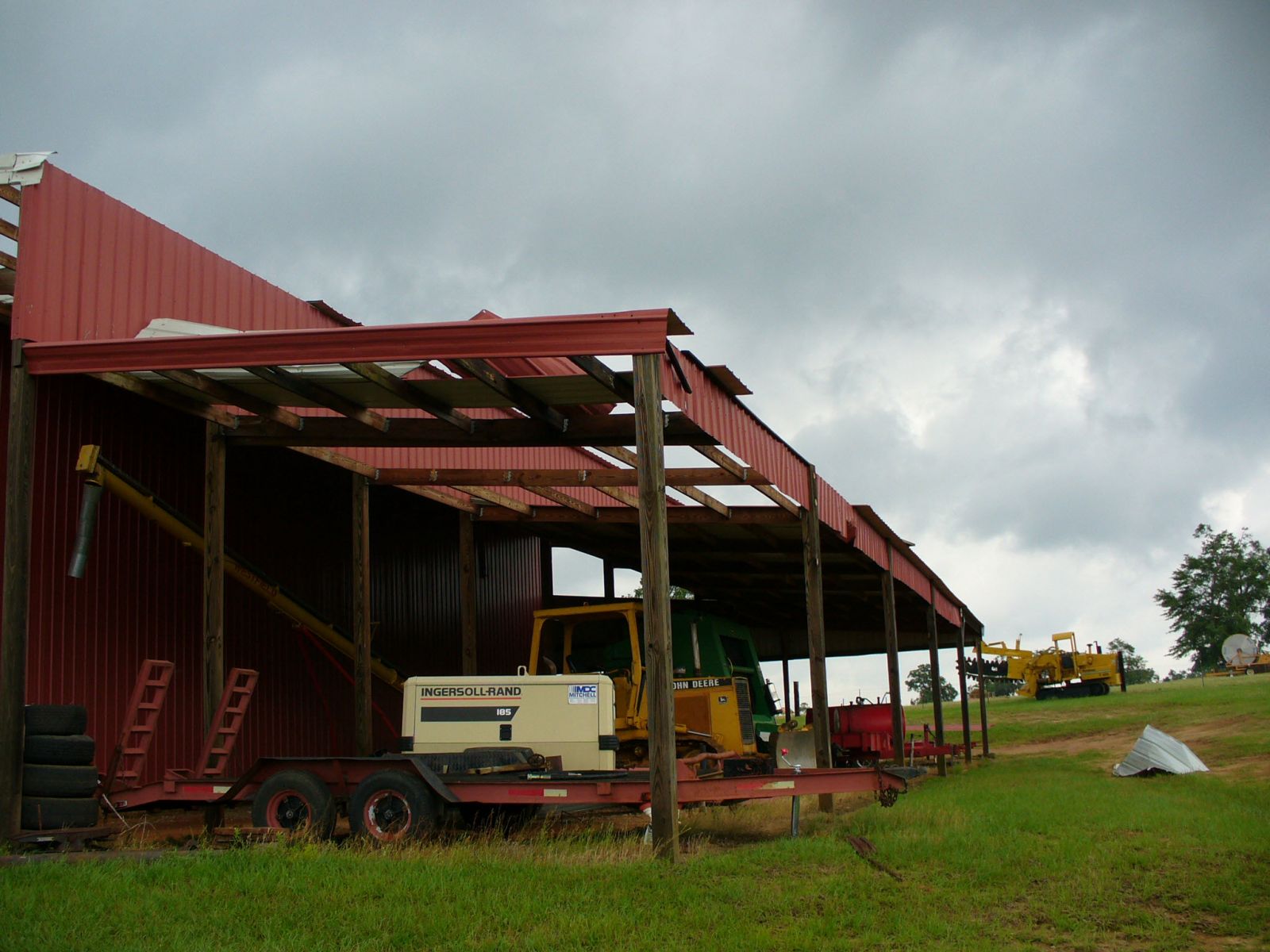
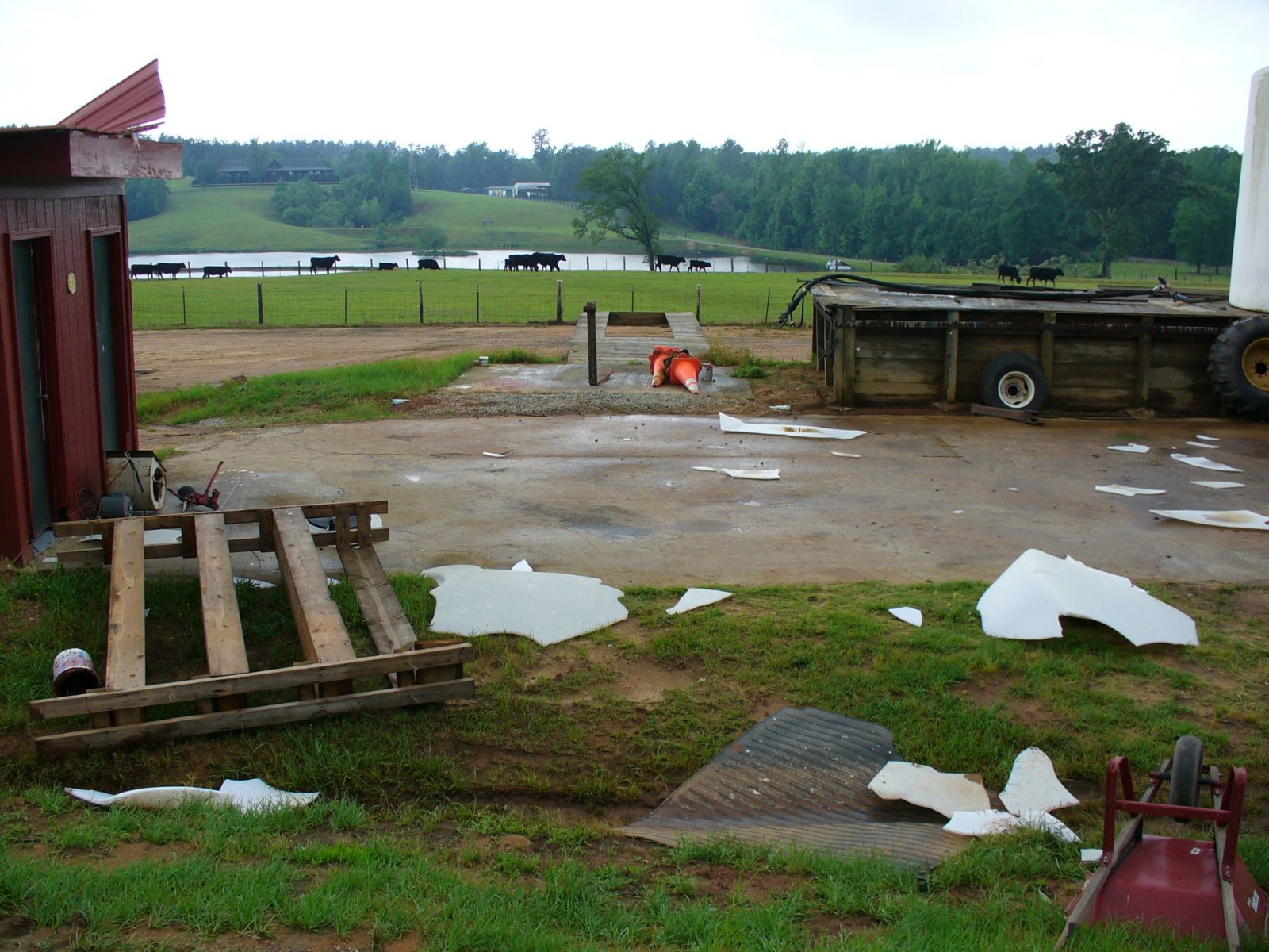
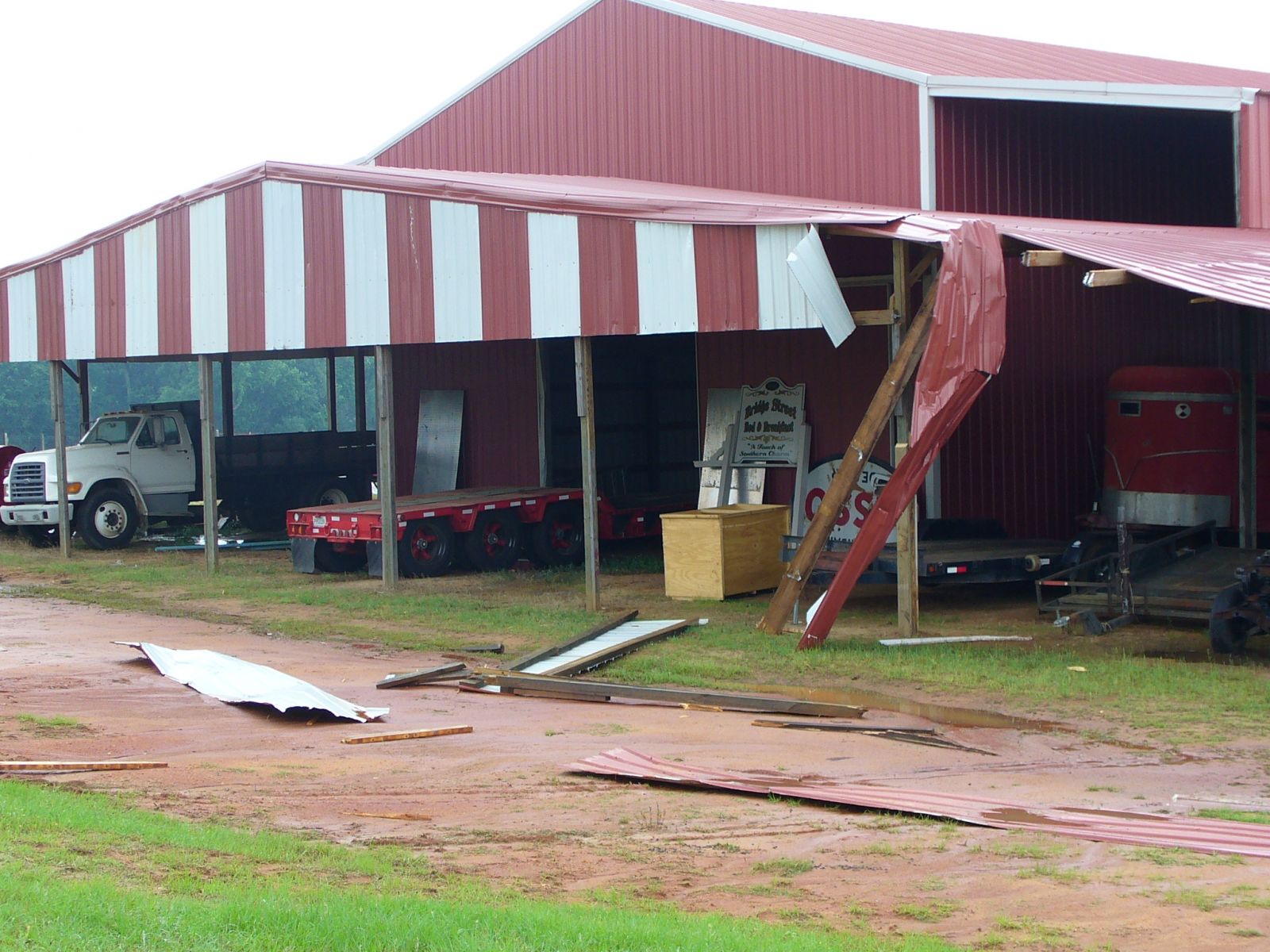
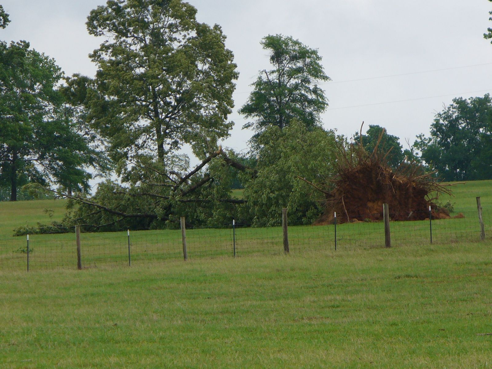
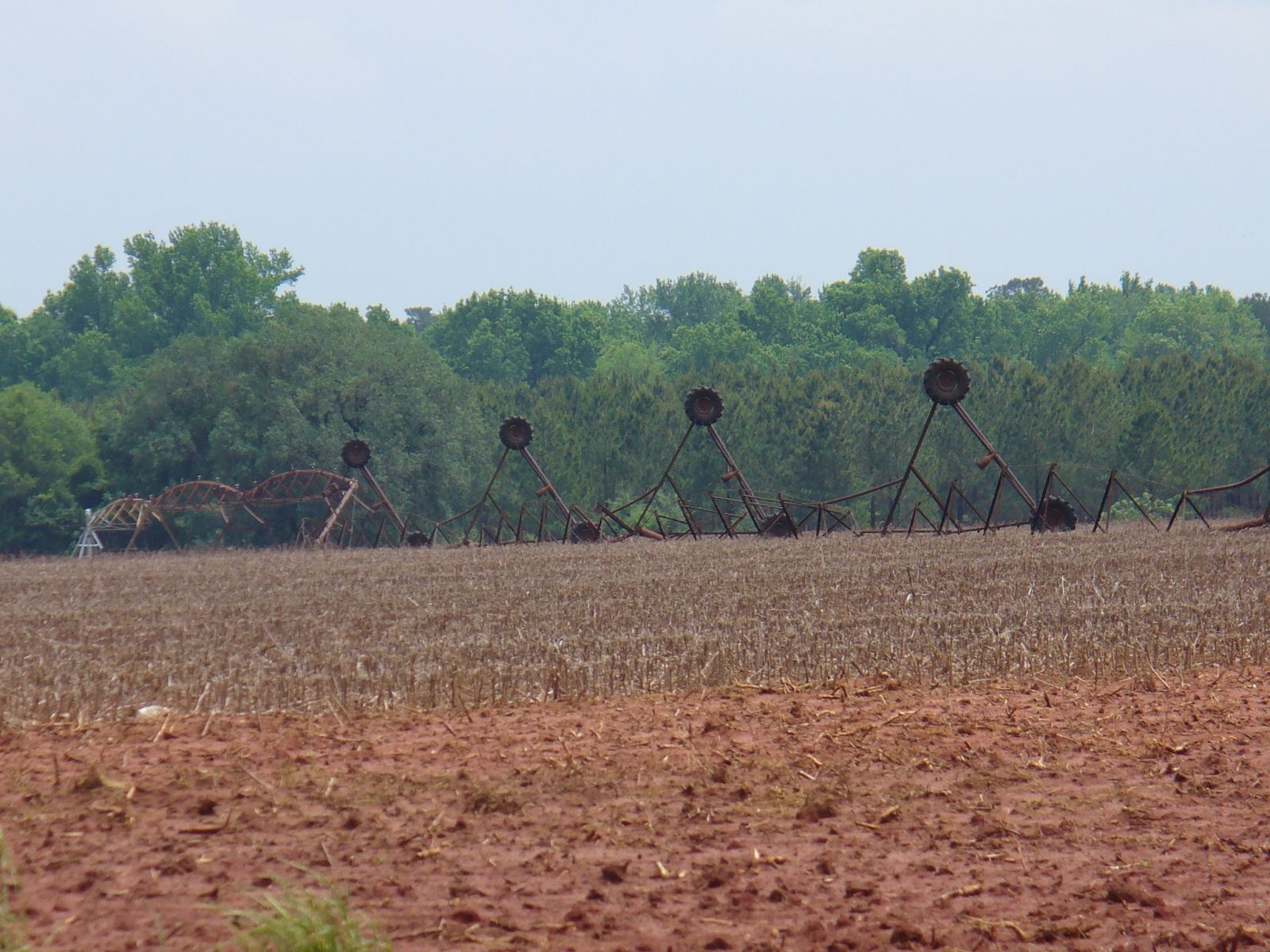
CALHOUN COUNTY TORNADO THE NWS-COLUMBIA SURVEY TEAM FOUND DAMAGE ASSOCIATED WITH AN EF1 TORNADO THAT OCCURED NEAR 750 AM IN A RURAL AREA SOUTH OF SUMTER, SC. THE PATH LENGTH WAS 12 MILES WITH INTERMITTENT TOUCHDOWNS. THE WIDTH WAS FOUND TO BE 1/8 MILE WIDE. THE SURVEY TEAM FOUND NUMEROUS TREES SNAPPED AND DAMAGED AND LARGE TREE LIMBS ON ROOFS OF HOMES. 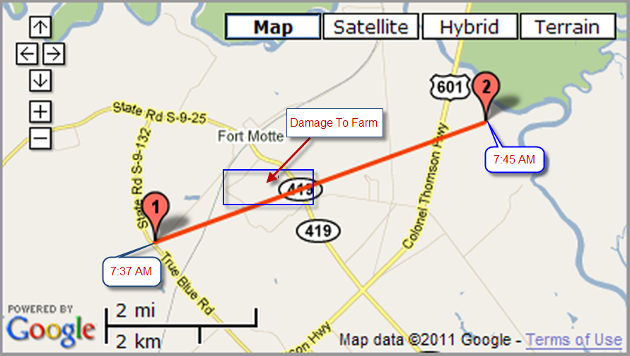
RADAR VIEW
FORT MOTTE DAMAGE PHOTOS
Click on the image to view the full size image. (credit photos to NOAA/NWS) |