
Severe thunderstorms capable of damaging winds will be possible from the Ozark Plateau east into portions of the Southeast today. Rounds of heavy thunderstorms ahead of a slow moving front will continue locally heavy rainfall and scattered flash flooding potential from the Ozarks to the Ohio and Tennessee Valleys today. Read More >
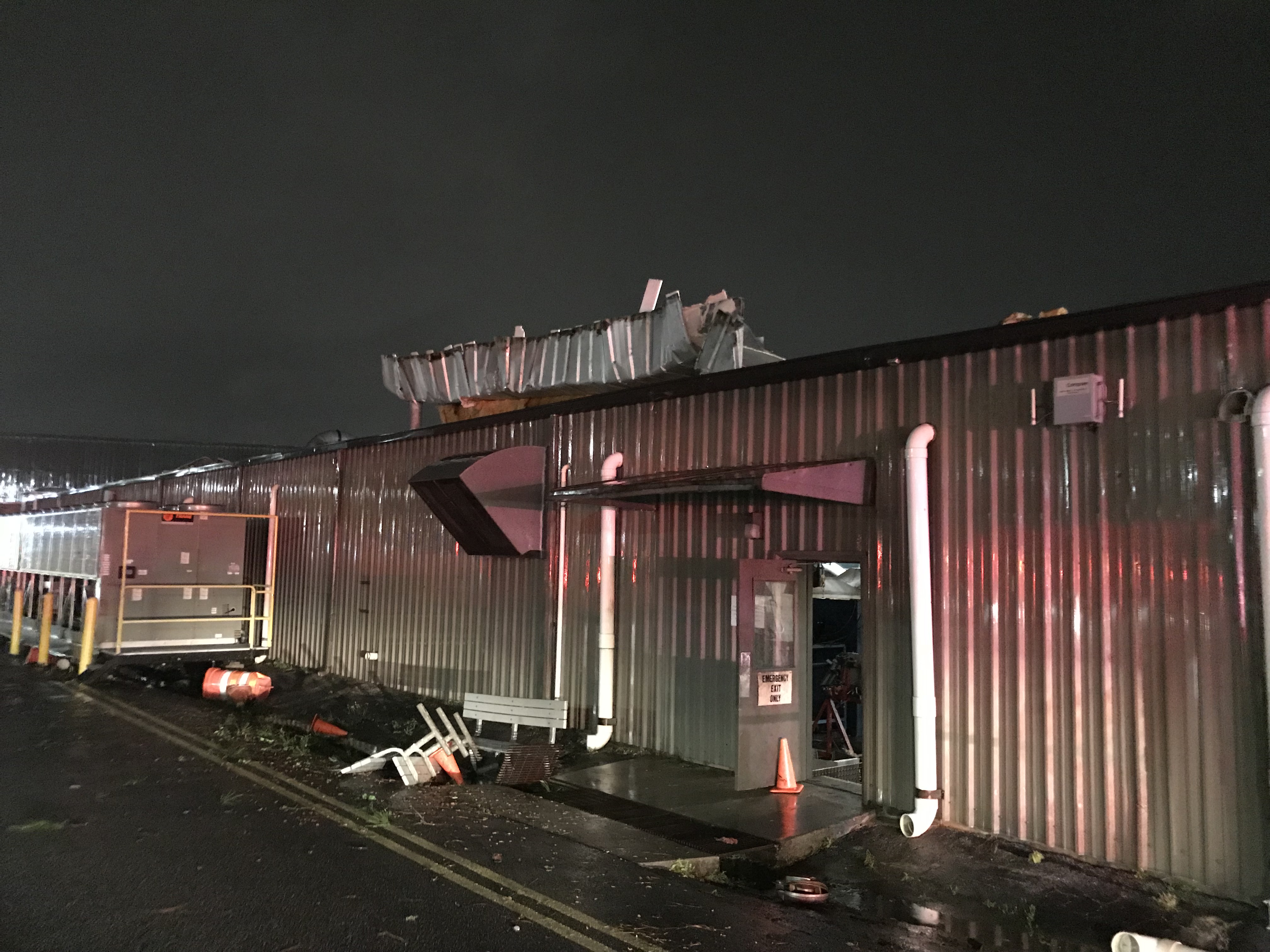
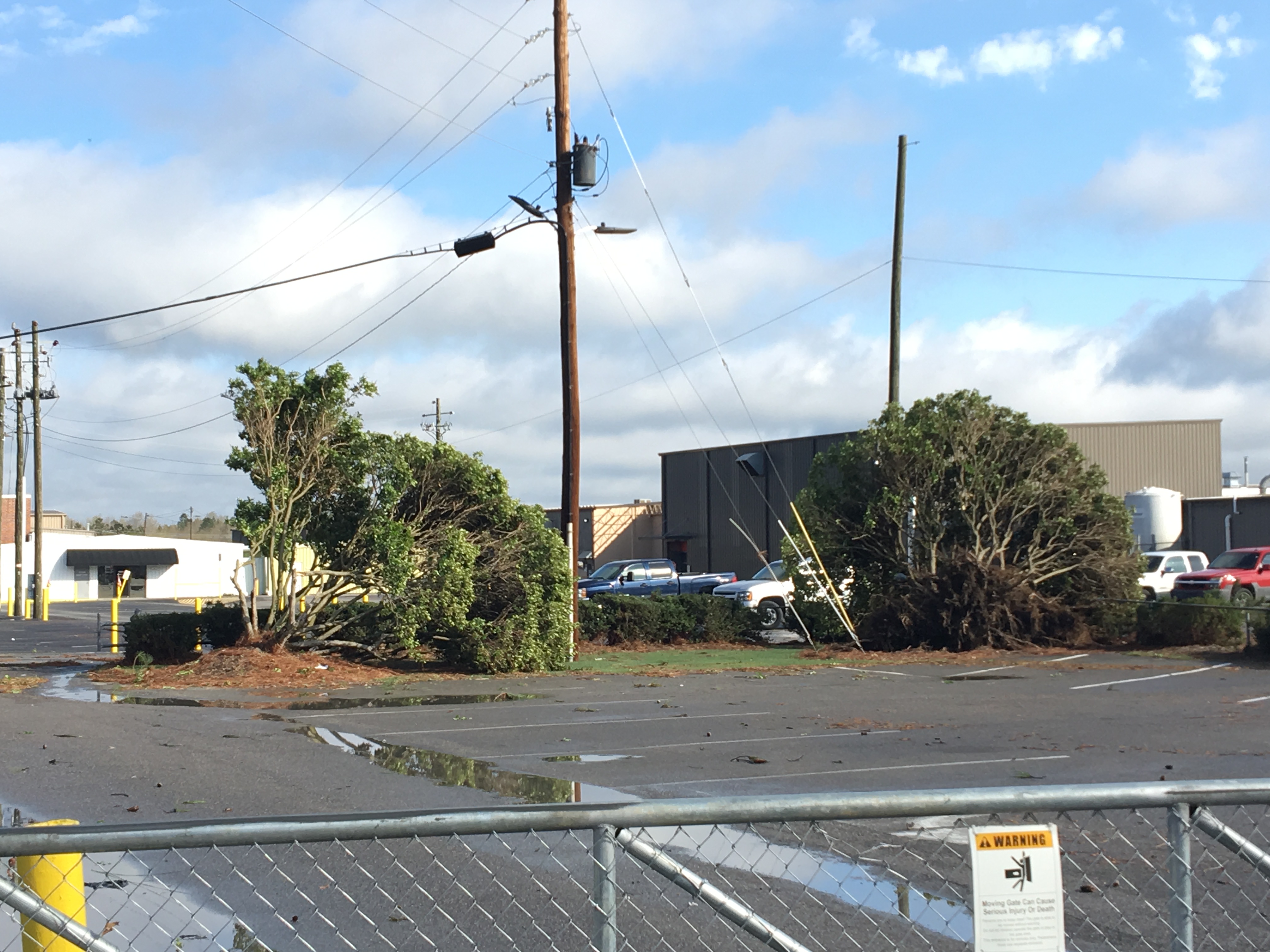
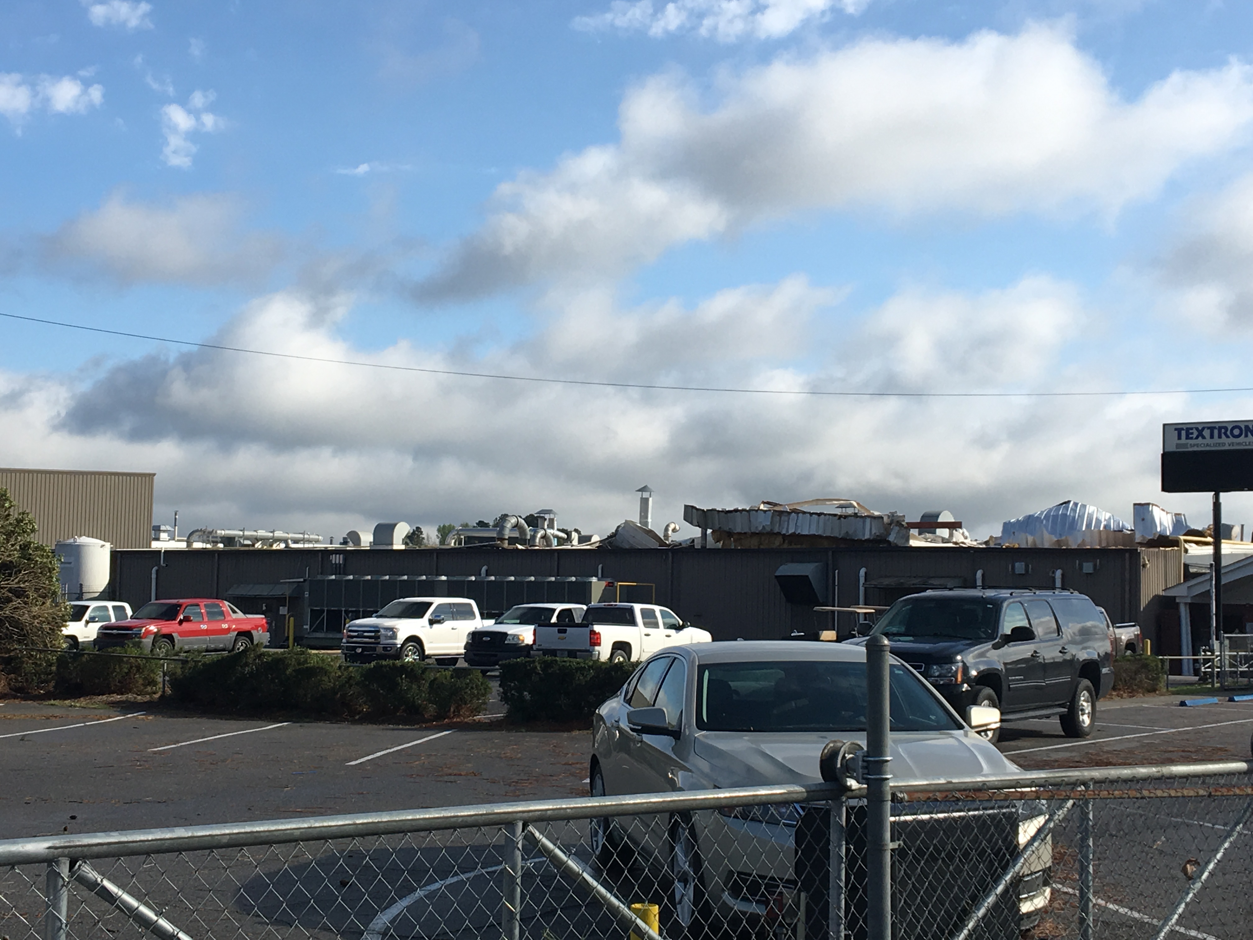
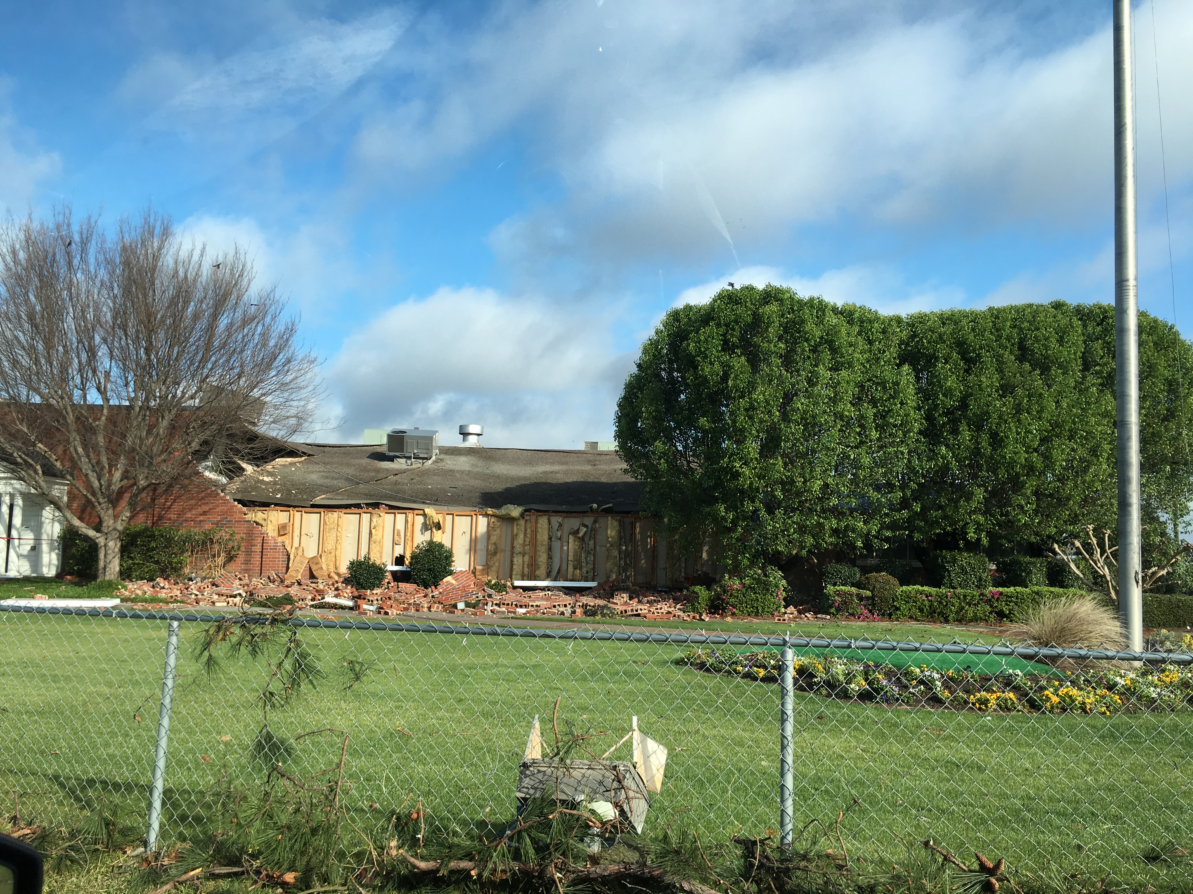
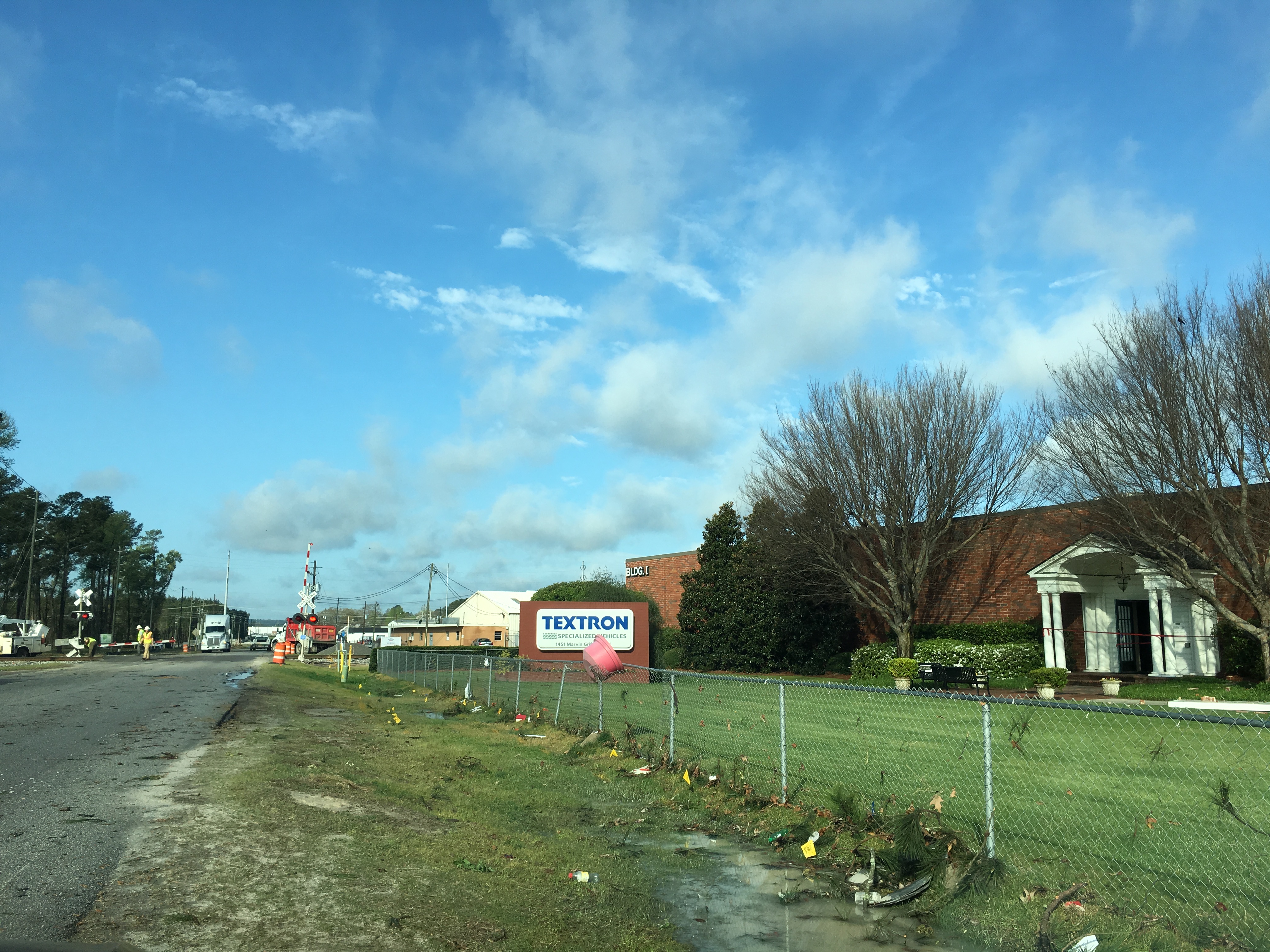
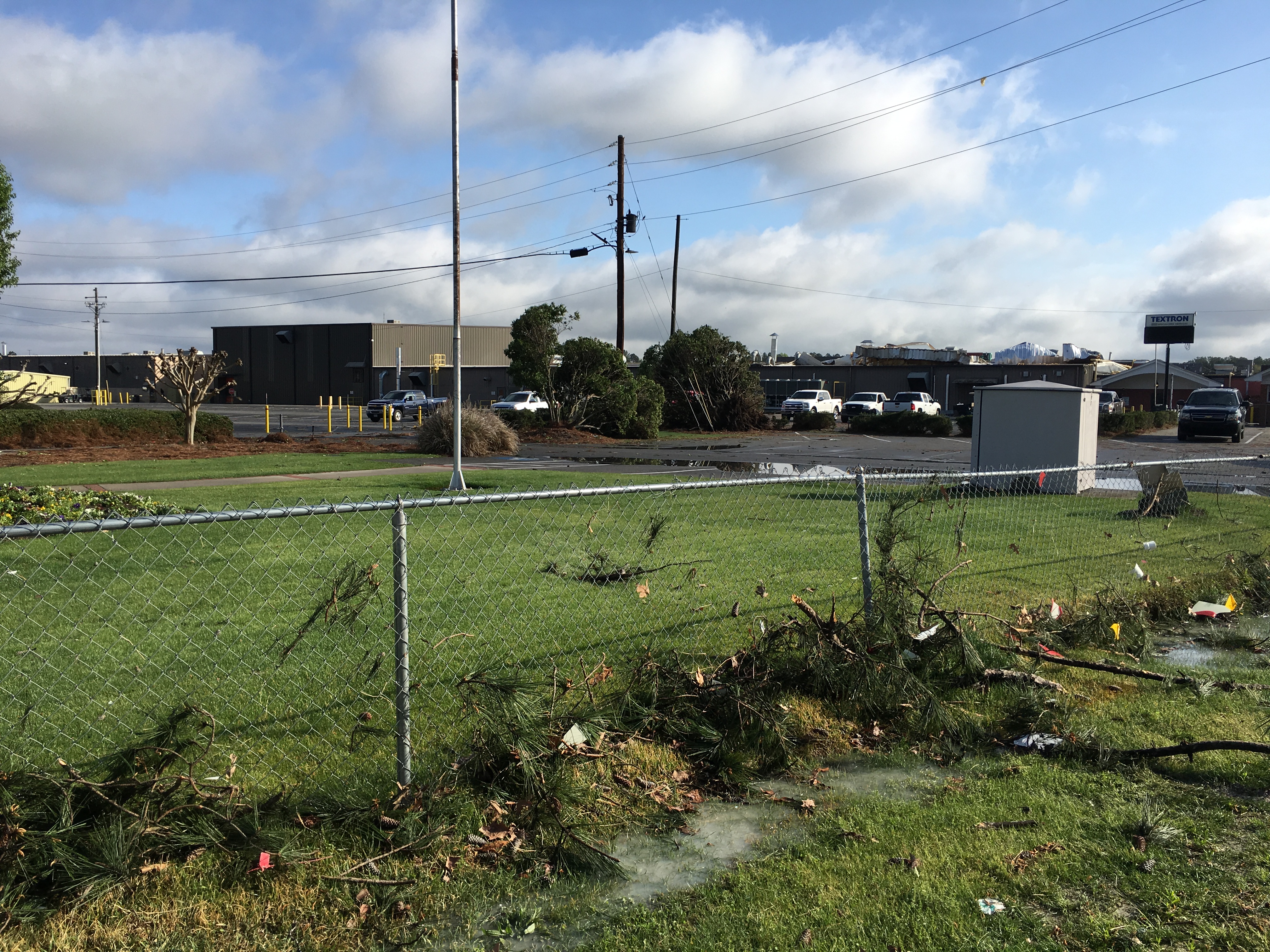
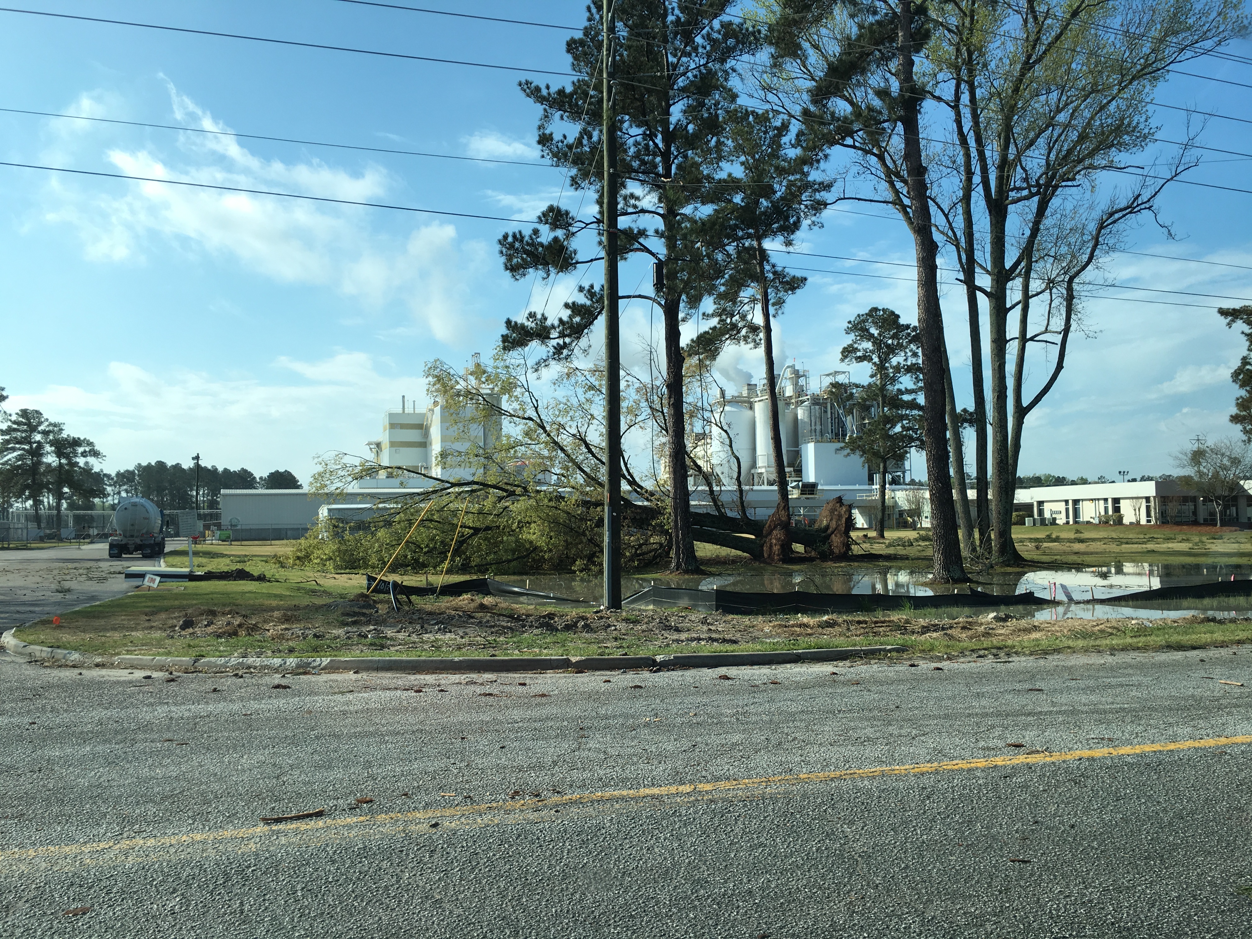
Public Information Statement
National Weather Service Columbia SC
407 PM EDT Wed Mar 21 2018

...NWS Damage Survey For March 20, 2018 Thunderstorm Wind Event...

.Augusta Straight Line Wind Damage...

Location...Augusta in Richmond County, Georgia
Date...March 20, 2018
Estimated Time...229 AM EDT
Estimated Maximum Wind Speed...95-105 mph
Maximum Path Width...50-75 yards
Path Length...0.7 miles
Beginning Lat/Lon...33.3941/-81.9924
Ending Lat/Lon...33.3990/-81.9819
* Fatalities...0
* Injuries...0

...Summary...
The National Weather Service in Columbia, SC conducted a storm
survey of damage which occurred around 229 AM EDT on March 20,
2018 in an industrial area just north of Bush Field (KAGS) in
Augusta. The survey determined that the cause of the damage was
due to straight line winds associated with a severe thunderstorm.

The damage occurred along Marvin Griffin Road, beginning near the
intersection with Perkins Road and ending just before Doug
Barnard Parkway. The damage occurred to 4 large industrial
buildings, where large sections of roofing material was uplifted
and removed. A portion of a masonry exterior wall collapsed after
the roof was uplifted and fell back onto the structure on one of
the buildings. Approximately 11 vehicles were heavily damaged by
debris, and 4 of the vehicles shifted from their original location
by the strong winds and debris. Approximately 6 trees were
uprooted with numerous limbs down in the area. In the most heavily
damaged areas, wind speeds were estimated to be as high as 95-105
mph, which is equivalent to wind speeds associated with an EF-1
tornado.

Although the buildings were occupied at the time, no injuries were
reported.

* The information in this statement is preliminary and subject to
change pending final review of the event and publication in NWS
Storm Data.
Damage Pictures courtesy of: Mie Lucas, GA CEM, Deputy EMA Director for Richmond County, GA.
 |
 |
 |
 |
 |
 |
 |

