
Dangerous heat will expand from the Gulf Coast into the Southern Plains and Desert Southwest through week's end. Additional extreme heat impacting the Pacific Northwest will shift to the northern Plains by the weekend. Tropical Storm Bertha is expected to continue to impact portions of the northwestern Gulf Coast from south central Louisiana to the upper Texas coast today. Read More >
|
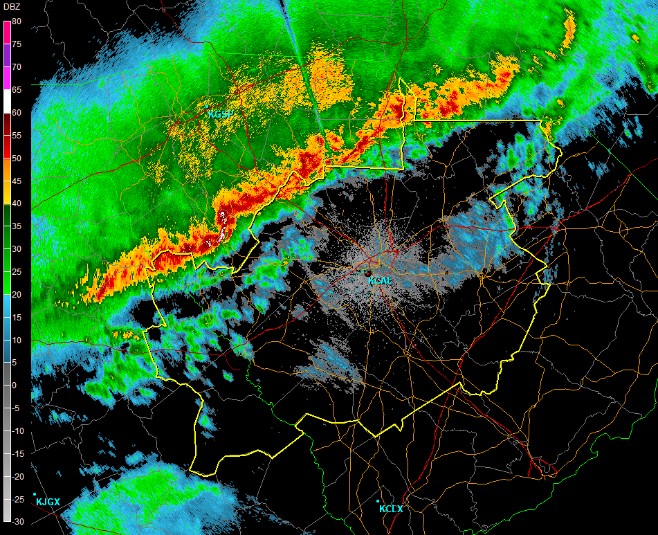
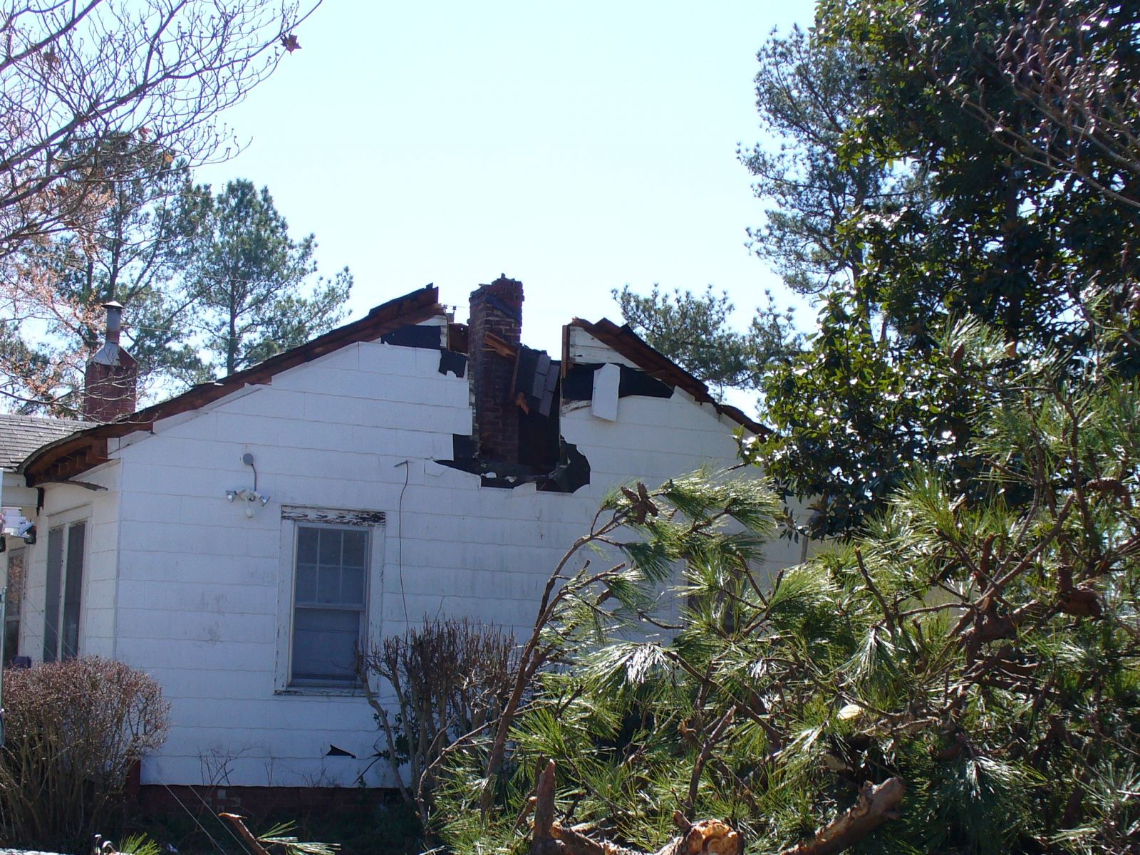
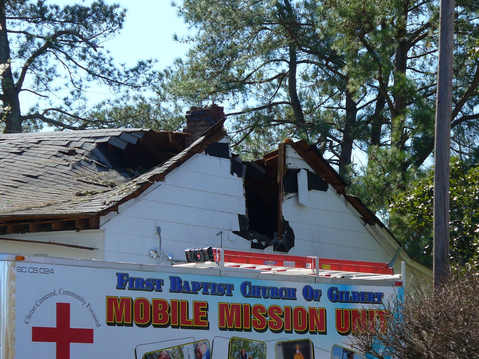
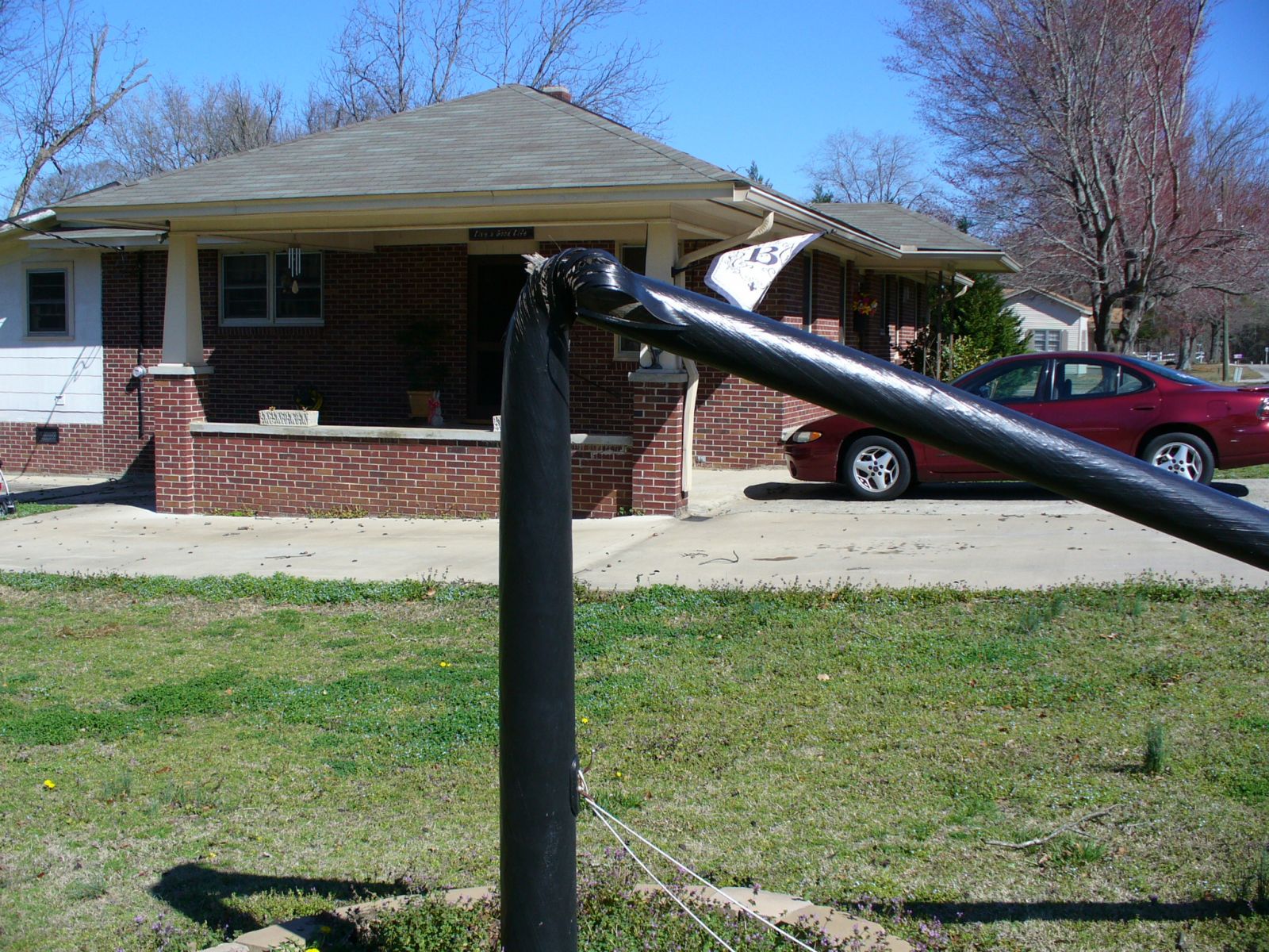
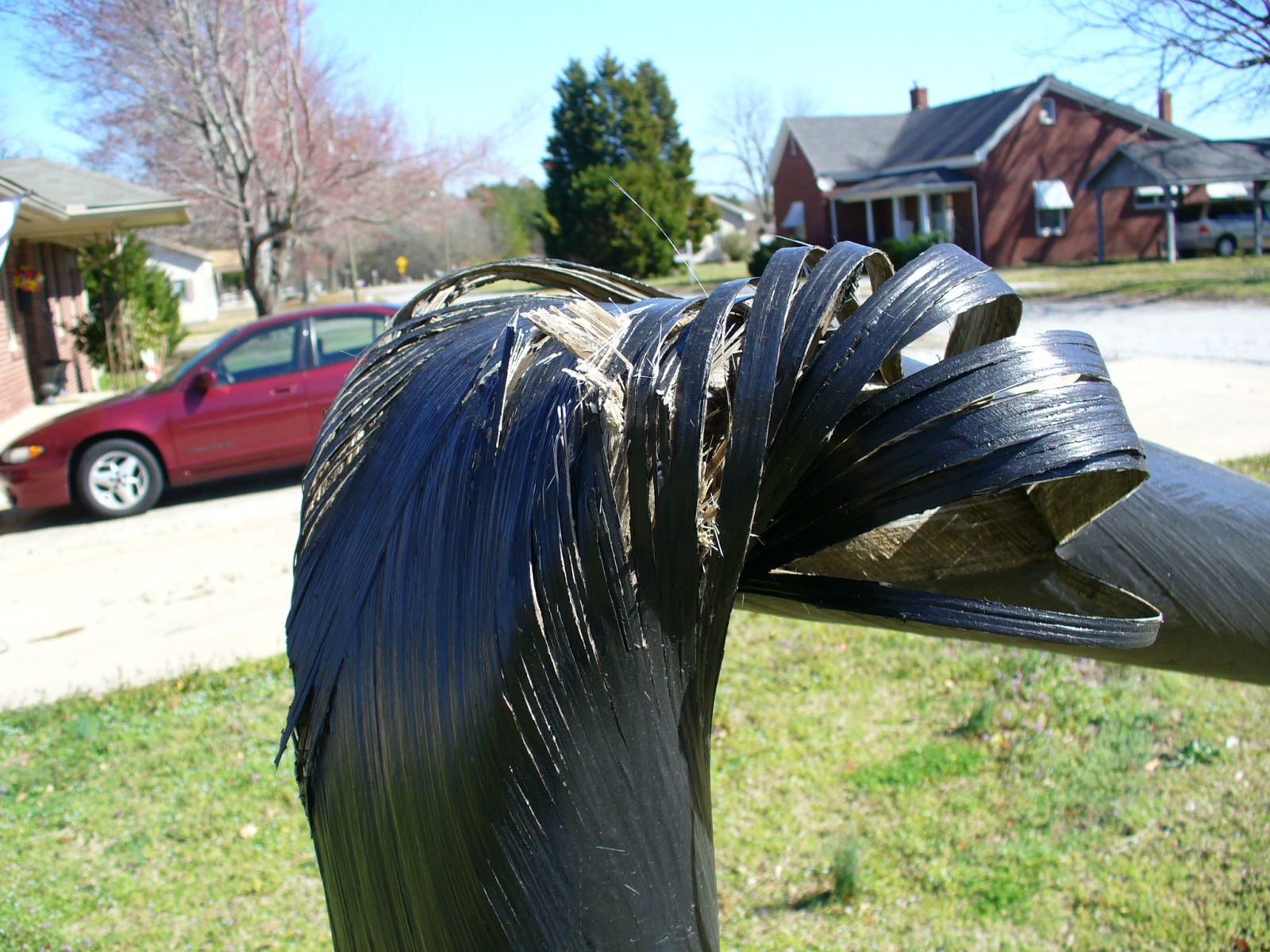
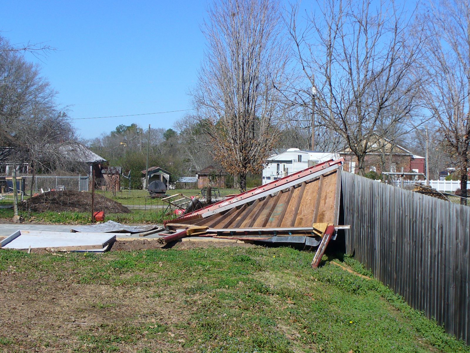
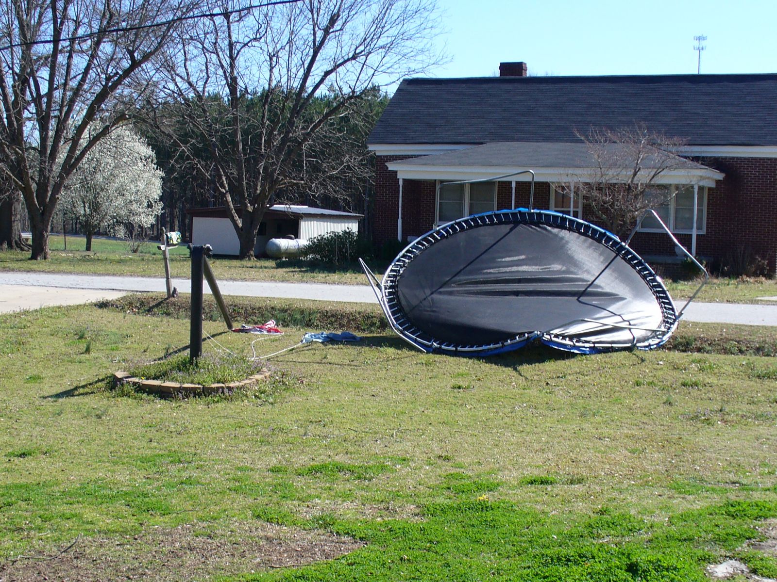
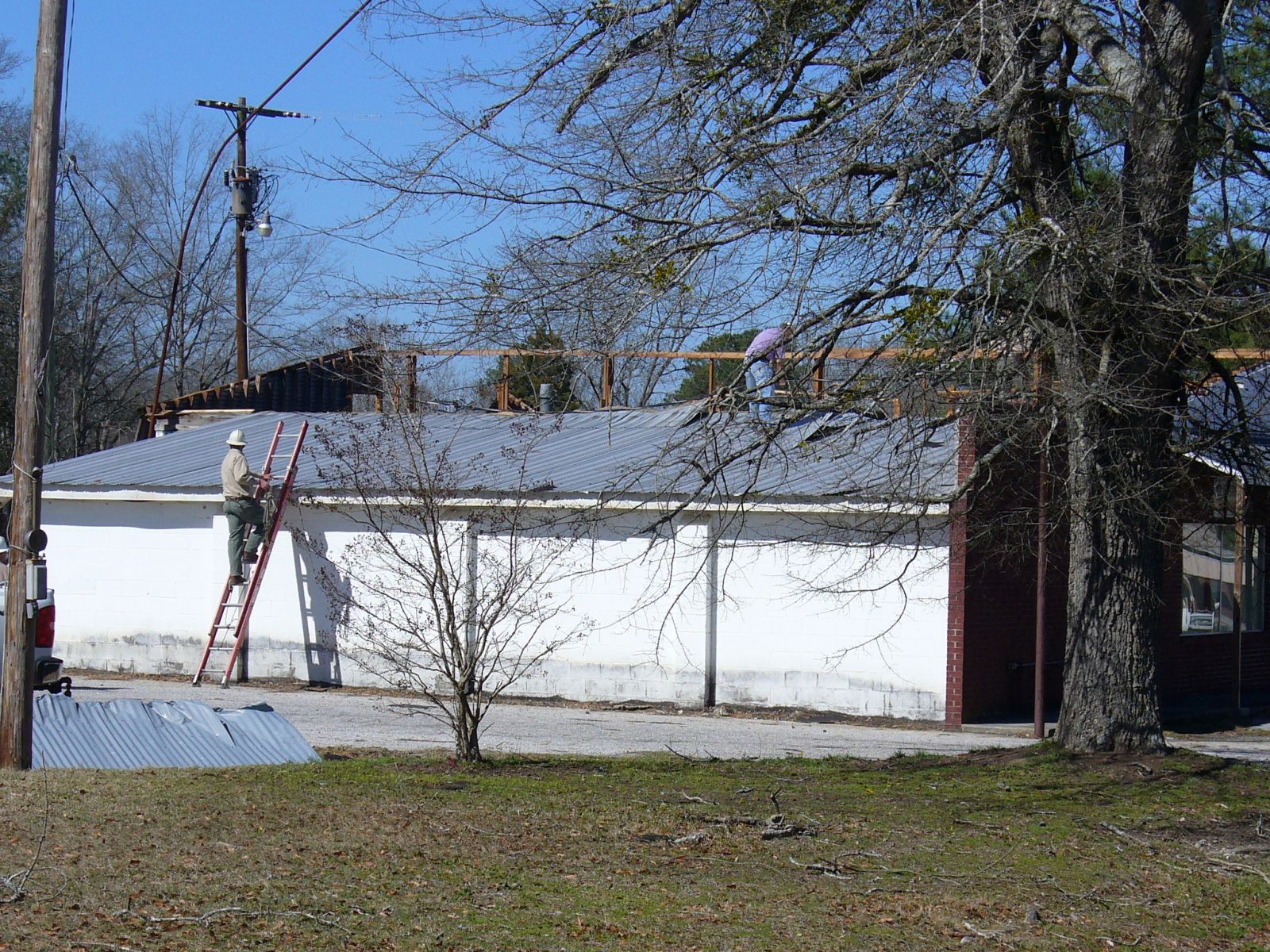
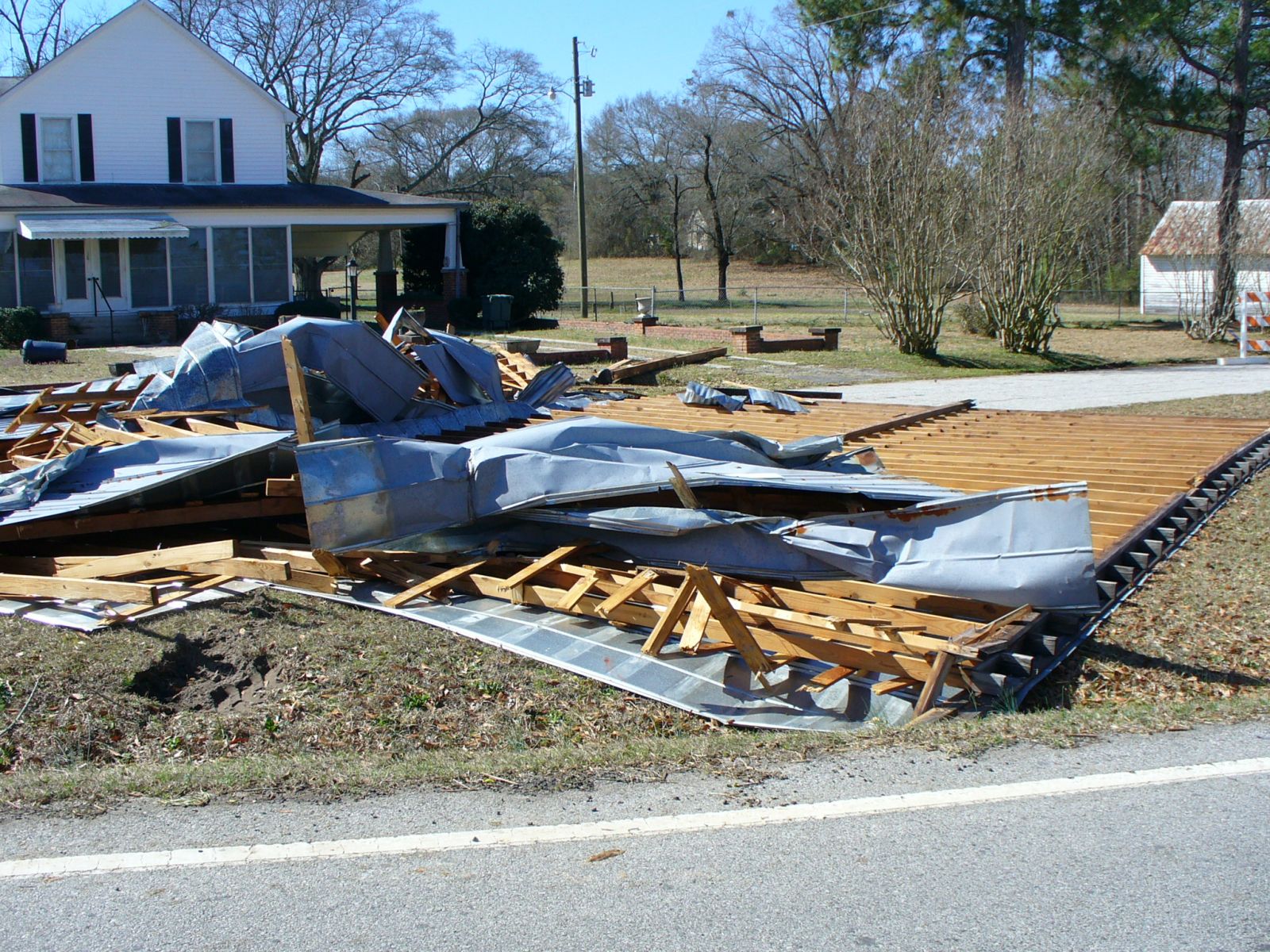
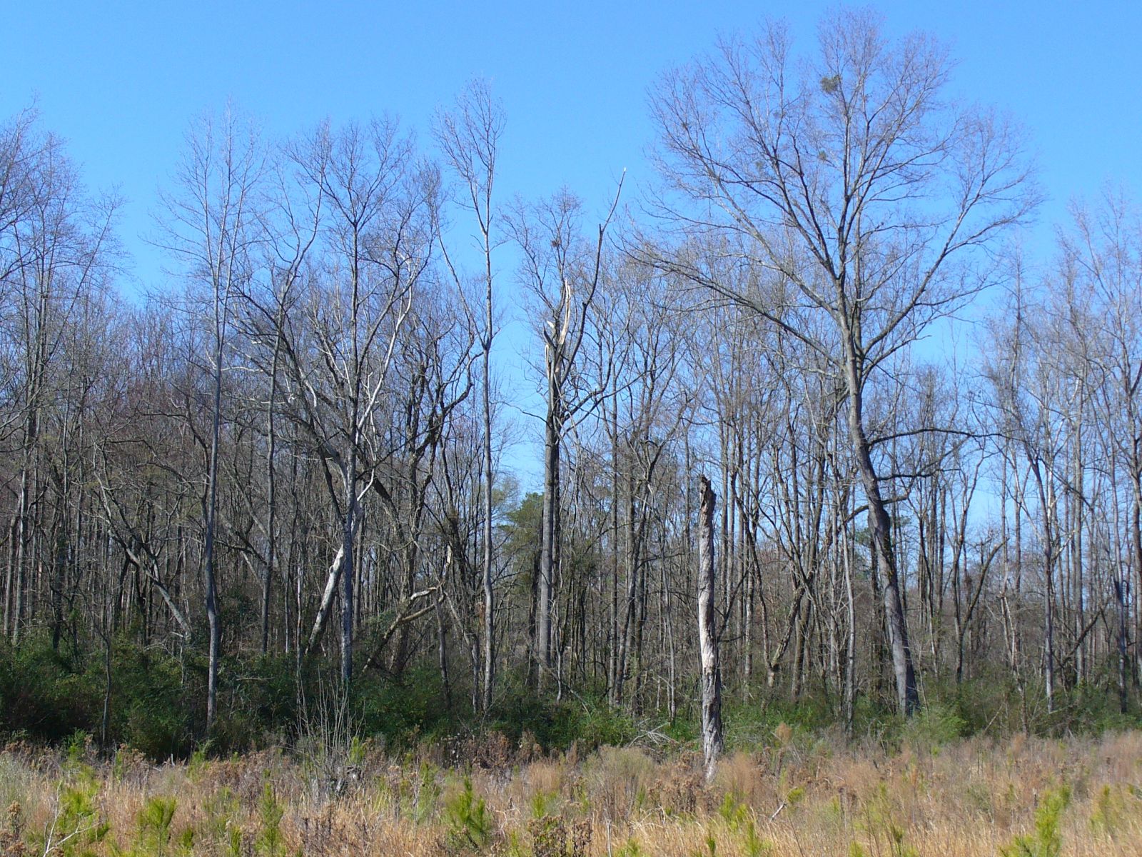
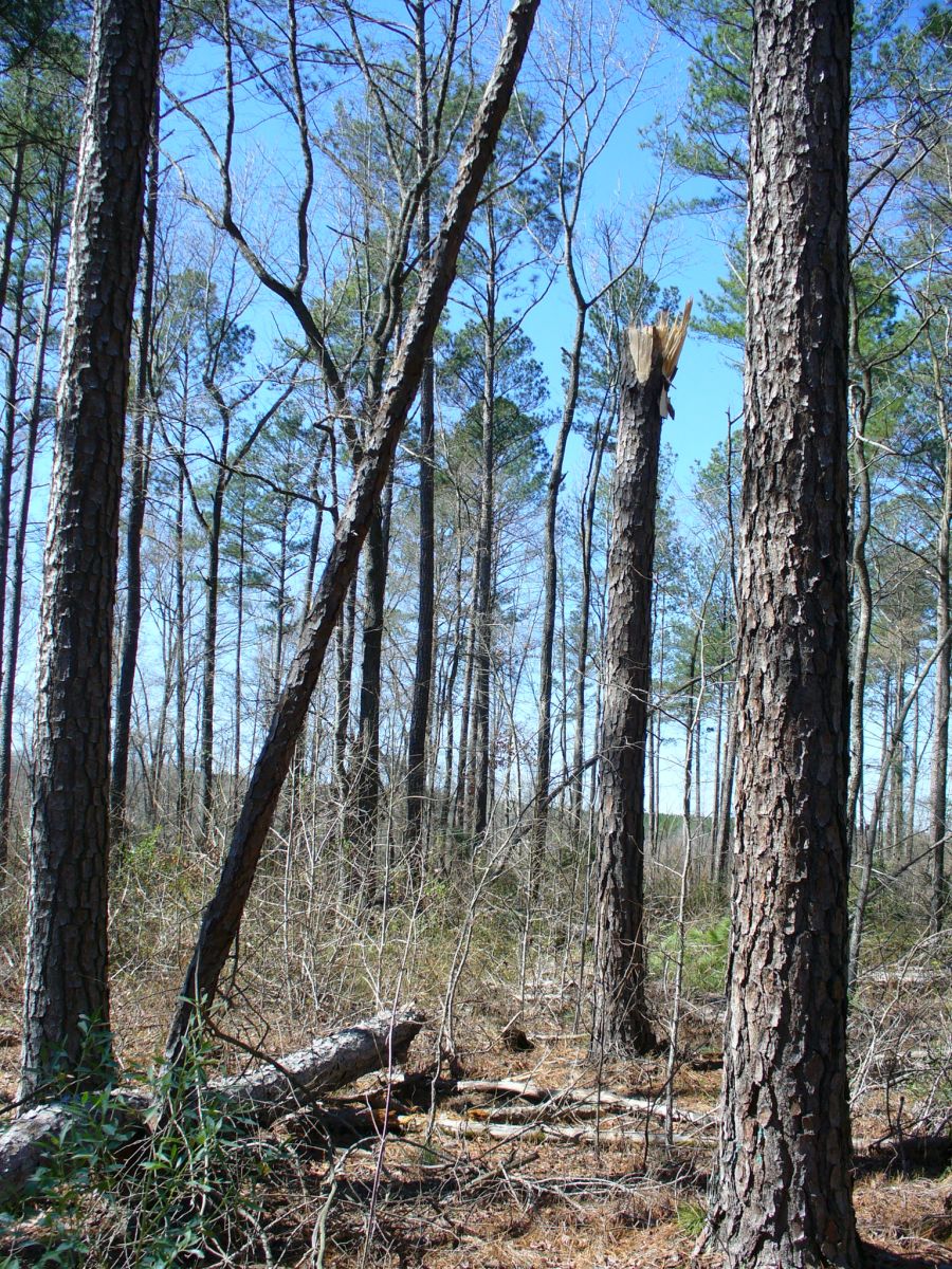
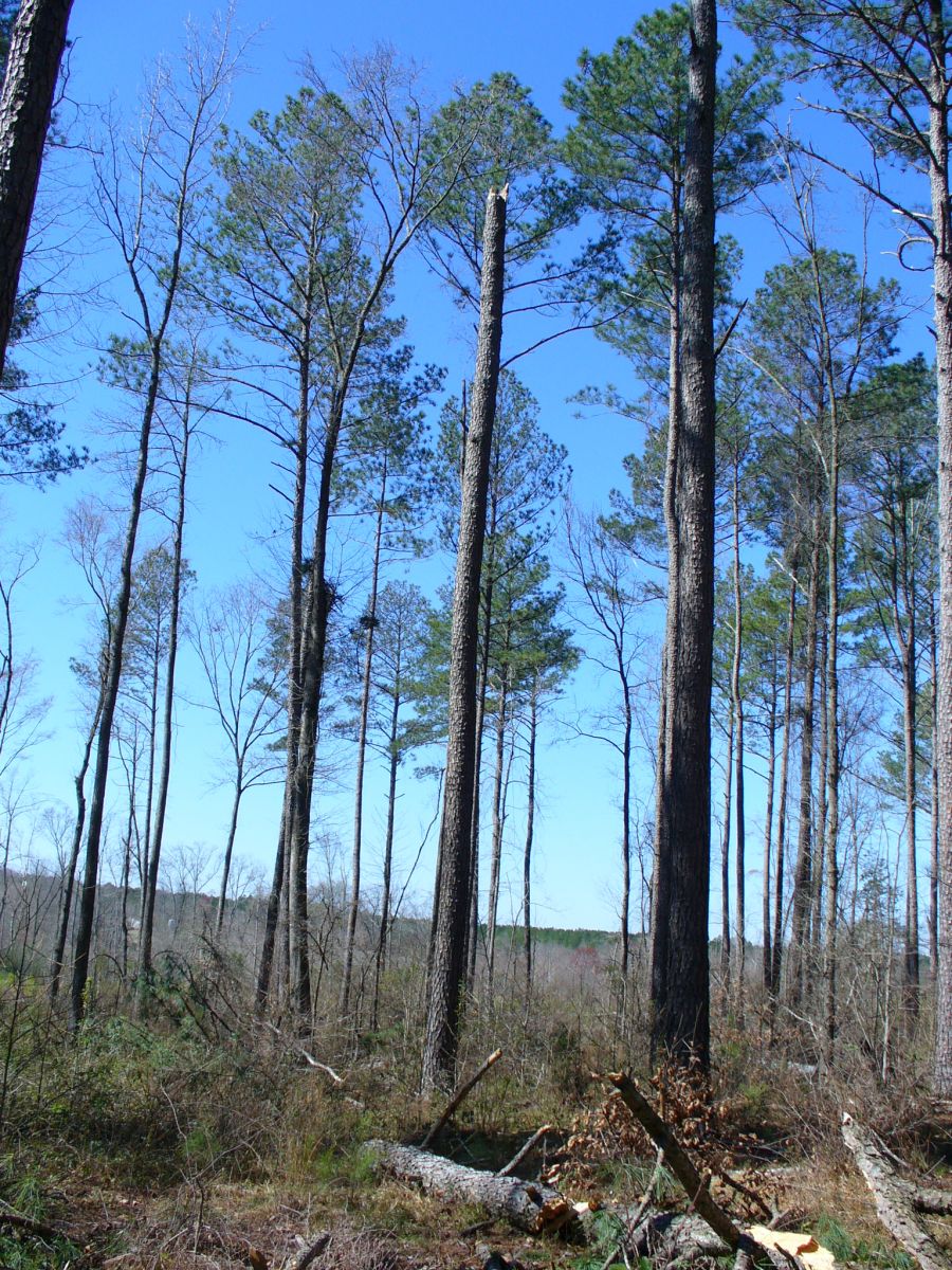
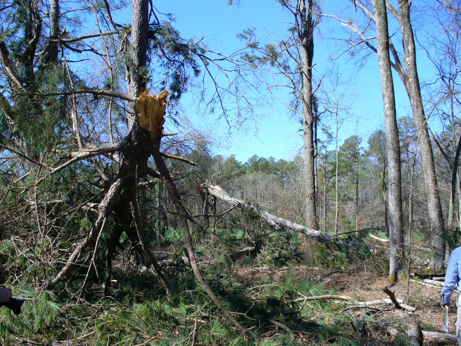
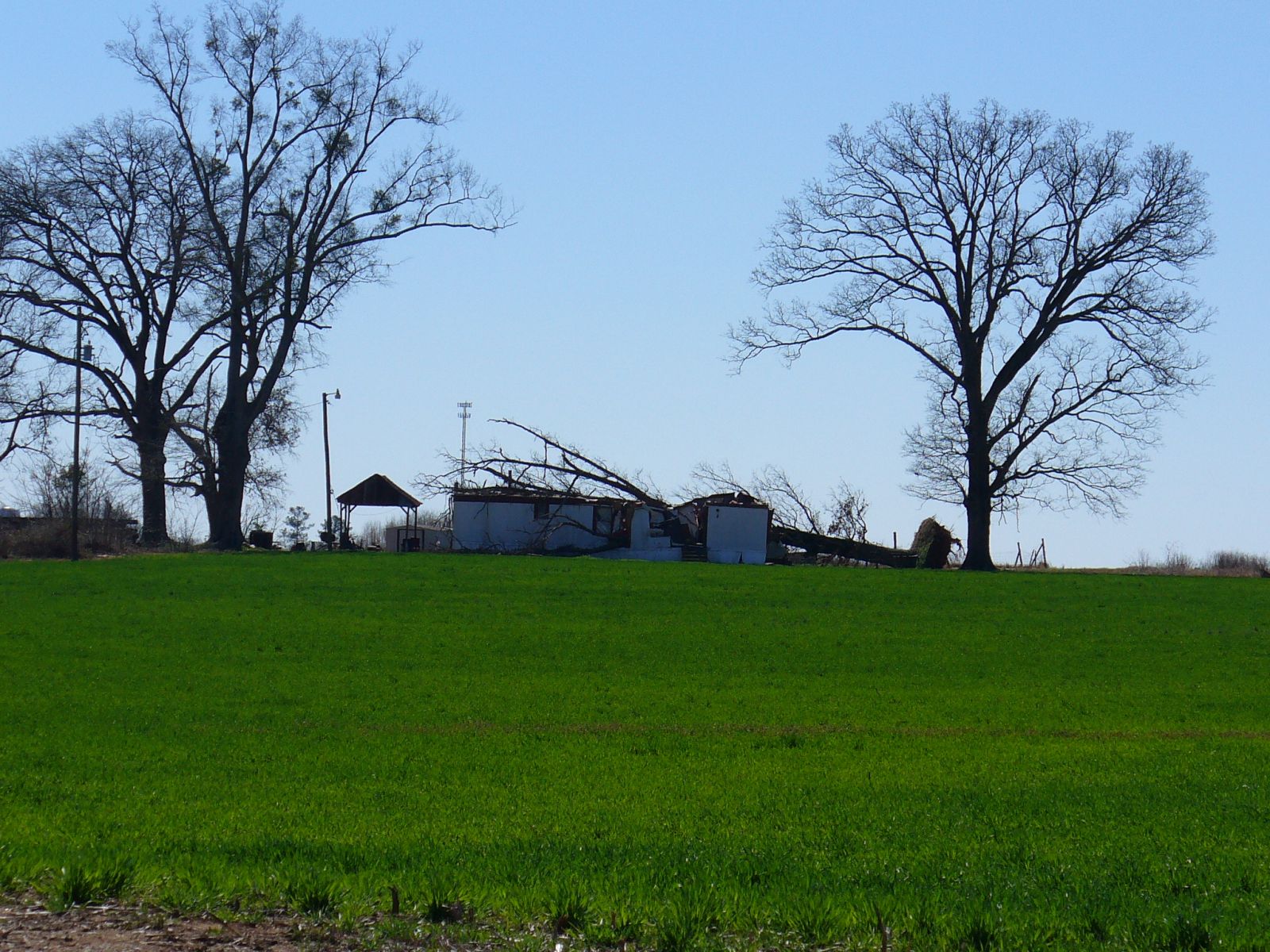
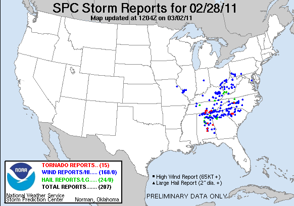
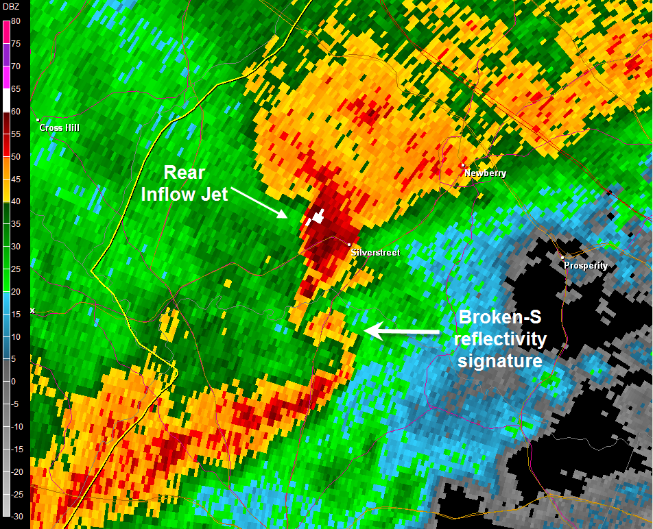
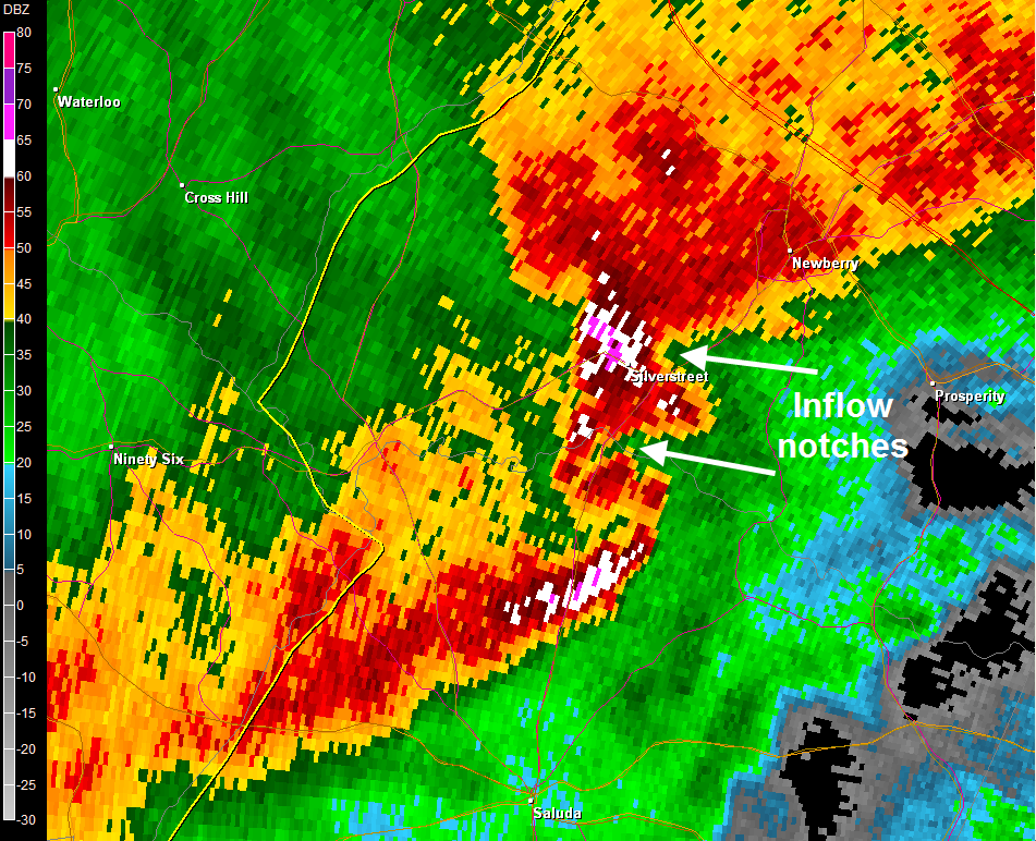
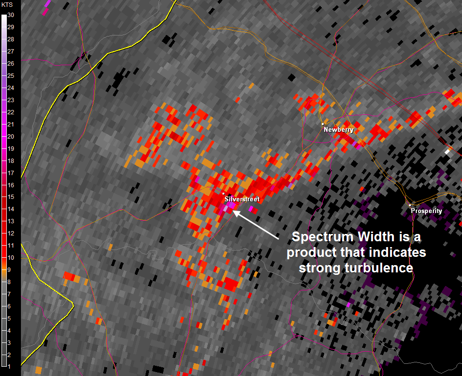
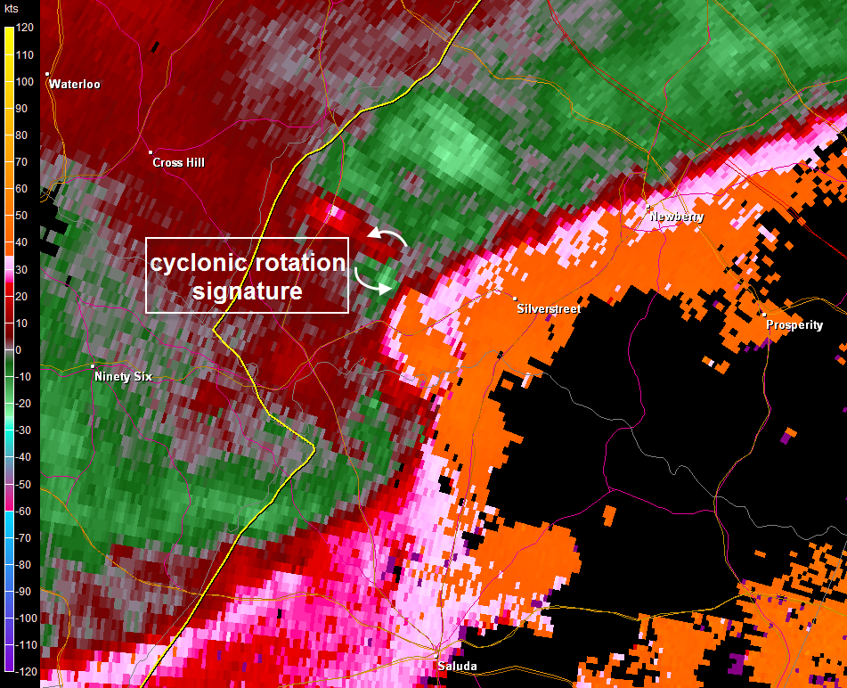
A line of strong thunderstorms moved through the Midlands on the evening of February 28, 2011. An upper level disturbance tracked across the Tennessee Valley while an area of low pressure tracked across the Tennessee Valley and into the Mid Atlantic region that evening. A line of showers and thunderstorms developed on a cold front and strengthened as it moved across the region, causing wind damage across much of the Upstate and Midlands. The line of storms was moving eastward at around 60 mph, which is quite a fast movement for storms. This was a unique event in that there was not alot of instability present but there was very strong wind shear, which compensated for the lack of instability. This environment is known as a High Shear Low Cape (HSLC) environment and there is ongoing research related to these types of environments to gain a better understanding of them. A typical mode of severe weather associated with the HSLC environment is a squall line where damaging wind gusts are the favorable severe weather report. Another radar signature associated with this environment is the broken-S, which shows up in the reflectivity data as a break in the line of thunderstorms. The S shape forms when strong winds occur within the inflow notches into the storm and a strong rear inflow jet is also evident. Damaging winds and less frequently isolated tornadoes are associated with this type of radar signature. The area that observed some of the worst damage was around Silverstreet in Newberry County. A NWS survey determined that there was significant damage associated with a downburst in Silverstreet where a large tree had fallen on a residence and a local business had a tin roof ripped off, while just north of Silverstreet EF-1 tornado damage was observed. Several trees were topped off in the vicinity of Reuben Elementary School. Reflectivity 1, Reflectivity 2, Spectum Width, and SRM for the Silverstreet Tornado Below are a few pictures taken by a NWS Storm Survey Team from around the Silverstreet Area of Newberry County.
|


