Severe storms, including large hail, wind, and perhaps a couple of tornadoes, are possible in the central Plains. Dry, windy conditions and lightning from dry thunderstorms may produce hazardous fire conditions in the Southwest and southern High Plains. Late-season snow is expected in the Northwest and the Great Basin. Heat is spreading across the eastern U.S.. Read More >
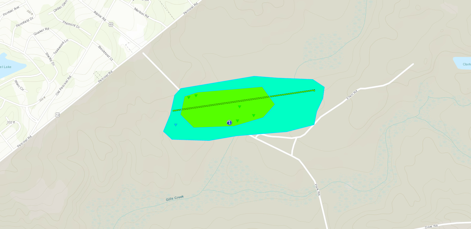
The National Weather Service in Columbia confirmed that an EF1 tornado touched down at Ft.Jackson in South Carolina on March 3rd, 2019.
|
|
Click image for larger view
Fort Jackson personnel surveyed damage on the base and provided the National Weather Service with detailed damage photos which are consistent with a tornado. The tornado uprooted and snapped multiple pine trees in the vicinity of Park Road near Gills Creek. The tornado touched down about half a mile southeast of the intersection of Percival Road and Alpine Road. The tornado path length was approximately 0.6 miles with a width of about 200 yards.
Statistics Summary of the EF-1 Tornado at Ft.Jackson in SC on March 3rd, 2019
| Location | Estimated Start Time | Maximum EF-Scale Rating | Estimated Maximum Wind Speed | Maximum Path Width | Path Length | Fatalities | Injuries |
|---|---|---|---|---|---|---|---|
| Ft.Jackson, SC | 7:33 P | EF1 | 95 MPH | 200 yards | 0.6 miles | 0 | 0 |
*This information is preliminary and subject to change pending final review of the event and publication in NWS Storm Data.