
Numerous severe thunderstorms are expected across a broad region from the Ohio Valley to the Mid-Atlantic and Northeast States today into tonight. Swaths of damaging wind gusts are expected and some tornadoes are possible. Bertha is expected to bring tropical storm conditions to portions of the Gulf Coast from the Florida Panhandle westward to southeastern Louisiana later today and Wednesday. Read More >
| Location | Estimated Time | Maximum EF-Scale Rating | Estimated Maximum Wind Speed | Maximum Path Width | Path Length | Fatalities | Injuries |
|---|---|---|---|---|---|---|---|
| Holly Hill, SC | 9:01 PM | EF1 | 103 MPH | 150 yards | 3.1 miles | 0 | 0 |
An anomalously deep upper low over the lower Mississippi valley was moving toward the Carolinas and Georgia late in the day on May 4th 2017. There was strong deep layer shear preceding the approaching upper level low. A deepening surface low was moving northeast from Tennessee toward North Carolina with a trailing cold front over western Georgia. Convection developed in an area of low level convergence, high precipitable water and warm advection over coastal Georgia. The squall line spread into the eastern Midlands and Low Country of South Carolina during the early evening. The environment was weakly unstable but the shear parameters favored mini-supercells. A tornadic supercell developed near Savannah late in the afternoon and tracked northeast across the Low Country and into the extreme east Midlands near Holly Hill in Orangeburg County. The storm produced EF1 tornado damage near Holly Hill with maximum winds of 103 mph. The tornado snapped/uprooted multiple trees, destroyed a mobile home, damaged several vehicles and peeled back the metal roof of a strip mall.
Strong warm, moist advection and convergence at the low levels across the eastern Midlands and the Low Country played an important role in thunderstorm development during the early evening.
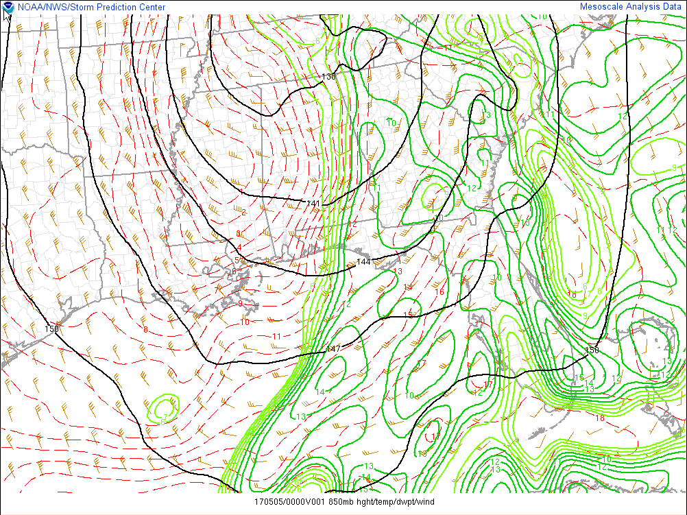
May 4, 2017, 8 PM EDT 850 mb height, winds and dewpoint (Mesoanalysis from Storm Prediction Center)
Weak instability over the region would typically not support tornadoes, however in this case there was strong upper level dynamics which resulted in strong forcing over the area.
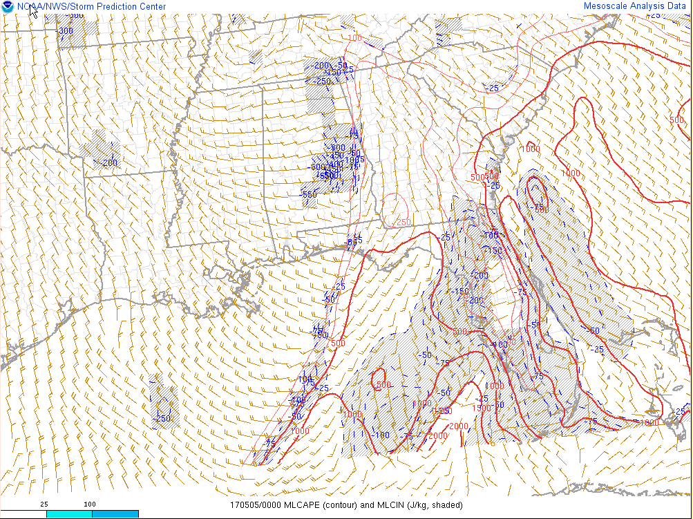
May 4, 2017, 8 PM EDT mixed layer Convective Available Potential Energy (J/kg) and surface winds (knots) (Mesoanalysis from Storm Prediction Center)
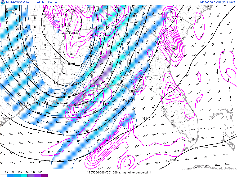
May 4, 2017, 8 PM EDT 300 mb heights, divergence and winds (knots) (Mesoanalysis from Storm Prediction Center)
In this case normalized Convective Available Potential Energy (CAPE) was useful in determining the area of strong updraft potential. A bullseye of 0.3 (dimensionless) value was analyzed at 7 pm near Holly Hill, SC. Normalized CAPE values of .3 to .4 suggest a "fat" CAPE profile with large parcel accelerations possible (from SPC).
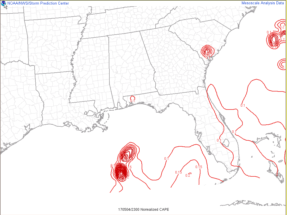
May 4, 2017, 7 PM EDT Normalized CAPE (dimensionless) (Mesoanalysis from Storm Prediction Center)
The Significant Tornado Parameter (STP) value was less than 1 which does not suggest tornadic supercells. However 0-1 km Storm Relatively Helicity (SRH) values near 300 m2/s2 favor tornadogenesis. Low vales of surface based CAPE likely reduced STP value below 1 despite the strong shear and helicity. But the STP did indicate there was an increased threat along the SC Low Country and extreme eastern Midlands.
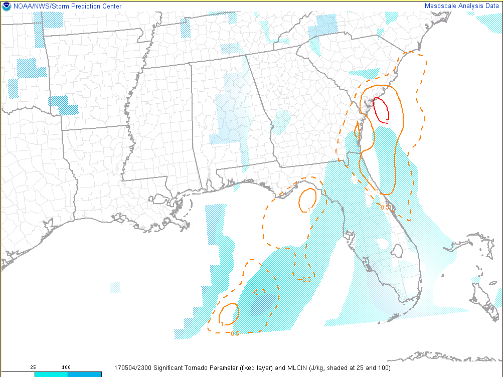
May 4, 2017, 7 PM EDT significant tornado parameter (STP) (Mesoanalysis from Storm Prediction Center)
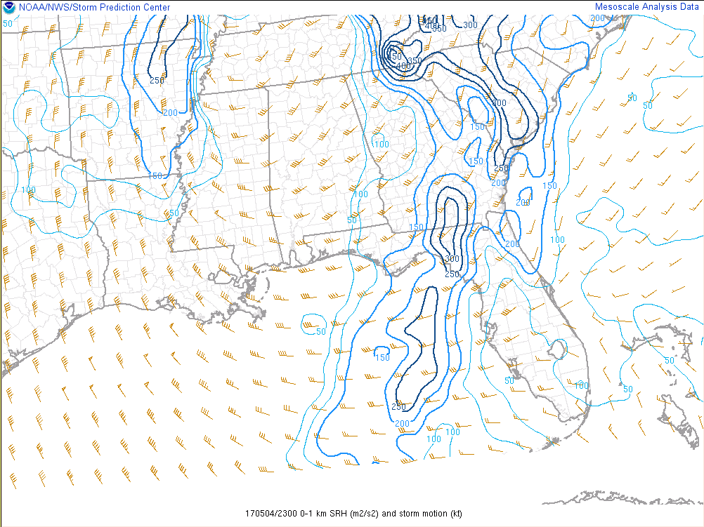
May 4, 2017, 7 PM EDT 0-1 km Storm Relative Helicity (SRH) (m2/s2) (Mesoanalysis from Storm Prediction Center)
The radar loop of the Holly Hill tornadic thunderstorm shows strong cells moving into Orangeburg County, SC from Dorchester County, SC and a tornado warning was issued at 852 PM. This storm produced an EF-1 tornado which first touched down at 901 PM south of Holly Hill (on White Sands Road) and traveled for just over 3 miles. The tornado moved into the town of Holly Hill causing damage to a strip mall and lifted shortly after at approximately 906 PM. During that time the radar indicated rotational velocity shear of 33 knots at 4000 ft over a diameter of approximately 2 miles suggesting a strong mesocyclone and possible tornado. At 9:00 PM (01:00 UTC) a bounded weak echo region (BWER) is evident in the reflectivity product (left). A BWER indicates there is a strong updraft and are often observed with tornadic supercells.
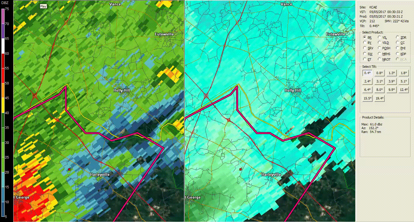
May 4, 2017 730 PM to 830 PM KCAE 0.5° Reflectivity and Storm Relative Motion (SRM) Loop
The confirmed EF-1 tornado traveled a distance of approximately 3.1 miles with wind speeds up to 103 mph. It caused damage to several structures and uprooted or snapped numerous trees.
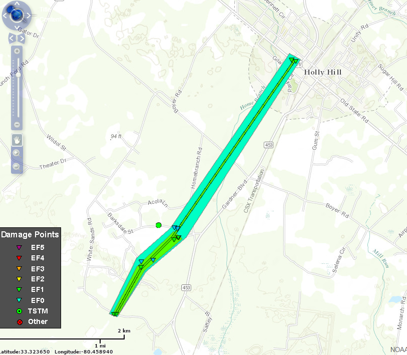
May 4, 2017 Tornado path from Holly Hill EF-1. Triangles indicate points of damage that were surveyed. Green polygon/triangles indicates areas/points of EF-1 damage, similarly cyan indicates EF-0. The center yellow line shows approximate tornado path.
Public Information Statement for the Holly Hill Tornado (direct link here)
At approximately 9:03 PM residents of this mobile home were sheltered in the far right room when two trees fell on the home. The trees also took down a powerline which fell into the home with the trees. The mother and daughter were rescued later that evening by the local fire department.
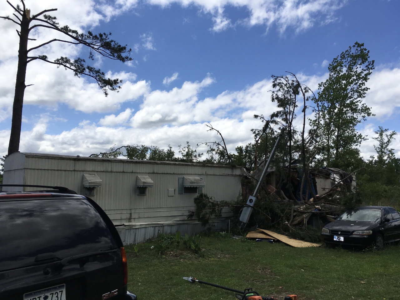
Damage to mobile home near Holly Hill, SC on May 4, 2017
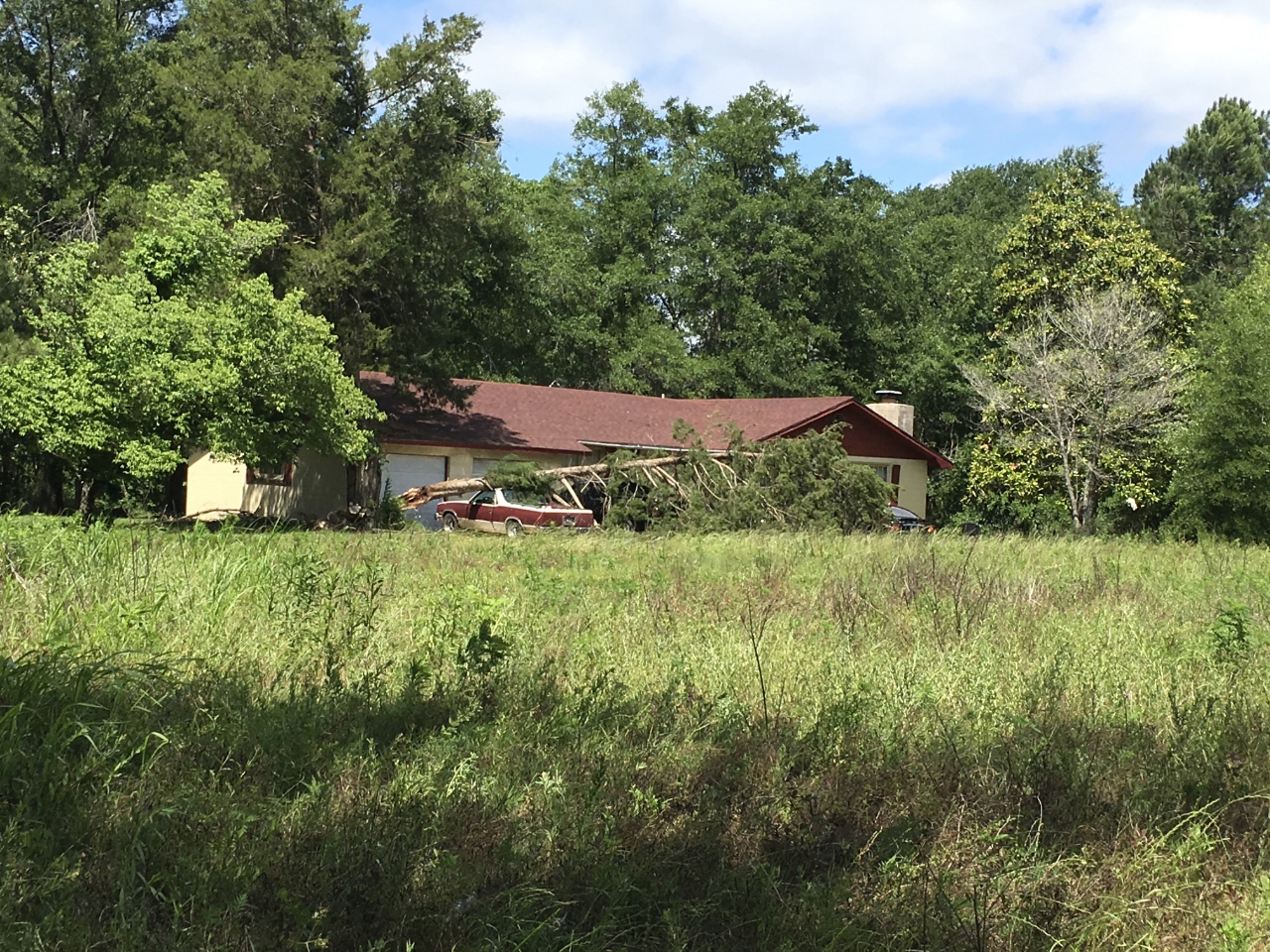
Damage to cars near Holly Hill, SC on May 4, 2017
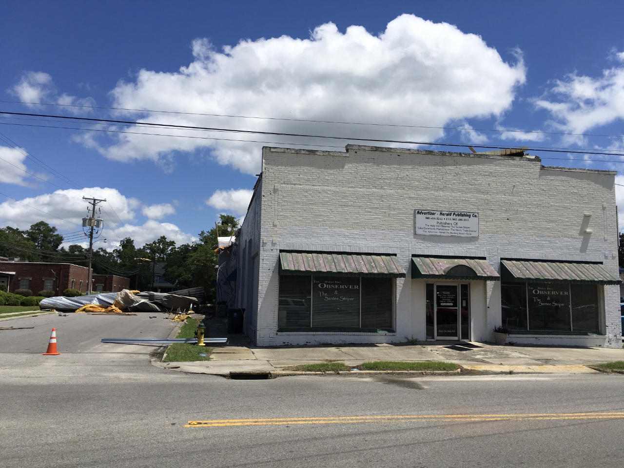
Tornado damage to strip mall in downtown Holly Hill, SC on May 4th, 2017

Tornado damage to strip mall in downtown Holly Hill, SC on May 4th, 2017 (view from west side of the building)

