
A significant heat wave is underway for the Intermountain West, Northern Plains, and Upper Great Lakes, peaking in intensity through midweek and lingering across parts of the Northern Plains and Midwest until this weekend. In southwest Texas, excessive rainfall may bring a risk for potentially life-threatening flash and arroyo flooding through Thursday. Read More >
On Sunday, October 8th, 2017, the remnants of Tropical Storm Nate lifted from Alabama into the Tennessee Valley ushering warm and moist air into the region. The Midlands and Central Savannah River Area (CSRA) were located in the front-right quadrant of the storm, which is historically favorable for tropical tornadoes.
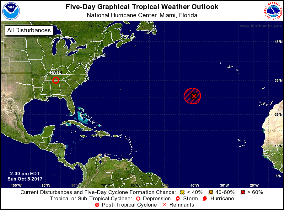 |
Oct 8, 2017, 2 PM EDT Tropical Weather Outlook (National Hurricane Center)
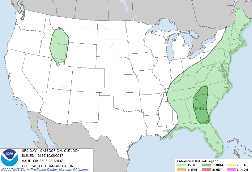
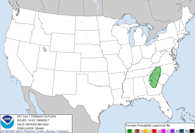
Western South Carolina was in the marginal risk category for severe weather by the Storm Prediction Center. This included a 2% risk of tornadoes.
 |
 |
Oct 8, 2017, 12:15 PM EDT Day 1 Categorical Outlook (Storm Prediction Center)
A band of thunderstorms strengthened across parts of central/eastern Georgia during the afternoon hours on October 8th and eventually moved into southern and western South Carolina.
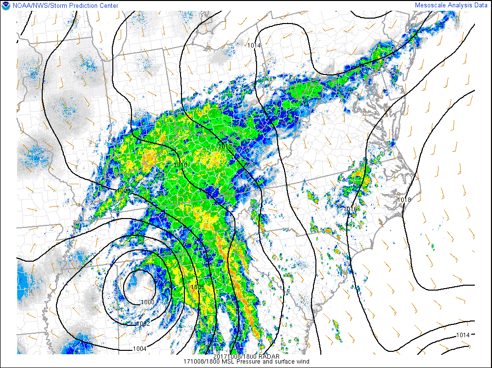 |
Oct 8, 2017, 2 PM EDT MSL Pressure and surface wind with radar (Mesoanalysis from Storm Prediction Center)
Despite prevalent cloud cover, modest surface heating occurred downstream of the line and combined with high low-level moisture. This resulted in moderate to strong instability.
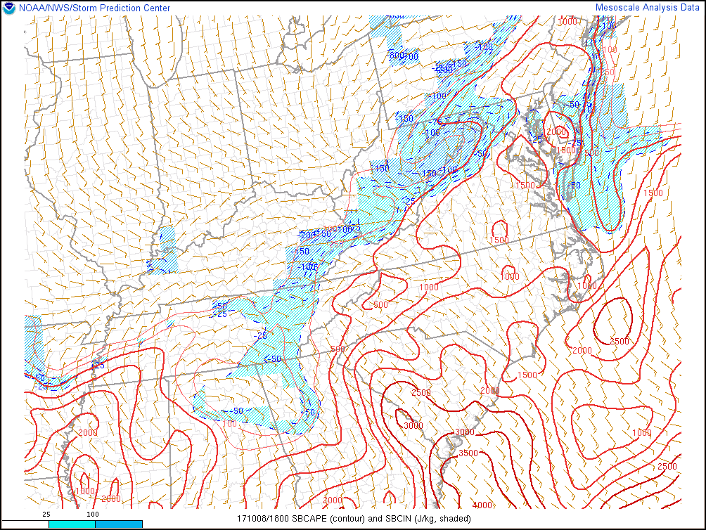 |
Oct 8, 2017, 2 PM EDT Surface Based Convective Available Potential Energy (SBCAPE) (J/kg) and Surface Based Convective Inhibition (SBCIN) (J/kg) (Mesoanalysis from Storm Prediction Center)
0-1km storm relative helicity values were around 150-200m2/s2 across the Piedmont of South Carolina which supported rotating updrafts.
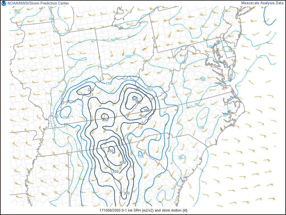 |
Oct 8, 2017, 4 PM EDT 0-1km Storm Relative Helicity (m2/s2) and storm motion vector (kt) (Mesoanalysis from Storm Prediction Center)
Storm Relative Velocity images from the KCAE radar show a rotational couplet tightening around 4 pm.
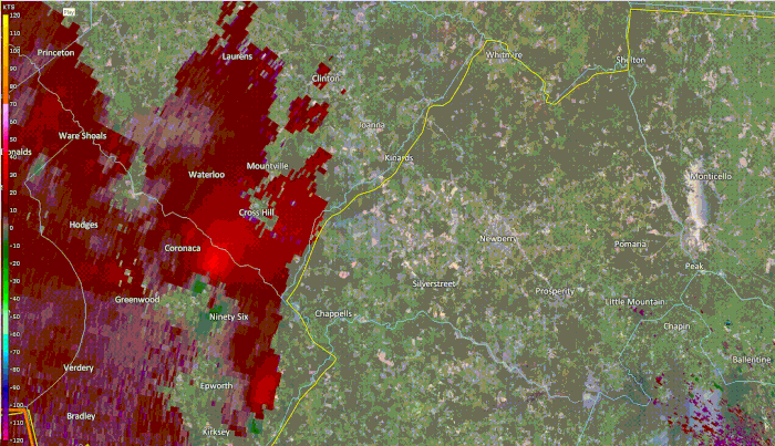
Oct 08, 2017 KCAE 0.5° Storm Relative Velocity (SRV) Loop from 3:58 pm to 4:57 pm.
The National Weather Service in Columbia confirmed that an EF1 tornado touched down near Chappells in Newberry County, South Carolina on October 8th, 2017.
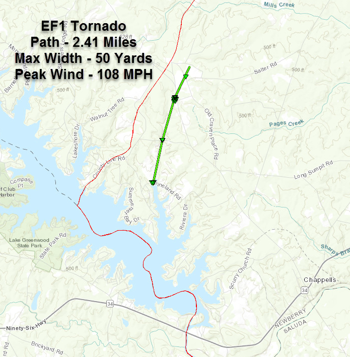
Click image for larger view
The tornado touched down intermittently as it moved north-northeast for just over 2.4 miles. It initially touched down on the northern bank of Lake Greenwood on Pineland Road near Fawn Court and continued north-northeast to Workman Kelly Road. Numerous large hardwood and softwood trees were snapped at their trunks on both roads. The tornado continued north-northeast to the intersection of Highway 39 and Salter Road. This is where the tornado damaged the roof of a home and severely damaged the rood and building of a workshop. Much of the metal roofing was destroyed then blown across the property. The two garage doors of the building were blown inward. A wood framed work shed with a metal roof with significant weight was lifted from its base and landed in the nearby woods. A portion of the front porch of the home was lifted and landed in the back yard. A large work trailer was overturned in the backyard, and damage was done to a few trees around the house. Along Poplar Spring Road, several trees were snapped at their trunks as the tornado continued northward. The tornado lifted before reaching Vaughnville Church Road approximately 2.4 miles after initially touching down. The tornado lasted approximately 7 minutes.
Statistics Summary of the EF-1 Tornado in Newberry County on Oct 8th, 2017
| Location | Estimated Start Time | Maximum EF-Scale Rating | Estimated Maximum Wind Speed | Maximum Path Width | Path Length | Fatalities | Injuries |
|---|---|---|---|---|---|---|---|
| Chappells, SC | 4:20 PM | EF1 | 108 MPH | 50 yards | 2.4 miles | 0 | 0 |
*This information is preliminary and subject to change pending final review of the event(s) and publication in NWS Storm Data.
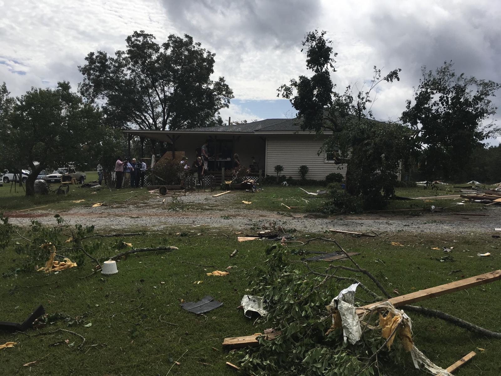
Tornado damage to a home on Salter Road near Chappells, SC.
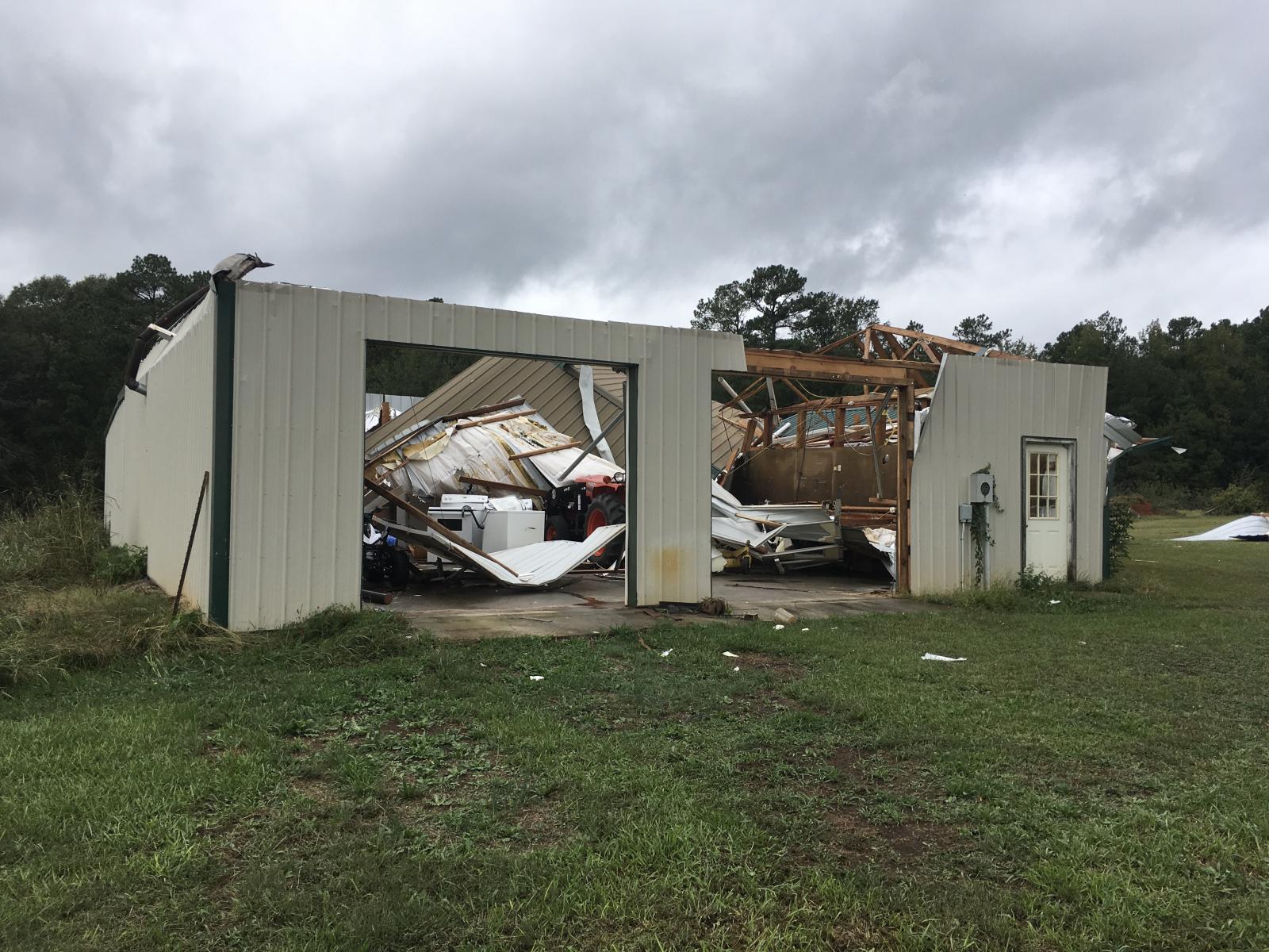
Roof ripped off from a workshop on the same property on Salter Road.
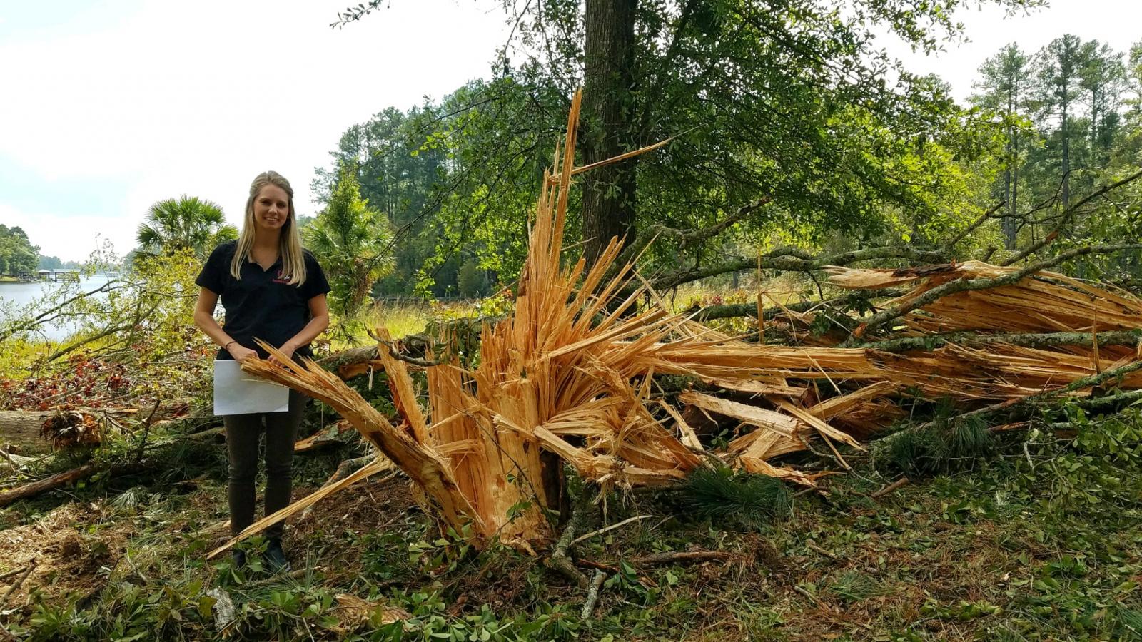
Tree damage on the north side of Lake Greenwood on Pineland Road.
For reference: the Enhanced Fujita Scale classifies tornadoes
into the following categories:
EF0...Wind speeds 65 to 85 mph
EF1...Wind speeds 86 to 110 mph
EF2...Wind speeds 111 to 135 mph
EF3...Wind speeds 136 to 165 mph
EF4...Wind speeds 166 to 200 mph
EF5...Wind speeds greater than 200 mph

