
Heat expands across the Desert Southwest, Plains, Mississippi Valley and Midwest into Monday. Fire weather concerns continue for portions of the Intermountain West. Active monsoonal moisture fuels thunderstorms over the Southwest with possible flash flooding. Tropical cyclone Fausto in the Pacific, should weaken as it approaches Hawaii; Dangerous surf, swells and rip currents are expected. Read More >
 |
Hurricane Bret gave Corpus Christi and Victoria quite a scare. With sustained winds of 140 mph, Bret could have caused much greater damage than what resulted. Fortunately, just as Bret seemed ready to make a direct hit on the city of Corpus Christi, the storm turned nearly due west and made landfall in the sparcely populated county of Kenedy on the late afternoon of Sunday August 22, 1999. Nevertheless, Bret brought high winds and very heavy rainfall to portions of South Texas. Below is a summary of Major Hurricane Bret.
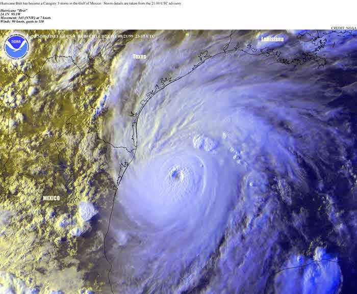
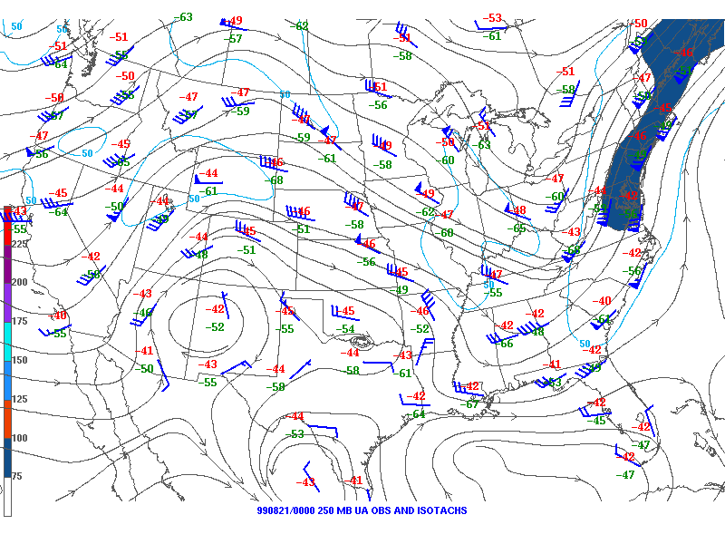
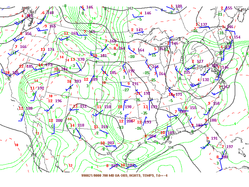
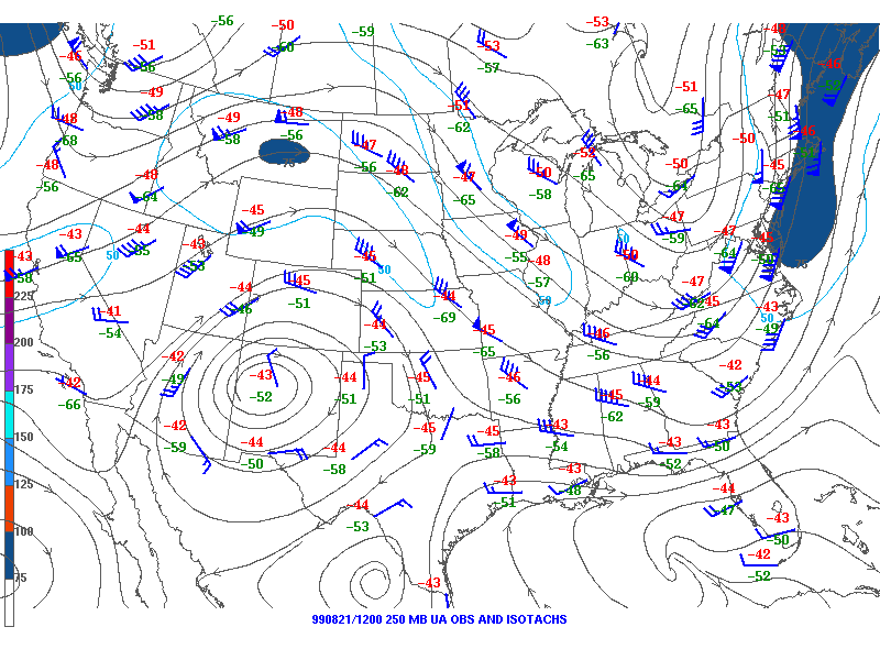
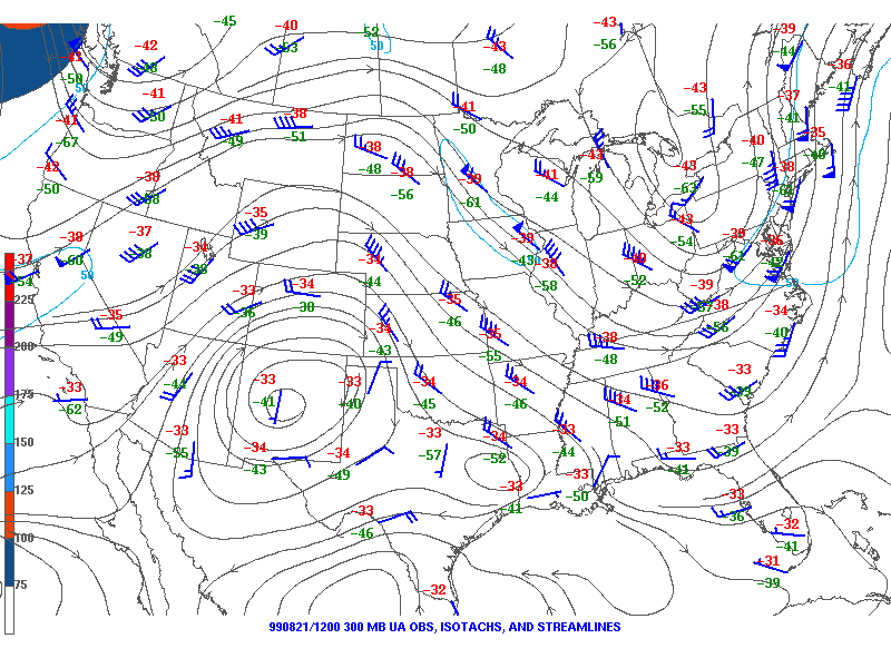
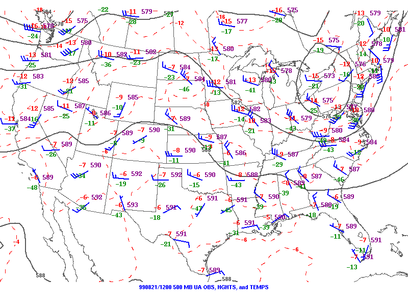
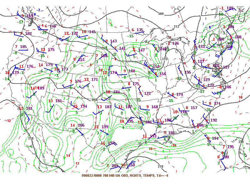
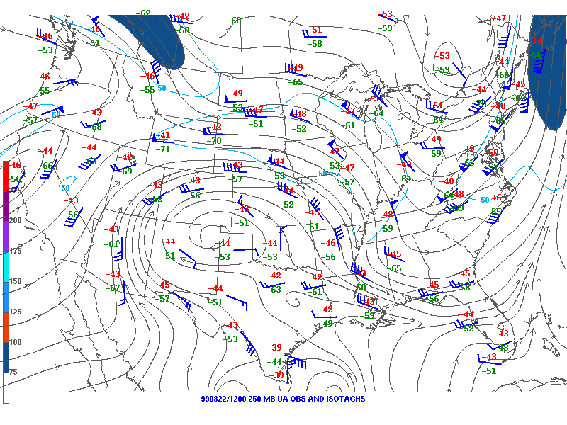
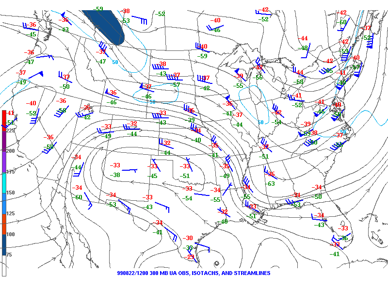
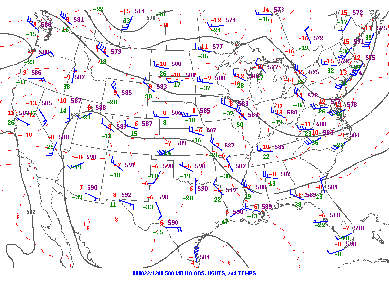
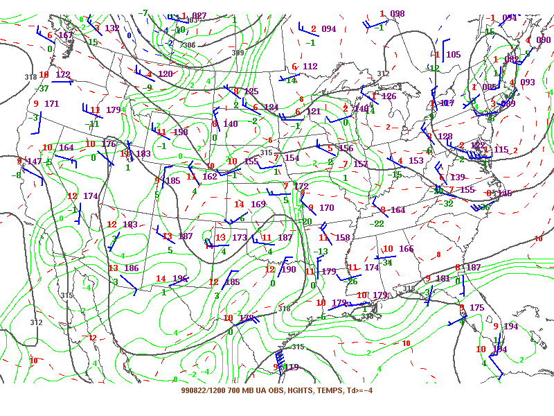
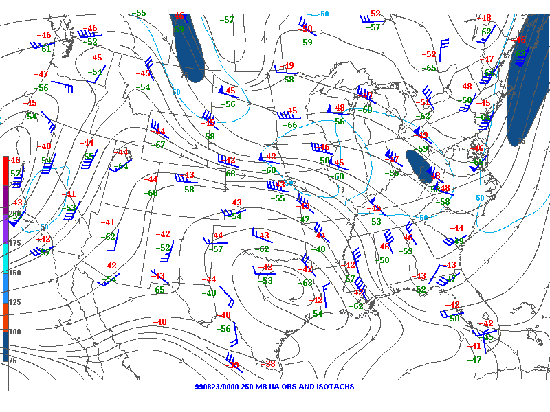
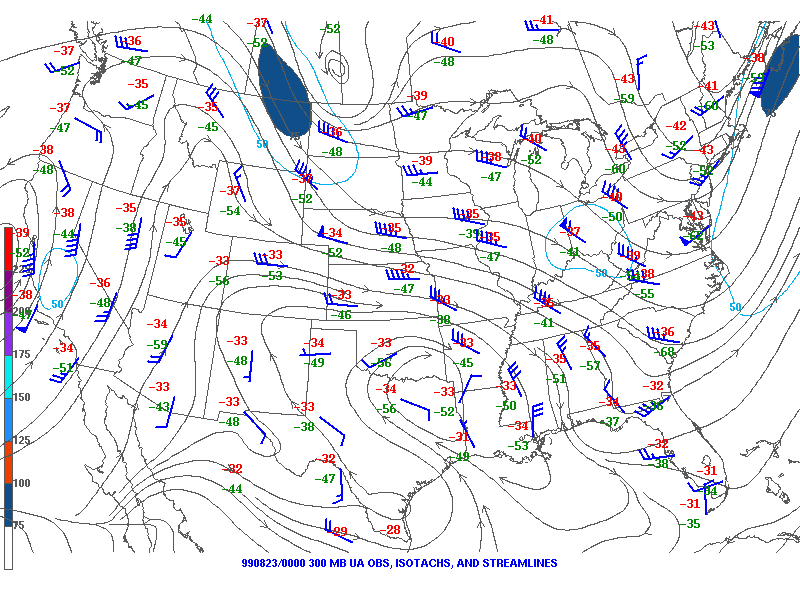
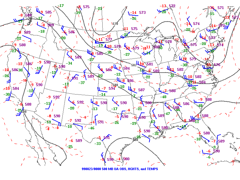
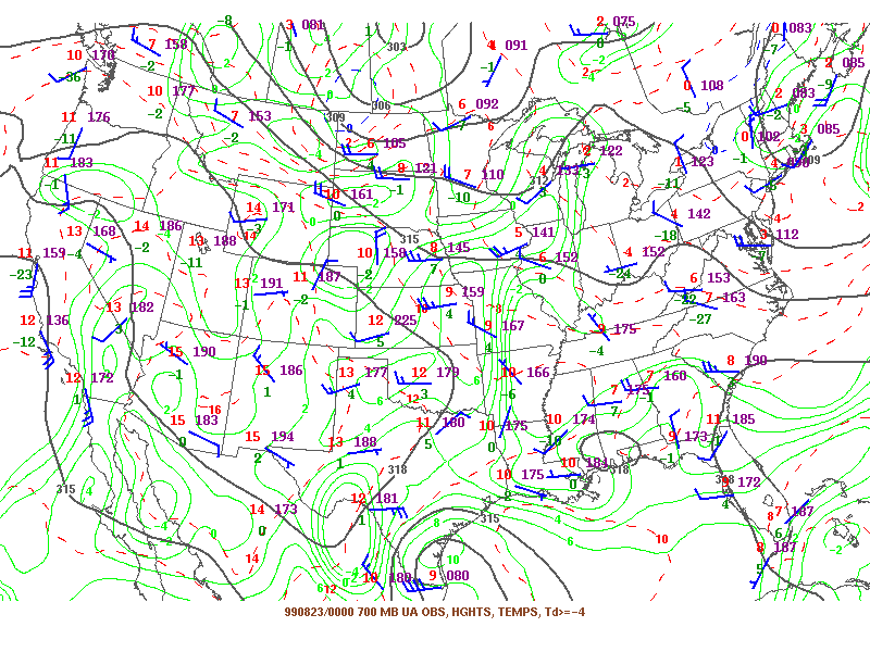
On the morning of Wednesday, August 18, a tropical disturbance wobbled off the Yucatan Peninsula in the Bay of Campeche. The next day, August 19, this disturbance became Tropical Storm Bret, the second named storm of the 1999 Atlantic Hurricane Season. Initial forecasts from the National Hurricane Center (NHC) in Miami, moved Bret toward the northeast Mexico coast, well south of Brownsville, Texas. Bret was classified a hurricane Friday evening, August 20. It was located 215 miles east of Tampico, Mexico with sustained winds of 80 mph. At this point, Bret was moving north-northwest, at 7 mph, with landfall forecast still along the north Mexico coast, near La Pesca, about 150 miles south of Brownsville. Bret's slow movement allowed the hurricane to intensify rapidly over the warm Gulf waters. By 4:00 a.m. Saturday morning (August 21), the NHC extended a Hurricane Warning to Baffin Bay, Texas, 40 miles south of Corpus Christi. Bret was now a strong Category 1 hurricane on the Saffir-Simpson scale of 1 to 5, with winds of 90 mph, and continued its north-northwest movement at 7 mph. Bret had not yet made an expected turn to the west into Mexico, as the upper level steering winds were still too far to the west (see the "Charts" section). This west-northwest trek left residents from Brownsville to Corpus Christi deeply concerned with the direction and strength of Hurricane Bret.
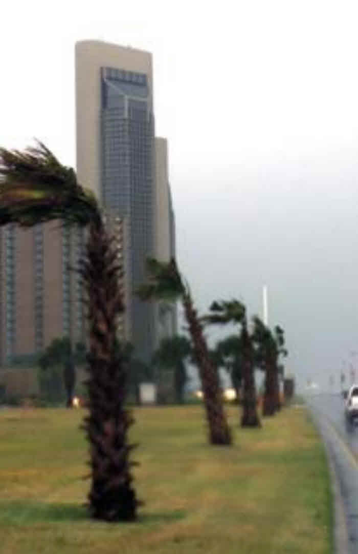
On Saturday afternoon, voluntary evacuations were ordered for residents on Padre and Mustang Islands. Gas stations and food markets quickly became overcrowded, as residents rushed to purchase food, water, gas, and other necessities. Interstate 37 to San Antonio looked like rush-hour traffic in New York City, as nearly 100,000 residents of Nueces county left their homes. Another 80,000 individuals from surrounding counties also traveled north to escape Bret's potential fury.
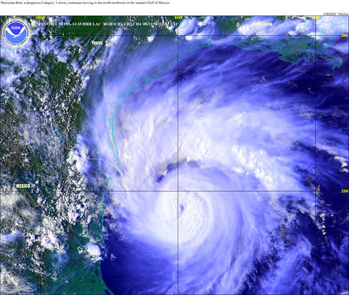
By Saturday evening (August 21) Bret quickly intensified to a major hurricane (category 3 or greater), reaching category 4 strength by 7:00 p.m. Saturday. In just 18 hours, the central surface pressure in the storm dropped from 980 millibars (mb) to 952 mb. Maximum sustained winds increased from 90 to 135 mph around the center. At 10:00 p.m. Saturday evening, the NHC extended hurricane warnings to Port O'Connor, Texas 80 miles northeast of Corpus Christi. Now, the center of Bret was located about 250 miles southeast of Corpus Christi.
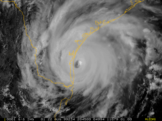
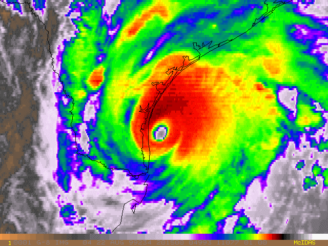
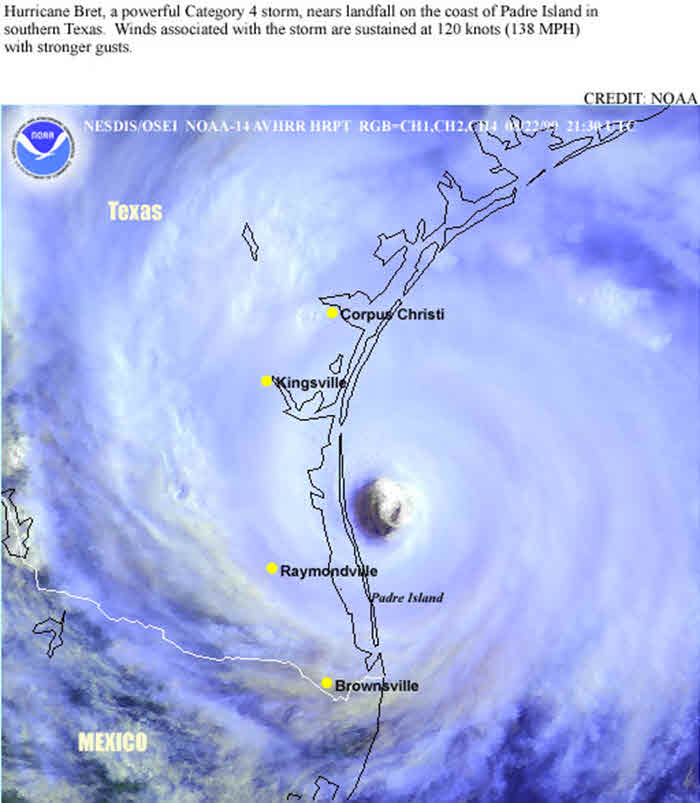
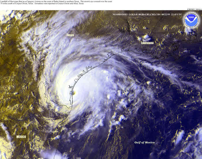
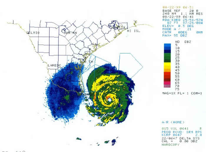
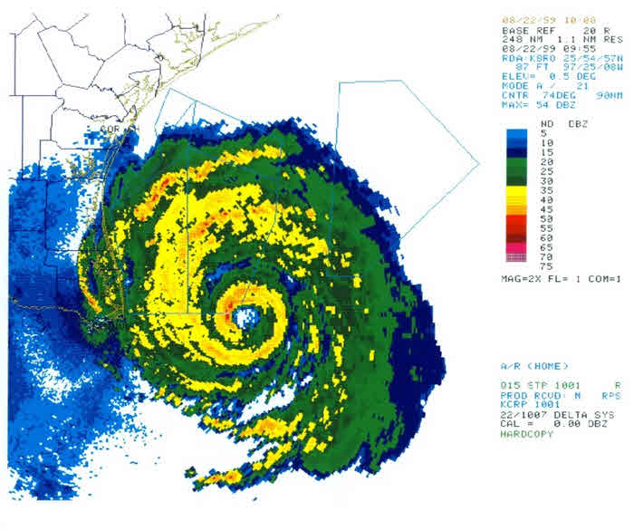
On Sunday morning (August 22) Major Hurricane Bret lingered 115 miles southeast of Corpus Christi with maximum sustained winds of 140 mph, as indicated by radar. The lowest estimated central pressure was 944 mb, (27.88 inches). Late Sunday morning, Bret finally slowed and churned slowly west-northwest, focusing its eventual landfall between Brownsville and Corpus Christi. Exact landfall was made in Central Kenedy county, 20 miles north of Port Mansfield (60 miles south of Corpus Christi), around 5:45 p.m. Sunday evening (August 22).
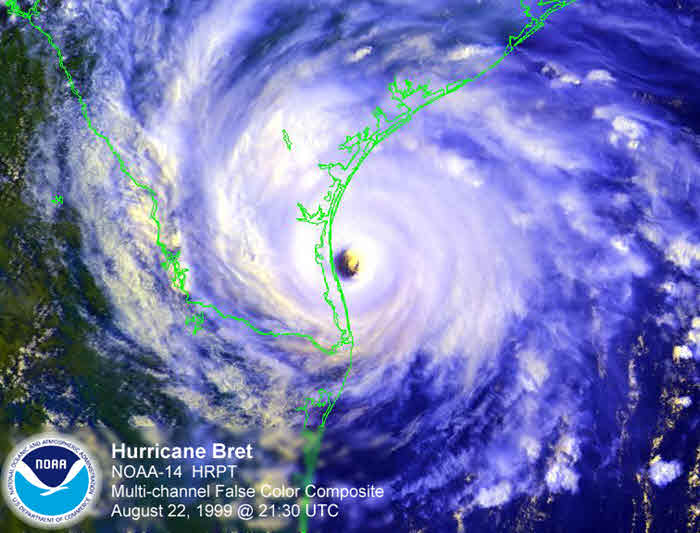
Fortunately, Bret hit a sparsely populated region of mostly lowland fields used for farming. Bret weakened as it moved west over the Rio Grande Plains, dissipating over northeast Mexico. Click here to see the track of Bret from tropical depression in the Bay of Campeche, to Hurricane Bret, to dissipation in NE Mexico.
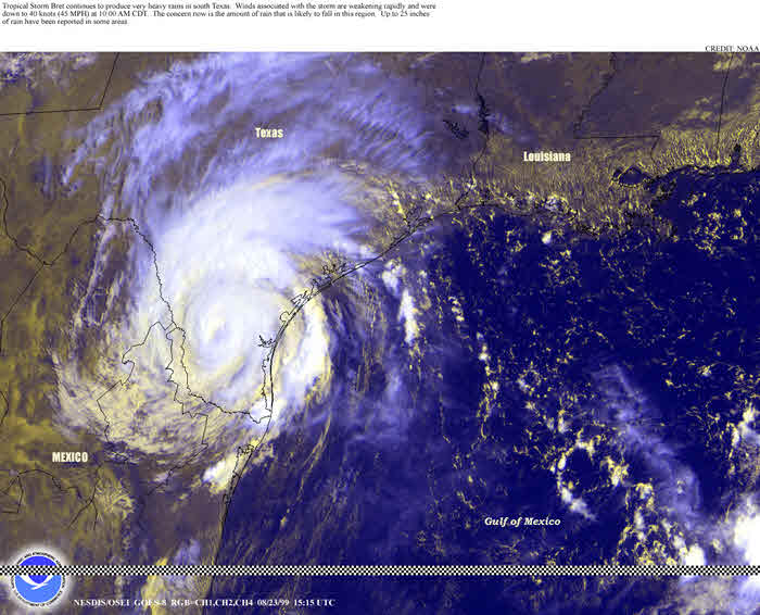
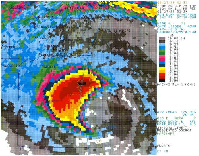
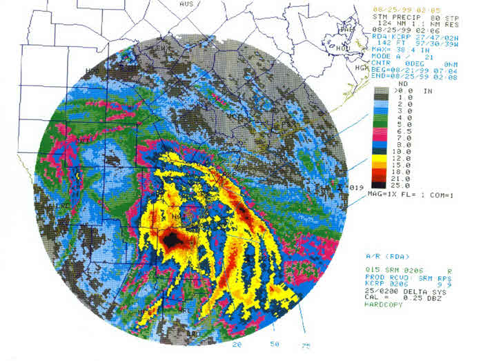
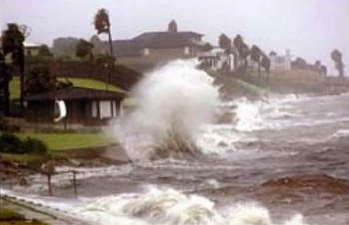
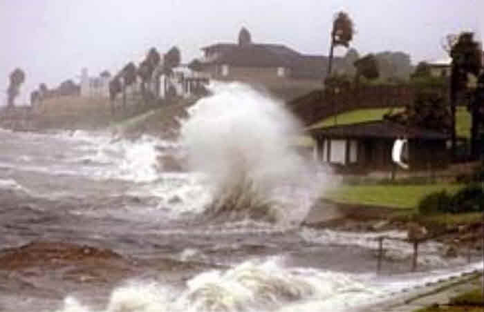
Storm total rainfall amounts from Bret were impressive. In two days, reports in excess of 15 inches fell over central Kenedy county. Elsewhere around the Coastal Bend, 6 to 10 inch rainfall amounts were reported. Flash flooding became a concern, as extremely heavy rains within Bret's squalls persisted over the same areas. Several major roadways around Corpus Christi were closed due to high water.
Hurricane Bret: 945 PM August 21 Until Landfall August 22 1999 (YouTube) |
|---|
Visible Satellite Loop - Morning of Landfall August 22 1999 |
|---|
 |
Infrared Satellite Loop - Morning of Landfall August 22 1999 |
|---|
 |
 |
 |
| AVHRR Imagery of Hurricane Bret 441 PM August 21 1999 | RGB Imagery Hurricane Bret 615 PM August 21 1999 |
|---|
 |
| RGB Imagery of Hurricane Bret Near Maximum Intensity |
|---|
 |
 |
| RGB Imagery Hurricane Bret Near Landfall 545 PM August 22 1999 | Degraded Tropical Storm Bret Inland 1015 AM August 23 1999 |
|---|
 |
 |
 |
Bret Wide Shot |
Bret 2nd Wide Shot |
|---|
 |
 |
Bret 3_Hour Rainfall Estimate |
Bret Storm Total Rainfall Estimate |
|---|
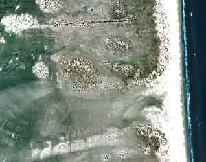
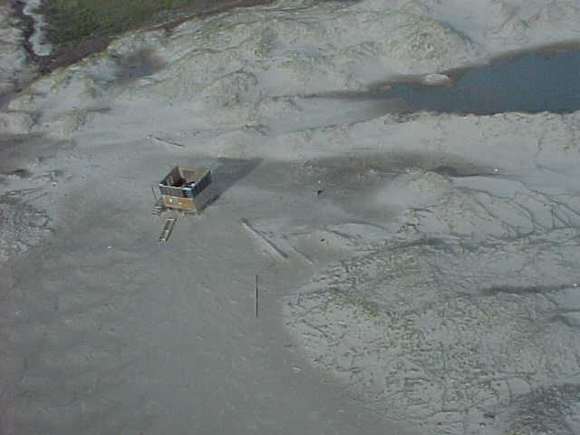
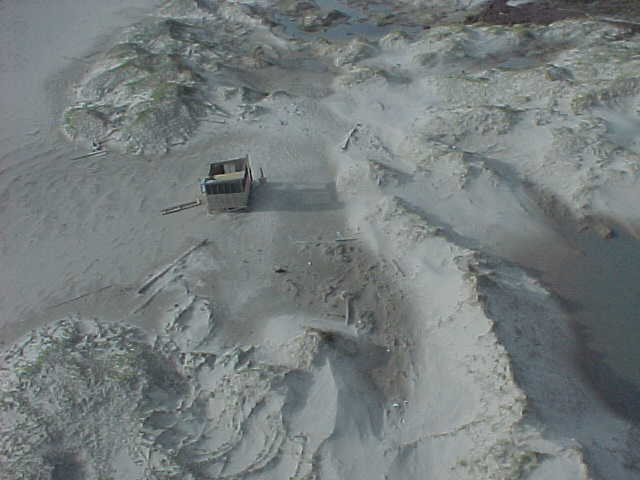
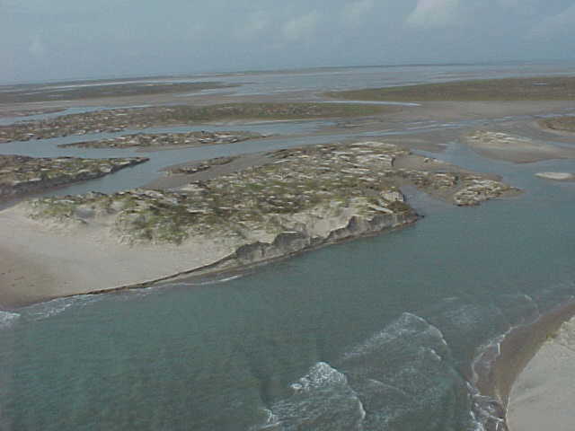
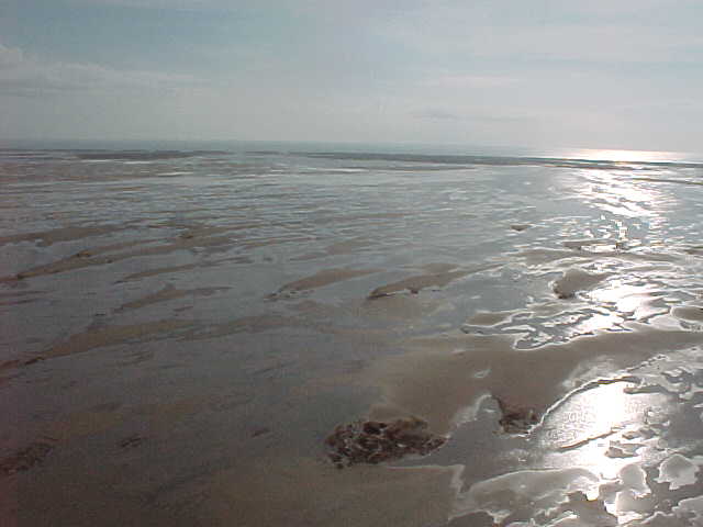
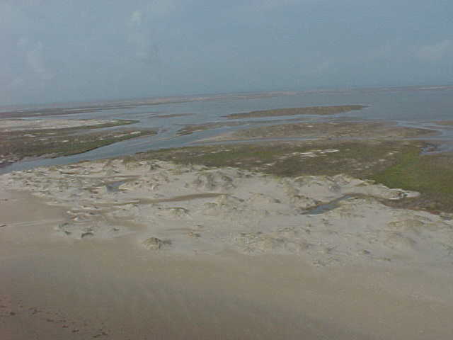
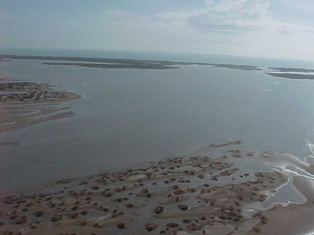
Bret Detailed Overflight Images 8-25-1999 Padre Island |


Other Bret Detailed Overflight Images of Coast 8-25-1999 |

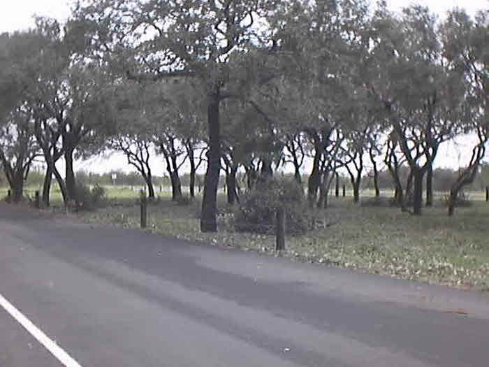
Land Photos of Coast After Bret |

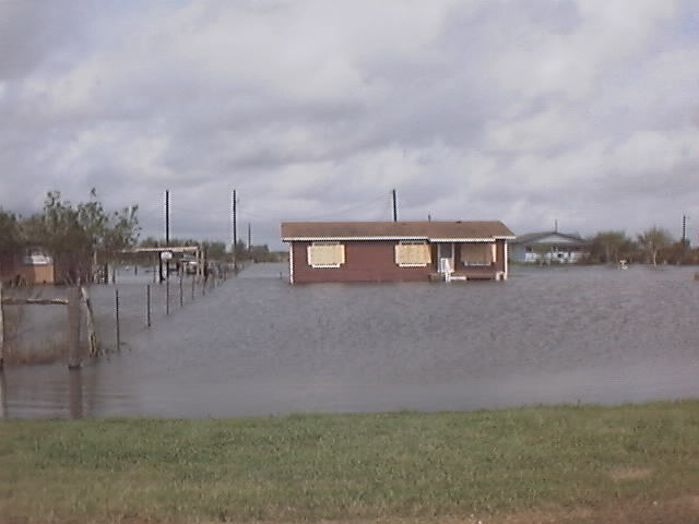
Damage Photos Hurricane Bret |

Miscellaneous Photos - Including Hurricane Eye |

Hurricane Bret History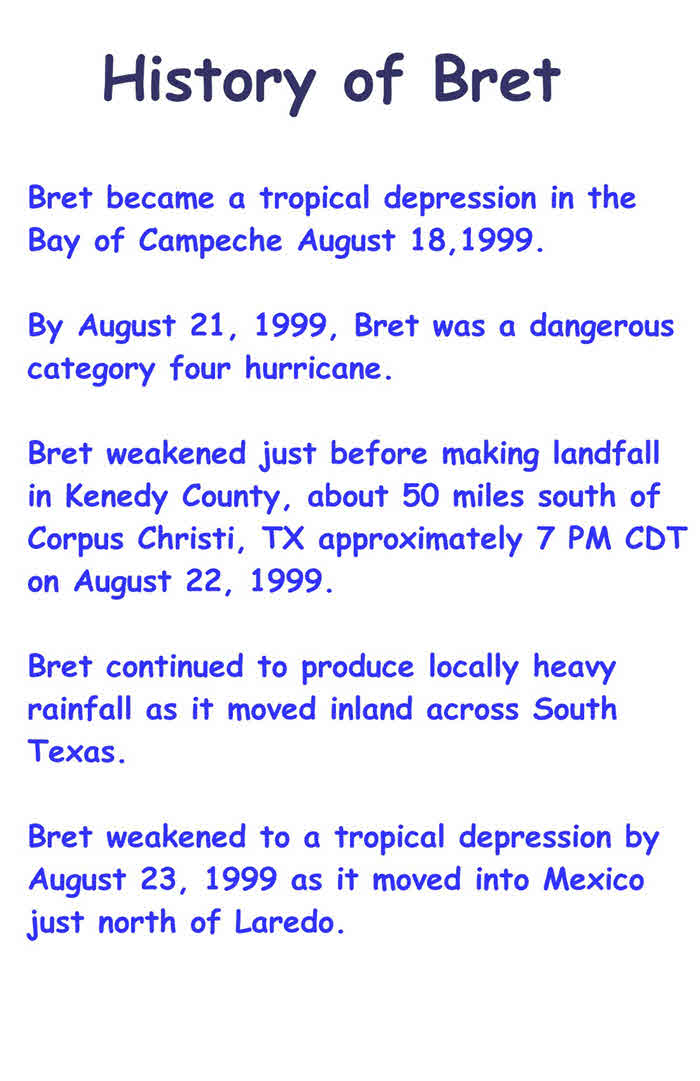 |
|
Hurricane Bret Summary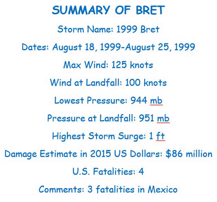 |
|
Hurricane Bret Stats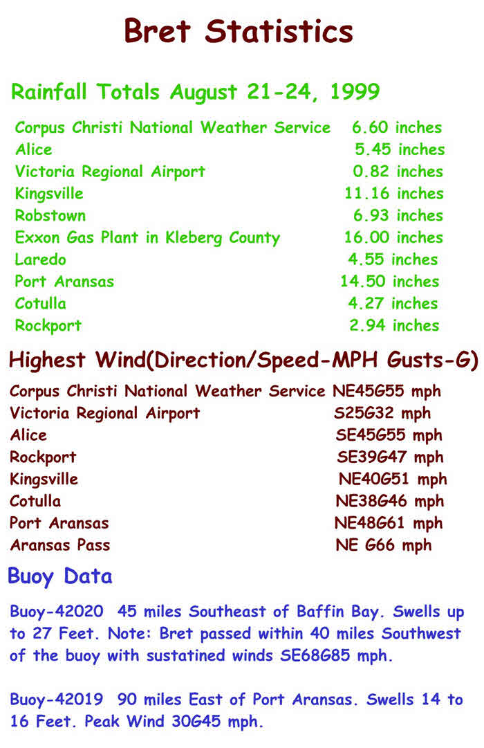 |
Date: 18-23 AUG 1999
Hurricane BRET
ADV  LAT    LON      TIME     WIND  PR  STAT
  1  20.10  -93.70 08/18/21Z   30  1010 TROPICAL DEPRESSION
  2  19.60  -94.30 08/19/03Z   30  1007 TROPICAL DEPRESSION
  3  19.90  -93.80 08/19/09Z   30  1007 TROPICAL DEPRESSION
  4  19.60  -94.60 08/19/15Z   30  1008 TROPICAL DEPRESSION
  5  19.90  -94.70 08/19/21Z   35  1006 TROPICAL STORM
 5A  19.90  -94.70 08/20/00Z   35  1000 TROPICAL STORM
  6  19.80  -94.70 08/20/03Z   40  1000 TROPICAL STORM
 6A  19.90  -94.60 08/20/06Z   45   999 TROPICAL STORM
  7  19.90  -94.60 08/20/09Z   45   999 TROPICAL STORM
 7A  20.40  -94.80 08/20/12Z   45   999 TROPICAL STORM
  8  20.90  -94.60 08/20/15Z   55   993 TROPICAL STORM
 8A  21.10  -94.40 08/20/18Z   55   992 TROPICAL STORM
  9  21.30  -94.40 08/20/21Z   55   992 TROPICAL STORM
 9A  21.90  -94.40 08/21/00Z   55   983 TROPICAL STORM
 10  22.30  -94.50 08/21/03Z   65   981 HURRICANE-1
10A  22.50  -94.60 08/21/06Z   70   980 HURRICANE-1
 11  23.00  -94.90 08/21/12Z   80   980 HURRICANE-1
 12  23.40  -94.90 08/21/15Z   80   978 HURRICANE-1
12A  23.80  -95.00 08/21/18Z   80   976 HURRICANE-1
 13  24.10  -95.10 08/21/21Z   90   976 HURRICANE-2
13A  24.50  -95.10 08/21/23Z  105   963 HURRICANE-3
13B  24.80  -95.10 08/22/01Z  115   955 HURRICANE-4
 14  25.20  -95.10 08/22/03Z  115   953 HURRICANE-4
14A  25.40  -95.30 08/22/05Z  115   952 HURRICANE-4
14B  25.70  -95.50 08/22/07Z  115   952 HURRICANE-4
 15  26.00  -95.70 08/22/09Z  120   948 HURRICANE-4
15A  26.20  -96.00 08/22/11Z  120   948 HURRICANE-4
15B  26.30  -96.20 08/22/13Z  120   945 HURRICANE-4
 16  26.50  -96.70 01/22/15Z  120   945 HURRICANE-4
16B  26.60  -96.90 08/22/19Z  120   945 HURRICANE-4
 17  26.80  -97.30 08/22/23Z  110   949 HURRICANE-3
17A  26.80  -97.30 08/22/23Z  110   949 HURRICANE-3
17B  26.90  -97.50 08/23/01Z  105   952 HURRICANE-3
 18  26.90  -97.60 08/23/03Z  100   955 HURRICANE-3
18A  27.00  -97.80 08/23/05Z   90   960 HURRICANE-2
18B  27.00  -98.00 08/23/07Z   80   965 HURRICANE-1
 19  27.10  -98.20 08/23/09Z   75   970 HURRICANE-1
19A  27.20  -98.30 08/23/11Z   70   975 HURRICANE-1
19B  27.30  -98.30 08/23/13Z   60   985 TROPICAL STORM
 20  27.40  -98.60 08/23/15Z   40   985 TROPICAL STORM
20A  27.60  -98.80 08/23/18Z   35   993 TROPICAL STORM
 21  27.80  -99.10 08/23/21Z   35   996 TROPICAL STORM
668
WWUS41 KCRP 262044
PSHCRP
PRELIMINARY STORM REPORT...HURRICANE BRET
NATIONAL WEATHER STATEMENT CORPUS CHRISTI TX
200 PM CDT THU AUG 26 1999
A. HIGHEST WINDS
NWSO CORPUS CHRISTI CRP...
HIGHEST SUSTAINED WIND: 39 KNOTS AT TWO TIMES:
FROM 050 DEGREES AT 0326 UTC 8/23/99
FROM 140 DEGREES AT 1124 UTC 8/23/99
PEAK GUST: 48 KNOTS FROM 090 DEGREES AT 0550 UTC ON 8/23/99
ASOS ROCKPORT RKP...
HIGHEST SUSTAINED WIND: 34 KNOTS FROM 140 DEGREES AT 1506 UTC 8/23/99
PEAK GUST: 41 KNOTS FROM 140 DEGREES AT 1506 UTC 8/23/99
ASOS VICTORIA VCT...
HIGHEST SUSTAINED WIND: 22 KNOTS FROM 170 DEGREES AT 1811 UTC 8/24/99
PEAK GUST: 28 KNOTS FROM 170 DEGREES AT 1810 UTC 8/24/99
ASOS ALICE ALI...
HIGHEST SUSTAINED WIND: 39 KNOTS FROM 140 DEGREES AT 1748 UTC 8/23/99
PEAK GUST: 48 KNOTS FROM 140 DEGREES AT 1747 UTC 8/23/99
ASOS COTULLA COT...
HIGHEST SUSTAINED WIND: 33 KNOTS FROM 060 DEGREES AT 2332 UTC 8/23/99
PEAK GUST: 40 KNOTS FROM 060 DEGREES AT 8/23/99 2026 UTC
ASOS KINGSVILLE NQI...
HIGHEST SUSTAINED WIND: 35 KNOTS FROM 020 DEGREES AT 8/22/99 1843 UTC
PEAK WIND: 44 KNOTS FROM 020 DEGREES AT 8/22/99 1844 UTC
ASOS MCMULLEN TARGET (KINGSVILLE)
PEAK WIND : 38 KNOTS FROM THE 080 DEGREES AT 2124 UTC 8/22/99 2124 UTC
CMAN PORT ARANSAS PTAT2
HIGHEST SUSTAINED WIND: 41 KNOTS FROM 050 DEGREES AT 8/23/99 2200 UTC
OTHER MEASURED PEAK WIND GUSTS:
ARANSAS PASS...57 KNOTS FROM NE AT 2115 UTC 8/23/99
B. LOWEST PRESSURE
NWSO CORPUS CHRISTI CRP...1002.4 MILLIBARS (29.60 INCHES) AT TWO
TIMES:
0322 UTC 8/23/99
1112 UTC 8/23/99
ASOS ROCKPORT RKP...1006.4 MILLIBARS (29.72 INCHES) AT 2228 UTC
8/22/99
ASOS VICTORIA VCT...1008.8 MILLIBARS (29.79 INCHES) AT 0900 UTC
8/23/99
ASOS NAS KINGSVILLE NQI... 1001.7 MILLIBARS (29.58 INCHES)
ASOS ALICE ALI.....998.3 MILLIBARS (29.48 INCHES) AT 1217 UTC
8/23/99
ASOS COTULLA COT...1006.4 MILLIBARS(29.72 INCHES) AT 8/23/99
1753 UTC
C. RAINFALL
ASOS NWSO CORPUS CHRISTI CRP
1 HOUR: 1.07 INCHES FROM 8/22/99 2300 UTC TO 8/23/99 0000 UTC
6 HOUR: 2.90 INCHES FROM 8/22/99 2200 UTC TO 8/23/99 0400 UTC
12 HOUR: 3.75 INCHES FROM 8/22/99 1600 UTC TO 8/23/99 0400 UTC
24 HOUR: 5.18 INCHES FROM 8/22/99 1600 UTC TO 8/23/99 1600 UTC
ASOS VICTORIA VCT...
6 HOUR: 0.51 INCHES FROM 1800-2400 UTC 8/23/99
12 HOUR: 0.69 INCHES FROM 1200-2400 UTC 8/23/99
24 HOUR: 0.69 INCHES ENDING 0000-0000 UTC 8/23/99 TO 8/24/99
ASOS ROCKPORT RKP...
6 HOUR: 0.80 INCHES FROM 0000-0600 UTC 8/23/99
12 HOUR: 1.58 INCHES FROM 1800-0600 UTC 8/23/99 TO 8/24/99
24 HOUR: 2.29 INCHES FROM 0600-0600 UTC 8/23/99 TO 8/24/99
ASOS ALICE ALI...
1 HOUR: 0.95 INCHES 0400-0500 UTC 8/24/99
6 HOUR: 2.11 INCHES 0000-0600 UTC 8/24/99
12 HOUR: 2.38 INCHES 1200-0000 UTC 8/23/99 TO 8/24/99
24 HOUR: 3.97 INCHES 0600-0600 UTC 8/23/99 TO 8/24/99
ASOS COTULLA COT
24 HOUR ENDING 0600 UTC 8/24/99: 3.95 INCHES
24 HOUR ENDING 0600 UTC 8/25/99: 0.32 INCHES
ASOS KINGSVILLE NQI...
24 HOUR ENDING 0600 UTC 8/23/99: 2.57 INCHES
24 HOUR ENDING 0600 UTC 8/24/99: 0.52 INCHES
STORM TOTALS FROM OTHER LOCATIONS:
24 HOUR RAINFALL ENDING 1200 UTC ENDING 8/23/99 1200 UTC...
CONCEPCION...................7.38
FOWLERTON....................1.70
GEORGE WEST..................1.70
POINT COMFORT................0.21
PORTLAND.....................6.47
ROBSTOWN.....................5.36
SINTON.......................4.31
TILDEN 9 S...................0.98
TILDEN 4SSE..................0.58
VICTORIA CP&L................0.05
ALICE THD....................3.00
24 HOUR RAINFALL ENDING 1200 UTC ENDING 8/24/99 1200 UTC...
BENAVIDES....................5.10
CALLIHAM.....................2.00
CONCEPCION 3 S...............0.26
CORPUS CHRISTI BAY FRONT.....3.30
FREER........................2.68
FOWLERTON....................2.37
GEORGE WEST..................3.60
PADRE ISLAND NATL SEASHORE...1.94
PORTLAND.....................1.48
ROBSTOWN.....................1.57
ROCKPORT.....................1.40
SINTON.......................1.15
TILDEN 9 S...................2.21
TILDEN 4 SSE.................2.72
THREE RIVERS.................2.32
VICTORIA CP&L................0.47
OTHER RAINFALL REPORTS (STORM TOTAL)
ARANSAS PASS...12.60
D. STORM TIDES...
MAXIMUM STORM TIDE LEVELS:
BOB HALL PIER: 2.6 FEET AT 0800 UTC 8/23/99
ROCKPORT: 1.8 FEET AT 1200 UTC 8/23/99
E. BEACH EROSION...
SAN PATRICIO COUNTY...VERY MINOR BEACH EROSION REPORTED.
NUECES COUNTY...CORPUS CHRISTI NORTH BEACH LOST 20 TO 40 CUBIC FEET
OF BEACH IN SOME PLACES. LITTLE OR NO BEACH EROSION ON BARRIER
ISLANDS.
KLEBERG...MINOR BEACH EROSION REPORTED ALONG THE NATIONAL SEASHORE
ON NORTH PADRE ISLAND. SOME PIERS WERE DESTROYED ON RIVIERA BEACH ON
THE TIP OF BAFFIN BAY.
FOR NORTH PADRE ISLAND SOUTH OF BAFFIN BAY...SEE REPORT BELOW UNDER OTHER
STORM EFFECTS.
NO SIGNIFICANT BEACH EROSION REPORTED IN ARANSAS...CALHOUN AND
REFUGIO COUNTIES.
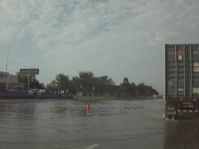
F. FLOODING...
COASTAL FLOODING...NO SIGNIFICANT COASTAL FLOODING WAS
REPORTED.
FLASH FLOODING...WIDESPREAD FLASH FLOODING WAS OBSERVED OVER
ARANSAS...REFUGIO...SAN PATRICIO...NUECES...BEE...LIVE OAK AND
KLEBERG COUNTIES. BANDS OF RAIN WERE LESS NUMEROUS FURTHER
WEST...BUT LOCALLY HEAVY RAINFALL PRODUCED FLASH FLOODING OVER PARTS
OF MCMULLEN AND WEBB COUNTIES.
RIVER FLOODING...HEAVY RAINS CONTINUED TO SPREAD WESTWARD TO THE
LAREDO AND COTULLA AREAS AS BRET PROGRESSED INLAND. HEAVY RAINFALL
OVER THE UPPER NUECES AND RIO GRANDE BASIN WILL LIKELY LEAD MINOR
FLOODING DOWNSTREAM. THE ARANSAS RIVER (AT SKIDMORE) AND OSO CREEK
NEAR CORPUS CHRISTI REACHED FLOOD STAGE RAPIDLY AND ARE CURRENTLY
FALLING.
G. TORNADOES...
ARANSAS COUNTY 8/22/99 2145 UTC...A TORNADO DESTROYED A RECREATIONAL
VEHICLE...A BARN AND A SHED. ALSO...SEVERAL TREES UPROOTED.
KLEBERG COUNTY 8/22/99 2245 UTC...TORNADO IN KINGSVILLE. MINOR
DAMAGE AND A FEW POWER LINES DOWN.
JIM WELLS COUNTY 08/23/99 0020 UTC....TORNADO IN ALICE. NO REPORTS
OF DAMAGE.
H. STORM EFFECTS...
FATALITIES: NONE.
EVACUATIONS: RECOMMENDATIONS FOR VOLUNTARY EVACUATIONS WERE ISSUED
BY PUBLIC OFFICIALS FOR SEVERAL COASTAL COUNTIES. THE FOLLOWING IS A
LIST OF COUNTIES AND AN APPROXIMATION (ACTUAL NUMBERS AND/OR
PERCENTAGE) OF THE NUMBER OF THOSE WHO EVACUATED:
SAN PATRICIO..........35,000-40,000 (50-60%)
KLEBERG...............17,500
ARANSAS...............15,000 (70%)
CALHOUN...............8,000-9,000 (30-40%)
NUECES................70,000-100,000
NAS CORPUS CHRISTI....5,300 MILITARY AND CIVILIAN EVACUATED
US COAST GUARD .......300
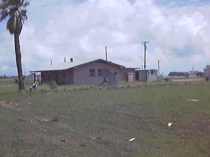
DAMAGE AMOUNTS: IN THE CORPUS CHRISTI AREA...DAMAGE TO HOMES AND
BUSINESSES WAS REPORTED BETWEEN 400,000 AND 500,000 DOLLARS. OVERALL
DAMAGE AMOUNTS IN THE CORPUS CHRISTI AREA TOTALED ABOUT ONE MILLION
DOLLARS WITH THE NAVAL AIR STATION IN CRP ALSO REPORTING AN
ADDITIONAL ONE MILLION IN DAMAGES. NO DOLLAR AMOUNT ON DAMAGE FROM
THE KINGSVILLE AREA WAS AVAILABLE AT THIS TIME.
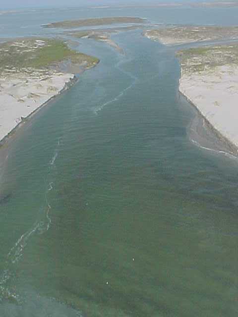
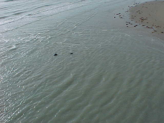
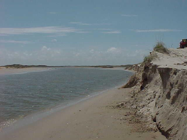
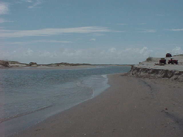
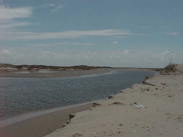
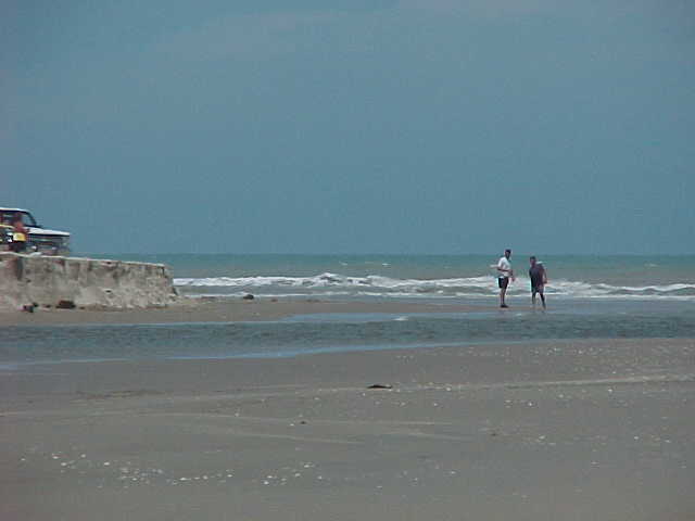
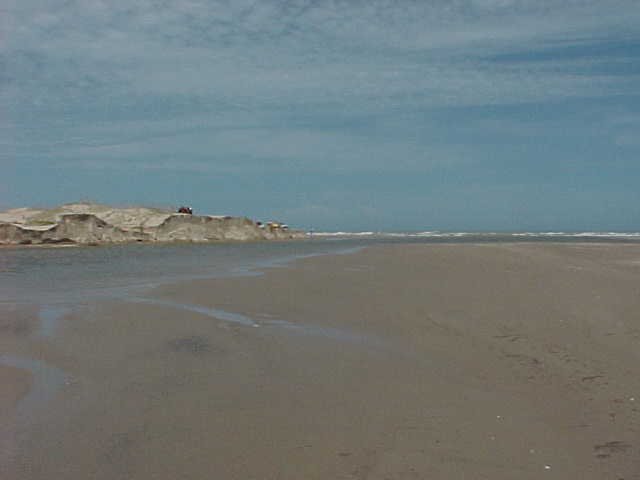
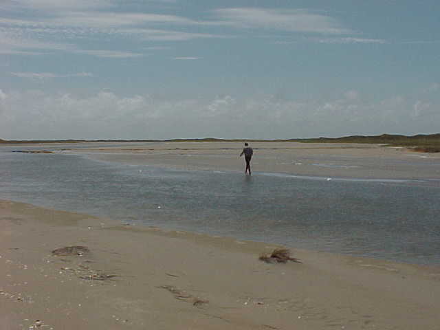
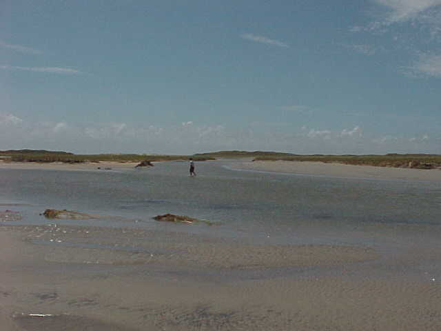
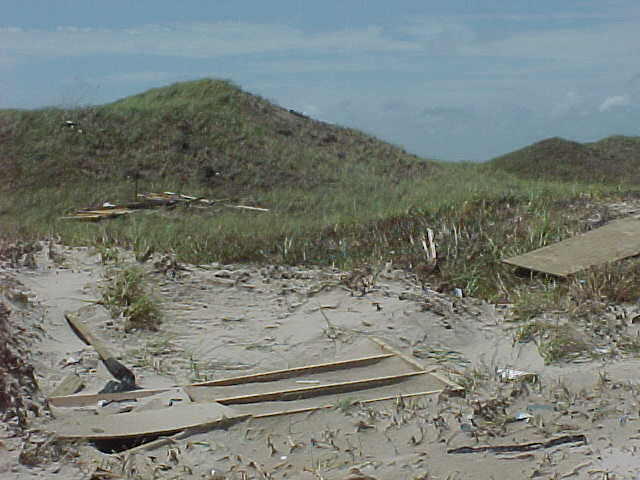
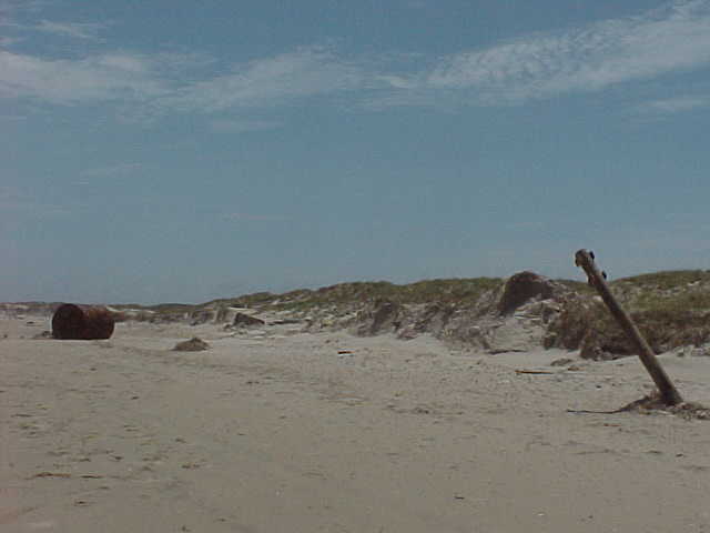
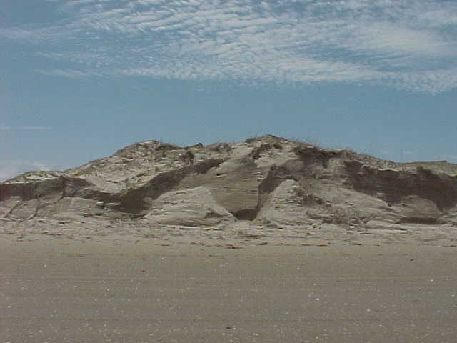
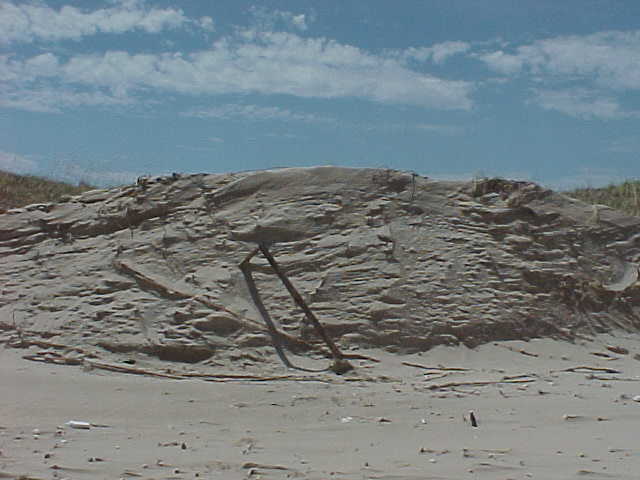
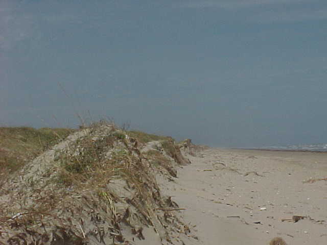
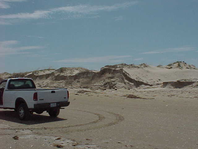
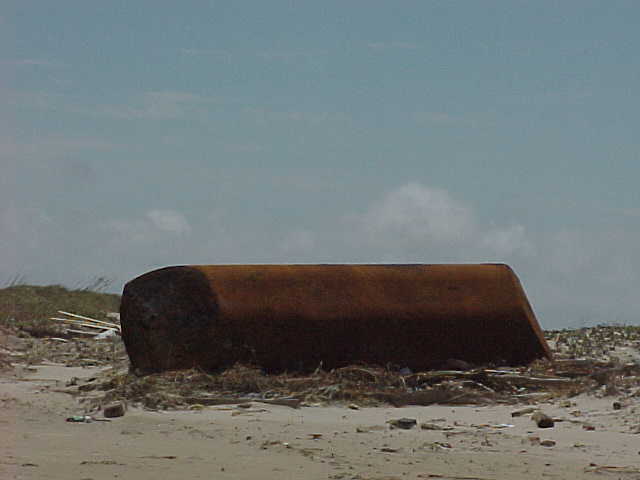
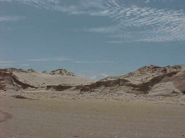
OTHER EFFECTS...BRET PRODUCED 12 NEW CUTS ACROSS PADRE ISLAND
NATIONAL SEASHORE WHERE WATERS FROM THE Gulf of America NOW CONNECT
TO THE LAGUNA MADRE. ABOUT 29 MILES SOUTH OF THE NATIONAL SEASHORE
HEADQUARTERS...SIGNIFICANT TO MAJOR BEACH EROSION BEGINS AND
CONTINUES TO THE PORT MANSFIELD PASS. THE FIRST MAJOR CUT IS AT
MILE MARKER 40 AND IS ABOUT 150 FEET ACROSS WITH WATER ESTIMATED AT
THREE TO FIVE FEET DEEP. FURTHER SOUTH NEAR MILE MARKER 50 AND
CLOSE TO WHERE THE EYE CAME ASHORE...THE LARGEST CUT IS SO WIDE THAT
AIRCREWS FLYING OVER THE AREA INITIALLY MISTOOK THE LARGE CUT AS THE
MANSFIELD PASS. ABOUT 20 MILES EITHER SIDE OF WHERE THE EYE CAME
ASHORE...DAMAGE SURVEY TEAMS REPORTED THE DUNES WERE SHEARED IN
HALF.
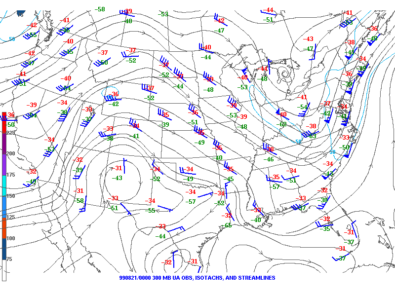
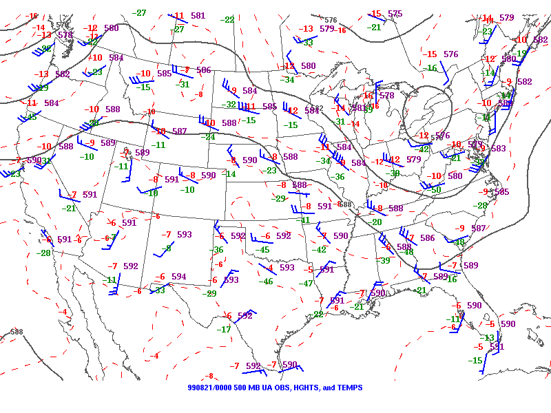
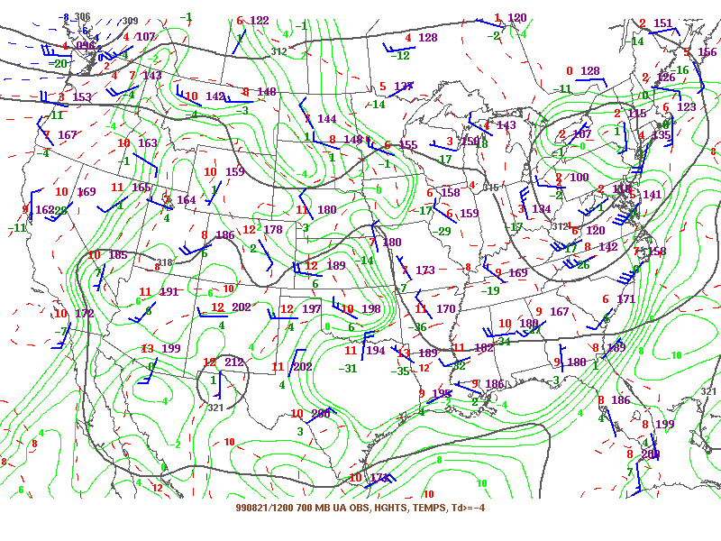
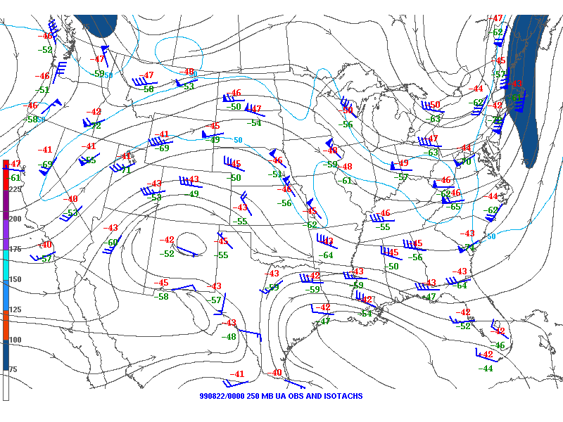
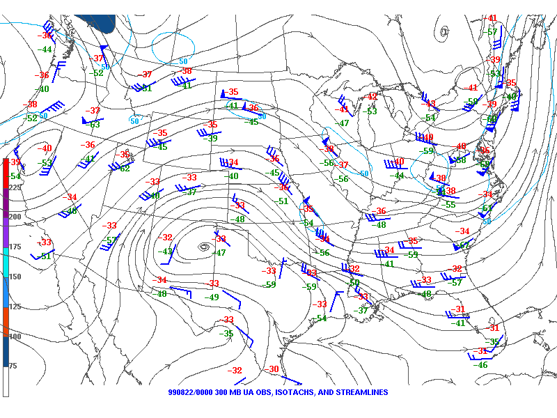
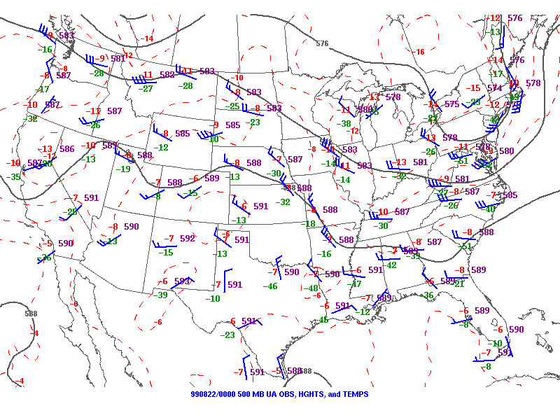
Upper Air Charts (250mb, 300mb, 500mb, 700mb)
|
|
| 250 MB | 300 MB |
|---|---|
 |
 |
| 500 MB | 700 MB |
 |
 |
Upper Air Charts (250mb, 300mb, 500mb, 700mb)
|
|
| 250 MB | 300 MB |
|---|---|
 |
 |
| 500 MB | 700 MB |
 |
 |
Upper Air Charts (250mb, 300mb, 500mb, 700mb)
|
|
| 250 MB | 300 MB |
|---|---|
 |
 |
| 500 MB | 700 MB |
 |
 |
Upper Air Charts (250mb, 300mb, 500mb, 700mb)
|
|
| 250 MB | 300 MB |
|---|---|
 |
 |
| 500 MB | 700 MB |
 |
 |
Upper Air Charts (250mb, 300mb, 500mb, 700mb)
|
|
| 250 MB | 300 MB |
|---|---|
 |
 |
| 500 MB | 700 MB |
 |
 |

