
The second storm will track across central and eastern portion of the country this weekend. Heavy wintry precipitation will affect the northern Plains to the upper peninsula of Michigan. Severe thunderstorms are expected along and ahead of the cold front, where very large hail, damaging winds and a few tornadoes are possible from the mid-Mississippi and Ohio Valleys to southern Plains. Read More >
 NOTE: This is a PRELIMINARY description of the event. Surveys and interviews are still ongoing, and many more images, reports, photos, and other information will be added as they become available. Feel free to check back often as new information is added.
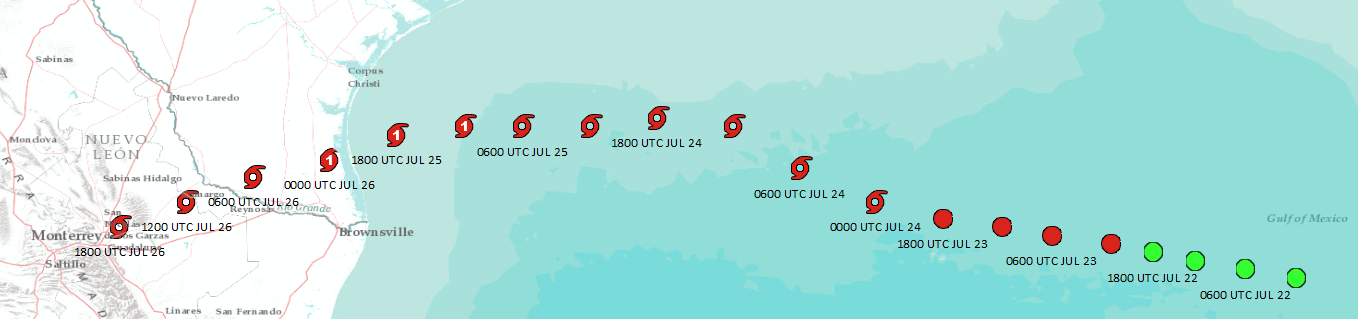
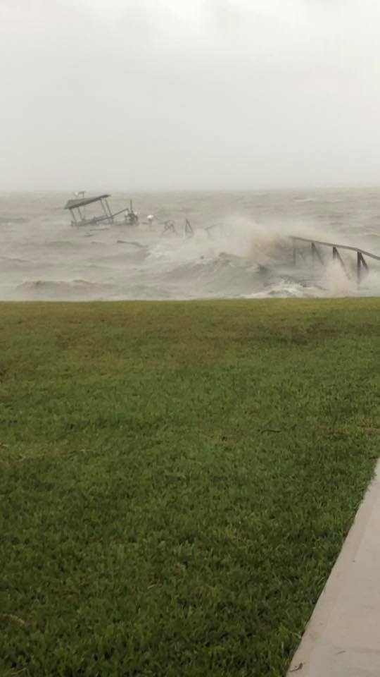
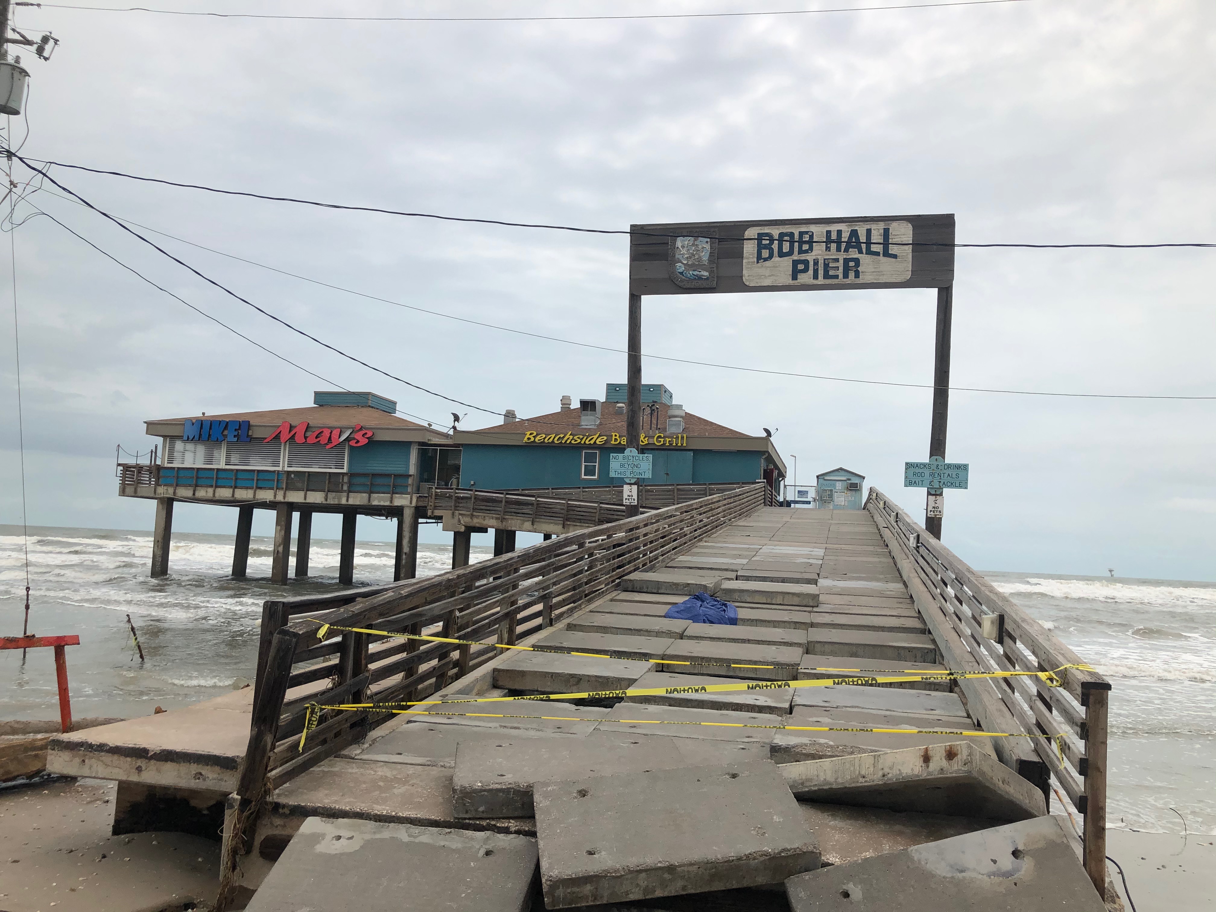
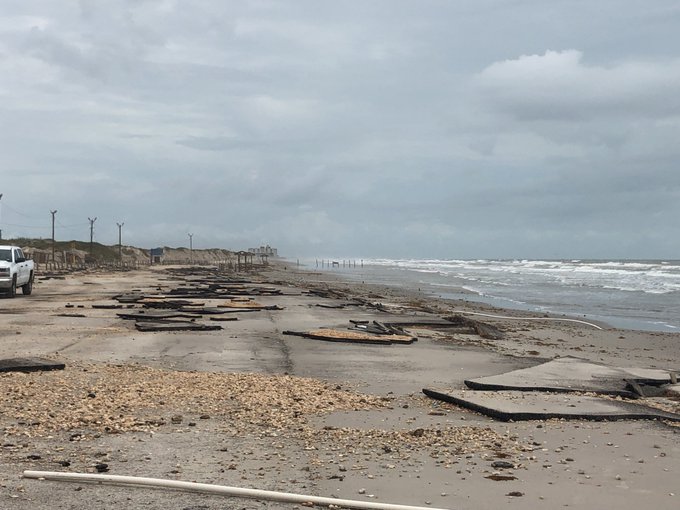
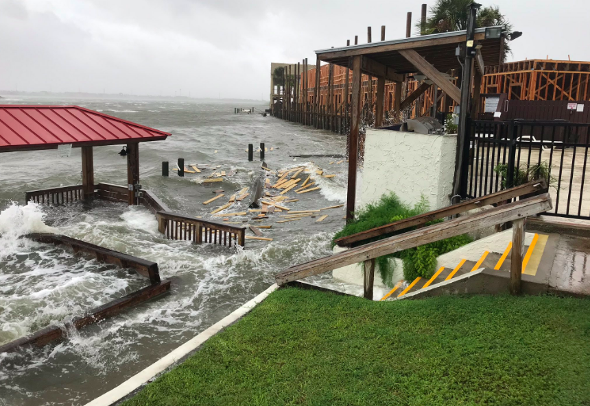
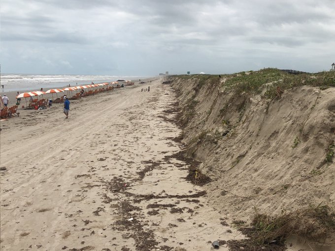
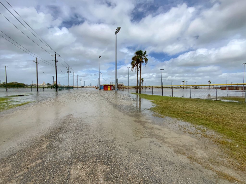
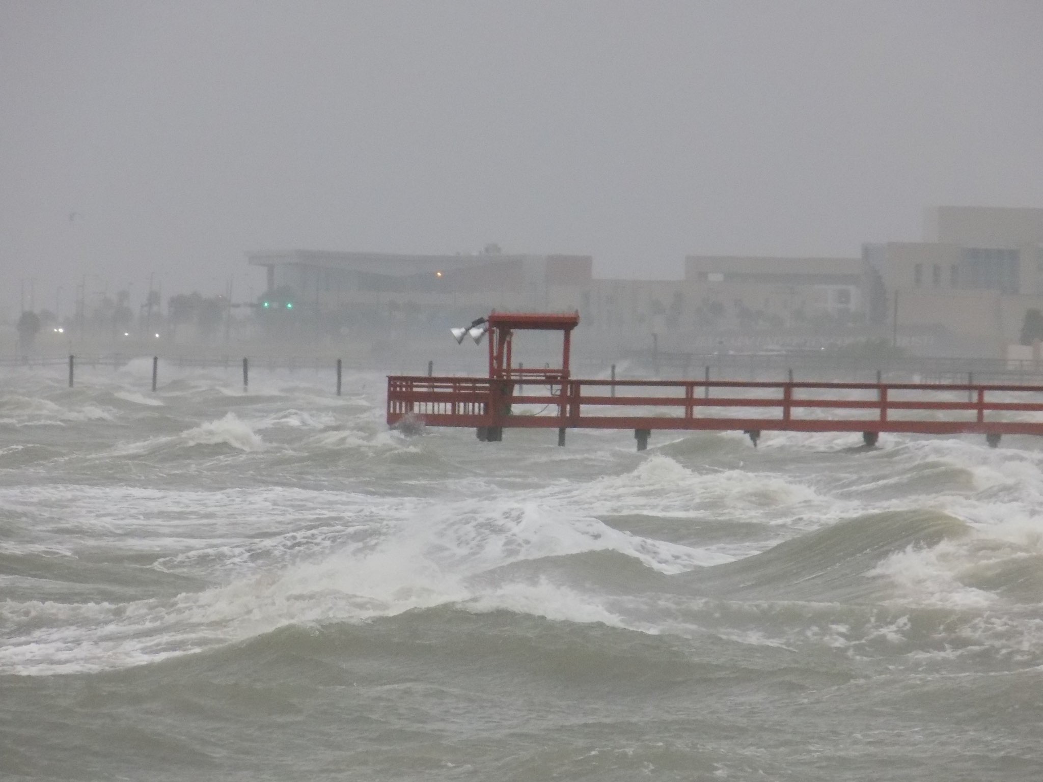
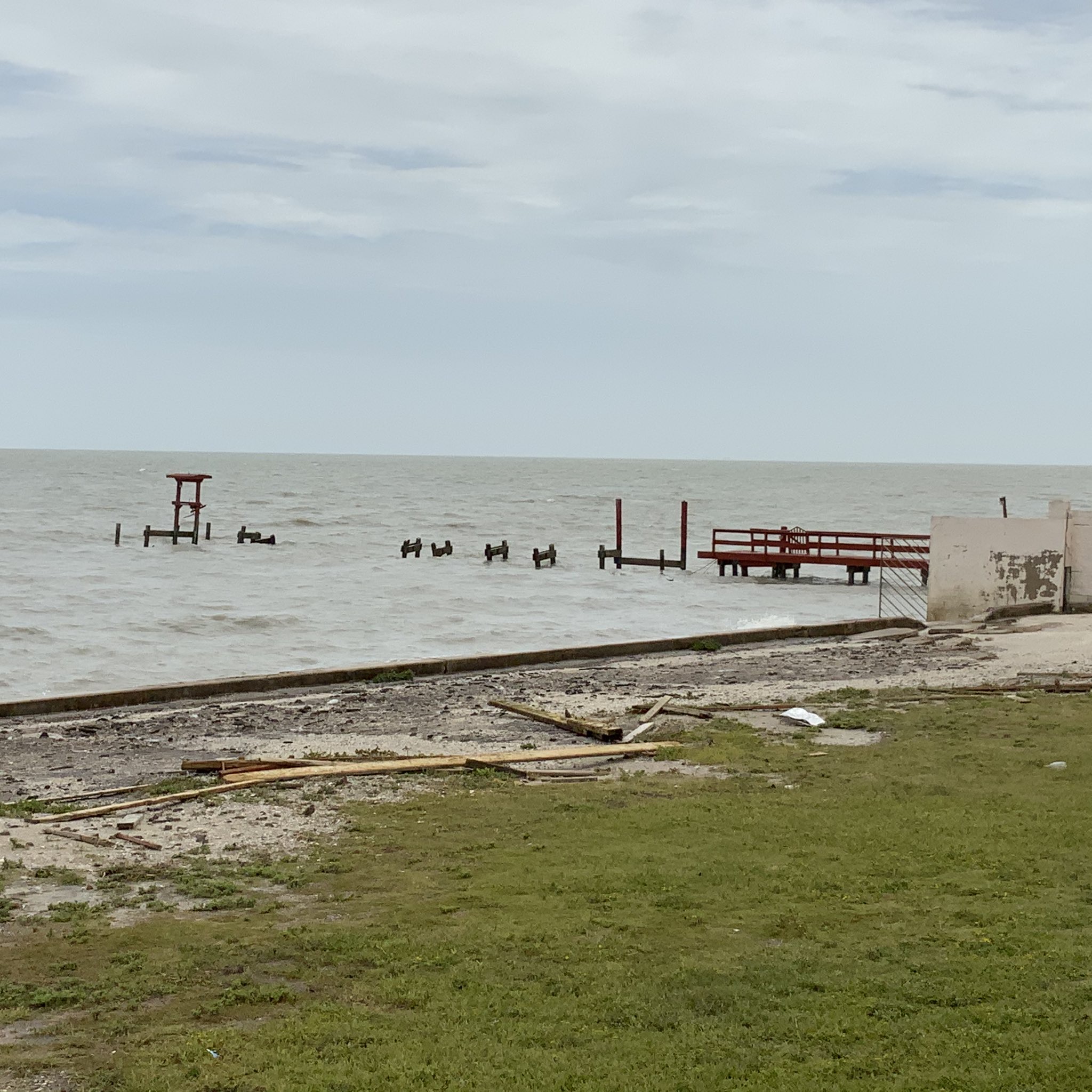
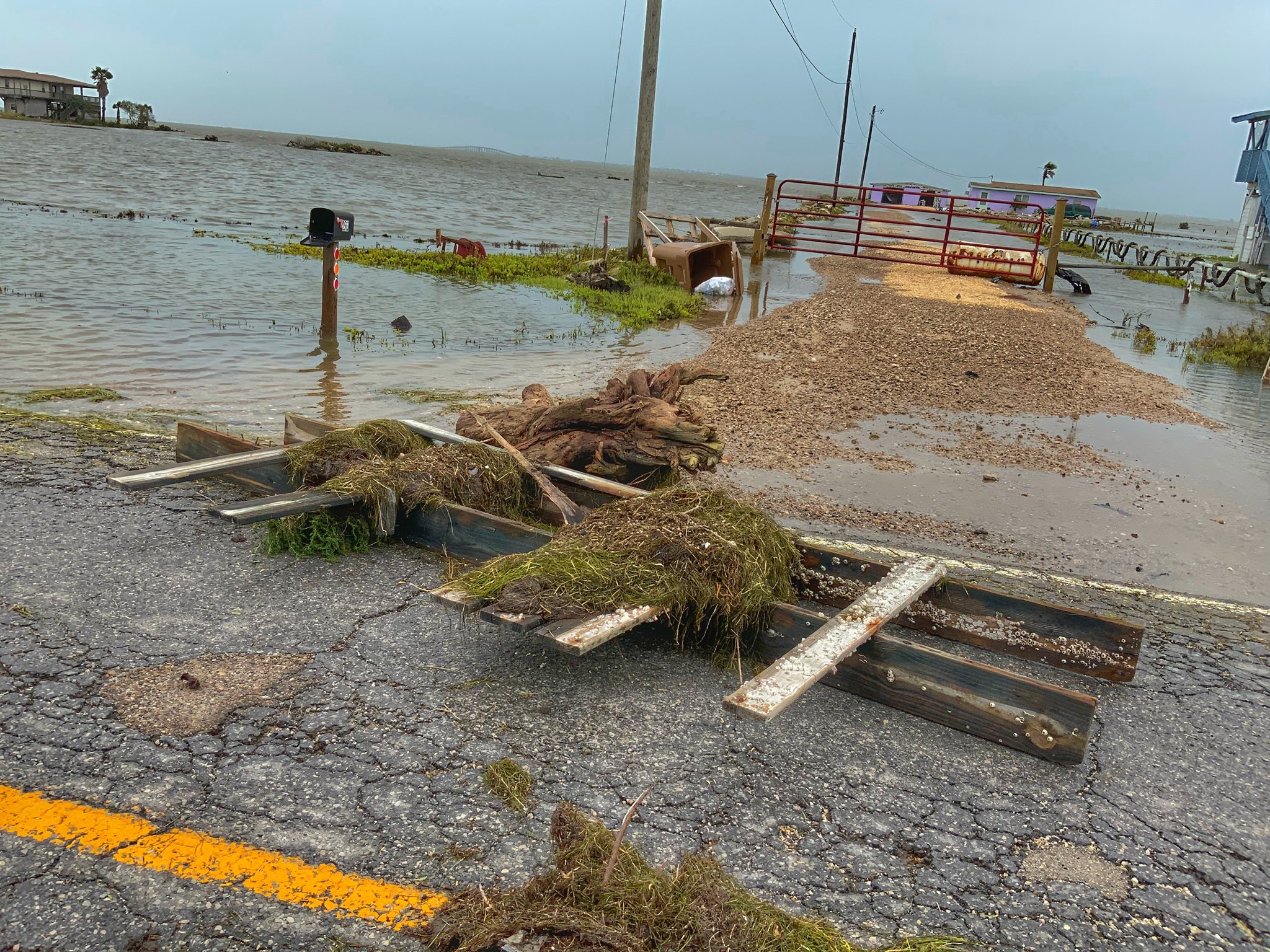
Hurricane Hanna made landfall in South Texas on Saturday, July 25, 2020. On these pages we'll talk about events leading up to landfall, immediate impacts from the hurricane, and continuing effects through the next day as severe weather associated with Hanna continued to impact South Texas.
 |
| Visible Satellite loop beginning at 10 AM CDT and ending at 9 PM CDT on July 25, 2020. |
|---|
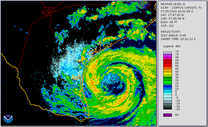 |
| This is the lowest elevation scan from our radar between 7 AM CDT and 9 PM CDT on July 25, 2020. |
|---|
PRELIMINARY LOCAL STORM REPORT
NATIONAL WEATHER SERVICE CORPUS CHRISTI TX
239 PM CDT SUN JUL 26 2020

..TIME...   ...EVENT...      ...CITY LOCATION...     ...LAT.LON...
..DATE...   ....MAG....      ..COUNTY LOCATION..ST.. ...SOURCE....
            ..REMARKS..

0246 PM     TROPICAL STORM   4 ENE SEADRIFT          28.41N 96.63W
07/25/2020                   CALHOUN            TX   MESONET

            MESONET STATION AT PORT O CONNOR MEASURED A
            WIND GUST OF 38 KNOTS (44 MPH).

0435 PM     TROPICAL STORM   2 SW REFUGIO            28.29N 97.30W
07/25/2020                   REFUGIO            TX   MESONET

            MESONET SITE IN REFUGIO MEASURED A WIND GUST
            OF 35 KNOTS (40 MPH).

0448 PM     TROPICAL STORM   11 SE CHAPMAN RANCH     27.48N 97.32W
07/25/2020                   GMZ230             TX   MESONET

            NOS SITE (IRDT2) AT SOUTH BIRD ISLAND
            MEASURED A WIND GUST TO 55 KNOTS (63 MPH).

0516 PM     TROPICAL STORM   10 WNW ROCKPORT         28.10N 97.21W
07/25/2020                   REFUGIO            TX   MESONET

            MESONET STATION AT BAYSIDE MEASURED A GUST
            TO 45 KNOTS (52 MPH).

0546 PM     TROPICAL STORM   3 ESE KINGSVILLE        27.50N 97.82W
07/25/2020                   KLEBERG            TX   AWOS

            AWOS STATION KNQI AT KINGSVILLE NAS MEASURED
            A WIND GUST TO 46 KNOTS (53 MPH).

0755 PM     TROPICAL STORM   7 W CORPUS CHRISTI      27.72N 97.41W
07/25/2020                   NUECES             TX   MESONET

            WEATHERFLOW SITE IN CORPUS CHRISTI MEASURED
            A GUST TO 37 KNOTS (42 MPH).

0814 PM     TROPICAL STORM   3 WNW CORPUS CHRISTI    27.72N 97.34W
07/25/2020                   GMZ230             TX   MESONET

            WEATHERFLOW MESONET STATION AT POENISCH PARK
            MEASURED A WIND GUST OF 48 KNOTS (55 MPH).

0835 PM     TROPICAL STORM   1 S NORTH SAN PEDRO     27.78N 97.68W
07/25/2020                   NUECES             TX   AWOS

            ROBSTOWN ASOS MEASURED A WIND GUSTS OF 41
            KNOTS (47 MPH).

0850 PM     TROPICAL STORM   10 ESE ROBSTOWN         27.77N 97.50W
07/25/2020                   NUECES             TX   ASOS

            ASOS STATION KCRP MEASUED A WIND GUST OF 47
            KNOTS (54 MPH).

0901 PM     TROPICAL STORM   3 NNE LAKE CORPUS CHRIS 28.16N 97.86W
07/25/2020                   LIVE OAK           TX   MESONET

            MESONET SITE IN MATHIS MEASURED A WIND GUST
            OF 41 KNOTS (47 MPH).

1133 PM     TROPICAL STORM   3 ESE ALICE             27.73N 98.02W
07/25/2020                   JIM WELLS          TX   ASOS

            ASOS IN ALICE MEASURED A WIND GUST TO 41
            KNOTS (47 MPH).

1159 PM     TROPICAL STORM   1 SSE PORTLAND          27.87N 97.32W
07/25/2020                   GMZ230             TX   MESONET

            WEATHERFLOW MESONET SITE AT WILDCAT MEASURED
            A WIND GUST OF 49 KNOTS (56 MPH).

1200 AM     TROPICAL STORM   10 SE ODEM              27.83N 97.49W
07/26/2020                   GMZ230             TX   MESONET

            TCOON SITE (NUET2) ON NUECES BAY MEASURED A
            WIND GUST OF 51 KNOTS (59 MPH).

1248 AM     TROPICAL STORM   3 S INGLESIDE           27.83N 97.20W
07/26/2020                   SAN PATRICIO       TX   MESONET

            MESONET STATION AT INGLESIDE MEASURED A WIND
            GUST OF 45 KNOTS (52 MPH).

0115 AM     TROPICAL STORM   3 SW BEEVILLE           28.37N 97.78W
07/26/2020                   BEE                TX   AWOS

            BEEVILLE ASOS MEASURED A WIND GUST OF 39
            KNOTS (45 MPH).

0118 AM     TROPICAL STORM   1 NW FULTON             28.08N 97.05W
07/26/2020                   ARANSAS            TX   ASOS

            THE ROCKPORT ASOS (KRKP) MEASURED A WIND
            GUST OF 42 KNOTS (48 MPH).

0159 AM     TROPICAL STORM   6 SSE AUSTWELL          28.30N 96.82W
07/26/2020                   ARANSAS            TX   MESONET

            MESONET STATION IN ARANSAS MEASURED A WIND
            GUST OF 42 KNOTS (48 MPH).
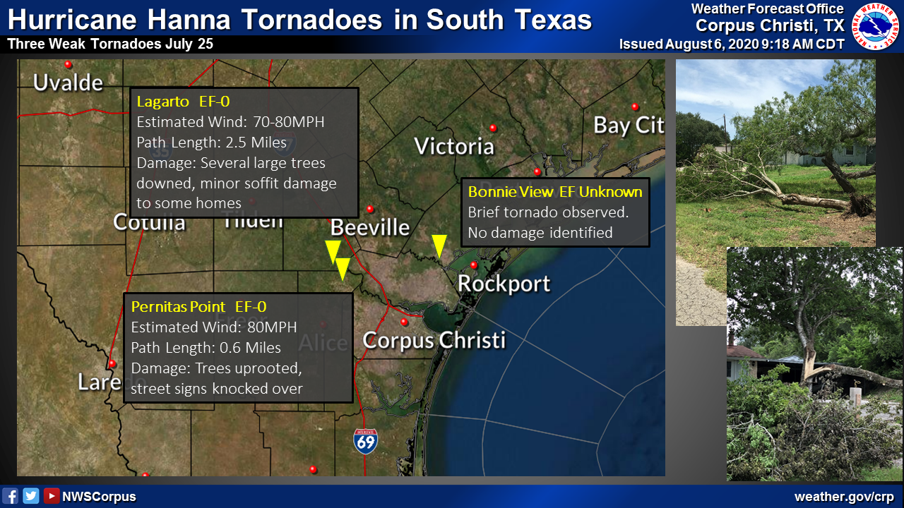
...NWS Damage Survey 07/27/20 Following Hurricane Hanna...

Update... After coordinating with Refugio County officials, no
damage was identified from the brief observed tornado near Bonnie View
on Saturday afternoon as the tornado occurred over open fields. A
preliminary damage rating of EF-0 has been assigned.

The NWS surveyed damage on Monday that occurred on Saturday and
Saturday night across portions of Live Oak and Jim Wells Counties,
including areas near and west of Lake Corpus Christi. The damage
survey team was unable to find conclusive evidence that any
tornadoes occurred within these areas. Updates to this statement
will be provided as more information is evaluated.

.Bonnie View Tornado...

Rating:                 EF-0
Estimated peak wind:    65 mph
Path length (statute):  0 miles
Path width (maximum):   30 yards
Fatalities:             0
Injuries:               0

Start date:             July 25, 2020
Start time:             12:48 PM CDT
Start location:         4 S Woodsboro / Refugio County / TX
Start lat/lon:          28.178/-97.134

End date:               July 25, 2020
End time:               12:48 PM CDT
End location:           4 S Woodsboro / Refugio County / TX
End lat/lon:            28.178/-97.134


EF scale: The enhanced Fujita scale classifies
tornadoes into the following categories.

EF0...weak......65 to 85 mph
EF1...weak......86 to 110 mph
EF2...strong....111 to 135 mph
EF3...strong....136 to 165 mph
EF4...violent...166 to 200 mph
EF5...violent...>200 mph

Note:
The information in this statement is preliminary and subject to
change pending final review of the events and publication in
NWS Storm Data.


Videos courtesy Brian Emfinger

