
Flash flooding threatens areas from the Tennessee Valley to the Carolinas as storms repeat along a stalled front. Monsoonal storms may trigger flooding in the Southwest. Dangerous heat expands across the Desert Southwest, Plains, mid-Mississippi Valley and Southern Tier. Critical fire weather for interior Pacific Northwest. Cooler, drier air brings brief relief to the Great Lakes and Northeast. Read More >
During the afternoon on January 23rd, 2014, a strong Arctic cold front moved through South Texas. Temperatures ahead of the front were in the 60s and 70s. Temperatures dropped around 20 degrees in 3 hours and around 30 degrees in 6 hours after the front had passed. Maximum wind gusts behind the front across most of South Texas averaged between 35 and 40 mph. Bob Hall Pier recorded a peak wind gust of 49 mph, the Naval Air Station in Corpus Christi recorded a peak wind gust of 48 mph, and the Corpus Christi International Airport recorded a peak wind gust of 46 mph during the evening of the 23rd.
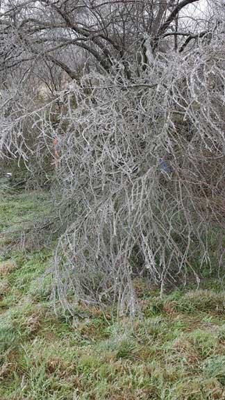
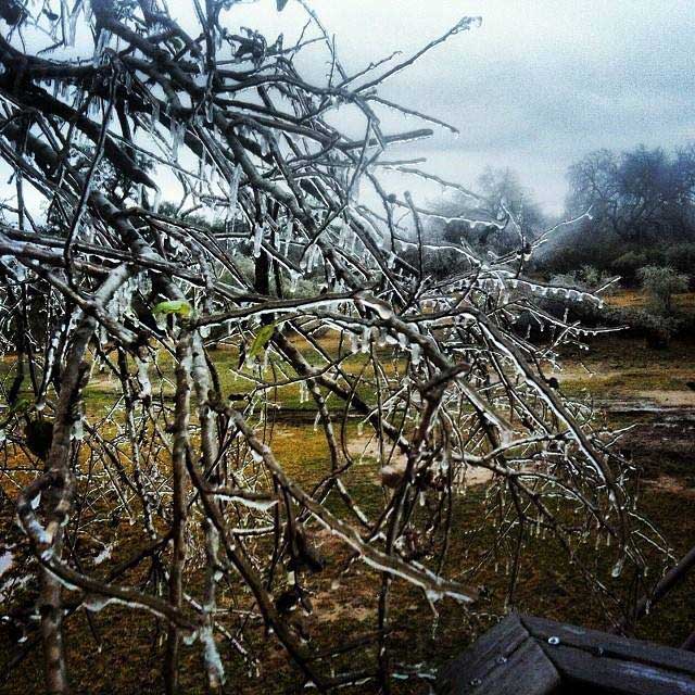
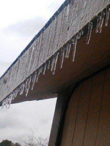
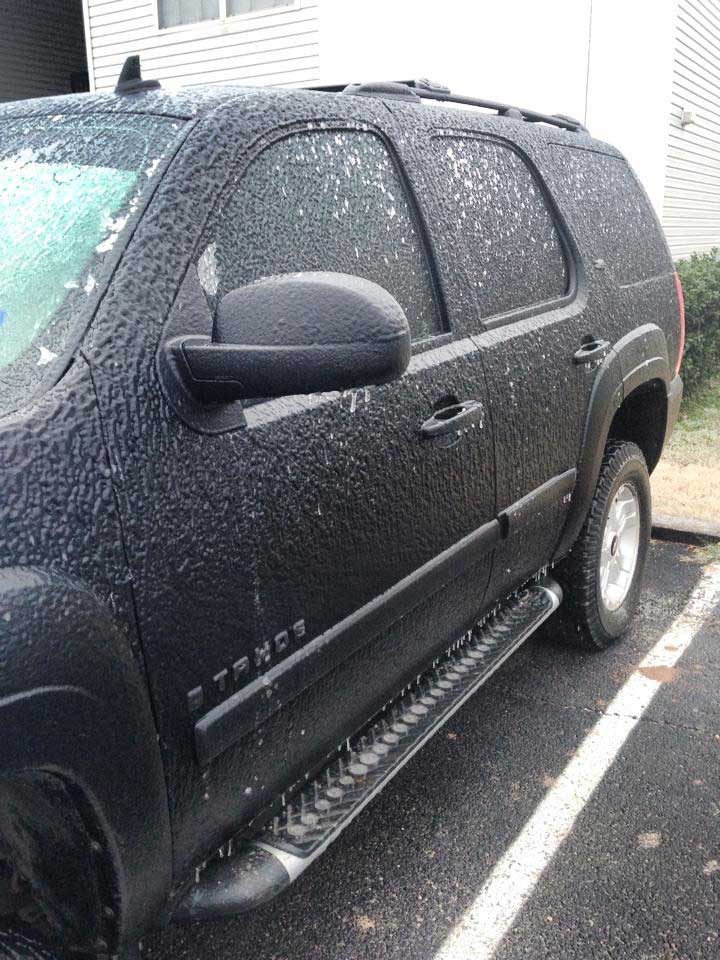
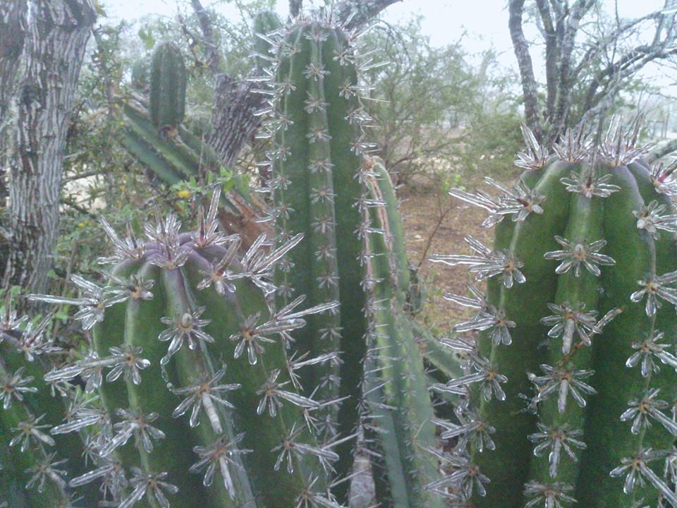
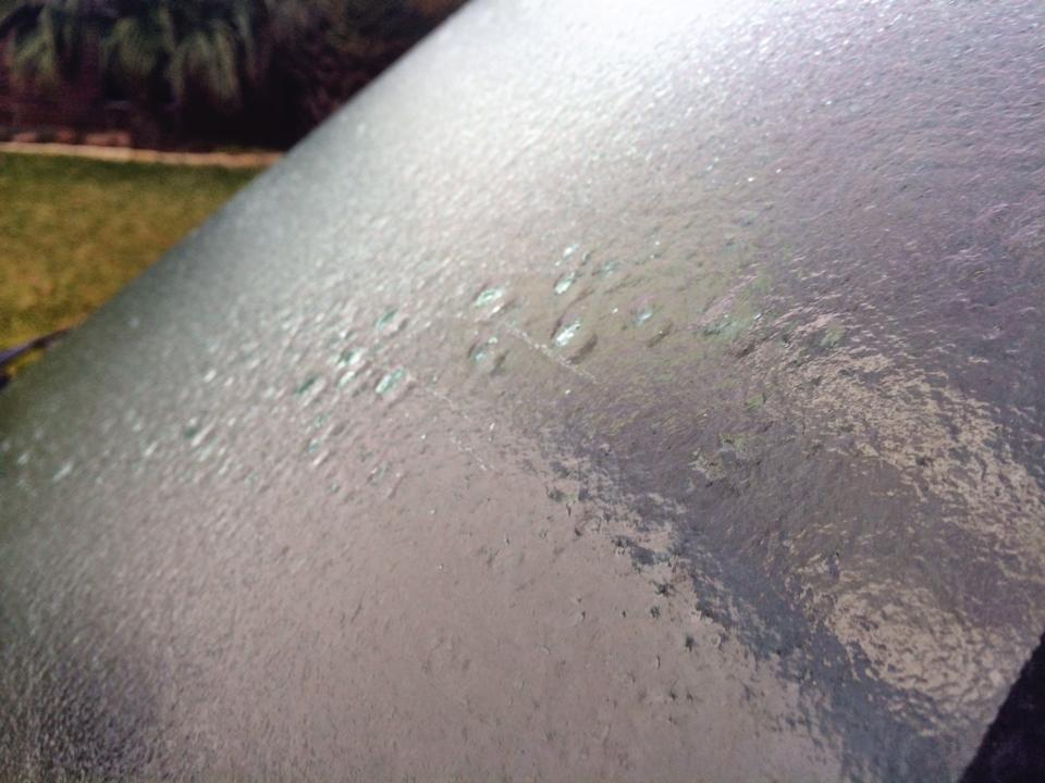
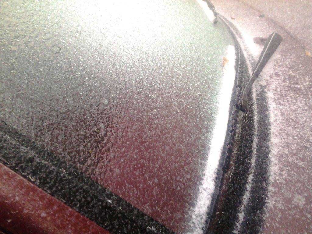
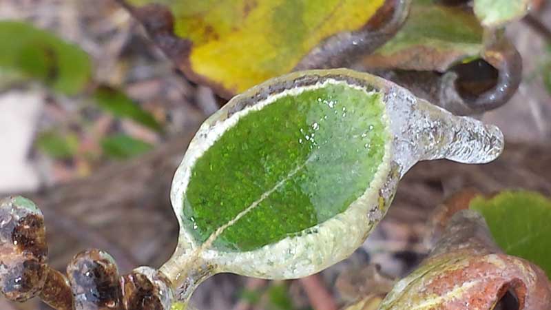
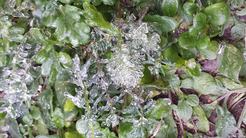
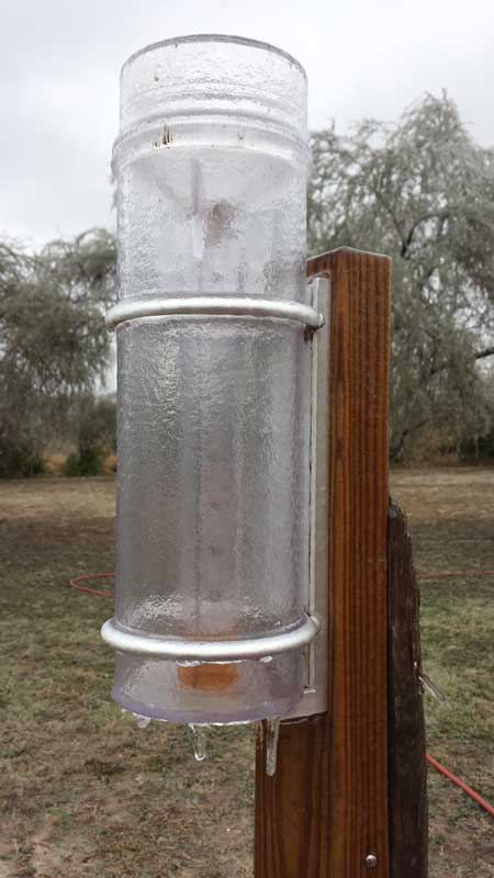
Overrunning moisture along with an upper level disturbance aided in the development of precipitation behind the cold front. As temperatures plummeted into the 30s, a wintry mix of precipitation began to develop as early as 800 PM CST on the 23rd across the northern Brush Country. As the Arctic air mass became more entrenched across South Texas during the late evening and overnight hours, freezing rain and freezing drizzle sometimes mixed with sleet became the more dominant precipitation type across much of South Texas. The wintry precipitation ended around 900 AM CST on the 24th along the coast. Ice accumulations averaged from less than 1⁄10″ to ∼ 1⁄8″ for most of South Texas except for portions along the Middle Texas Coast where no ice accumulation occurred since the temperatures within this area remained just above freezing. Ice accumulations closer to 1⁄8″ occurred across portions of Jim Wells, Live Oak, Bee, Goliad, and Victoria counties.
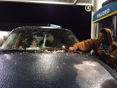
Multiple vehicle accidents occurred across South Texas due to the icy roads and bridges. Even portions of Interstate 35, Interstate 37, and US Highway 181 along with the Harbor Bridge were closed briefly during the morning of the 24th. Most roads were re-opened by 1000 AM CST on the 24th as the temperatures slowly rose above freezing. Many schools either delayed or canceled classes. Flights were delayed for several hours at the Victoria Regional Airport. Power outages were also reported.
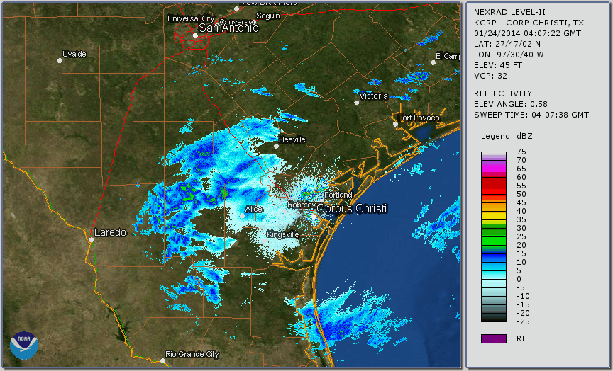
Reflectivity Loop from 1007 PM CST January 23, 2014 to 911 AM CST January 24, 2014.
 |
 |
 |
 |
 |
 |
 |
 |
 |
 |
 |
 |
 |
 |
PRELIMINARY LOCAL STORM REPORT...CORRECTED
NATIONAL WEATHER SERVICE CORPUS CHRISTI TX
1237 PM CST FRI JAN 24 2014

..TIME...   ...EVENT...      ...CITY LOCATION...     ...LAT.LON...
..DATE...   ....MAG....      ..COUNTY LOCATION..ST.. ...SOURCE....
            ..REMARKS..

1233 AM     FREEZING RAIN    7 E THREE RIVERS        28.47N 98.06W
01/24/2014  U0.00 INCH       LIVE OAK           TX   BROADCAST MEDIA

            FREEZING RAIN REPORTED. TXDOT ALSO INDICATES ROADWAYS ARE
            BEGINNING TO BECOME SLICK ACROSS LIVE OAK COUNTY.

0131 AM     FREEZING RAIN    SANDIA                  28.01N 97.88W
01/24/2014  U0.00 INCH       JIM WELLS          TX   LAW ENFORCEMENT

            INCREASING NUMBER OF ACCIDENTS ACROSS JIM WELLS COUNTY OF
            CARS SLIDING OFF ROADWAYS...INCLUDING NEAR SANDIA AREA.

0305 AM     FREEZING RAIN    VICTORIA                28.82N 96.98W
01/24/2014  E0.00 INCH       VICTORIA           TX   LAW ENFORCEMENT

            ICING ON BRIDGES AND OVERPASSES ALONG HWY 87N AROUND AND
            NORTHWEST OF VICTORIA.

0447 AM     FREEZING RAIN    CORPUS CHRISTI          27.71N 97.29W
01/24/2014  E0.00 INCH       NUECES             TX   NWS EMPLOYEE

            LIGHT RAIN FREEZING ON VEHICLES AROUND INTL AIRPORT

0530 AM     FREEZING RAIN    15 N ALICE              27.97N 98.07W
01/24/2014  E0.00 INCH       JIM WELLS          TX   LAW ENFORCEMENT

            ICING REPORTED ON U.S. 624 AND 181. NO CLOSED ROADS
            REPORTED...BUT TROOPERS STANDING BY AS A MINOR ACCIDENT
            OCCURED AT THIS LOCATION.

0606 AM     FREEZING RAIN    BEEVILLE                28.41N 97.75W
01/24/2014  E0.00 INCH       BEE                TX   LAW ENFORCEMENT

            NORTH AND SOUTH 181 BYPASS CLOSED DUE TO ICING AROUND
            BEEVILLE.

0606 AM     FREEZING RAIN    GEORGE WEST             28.33N 98.12W
01/24/2014  E0.00 INCH       LIVE OAK           TX   LAW ENFORCEMENT

            I-37 CLOSED IN LIVE OAK COUNTY...BOTH NORTH AND SOUTH
            BOUND DUE TO ICING. AN ACCIDENT WAS REPORTED AT I-37 AND
            U.S. 59 EAST OF GEORGE WEST.

0700 AM     FREEZING RAIN    PORTLAND                27.88N 97.33W
01/24/2014  E0.00 INCH       SAN PATRICIO       TX   NWS EMPLOYEE

            GLAZING OF ICE COATING CARS AND PAVEMENT IN PLACES.
            SPOTTY SLICK SPOTS ON ROADS.

0715 AM     FREEZING RAIN    ARTESIA WELLS           28.28N 99.28W
01/24/2014  U0.00 INCH       LA SALLE           TX   LAW ENFORCEMENT

            IH-35 FROM MILE MARKER 56 TO MILE MARKER 60 IS BEING
            SHUTDOWN DUE TO ICING.

0715 AM     FREEZING RAIN    CORPUS CHRISTI          27.75N 97.42W
01/24/2014  U0.00 INCH       NUECES             TX   LAW ENFORCEMENT

            CORPUS CHRISTI POLICE REPORT U.S. 77 FLYOVER AT IH-37 IS
            ICING OVER. TRAFFIC OFFICERS ARE SHUTTING DOWN THE
            HIGHWAY.

0750 AM     FREEZING RAIN    CORPUS CHRISTI          27.75N 97.42W
01/24/2014  U0.00 INCH       NUECES             TX   LAW ENFORCEMENT

            CORPUS CHRISTI POLICE DEPARTMENT HAS CLOSED THE HARBOR
            BRIDGE DUE TO ICING. THE JOE FULTON CORRIOR IS ALSO
            CLOSED IN BOTH DIRECTIONS.

0755 AM     FREEZING RAIN    LAREDO                  27.53N 99.49W
01/24/2014  E0.00 INCH       WEBB               TX   DEPT OF HIGHWAYS

            TXDOT LAREDO DISTRICT IS REPORTING I-35 MILO INTERCHANGE
            DIRECT CONNECTOR BRIDGES 1, 2, AND 7 AT MILE MARKER 8 ARE
            CLOSED DO TO ICE ON BRIDGES. ALSO CLOSED IS THE I-35
            SOUTHBOUND APPROACHES TO MILO INTERCHANGE.

0824 AM     FREEZING RAIN    VICTORIA                28.82N 96.98W
01/24/2014  E0.00 INCH       VICTORIA           TX   911 CALL CENTER

            LAW ENFORCEMENT REPORTED ICE ON OVERPASSES ON LOOP 463 IN
            VICTORIA AND WERE WORKING SEVERAL MOTOR VEHICLE ACCIDENTS
            IN THESE AREAS.

0830 AM     FREEZING RAIN    ALICE                   27.76N 98.07W
01/24/2014  E0.00 INCH       JIM WELLS          TX   LAW ENFORCEMENT

            LAW ENFORCEMENT STILL REPORTING OVERPASSES NORTH AND
            SOUTH OF ALICE ICE COVERED AND SLICK.

0836 AM     FREEZING RAIN    GOLIAD                  28.67N 97.39W
01/24/2014  U0.00 INCH       GOLIAD             TX   LAW ENFORCEMENT

            POWER OUTAGE IN GOLIAD FROM ICING. HALF THE TOWN WITHOUT
            POWER.

0843 AM     FREEZING RAIN    BEEVILLE                28.41N 97.75W
01/24/2014  E0.00 INCH       BEE                TX   LAW ENFORCEMENT

            LAW ENFORCEMENT IS REPORTING THE 181 BYPASS AROUND THE
            CITY OF BEEVILLE IS STILL CLOSED DUE TO ICING.

