| Overview | Radar | SPC Products | Additional Resources |
The winter that never seems to end, brought another round of snow to the Great Lakes area Monday and Tuesday. A low pressure system moved up from the southwest before quickly occluding as the center of the low moved over southern lower Michigan. The mid-level dry slot moved into southern areas of the CWA, helping to keep overall snow totals down. Snow moved into Southeast Michigan late Monday afternoon and continued through the overnight hours before ending early Tuesday morning. One inch per hour snowfall rates were seen, with a few locations even reporting thundersnow. Highest snowfall totals were seen across the Saginaw Valley and Thumb areas, with 3 to 5 inch range south.
Back to top
|
|
 |
| Radar loop courtesy of Iowa Environmental Mesonet (IEM). |
|
|
Correction: Time durations for following two sites should read:
2 NE Corunna 12.5 hours
Wyandotte 13.5 hours
Back to top
SPC Products (More details can be found by clicking on the images)
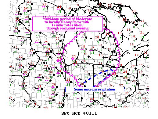
Mesoscale Discussion (MD) from February 17, 2014 at 4PM
 |
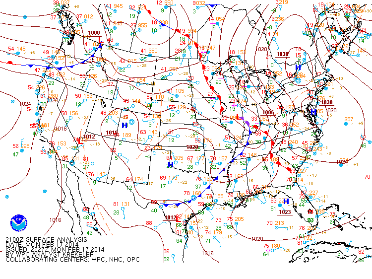
Surface Map from February 17, 2014 at 4 PM (courtesy of WPC)
 |
Local Area Event Summaries: