Overview
Hail and strong winds were seen across parts of Southeast Michigan as severe storms rolled through during the evening of April 29th. Nickel size hail was reported with the storms, along 50-58 mph wind gusts causing downed trees and power lines. These storms formed in association with a warm front that had set up across the area from a large low pressure system over the Midwest. Southerly winds and clouds clearing out during the day allowed for temperatures to climb into the 70s across much of the area creating the instability needed to help in storm development. The large weather system that brought the storms to Michigan, also brought a whole spectrum of weather from the Northern Great Lakes to the Deep South. Snow was reported in parts of Minnesota and Northern Wisconsin, while the South endured round after round of intense severe weather, including numerous tornadoes.
Back to top
Radar
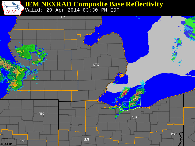 |
| Radar loop courtesy of Iowa Environmental Mesonet (IEM). Yellow boxes are severe thunderstorm warnings and green boxes are special marine warnings. |
Back to top
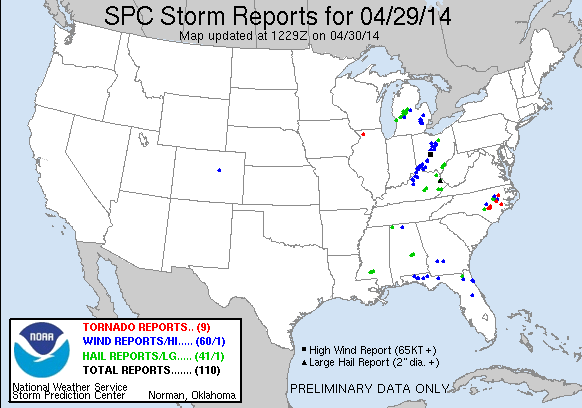
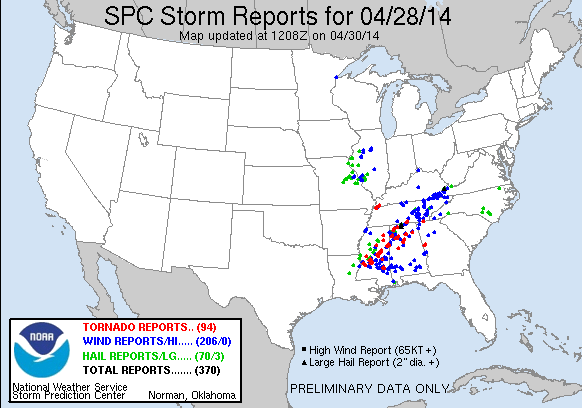
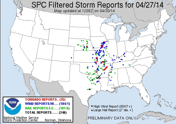
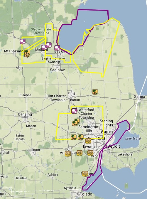
Local Storm Reports
 |
|
Image courtesy of Iowa Environmental Mesonet (IEM). Yellow boxes are severe thunderstorm warnings and purple boxes are special marine warnings. Local Storm Reports (LSR) are also shown plotted on the map.
NOTE: Icons on the map above include both severe and sub severe LSRs.
|
|
|
NWUS53 KDTX 301901
LSRDTX
PRELIMINARY LOCAL STORM REPORT...SUMMARY
NATIONAL WEATHER SERVICE DETROIT/PONTIAC MI
258 PM EDT WED APR 30 2014
..TIME... ...EVENT... ...CITY LOCATION... ...LAT.LON...
..DATE... ....MAG.... ..COUNTY LOCATION..ST.. ...SOURCE....
..REMARKS..
0648 PM TSTM WND DMG 5 ESE OIL CITY 43.58N 84.51W
04/29/2014 MIDLAND MI 911 CALL CENTER
TRAILER FLIPPED ON SIDE OFF OF SOUTH MAGRUDDER RD.
0649 PM TSTM WND DMG 4 E OIL CITY 43.61N 84.51W
04/29/2014 MIDLAND MI 911 CALL CENTER
TWO TREES UPROOTED AT MAGRUDDER AND ISABELLA/M-20
0900 PM TSTM WND DMG 4 N DEXTER 42.38N 83.87W
04/29/2014 WASHTENAW MI TRAINED SPOTTER
2 FOOT TREE LIMBS DOWN AT MAST RD AND N TERRITORIAL RD.
0900 PM TSTM WND DMG 4 NNW DEXTER 42.39N 83.92W
04/29/2014 WASHTENAW MI TRAINED SPOTTER
3 FOOT TREE LIMB FELL ON 2 CARS AT THE DEXTER DENTAL
OFFICE.
0905 PM TSTM WND DMG 1 SSE SOUTH LYON 42.45N 83.64W
04/29/2014 OAKLAND MI TRAINED SPOTTER
TREE BLOWN DOWN AT 8 MILE AND GRISWOLD ROADS
0908 PM TSTM WND DMG 2 SW NOVI 42.45N 83.51W
04/29/2014 OAKLAND MI TRAINED SPOTTER
POWERLINES REPORTED DOWNED AT NINE MILE AND BECK ROADS.
ALSO DIME SIZED HAIL REPORTED
0921 PM TSTM WND DMG 3 NE HIGHLAND 42.67N 83.58W
04/29/2014 OAKLAND MI LAW ENFORCEMENT
TREE REPORTED DOWN ON A CAR AT DAVISTA AND ORCHARD NEAR
DUCK LAKE
0923 PM TSTM WND DMG HIGHLAND 42.64N 83.62W
04/29/2014 OAKLAND MI LAW ENFORCEMENT
WIRES DOWNED ON MOBILE HOME CAUSING IT TO CATCH FIRE
0935 PM TSTM WND GST 4 E FENTON 42.81N 83.63W
04/29/2014 E58.00 MPH OAKLAND MI TRAINED SPOTTER
1006 PM TSTM WND DMG 5 ENE LAPEER 43.07N 83.24W
04/29/2014 LAPEER MI TRAINED SPOTTER
LARGE TREE DOWNED AND BLOCKING HAINES ROAD WEST OF
GROSBECK
1026 PM TSTM WND DMG 1 ESE CARO 43.48N 83.38W
04/29/2014 TUSCOLA MI 911 CALL CENTER
TREES DOWN AT GUN CLUB ROAD AND WEEDEN ROAD
1034 PM TSTM WND DMG 1 S COLWOOD 43.60N 83.35W
04/29/2014 TUSCOLA MI 911 CALL CENTER
TREES DOWNED AT COLWOOD AND EAST CASS CITY ROADS
Back to top
SPC Products (More details can be found by clicking on the images)
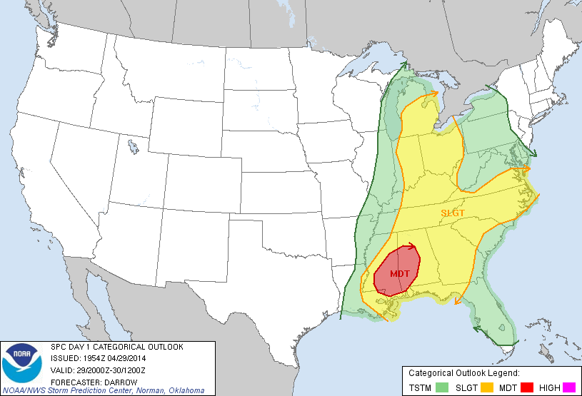 |
| SPC Day 1 Outlook |
Back to top
Additional Resources
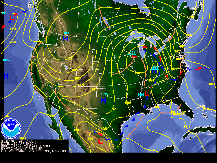 |
| HPC surface analysis at 9:27pm EDT (0127Z). |
Back to top