| Overview | Radar | SPC Products | Additional Resources |
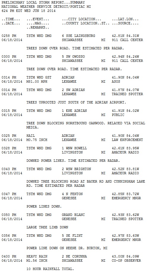
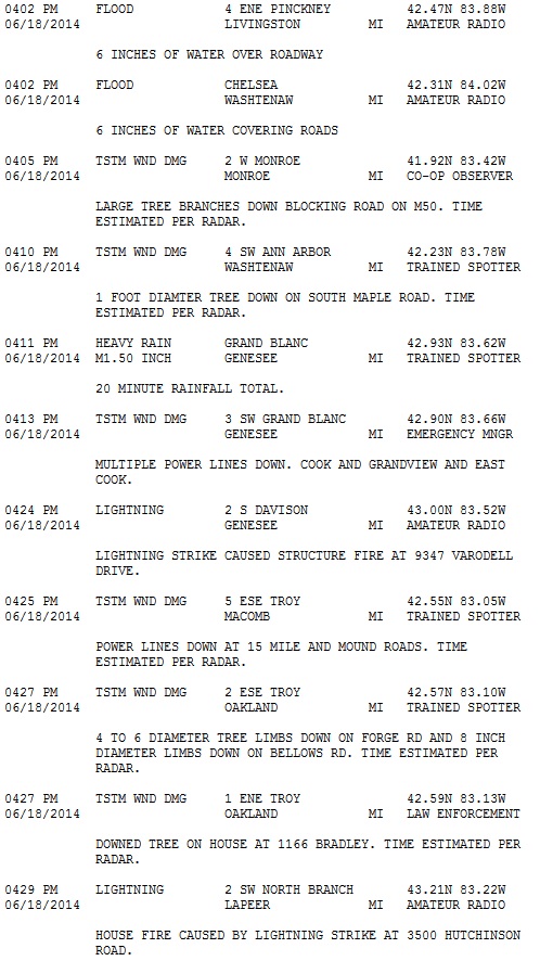
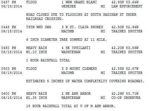
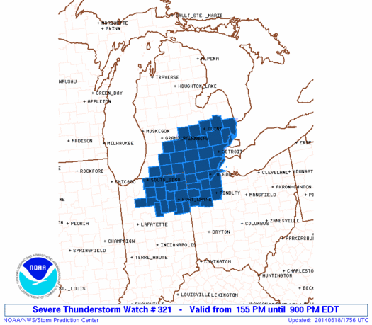
Southeast Michigan saw active weather in both the morning and afternoon on Wednesday, June 18th, with the afternoon convection turning severe. Previous convection during the morning hours had moved off and there was enough instability for the thundersorm complex over southern Wisconsin and northern Illinois to hold together as it crossed Lake Michigan and into lower Michigan. This line of storms raced across the state bringing winds, heavy rain, and frequent lightning with numerous reports of trees down, power outages, and local flooding.
Back to top
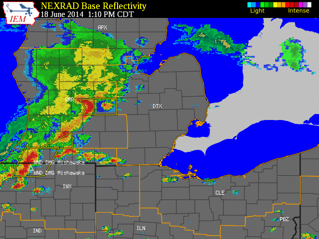 |
| Radar loop courtesy of Iowa Environmental Mesonet (IEM). Yellow boxes are severe thunderstorm warnings, and blue boxes are special marine warnings. Note: Times are in CDT |
|
|
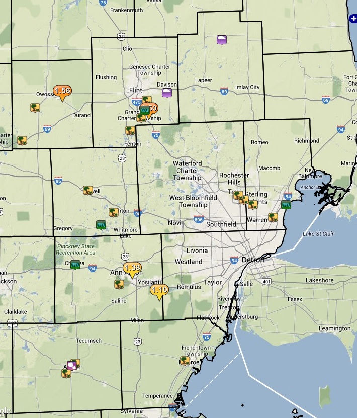
| Image courtesy of Iowa Environmental Mesonet (IEM). Yellow boxes are severe thunderstorm warnings, red box is a tornado warning, and purple boxes are special marine warnings. Local Storm Reports (LSR) are also shown plotted on the map. |
|
|
Back to top
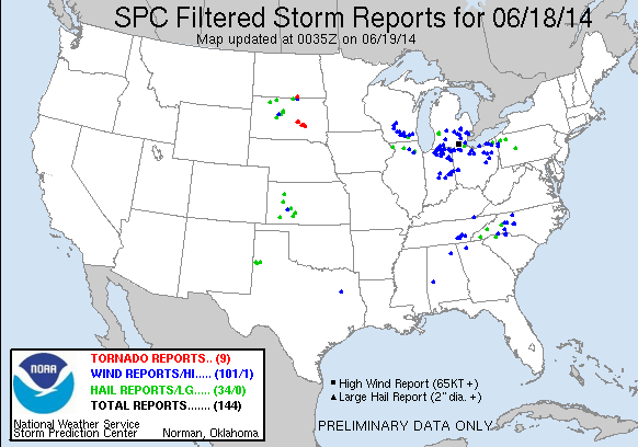
SPC Products (More details can be found by clicking on the images)
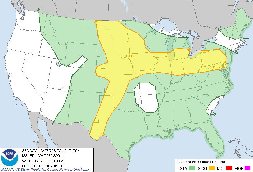 |
| SPC Day 1 Outlook issued at 2:30 PM EST |
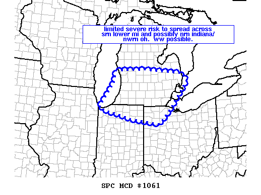 |
| Mesoscale Disscussion issued at 10:32 AM EST |
 |
 |