March came in like a lion, as a strengthening low pressure system moved up across the Ohio valley on Thursday, bringing an area of heavy, wet snowfall to parts of Southeast Michigan. The onset of precipitation was rain before it quickly changed over to all snow by the early afternoon. Snowfall rates during the event were 1-2" per hour with a quick 3-4" falling within 2 hours early Monday afternoon. Snowfall totals across the area as of 7pm were upwards of 6-7 inches in some locations. Interestingly enough, highest snowfall totals coincided with higher elevation across SE MI. The reason for this can be twofold -- Snow aloft had less time to melt into raindrops before hitting the surface due to the higher elevation, and surface temperatures were slightly cooler across the elevated areas, allowing snow to accumulate more quickly on the surface relative to communities closer to sea level. More detailed snowfall reports can be found in the storm reports section.
Snowfall Map
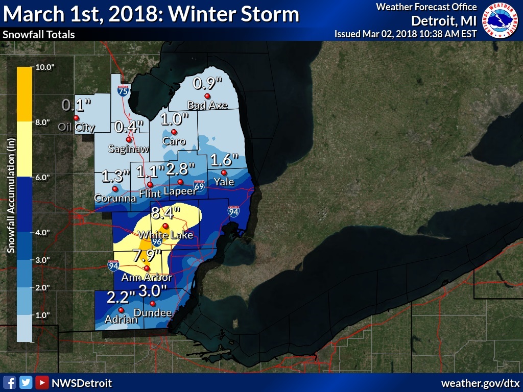 |
| Thursday, March 1, 2018 Total Snowfall Amounts |
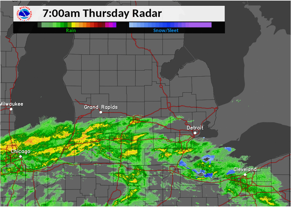
Radar:
Thursday's radar loop starting at 7 PM and lasting through midnight:
Note: Although the radar looks like most of the precipitation fell as rain, it started out as all rain then transitioned to all snow by the early afternoon.
 |
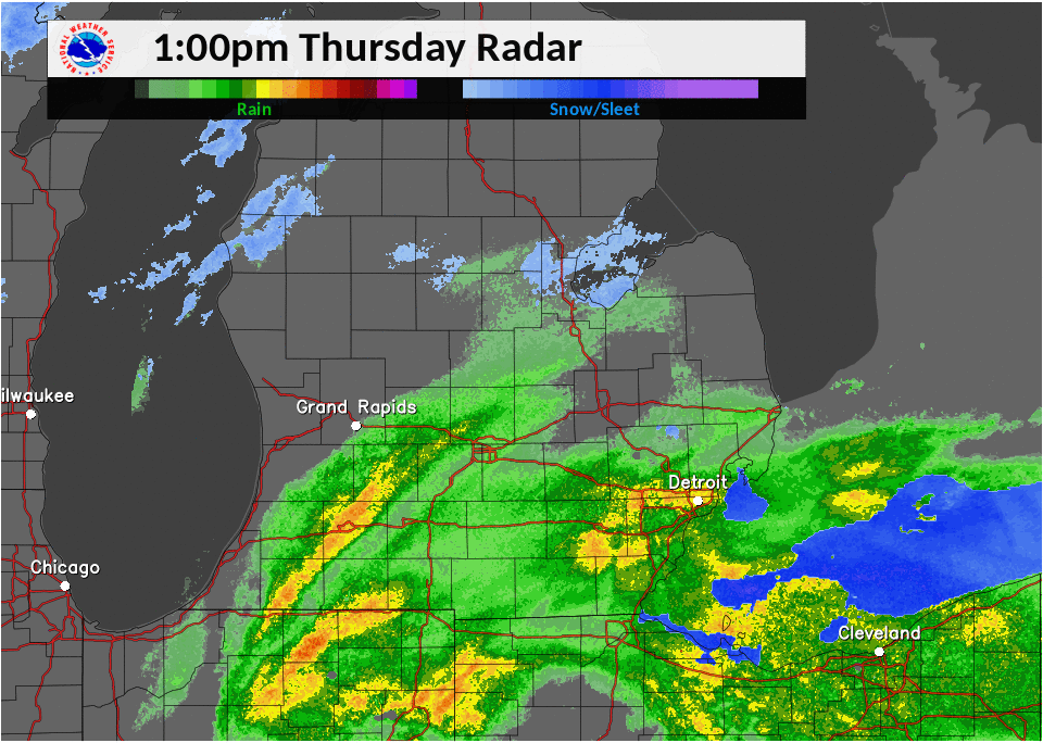 |
| 7 AM - 1 PM Radar Loop | 1 PM - 7 PM Radar Loop |
Storm Reports
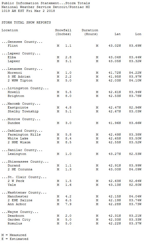
Note: This is a general overview of the event. More local storm reports can be found by visiting the link below. We appreciate all the reports we receive, even if a report is not listed, we still keep track of all the reports we get.
Preliminary snowfall reports can be found here.
All storm reports from the event can be found on the Iowa Environmental Mesonet (IEM) here.
 |
|
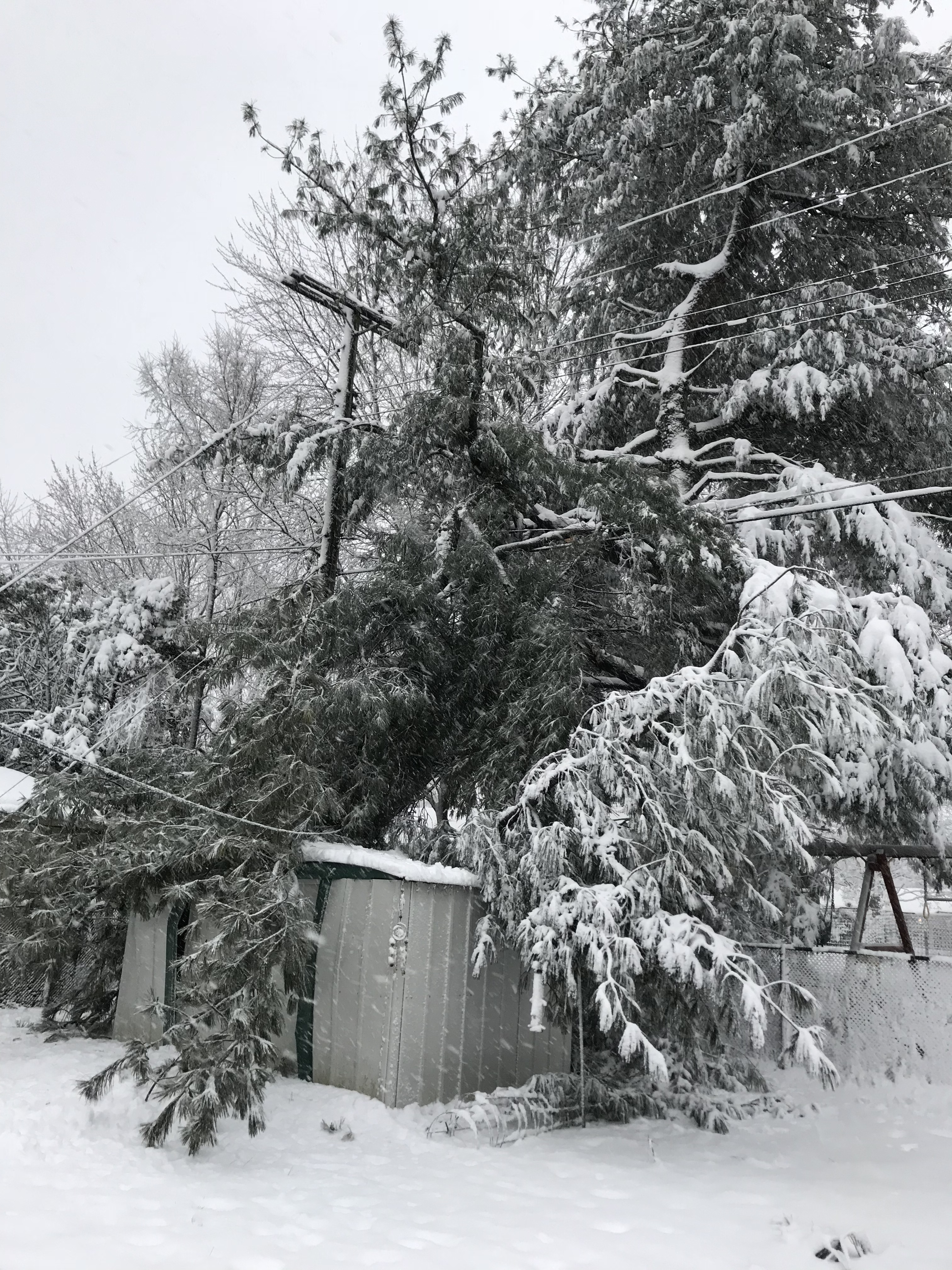
Large tree branch down in Walled Lake due to heavy snow. (Photo courtesy of Kayla Terrasi) |
 |
Media use of NWS Web News Stories is encouraged! Please acknowledge the NWS as the source of any news information accessed from this site. |
|

