2017 SUMMER CLIMATE REVIEW
Dominant Weather Pattern: An upper level ridge dominated the western half of North America with attendant warmer and drier than normal weather. In turn, an upper level trough set up over eastern North America. Its associated short wave troughs, fronts and low pressure systems brought cooler than normal weather. Southeast Michigan was heavily influenced by this trough through most of the summer. There were however a few times when this trough retreated and the ridge out west expanded into the central and eastern US, bringing warmer and more humid conditions to southeast Michigan. The most notable occurrences of this were the second and third week of June and the latter half of July.
Temperatures: After a cool start to June, the warm stretch during the middle of the month pushed the average June temperatures one to two degrees above normal. July also started on the cool side, but warmer conditions during the latter half of the month kept the monthly temps for July near average to one degree above. The upper level trough dominated for much of August, causing temperatures to average one to two degrees below average. Taking the entire summer into consideration, temperatures across Southeast Michigan averaged between 68.5 and 72 degrees, roughly near average to one degree above.
The image below indicates the summer departure from normal across the continental US. Note most of the central and eastern US saw temperatures average within a couple degrees of normal while the western US experienced above normal temperatures.
The following image denotes the average temperature for this summer across the Midwest. The average comprises both daytime highs and nighttime mins.
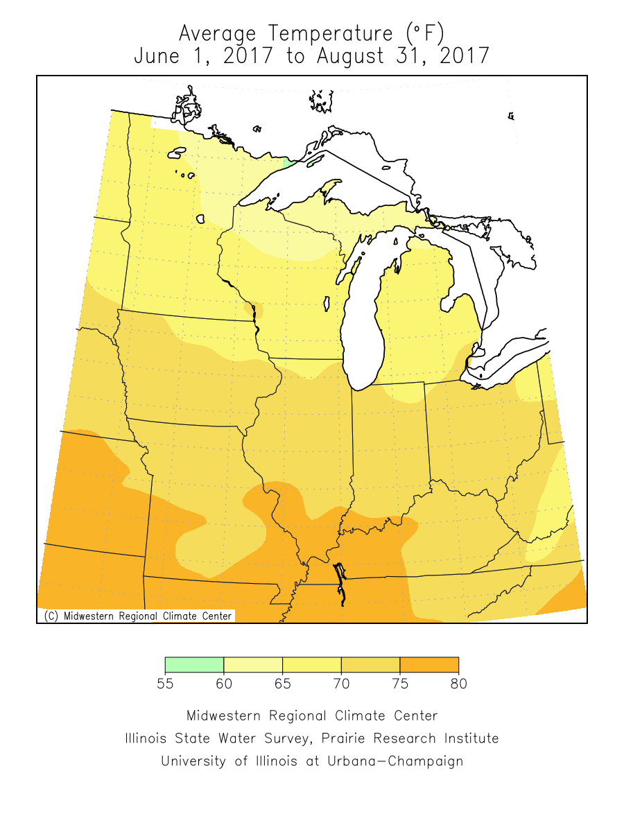
Although temperatures averaged slightly above normal this past summer, the number of days in which high temperatures reached or exceeded 90 degrees was actually low. Detroit only had 4 days, three of which occurred in June. Flint recorded three days, all in June, while Saginaw had two, also in June. The table below gives some additional temperature statistics for the three Southeast Michigan climate sites.
|
City |
Highest Temp (Date) |
Lowest Temp (Date) |
|
Detroit |
92 (June 12th and 13th) |
51 (June 1st, 8th, 28th) |
|
Flint |
91 (June 12th and 22nd) |
43 (August 25th) |
|
Saginaw |
92 (June 12th) |
44 (June 1st) |
Precipitation: The month of June ended up being extremely wet across the Saginaw Valley and thumb region where thunderstorm clusters developed along a persistent frontal boundary. In fact, Saginaw (measured at MBS airport in Freeland) recorded 10.76 inches of rain during the month of June. This made it the wettest June on record and second wettest month ever (behind September 1986). The heaviest rainfall occurred on June 22nd to 23rd. Four to eight inches of rain fell from Bay City through Midland and over to Mount Pleasant. This led to extensive flooding across this region and caused the Tittibawassee and Chippewa Rivers to crest at record levels. Meanwhile, rainfall was much less farther south (actually a little below normal across Detroit). Rainfall throughout the rest of the summer was more typical of summertime rains in Michigan. Frequent frontal boundaries brought periods of showers and thunderstorms, some of which did produce some locally higher rainfall amounts. As is often the case with summertime thunderstorms, several locations did miss out on the heavier convection, leading to localized dry conditions. Several locales, generally along/south of the I-69 corridor, experienced a period of abnormally dry conditions, especially during mid to late summer.
The image below shows the percent of average rainfall for this past summer across the continental US. Note most of Southeast Michigan had around normal rainfall, with lower than normal over the south and higher than normal across the Saginaw Valley and thumb. Also note the impact of Hurricane Harvey along the Texas Gulf Coast.
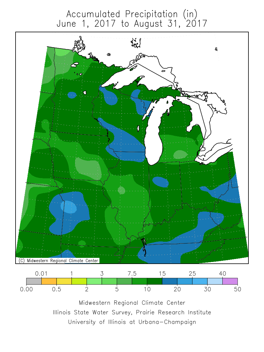
The next image gives the total summer rainfall in inches which occurred across the Midwest. Average rainfall across Southeast Michigan in the summer is between nine and ten inches.
The table below gives the rainfall totals (in inches) and departure from normal for the three Southeast Michigan climate sites.
|
City |
June (Departure) |
July (Departure) |
August (Departure) |
Summer Total |
Summer Departure |
|
Detroit |
2.02 (-1.5) |
2.44 (-0.93) |
3.91 (+0.91) |
8.37 |
-1.52 |
|
Flint |
2.66 (-0.41) |
2.72 (-0.60) |
3.88 (+0.70) |
9.26 |
-0.31 |
|
Saginaw |
10.76 (+7.78) |
1.48 (-1.10) |
2.28 (-1.03) |
14.52 |
+5.65 |
Severe Weather: Much like last summer, severe storms were rather infrequent across Southeast Michigan. Despite several frontal boundaries which tracked across the area, the ingredients for widespread severe weather, namely ample instability, were often lacking.
Aside from the Midland and Bay County flooding in June, some of the more notable severe events from this past summer include:
June 17th; 60+ MPH winds from thunderstorms affected portions of Saginaw and Sanilac Counties, downing several trees.
June 22nd; thunderstorm winds blew several trees down across Monroe County.
July 6th; a cluster of thunderstorms produce some locally strong wind gusts across portions of Genesee and Lapeer Counties, resulting in a few trees down.
July 7th; thunderstorms produced a few localized areas of large hail and damaging winds across portions of the Flint and Detroit areas.
July 23rd; thunderstorms intensified over Saginaw Bay and produced strong winds as they moved onshore across western Huron County, causing numerous trees to be blown down.
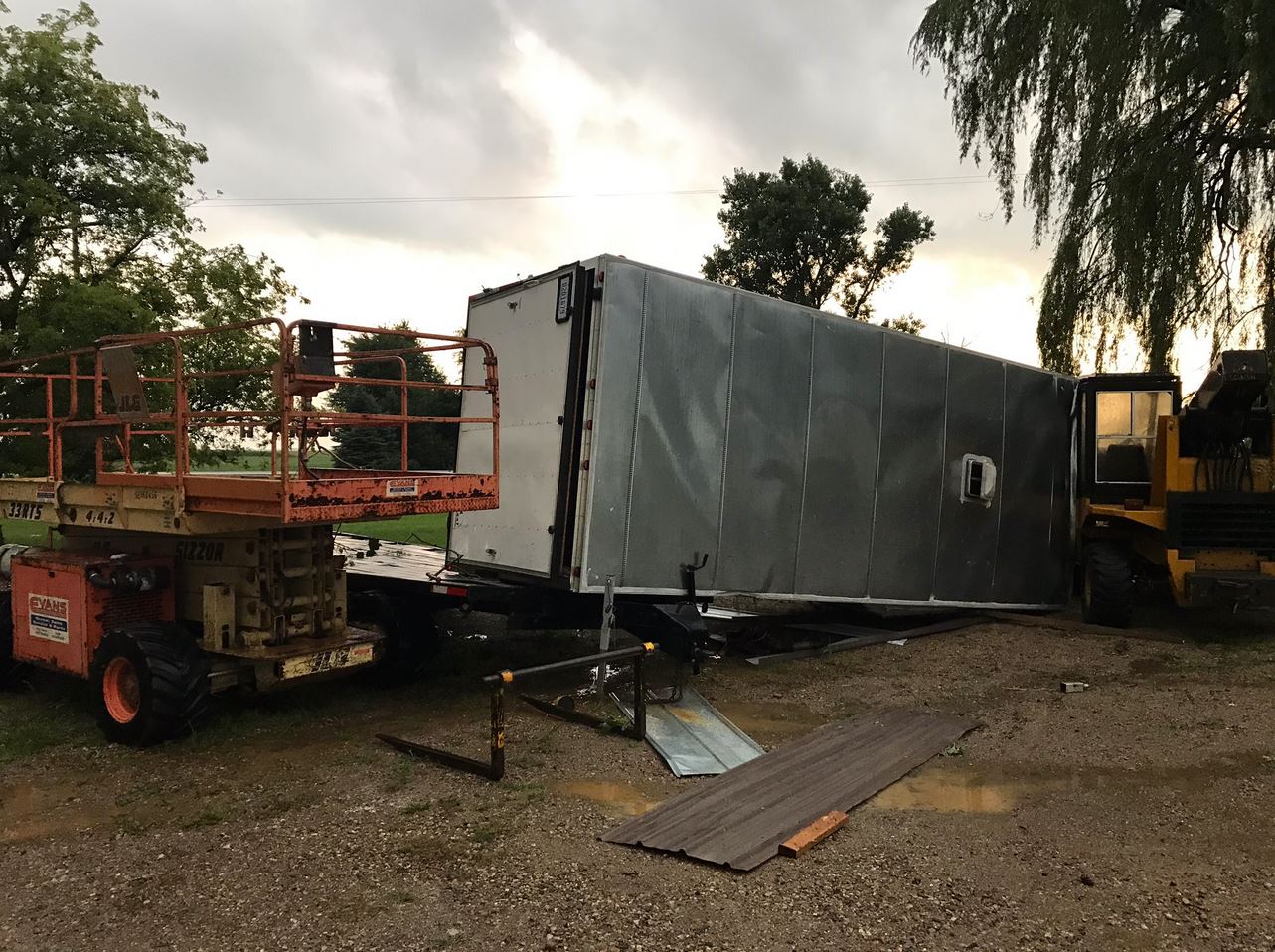
Only one tornado occurred in Southeast Michigan this past summer. In fact, as of September 17th, this has been the only tornado thus far the entire year. This occurred August 17th near Kingston in Tuscola County. Below are the details from the NWS storm survey. This is followed by a couple pictures of the damage.