703 PM EDT Wed Jul 22 2026
.AVIATION...
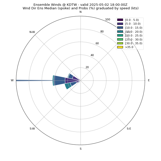
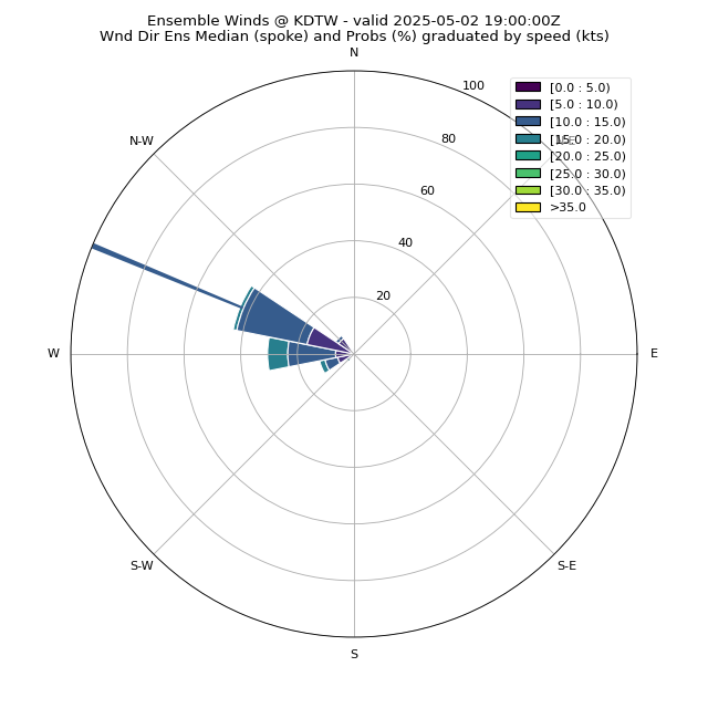
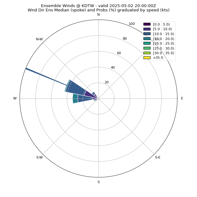
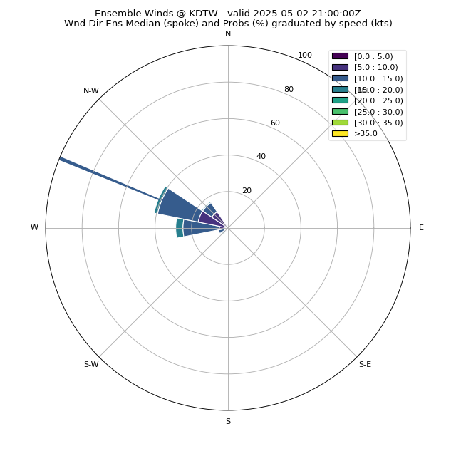
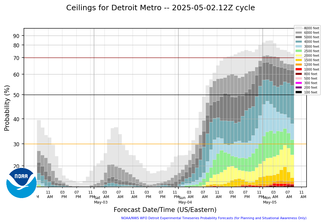
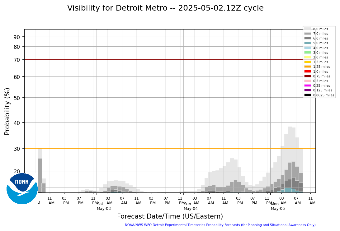
A broad area of Midwest high pressure builds into southern Lower Mi
and the Ohio valley tonight and Thursday. It provides ideal aviation
conditions as high based cumulus gradually dissipates this evening
leaving clear sky and light wind late tonight through Thursday
morning. A fair weather cumulus field returns Thursday afternoon but
with less coverage compared to this afternoon. These clouds
dissipate in favor of clear sky again for Thursday evening.
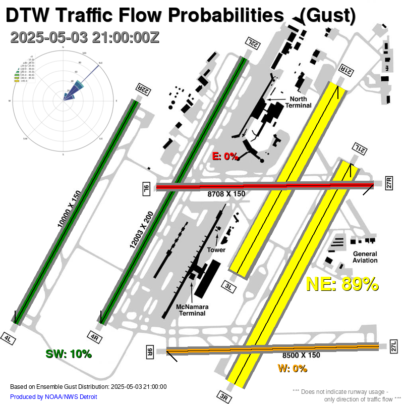
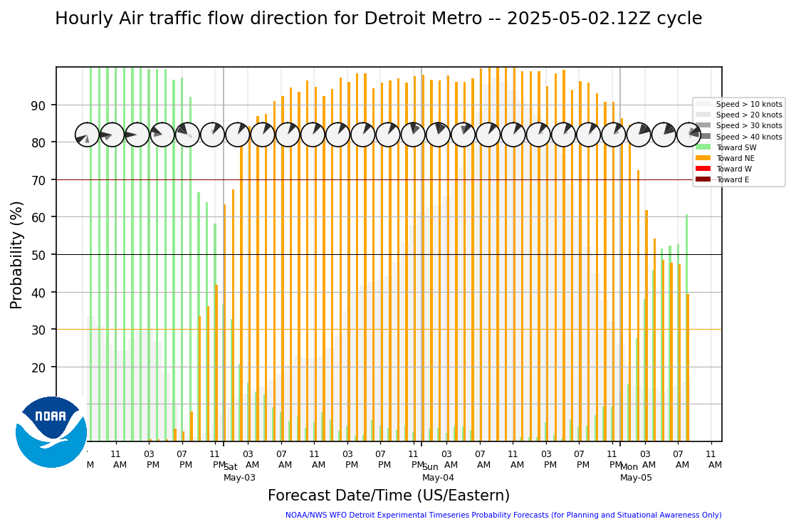
D21/DTW Convection...No thunderstorms forecast tonight through
Thursday.
.DTW THRESHOLD PROBABILITIES...
* None.
570 FTUS43 KDTX 230301 AAA TAFDTW TAF AMD KDTW 230301Z 2303/2406 33005KT P6SM SKC FM231600 30008KT P6SM SCT050 FM232300 24005KT P6SM SCT080=

f01
|
f02
|
f03
|
f04
|
f05
|
f06
|
f07
|
f08
|
f09
|
f10
|
f11
|
f12
|
f13
|
f14
|
f15
|
f16
|
f17
|
f18
|
f24
|
f27
|
f30
|
f33
|
f36
|
f01
|
f02
|
f03
|
f04
|
f05
|
f06
|
f07
|
f08
|
f09
|
f10
|
f11
|
f12
|
f13
|
f14
|
f15
|
f16
|
f17
|
f18
|
f24
|
f27
|
f30
|
f33
|
f36
|
f01
|
f02
|
f03
|
f04
|
f05
|
f06
|
f07
|
f08
|
f09
|
f10
|
f11
|
f12
|
f13
|
f14
|
f15
|
f16
|
f17
|
f18
|
f24
|
f27
|
f30
|
f33
|
f36
|
f01
|
f02
|
f03
|
f04
|
f05
|
f06
|
f07
|
f08
|
f09
|
f10
|
f11
|
f12
|
f13
|
f14
|
f15
|
f16
|
f17
|
f18
|
f24
|
f27
|
f30
|
f33
|
f36
|
Ceiling Guidance at DTW |
Visibility Guidance at DTW |
 |
 |
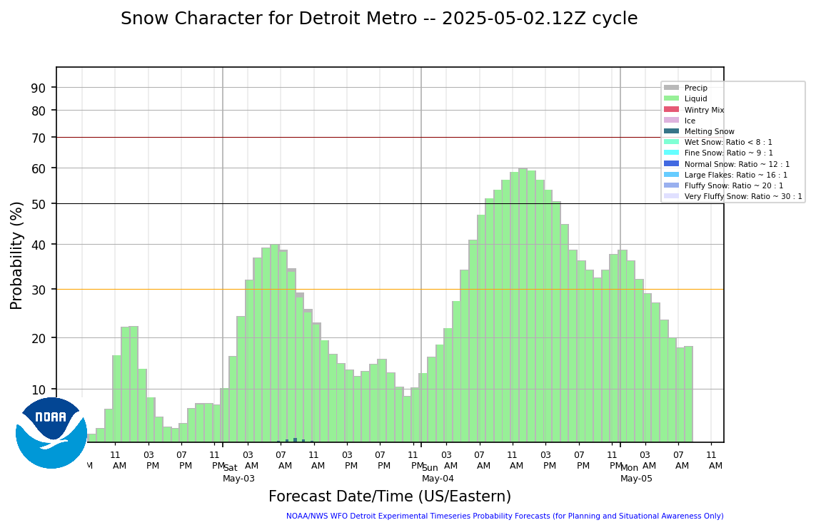
Hourly Snow Rate at DTW |
3 Hourly (centered running total) Snow Rate at DTW |
 |
 |