Overview
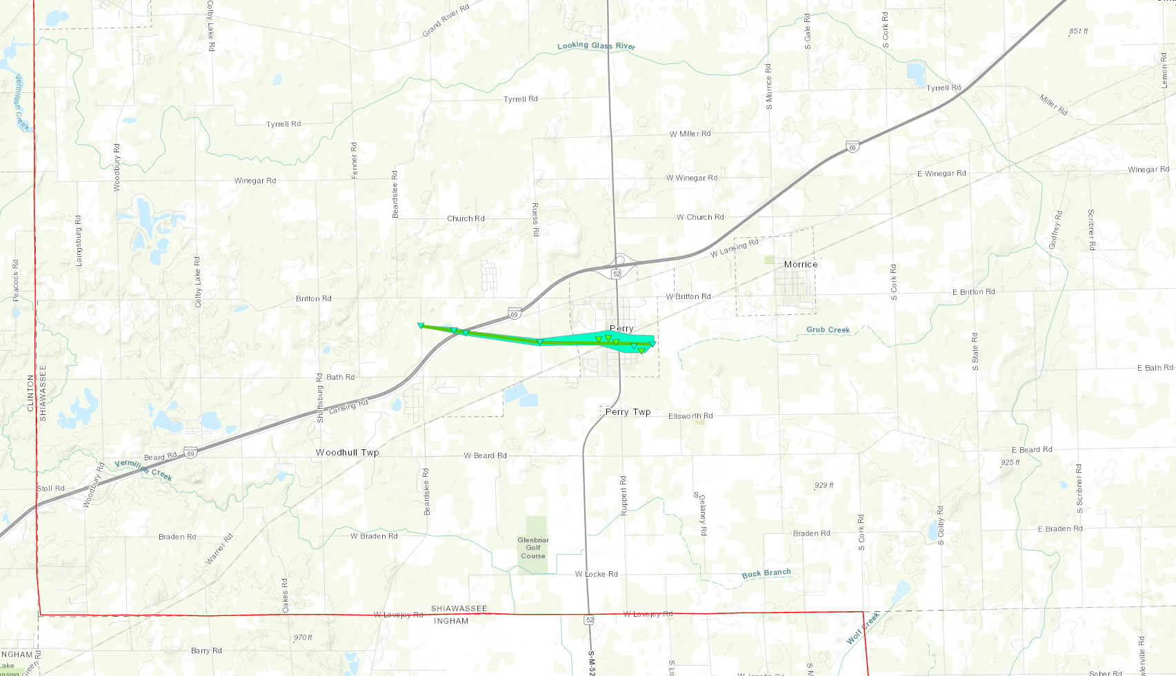
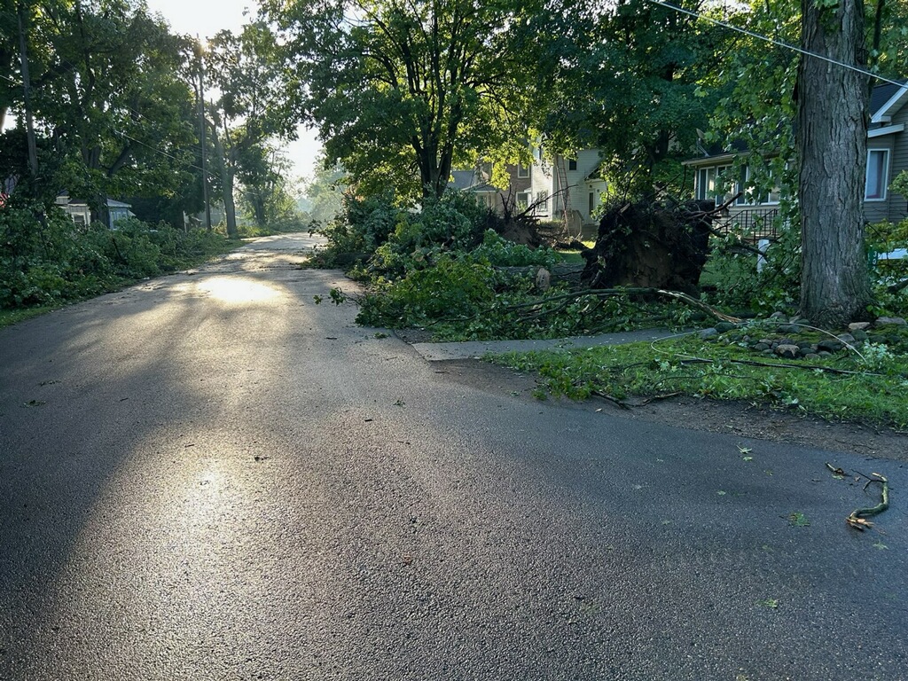
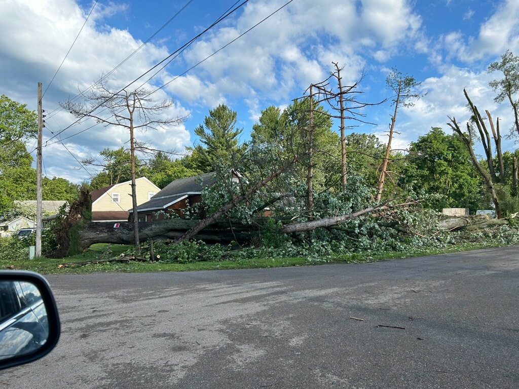
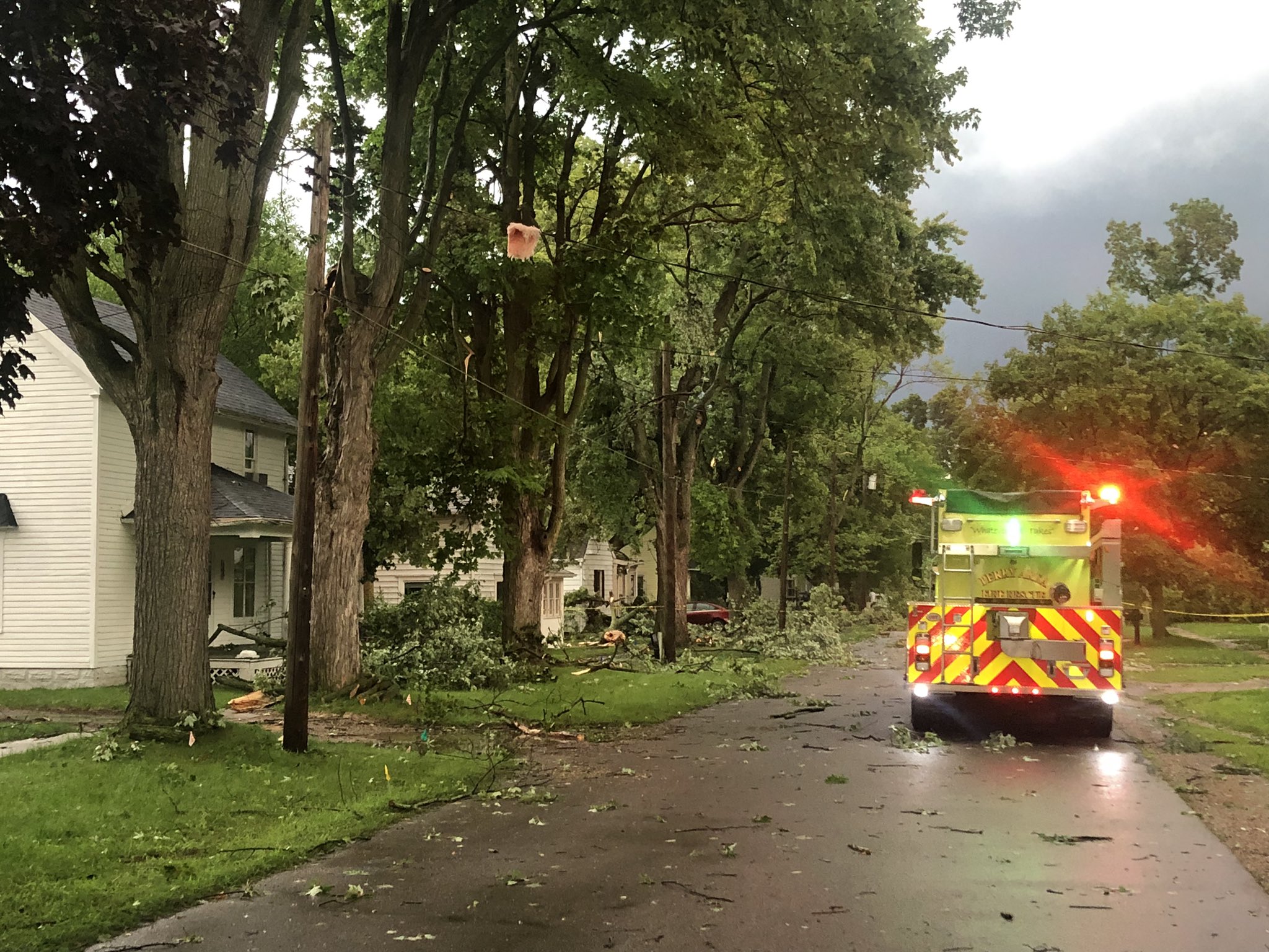
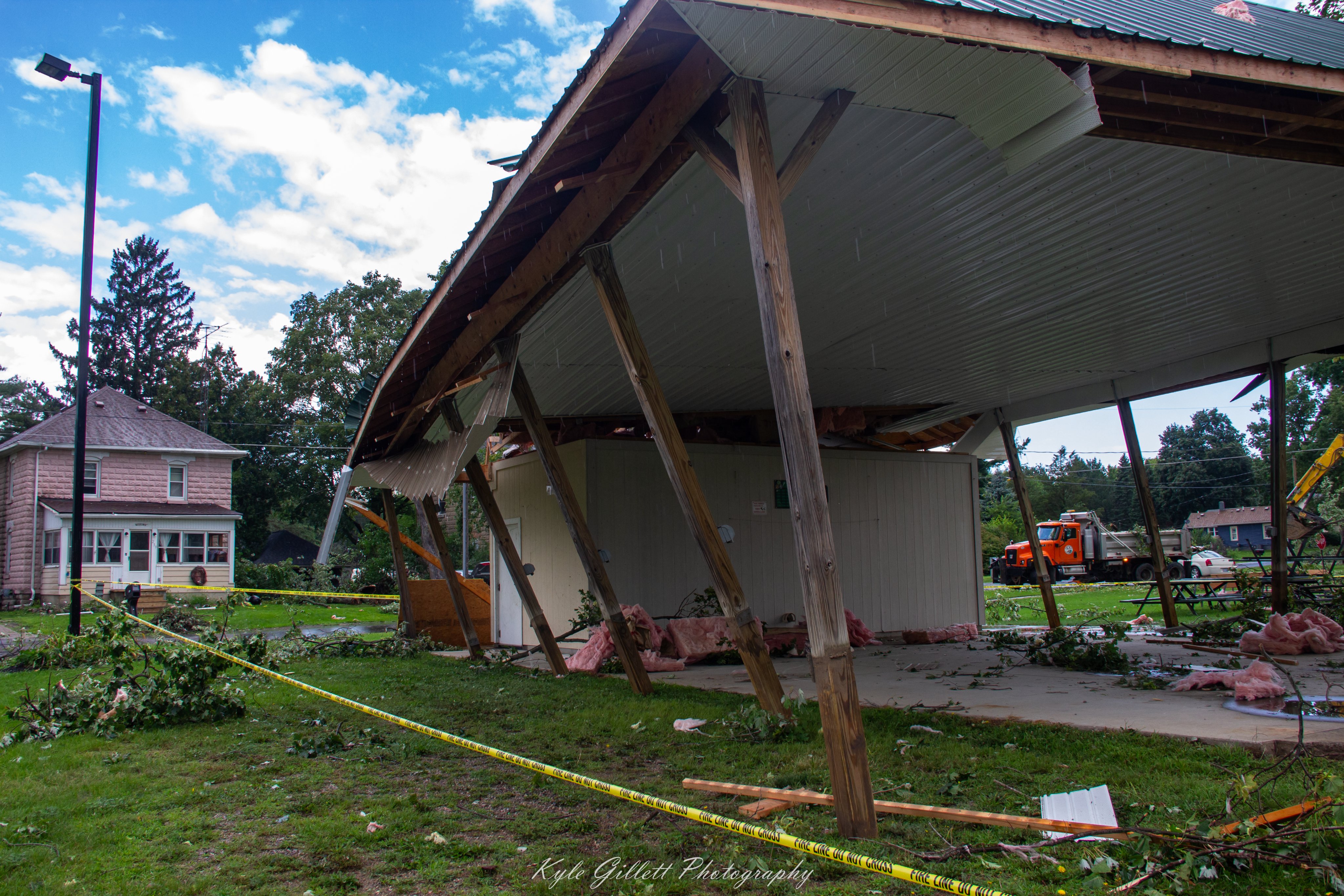
Numerous showers and thunderstorms filtered in across portions of Southeast Michigan through the evening of August 11, 2023. The strongest storms were found within the vicinity of or along a warm front, which produced sporadic reports of hail up to an inch and some isolated damaging wind gusts. Prolonged heavy rainfall also led to flooding within Flint which led to multiple road closures. The most significant damage came from a supercell over Perry, MI, which resulted in the production of an EF-1 tornado with maximum wind gusts up to 95 mph. This tornado was on the ground for 12 minutes and started just west of Perry, before moving into the city. Uprooted and sheared trees, damage to outbuildings, and some siding/shingle damage to residential builds were observed. Downed trees also landed on some residential houses and vehicles, resulting in further damage.
Tornadoes:
|
Tornado - Perry, MI
Track Map

|
||||||||||||||||
The Enhanced Fujita (EF) Scale classifies tornadoes into the following categories:
| EF0 Weak 65-85 mph |
EF1 Moderate 86-110 mph |
EF2 Significant 111-135 mph |
EF3 Severe 136-165 mph |
EF4 Extreme 166-200 mph |
EF5 Catastrophic 200+ mph |
 |
|||||
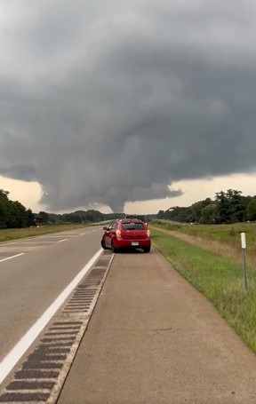
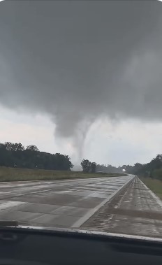
Photos
 |
 |
 |
|
|
Tornado near Perry Credit: Bill Bouwman |
Tornado near Perry Credit: Bill Bouwman |
Tornado near Perry Credit: David Ross |
|
 |
 |
 |
|
|
Tornado damage in Perry Credit: NWS |
Tornado damage in Perry Credit: NWS |
Tornado Damage in Perry Credit: Joel Fritsma |
|
 |
 |
 |
|
|
Tornado damage in Perry Credit: Kyle Gillett |
Tornado damage in Perry Credit: Kyle Gillett |
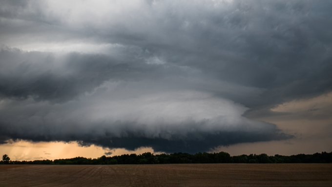
Wall Cloud approaching Byron Credit: Zachary Henn |
Radar
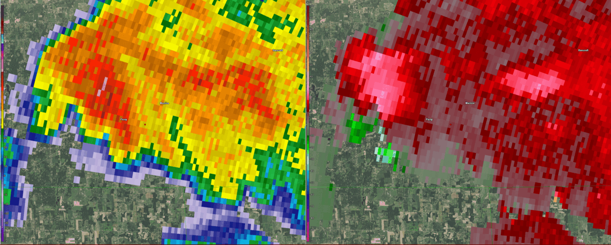
Figure 1. KDTX 0.5 degree reflectivity & storm relative velocity between 2347 and 0006 UTC starting Aug 11 2023, centered on Perry, MI. Radar imagery courtesy of GR2Analyst.
Environment
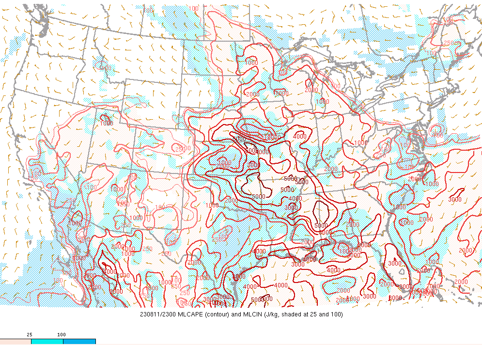
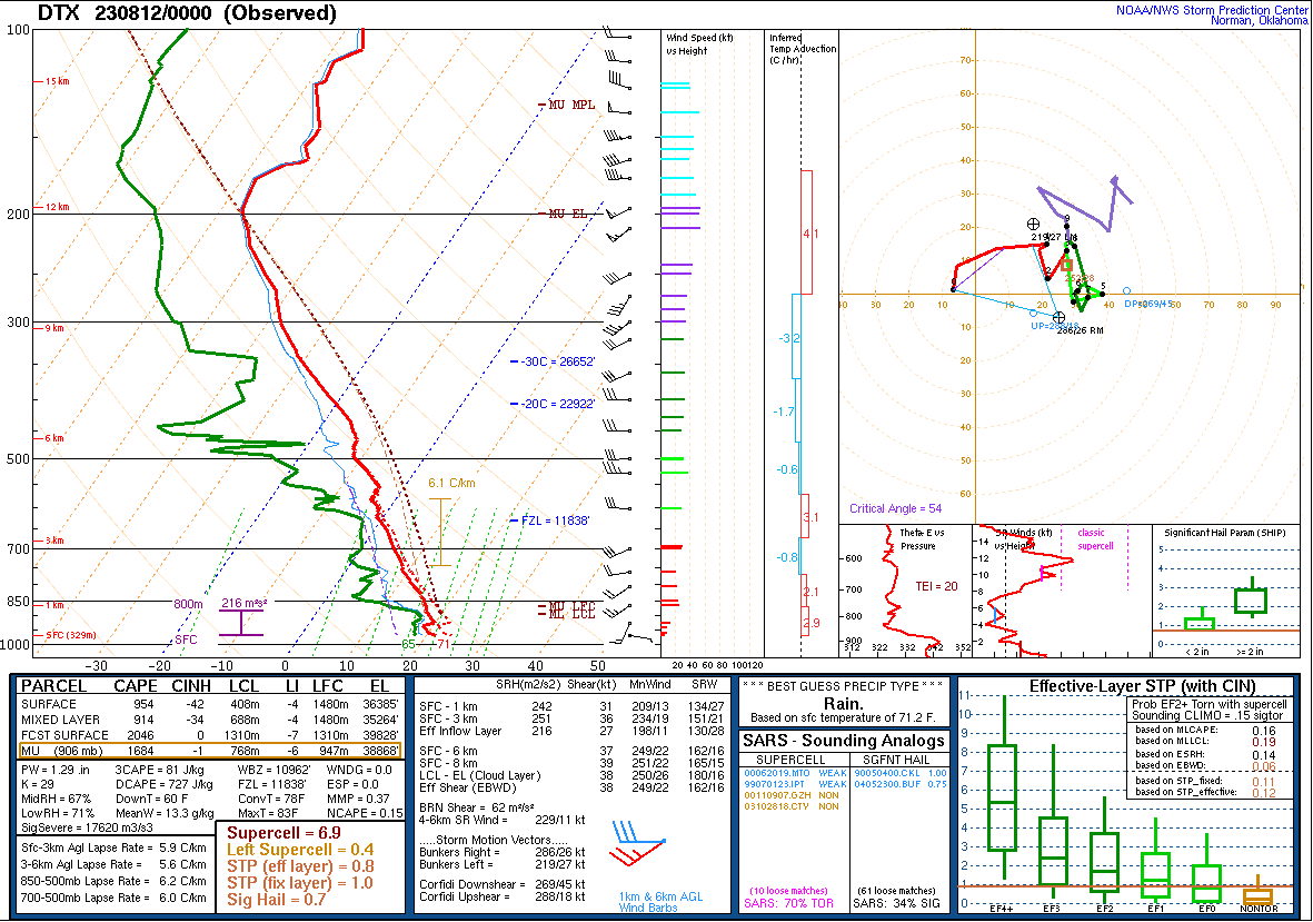
Ongoing convection derived within the lake shadow of Lake Michigan progressed eastward and capitilized on the boost of instability that concurrently progressed northeastward through the evening behind a warm front, with the frontal boundary eventually stalling out over SE MI (Figure 1). This frontal boundary delineated a sharp contrast of instability as dew points rose into the mid to upper 60s, correlating to MLCAPE values to or in excess of 1,000 J/kg along and south of the front (Figure 2). The Storm Prediction Center did upgrade portions of SE MI to a slight risk for severe weather in the early afternoon (Figure 3), highlighting the risk for large hail, damaging wind gusts, and/or a tornado. The KDTX weather balloon in White Lake MI, which was concretely within the warm sector, recorded a MLCAPE value of 914 J/kg for the 00Z launch. Other notable values were the 0-1 km shear of 31 knots, effective shear of 38 knots, and low LCL heights of 688m, all markers that can help with sustaining strong to severe storms, including tornadogenesis (Figure 4). SPC mesoanalysis also showed convergence with the DTX sounding, with 40 knots effective shear in place across central Michigan (Figure 5). The mesoanalyst 0-1 km values were slightly muted around 15 knots (Figure 6). Regardless, dynamics along the warm front aided in tornadogenesis in Perry MI, where an EF1 tornado was observed. Uprooted and sheared trees, damage to outbuildings, and some siding/shingle damage to residential builds were observed. Downed trees also landed on some residential houses and vehicles, resulting in further damage.
.png) |
 |
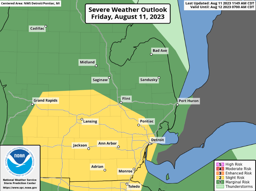 |
| Figure 1: WPC Surface Analysis, valid 2100 UTC 11 Aug 2023 | Figure 2: Mixed Layer Convective Available Potential Energy, valid 2300 UTC 11 Aug 2023 | Figure 3: SPC Day 1 Severe Weather Outlook, valid 13 UTC 11 Aug 2023 |
 |
.png) |
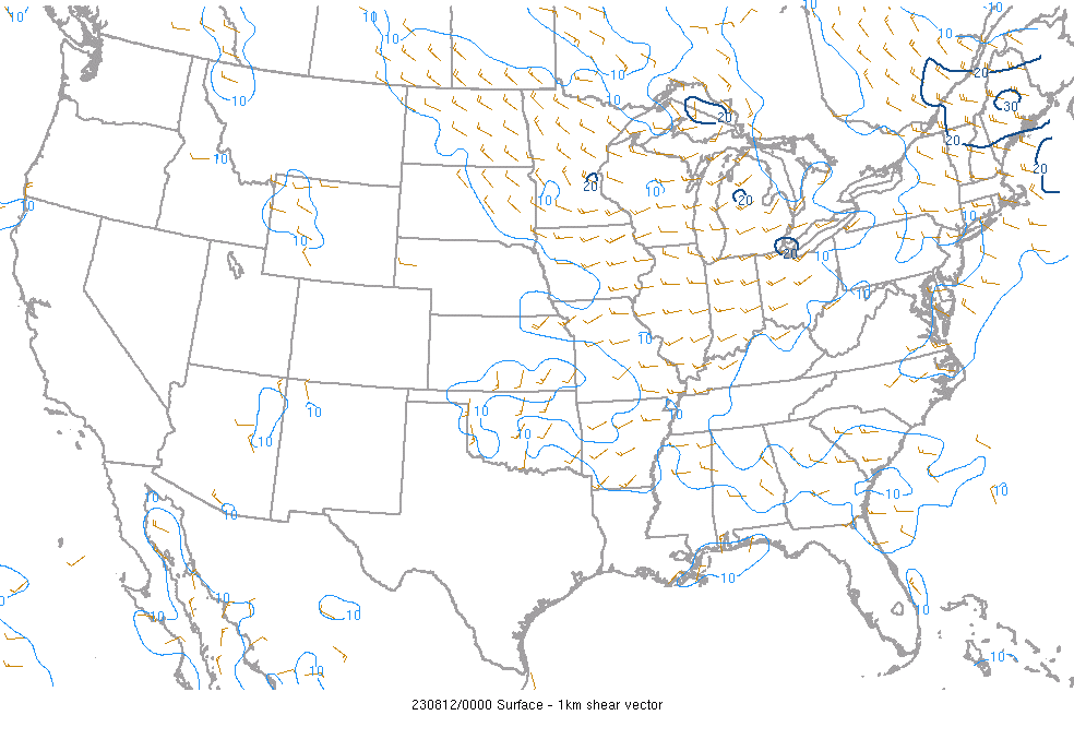 |
| Figure 4: DTX Sounding, valid 0000 UTC 12 Aug 2023 | Figure 5: Effective Bulk Shear, valid 0000 UTC 12 Aug 2023 | Figure 6: 0-1km Bulk Wind Shear, valid 0000 UTC 12 Aug 2023 |
 |
Media use of NWS Web News Stories is encouraged! Please acknowledge the NWS as the source of any news information accessed from this site. |
|