Record November Cold Wave Holds Steadfast For Well Over a Century
By: Bill Deedler, Weather Historian, NWS White Lake Mi
Nothing in
Below is the record chart for that period that contains both the record low maximums and record lows that occurred during the November cold wave which left six days of records that have not been touched since! The three degree reading on the 21st and zero on the 22nd have yet to be superseded by colder temperatures in the entire month of November. A zero (or below) record low does not appear in
.jpg)
Again, not only is the cold impressive but that both the record low maximums and the record lows have not been breached since this cold wave. The six days of record breaking cold remains intact since 1880! So what caused this bone-chilling cold so early in the season, what did the weather maps (or best representation of) look like so far back? Let’s take a look at copies of the archaic weather map records from Nov 18-23, 1880 which shows the couple of mammoth Arctic high pressure systems that affected much of the during the period.
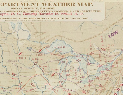
As of 7AM - Thu Nov 18th Note the first big chunk of cold dense air is well reflected by the exceptionally high pressure for November (not to mention over the southern states) in eastern Oklahoma of 30.78" /1042.MB/ (just at the bottom edge of our map). This massive Arctic high made its way south out of the Northern Plains and as a result, temperatures across much of the region were in the single digits and teens.
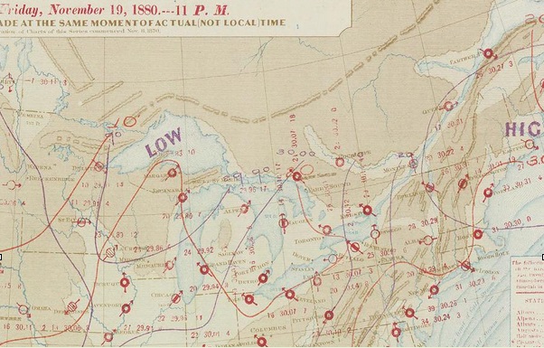
As of 11PM - Nov 19th By late Friday night, a new surge of Arctic air is beginning to show its face here as a new low pressure trough enters the Upper Midwest and Great Lakes Region. Note, temperatures haven’t had a chance to recover much from the first bitter cold blast!
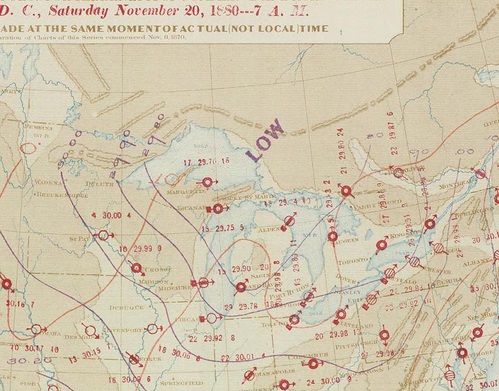
As of 11PM - Nov 20th The second surge of fresh Arctic air continues advancing across the Great Lakes and Ohio Valley as general high pressure holds over the southern states.
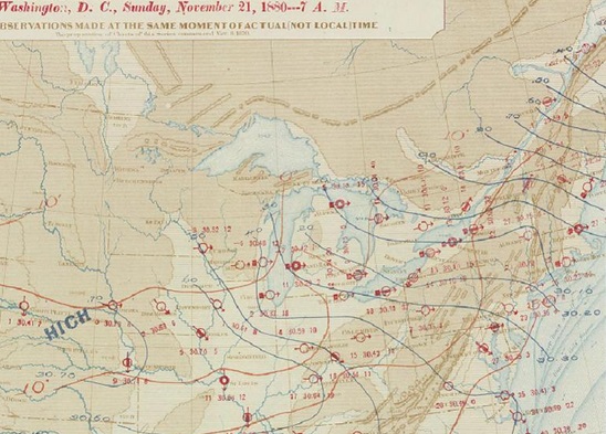
As of 11PM - Nov 21st A second, duplicate strong high pressure appears on our map, once again by way of the Northern Plains and expands south and east into into the Upper Mississippi Valley and Great Lakes. Low pressure troughing holds sway over the relatively warmer waters of the Great Lakes (estimates of water temperatures in the mid 30s to mid 40s). Temperatures have plummeted below zero already in the Upper Mississippi Valley by late Sunday night.
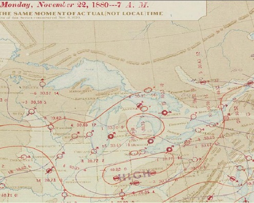
As of 11PM - Nov 22nd A huge bitter cold high pressure lies spralled across the Ohio Valley and Great Lakes with a central pressure of 30.85" /1045 MB/! The public continues to be greated by record cold as the Thanksgiving work week commenced across the nation. The 30.85" was a record high pressure at the time (and may be yet) for Cincinnati, Ohio. Besides our own, numerous other record lows were attained with the passage of these Arctic highs.
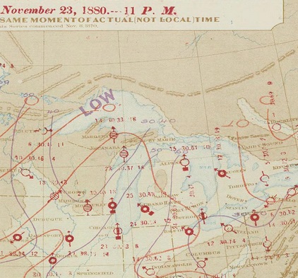
As of 11PM - Nov 23rd The large high pressure moves ever so slowly east with the central high pressure now over the mid Atlantic States.
Evidently this was not the first notable November cold snap that engulfed the region so early in the weather record days. The following was taken from the 1880 Monthly Weather Review:
"The passage of of this area was marked by minimum temperatures for the Lakes region, the Atlantic States, the
As mentioned, all the