Detroit/Pontiac, MI
Weather Forecast Office
Overview
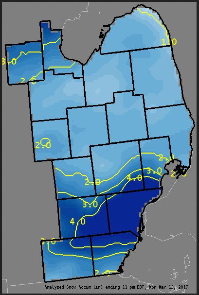
A clipper system pushed southeast across the Ohio Valley, bringing snow accumulation to all of Southeast Michigan. While most places saw between 1 - 2 inches of snow accumulation, Washtenaw, Wayne, and portions of Oakland, Macomb, Lenawee and Monroe saw enhanced accumulation, as easterly flow brought added lake-effect snowfall during the day. Snow started across the region early Monday morning and tapered off from northwest to southeast, between 6 PM and midnight. |
Media use of NWS Web News Stories is encouraged! Please acknowledge the NWS as the source of any news information accessed from this site. |
|
Weather Forecasts
Fire Weather
Snowfall Forecast
Marine Forecast
Beach Forecast
Aviation
Digital Forecast Graphics
Current Weather Conditions
Local Observations
Today's Weather History
Observed Snowfall
Regional Radar Mosaic
Past Weather Records
Climate records by month
Additional Daily Climate Data
Top 20 Lists
Breakdown by Decade
Largest Snowstorms
Season Snowfall Maps
Year To Date Plots
Severe Weather
Daily Plots
Annual Plots
Event Summaries
US Dept of Commerce
National Oceanic and Atmospheric Administration
National Weather Service
Detroit/Pontiac, MI
9200 White Lake Road
White Lake, MI 48386
248-620-9804
Comments? Questions? Please Contact Us.