Current Regional Radar
|
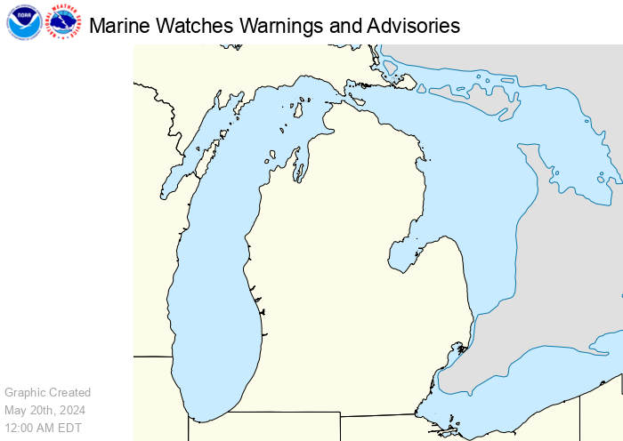
Current Hazards
|
|
|
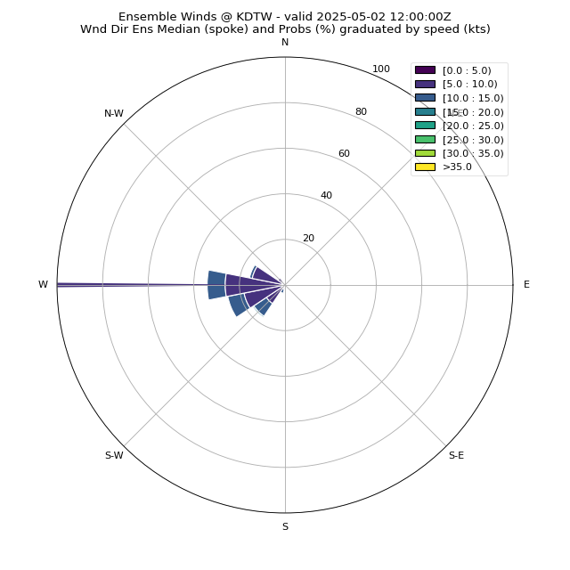
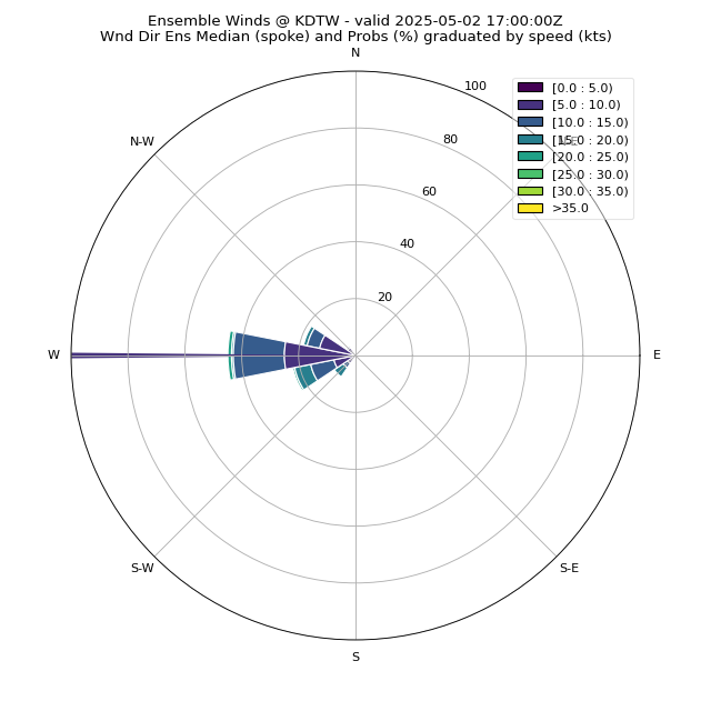
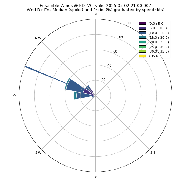
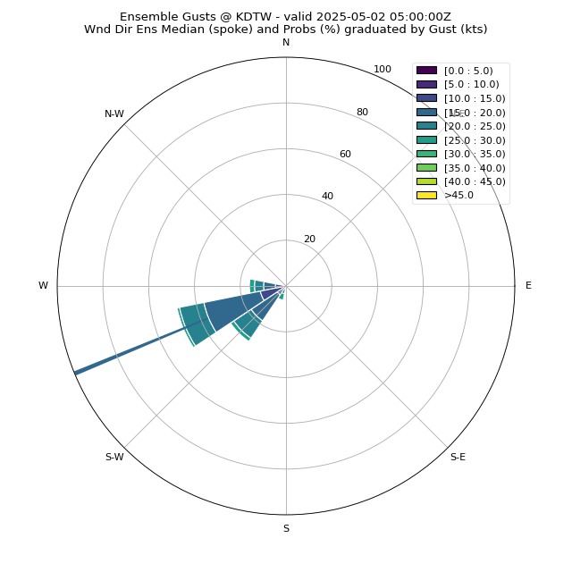
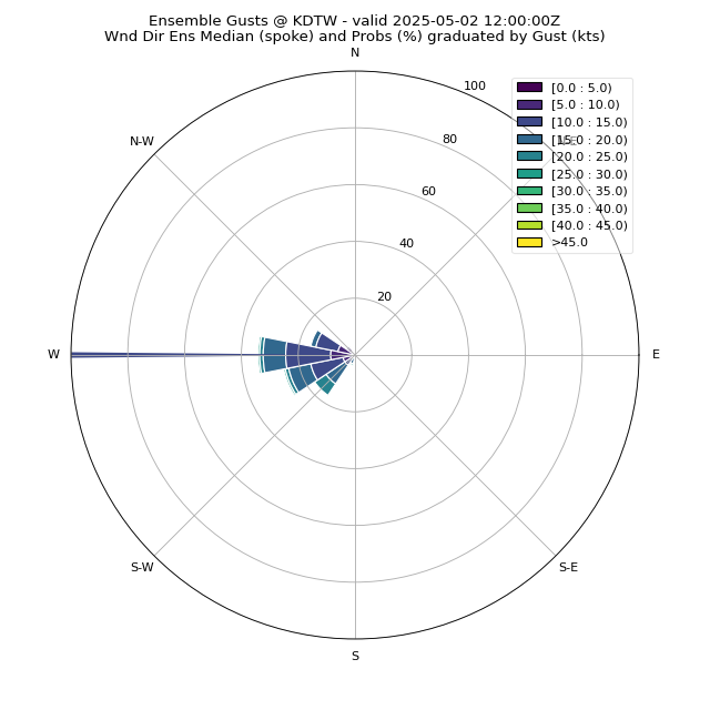
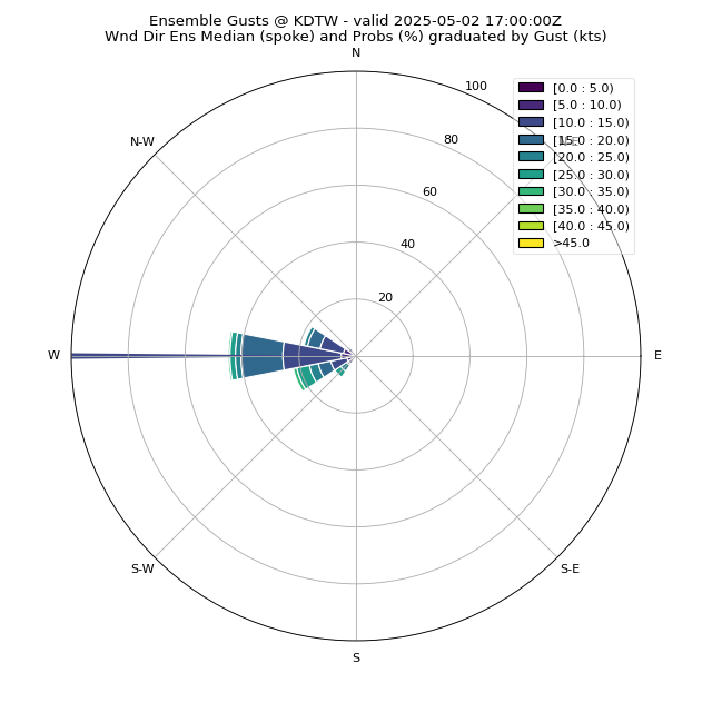
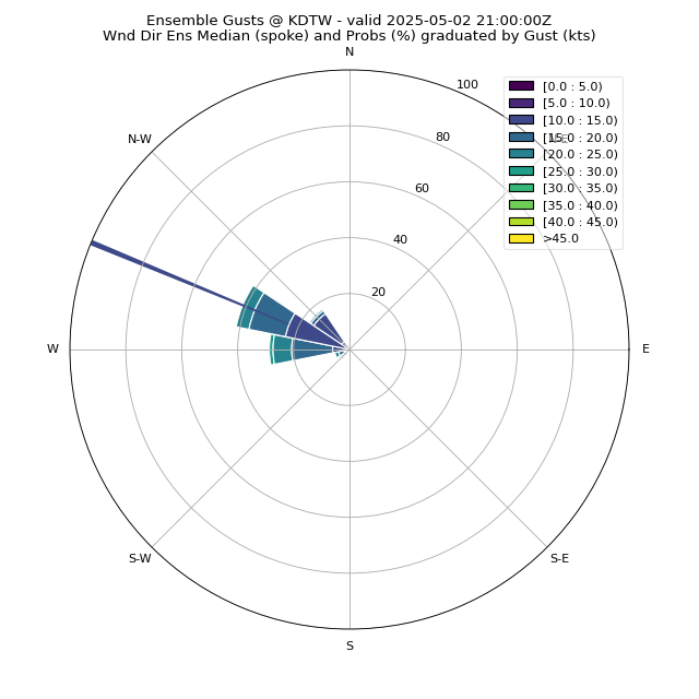
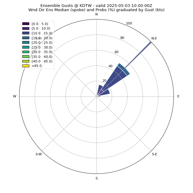
f01
|
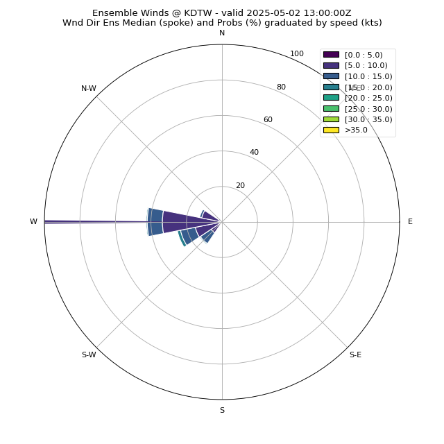
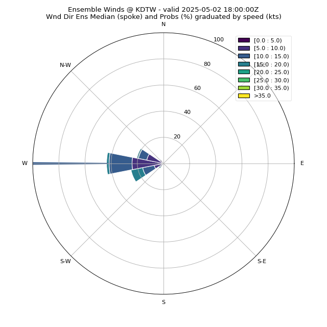
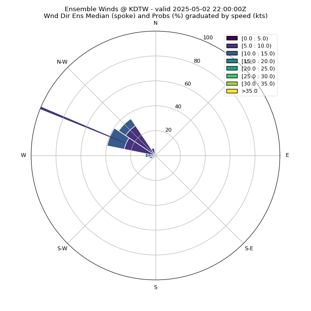
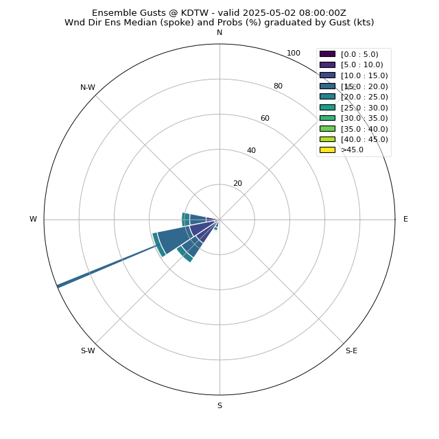
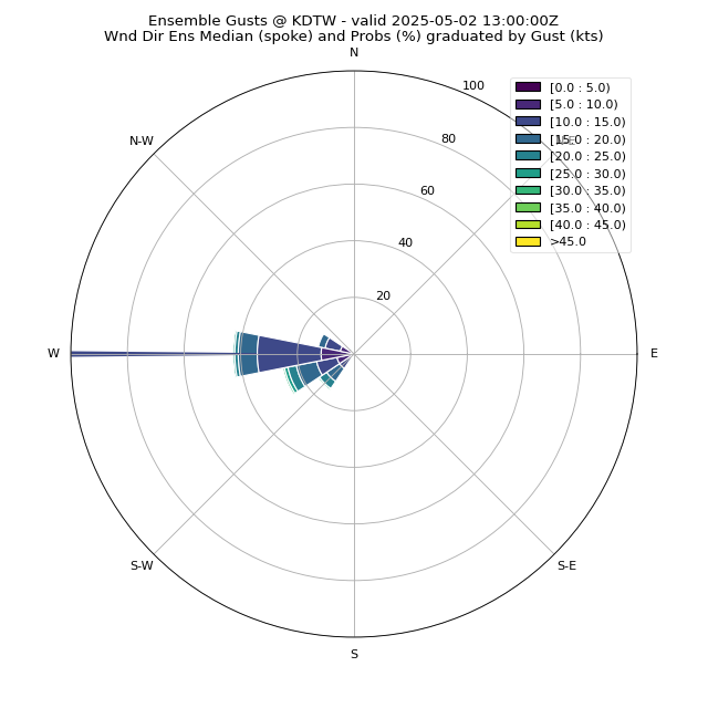
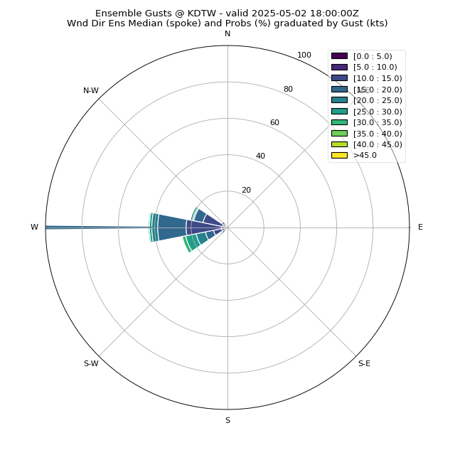
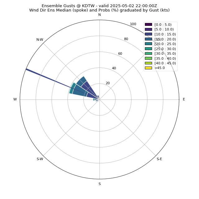
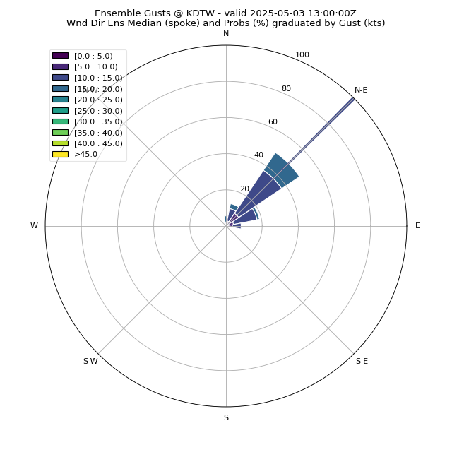
f02
|
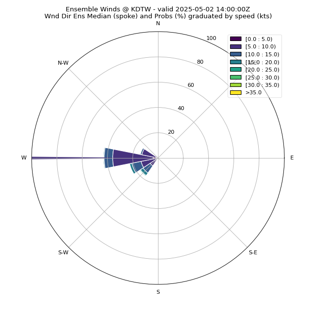
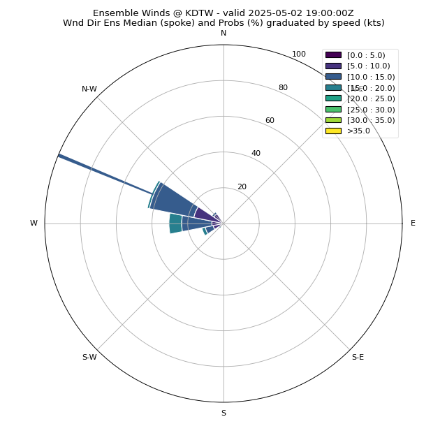
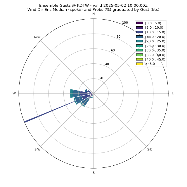
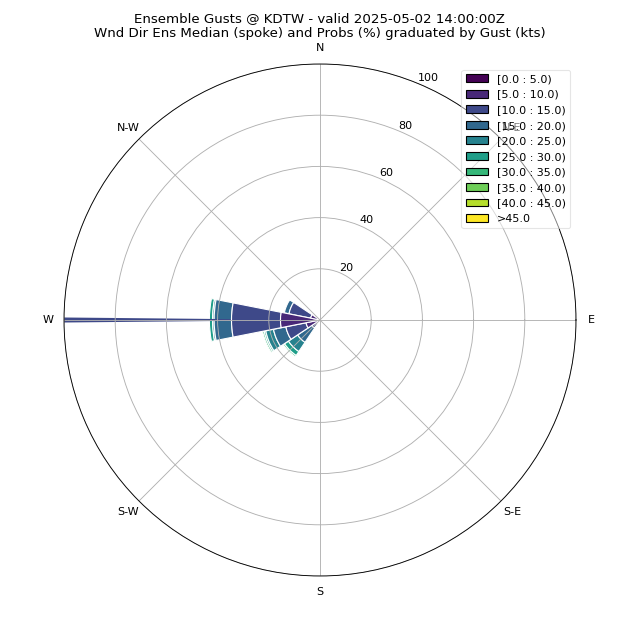
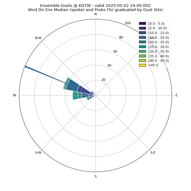
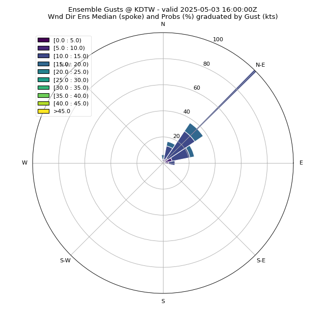
f03
|
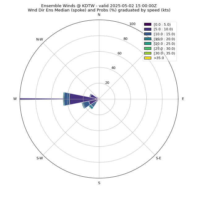
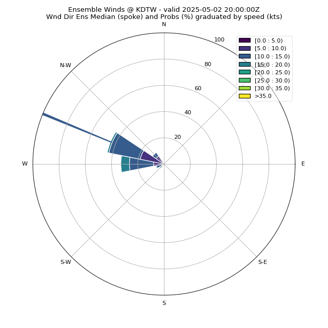
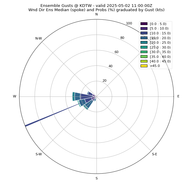
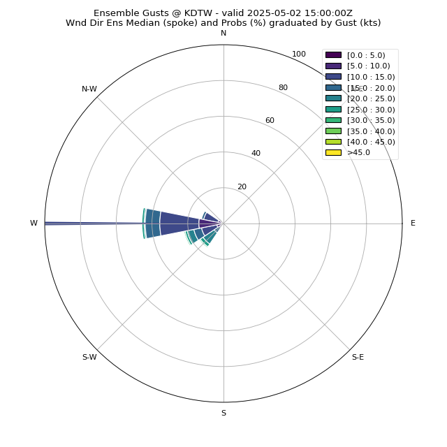
f04
|
f05
|
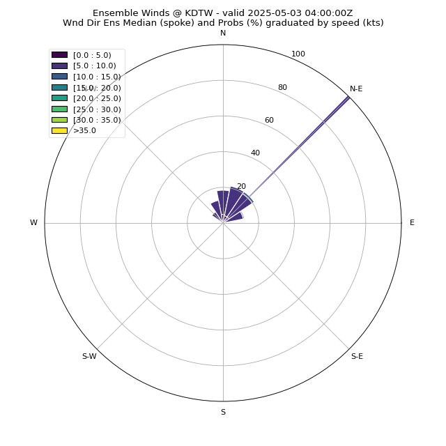
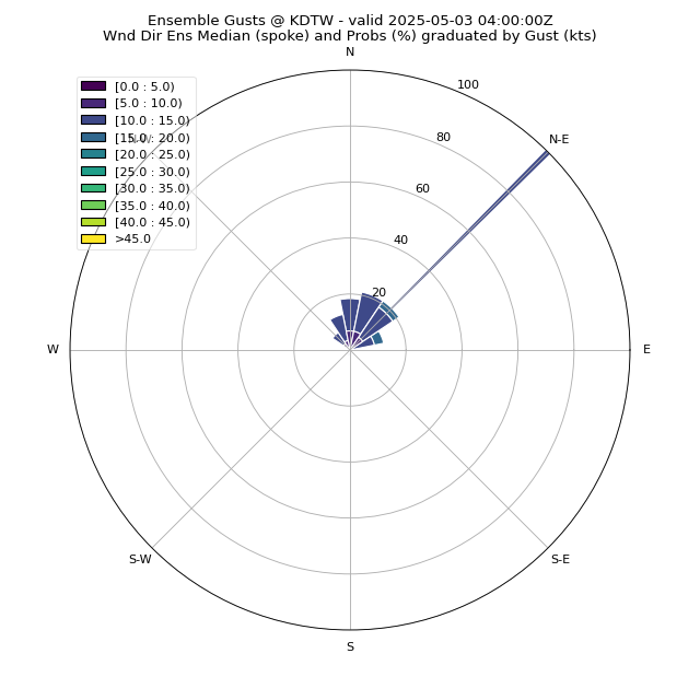
f06
|
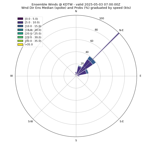
f07
|
f08
|
f09
|
f10
|
f11
|
f12
|
f13
|
f14
|
f15
|
f16
|
f17
|
f18
|
f24
|
f27
|
f30
|
f33
|
f36
|
|
|
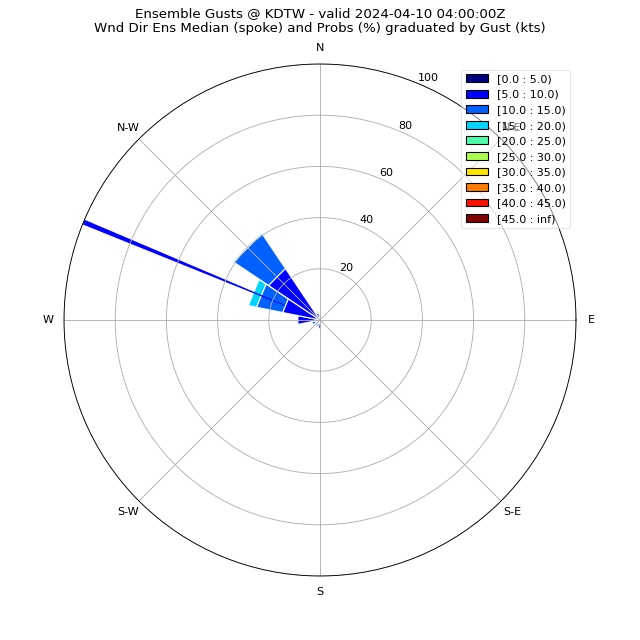
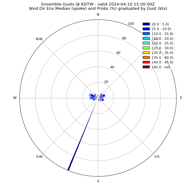
f01
|
f02
|
f03
|
f04
|
f05
|
f06
|
f07
|
f08
|
f09
|
f10
|
f11
|
f12
|
f13
|
f14
|
f15
|
f16
|
f17
|
f18
|
f24
|
f27
|
f30
|
f33
|
f36
|
(click to enlarge)
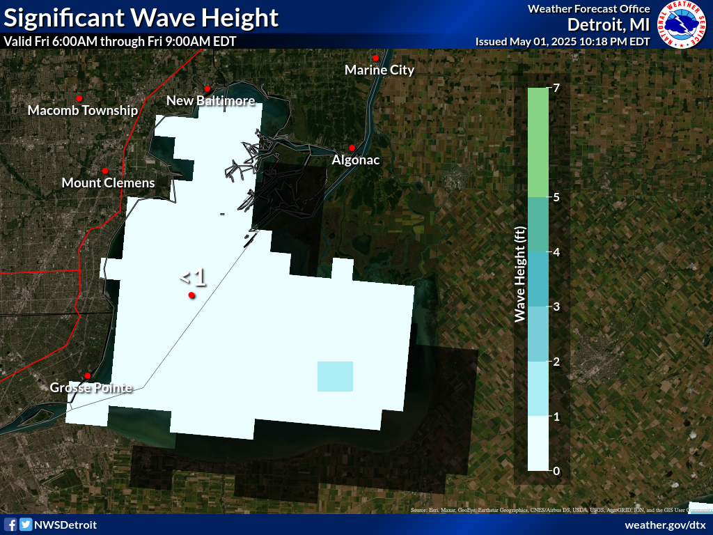
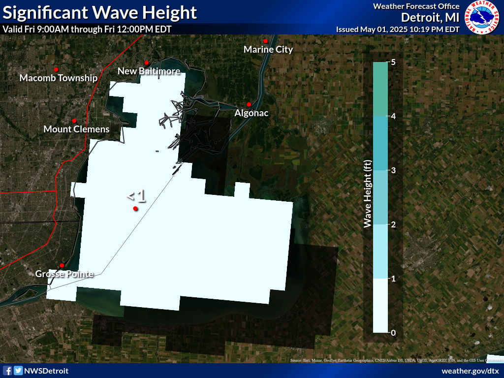
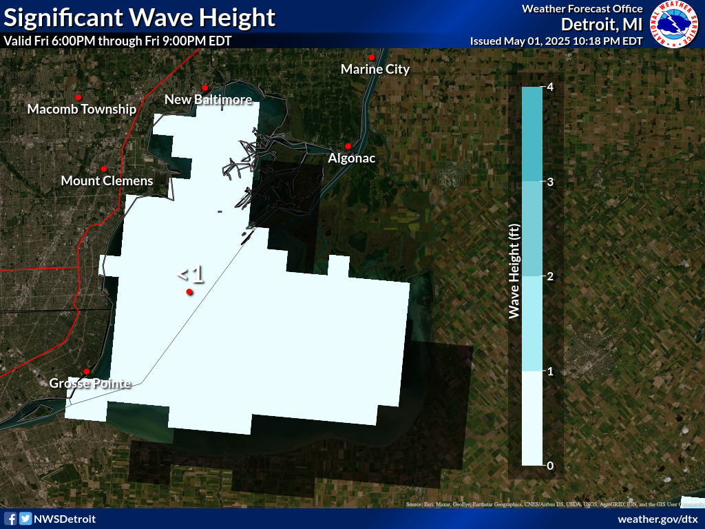
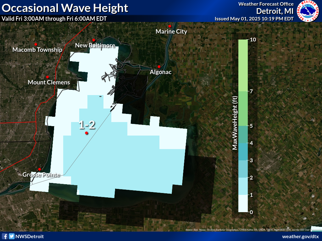
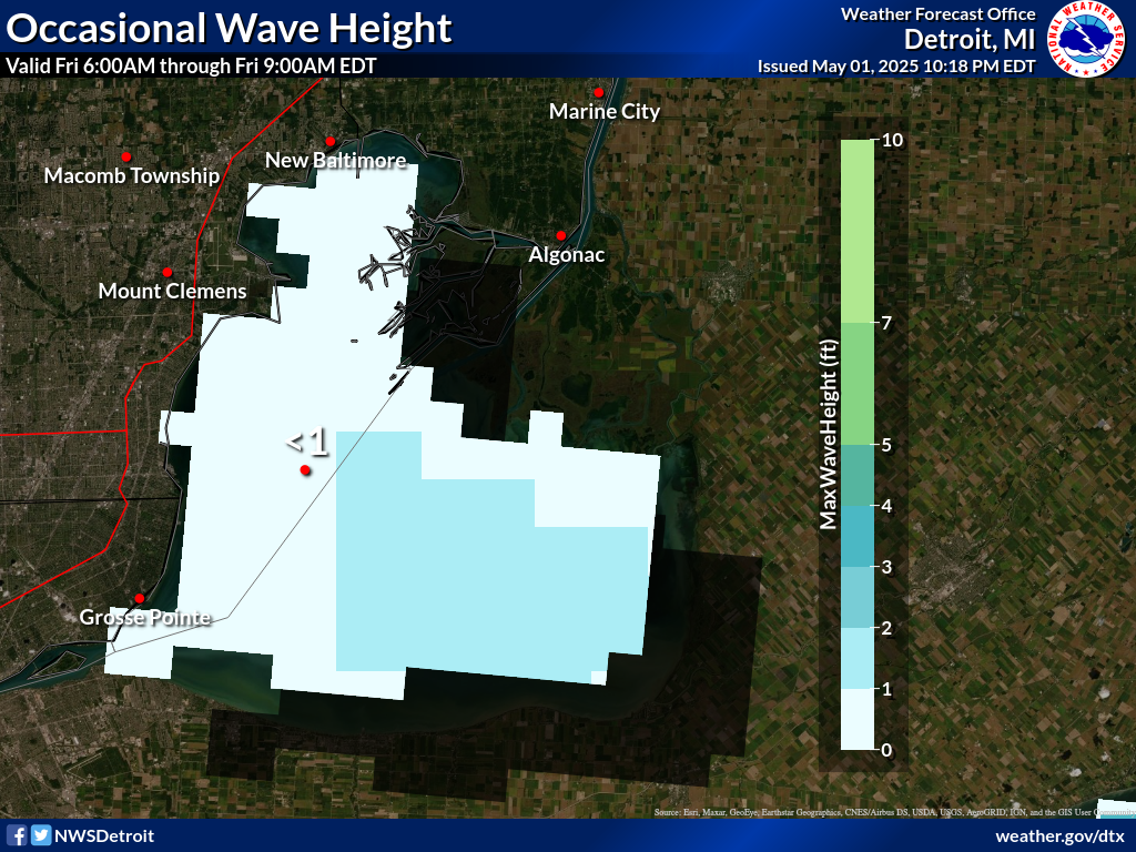
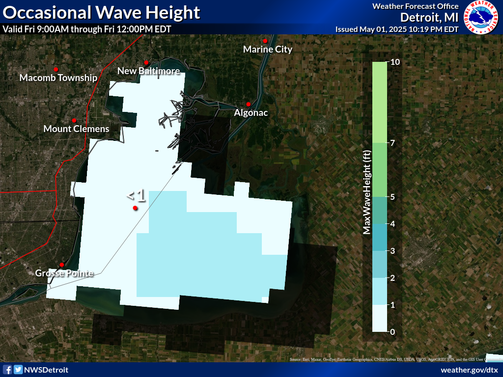
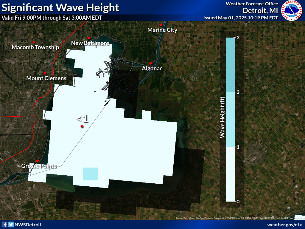
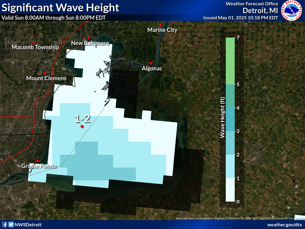
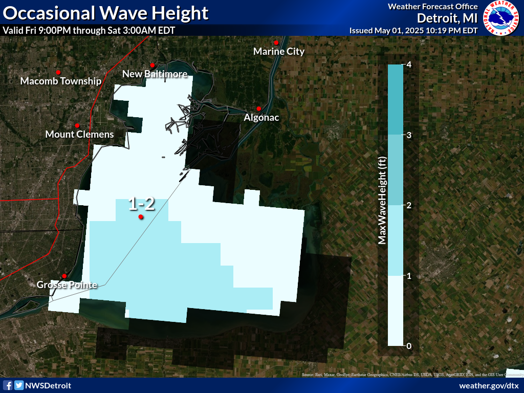
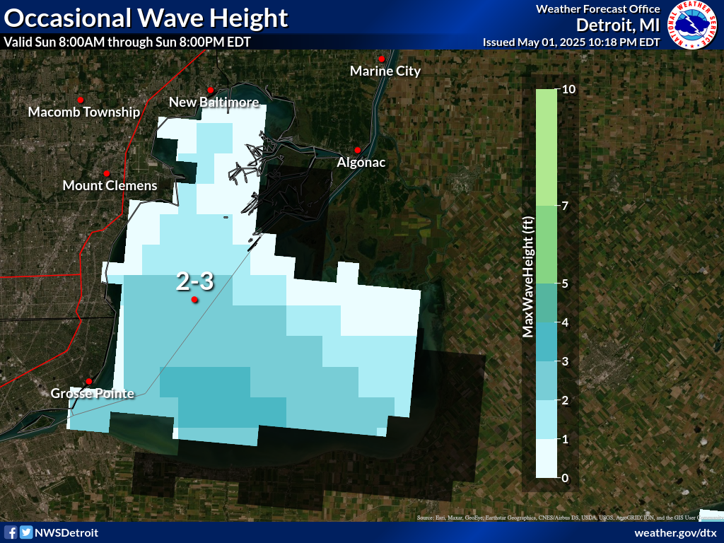
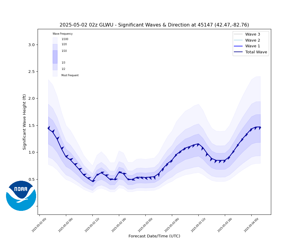
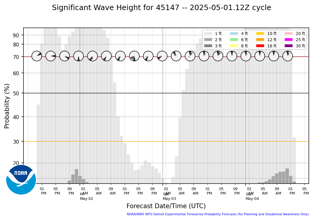
Wave HeightsNow-15 hours |
|||||||
Significant |
 |
 |
 |
 |
 |
 |
|
Occasional(top 10%) |
 |
 |
 |
 |
 |
 |
|
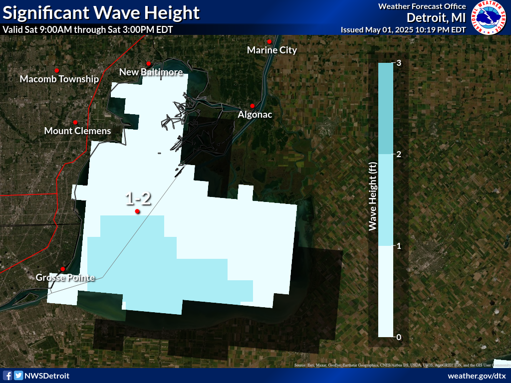
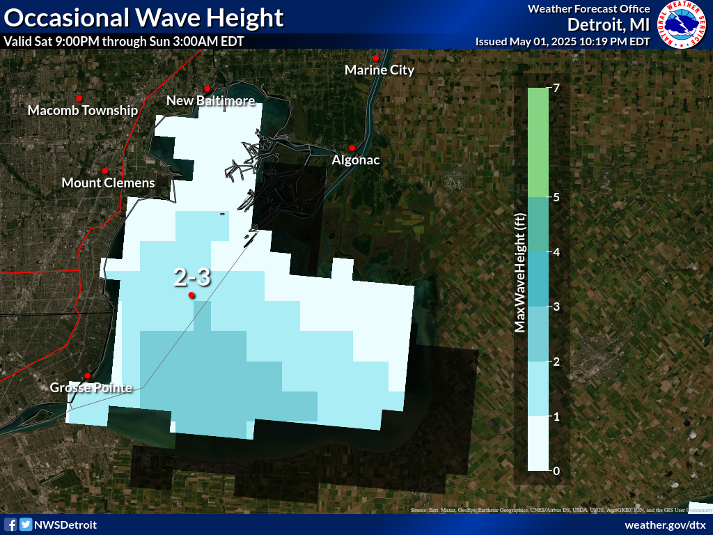
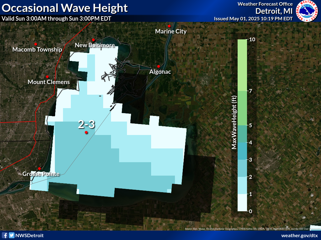
Wave Heights18-60 hours |
|||||||
Significant |
 |
 |
 |
 |
 |
 |
 |
Occasional(top 10%) |
 |
 |
 |
 |
 |
 |
 |
(click to enlarge)
 |
 |
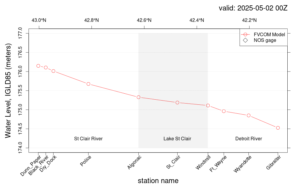
Prototype: Under Development: Not to be relied on for Operational Decision Making.