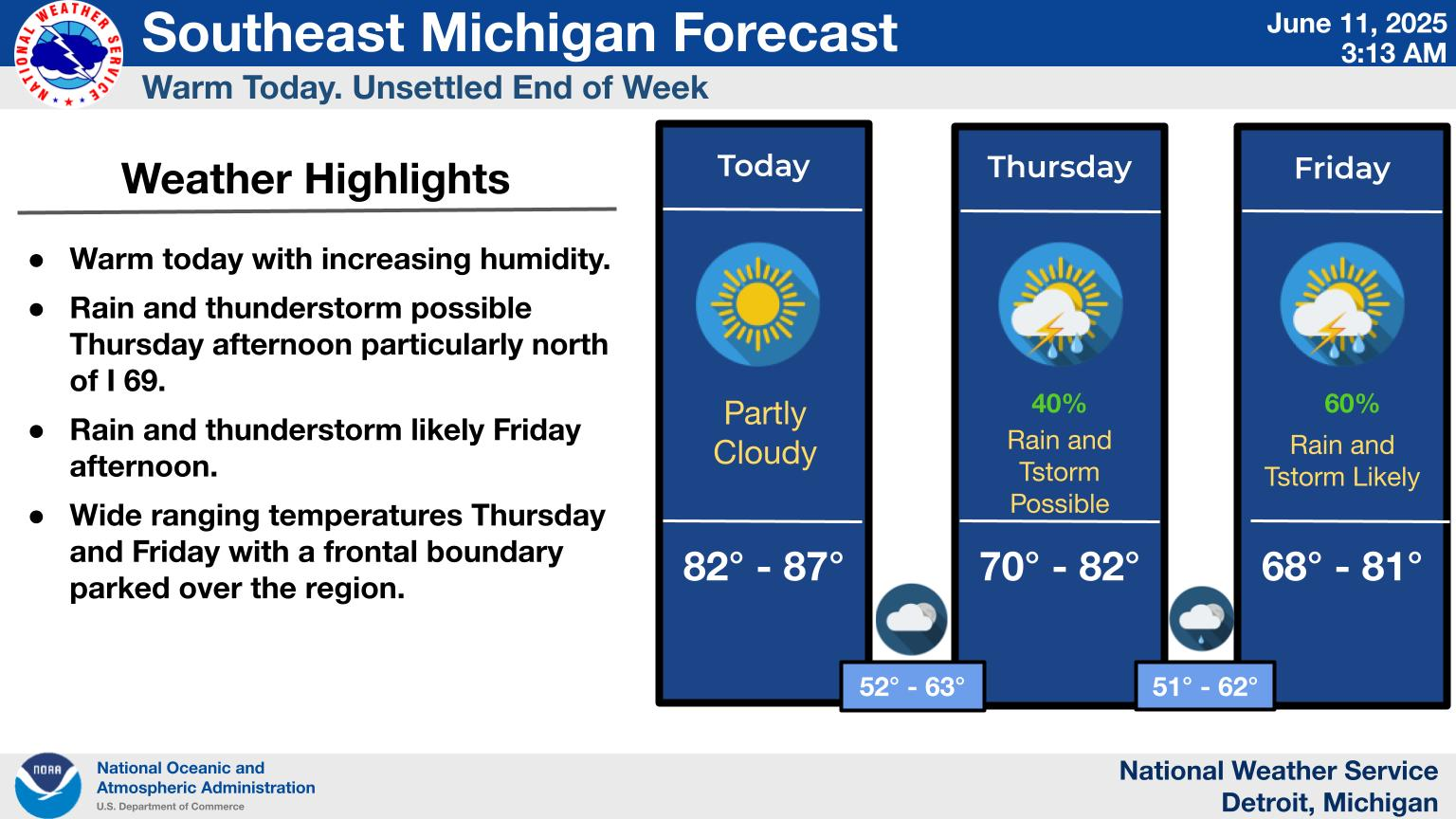
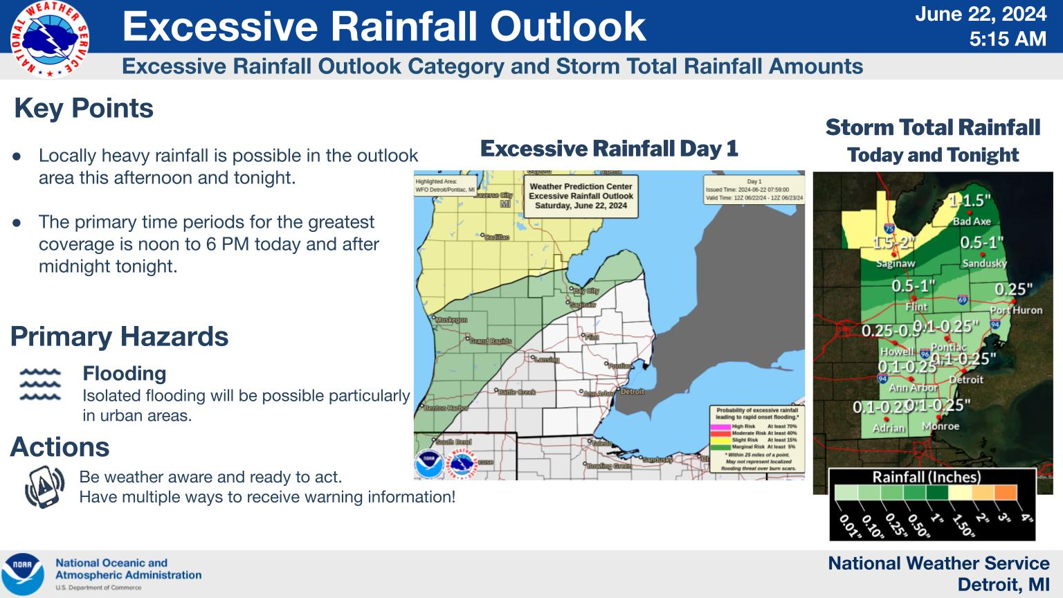
National Weather Service United States Department of Commerce

Mostly sunny today and warmer with light northeast winds. Highs in the mid 80s. Increasing clouds overnight with lows in the 60s. Low chance of a shower or thunderstorm early Monday morning followed by hot and humid conditions for the rest of the week.
Today will be hot and humid with temperatures in the 90s and heat index in the mid to upper 90s. A few areas could see heat indices briefly reach 100 degrees.
An Extreme Heat Watch continues across all of Southeast Michigan for Tuesday through Thursday this week. Dangerously hot and humid conditions will push daily heat index near or above 105 degrees, while lows in the mid 70s provide little overnight relief from the heat.
A prolonged stretch of extreme heat is expected this week with heat indices climbing well above 100 degrees. Here are some heat safety recommendations to keep in mind this week.