Overview
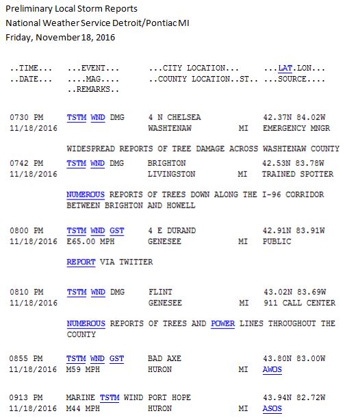
A strong low pressure system developed out in the Central Plains and moved northeast across Northwest Wisconsin and the northern Great Lakes on Friday. This system brought snow to parts of the northern plains, where a couple of feet of new snow was reported in Northeast Minnesota. A cold front associated with the system impacted Southeast Michigan Friday evening, bringing widespread damaging winds as a line of thunderstorms pushed northeast. Highs ahead of the approaching cold front during the day brought record high temperatures! New record high of 73F was set at Detroit; Flint and Saginaw also both set new record highs of 71F. Gusty winds and much colder air filtered in behind the departing cold front Friday night into Saturday as rain switched over to snow showers.Storm Reports:
 |
 |
 |
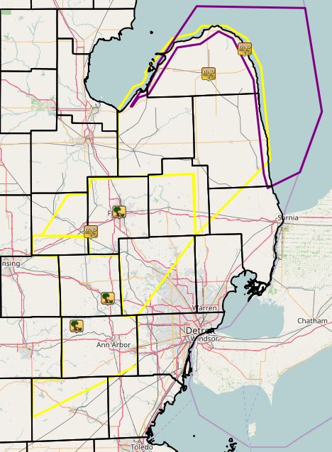
| Figure 1: Local Storm Reports - Graphic (Courtesy of IEM) |
Figure 2: Local Storm Reports - Text (Courtesy of NWS) |
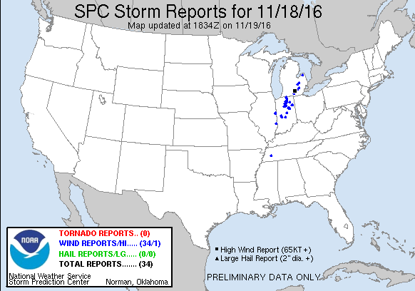
Figure 3: SPC Storm Reports for November 18, 2016 (Courtesy of SPC) |
Radar:
 |
|
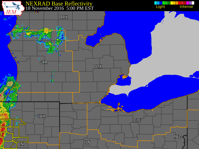
Figure 4: Radar loop during the evening of November 18, 2016. (Radar courtesy of Iowa Environmental Mesonet (IEM)) |
Environment
 |
|
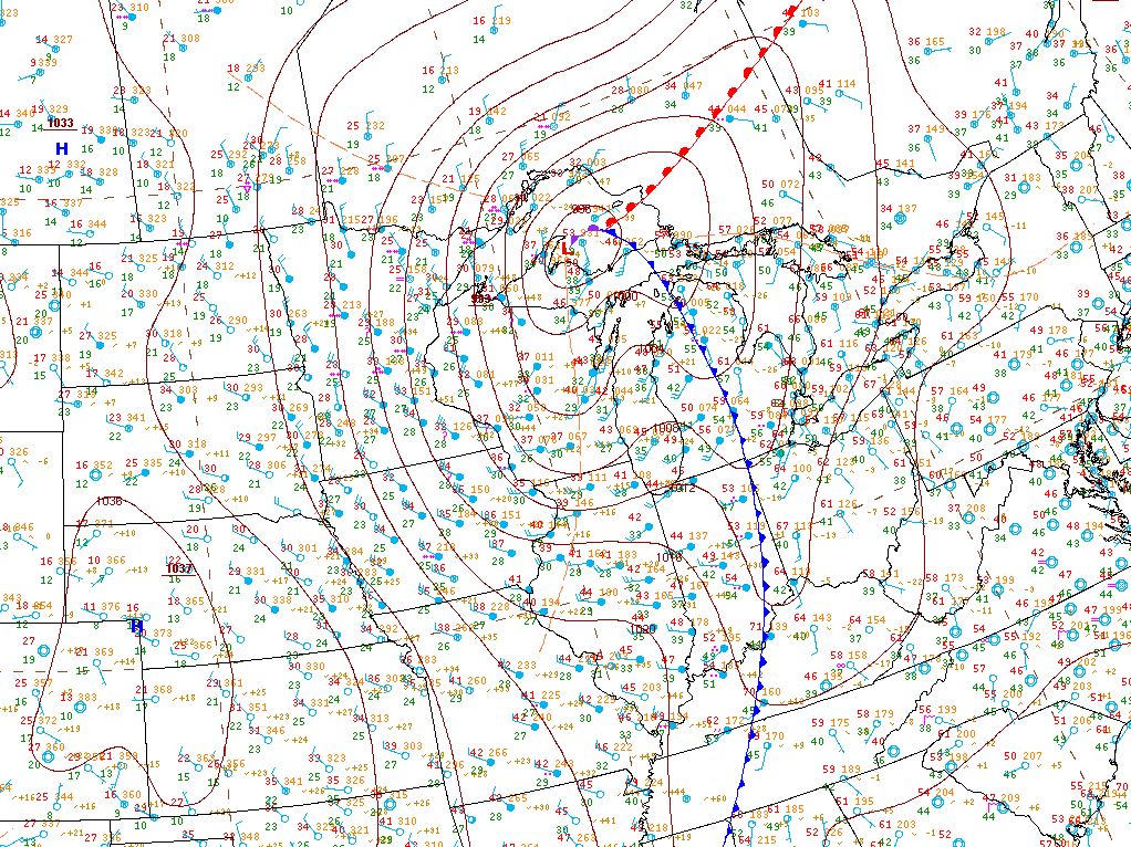
Figure 5: WPC graphic showing the surface analysis at 7pm (00Z) on November 18, 2016 |
For other past surface analysis maps, check out WPCs surface archive here.
 |
Media use of NWS Web News Stories is encouraged! Please acknowledge the NWS as the source of any news information accessed from this site. |
|

