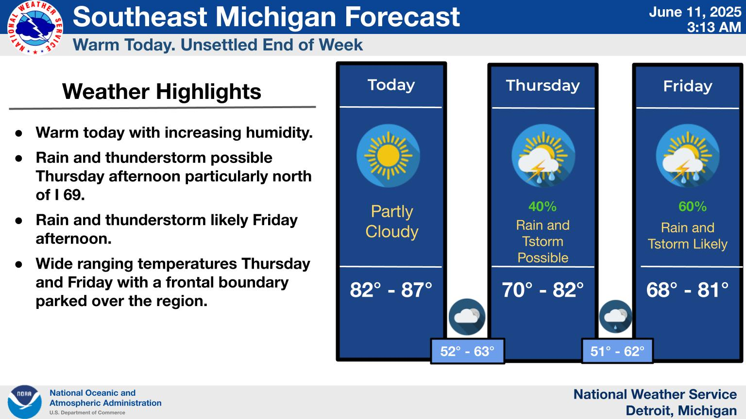
National Weather Service United States Department of Commerce
Windy and colder this week with chances for accumulating snow Friday and again Saturday night. Temperatures return to near average with highs in the 40s most days. Southwest gusts of 45 to 50 mph are within reach Friday.
A winter storm is expected to impact the Great Lakes this weekend, with potential for a wide range of hazards including heavy snow, a wintry mix, and heavy rain and thunderstorm potential. Expect forecast refinements in the coming days.
A Gale Watch has been issued for Friday and Friday night with gusts up to 45 knots possible for all marine zones.
Severe Weather Hazards
Day 1 | Day 2 | Day 3
Winter Hazards
Day 1 | Day 2 | Day 3
Flooding Hazards
Day 1 | Day 2 | Day 3
Excessive Rainfall Hazard
Day 1 | Day 2 | Day 3
Fire Weather Hazards
Day 1 | Day 2 | Day 3

Frequently Requested Products