Overview
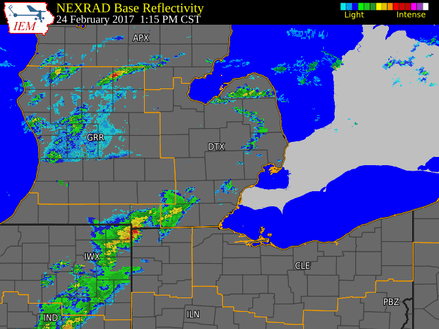
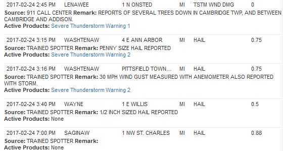
The first severe weather event of 2017, was also an early one to start off the year. Temperatures so far this year have been a roller coaster, as high records have been broken. That was the case on Friday, February 24, as highs across the Detroit area made it up to 70 degrees. This smashed the old daytime high record of 59 degrees back in 1976. This also tied Detroit's all-time record high for the month of February, which was previously set on February 11, 1999! This was a result of warm air surging northward as a strong low pressure system brought a warm front up across the area. With the warmer temperatures, higher dewpoints, and the warm front over the area, severe storms were able to develop. These storms brought some hail and strong winds, knocking down trees in Lenawee County.Radar:
Header
 |
|
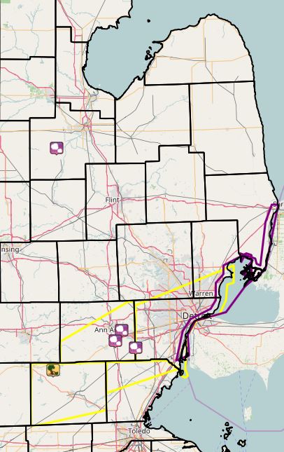
Radar loop courtesy of IEM (Iowa Environmental Mesonet) Smaller yellow boxes depict severe thunderstorm warnings and larger yellow box depicts severe thunderstorm watch. |
Storm Reports
Environment & Outlooks
 |
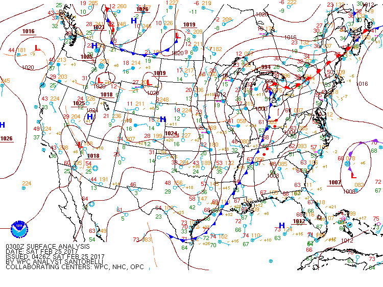 |
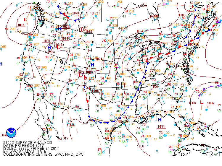
| Figure 1: Surface analysis showing the position of the warm front at 21Z (4 PM EST) | Figure 2: Surface analysis showing the position of the cold front at 03Z (10 PM EST) |
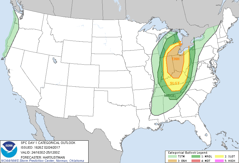
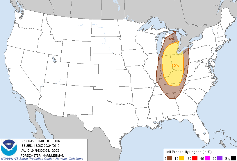
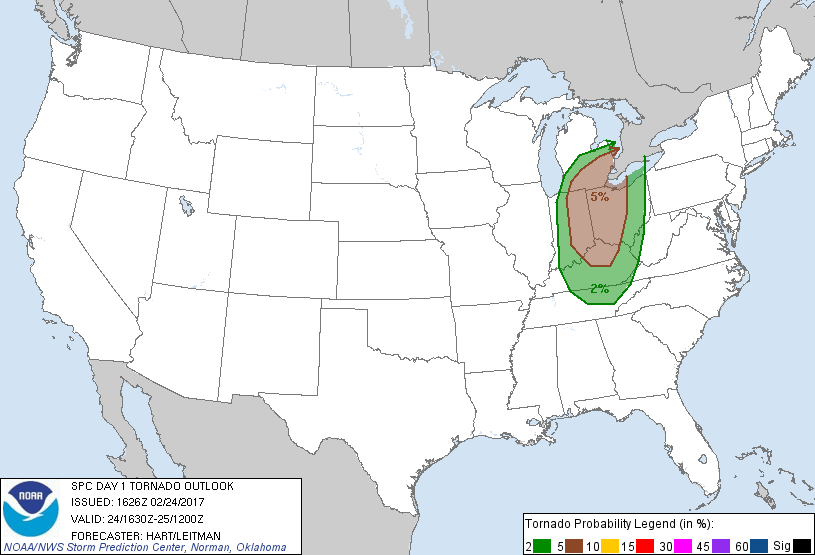
SPC Outlooks (Graphics, including discussion for Day 1, 1630Z Update can be found here)
 |
 |
| Figure 3: SPC Day 1 Thunderstorm Outlook | Figure 4: SPC Day 1 Tornado Outlook |
 |
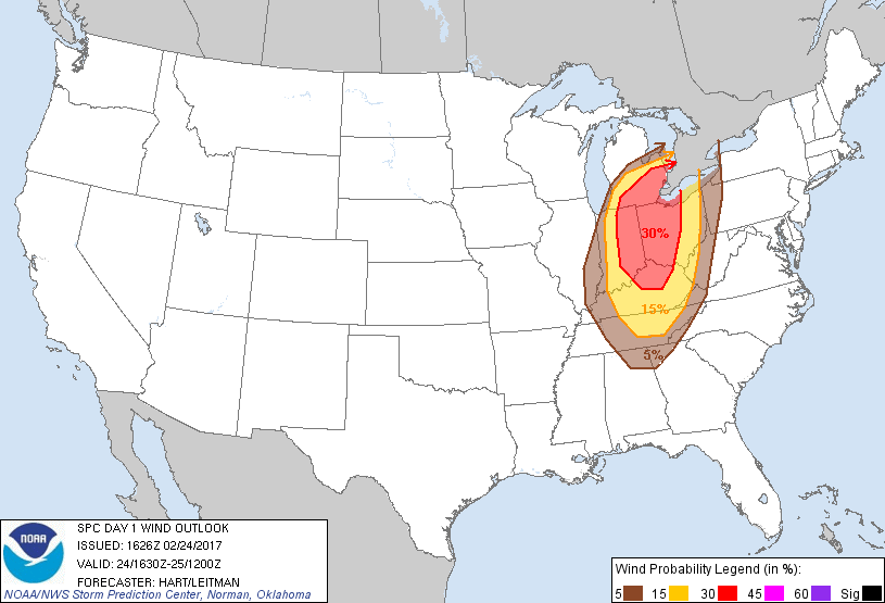 |
| Figure 5: SPC Day 1 Hail Outlook | Figure 6: SPC Day 1 Wind Outlook |
 |
Media use of NWS Web News Stories is encouraged! Please acknowledge the NWS as the source of any news information accessed from this site. |
|

