301 AM EDT Thu Jun 5 2025
.HYDROLOGY...
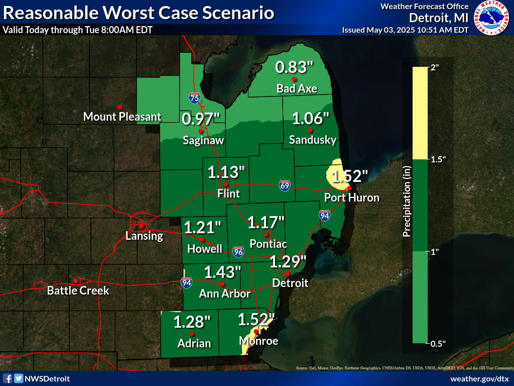
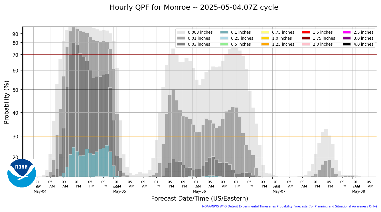
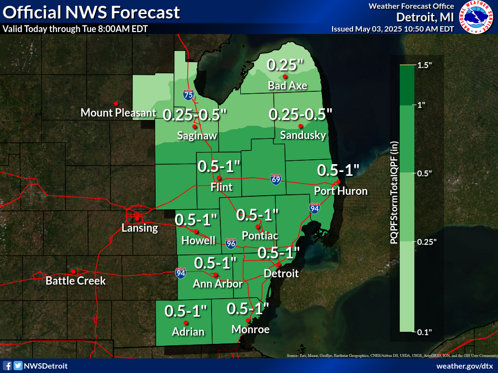
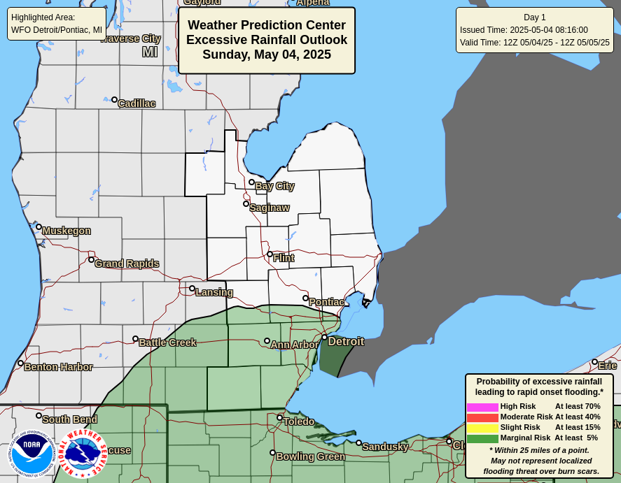
Showers, locally heavy, will continue to track through the southern
half of the CWA (mainly south of M-59) early this morning. Most
areas along and south of M-59 have seen between half an inch to one
inch of rain thus far. Per radar estimates, northern Monroe and far
southern Wayne saw localized amounts at or above 2 inches. Quick
comparison/ground truthing at ADG/DTW showed reasonable rainfall
estimates by the radar. Another half an inch to one inch of rainfall
is likely for areas along and south of I-94, which could lead to some
minor flooding in flood prone/low lying areas. There is a slight
chance of embedded thunderstorms, which would enhance rainfall rates
further, and could lead to more significant flooding. However,
activity will be diminishing as the day goes on, with mainly dry
conditions expected for most of southeast Michigan this afternoon.
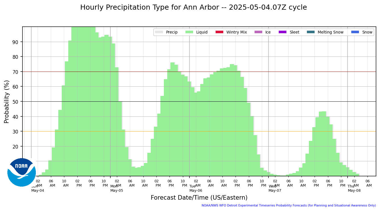
Hourly Precip Type
|
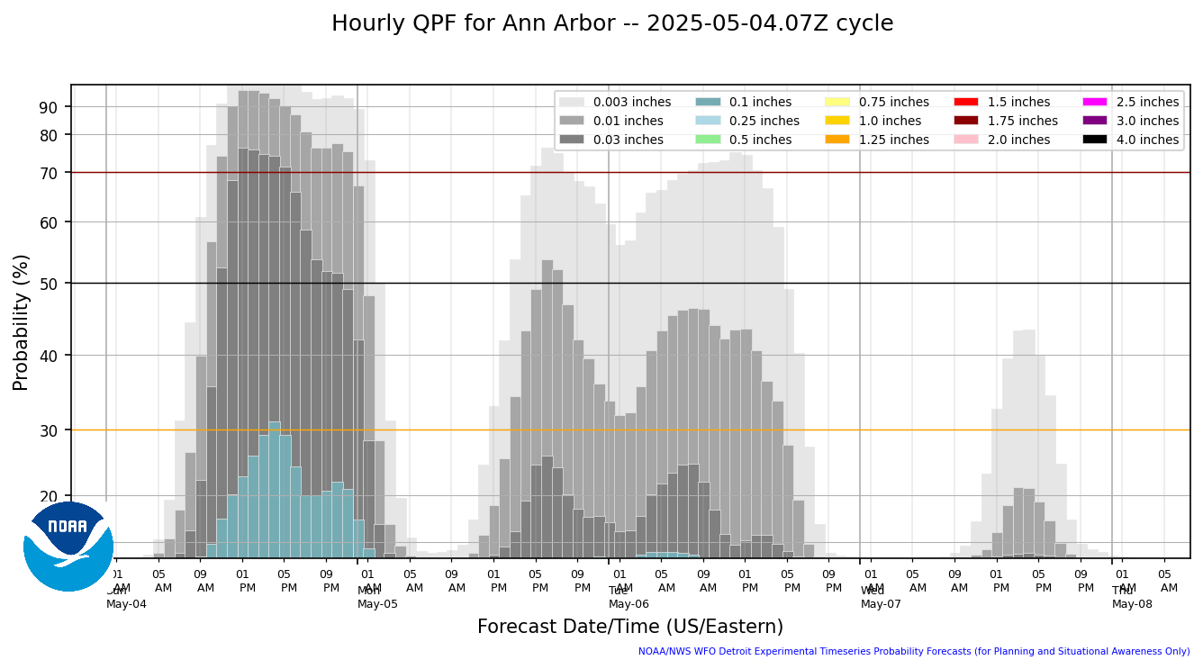
Hourly Precip Amount
|
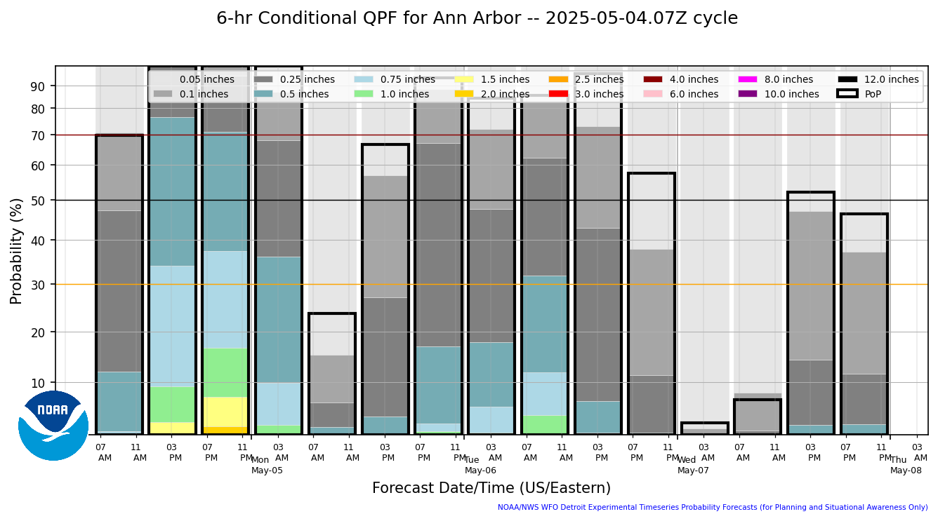
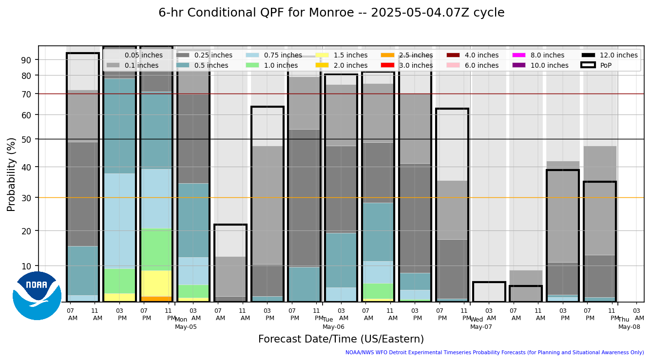
6 Hourly Conditional Precip Amount
|
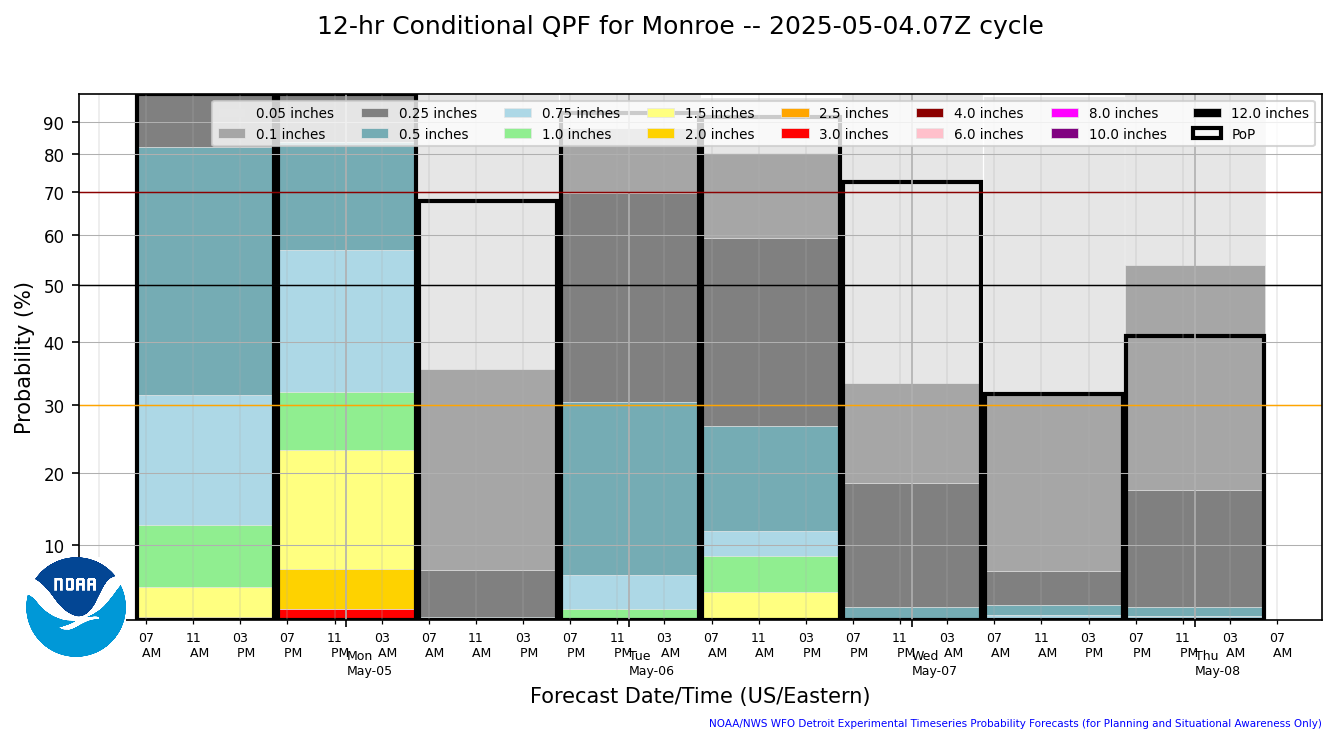
12 Hourly Conditional Precip Amount
|
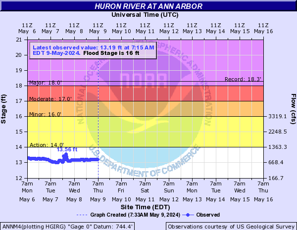
River Info - Ann Arbor
|
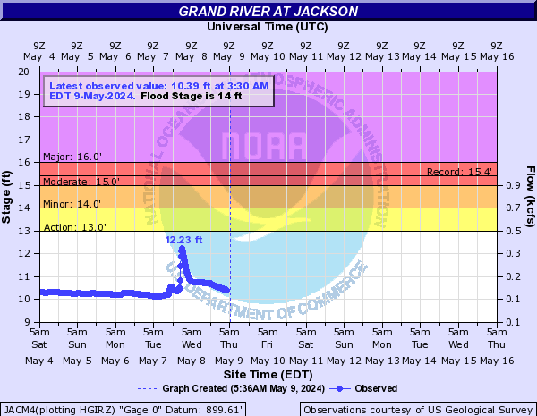
River Info - Jackson
|
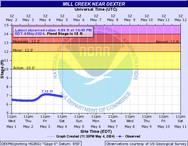
River Info - Dexter
|
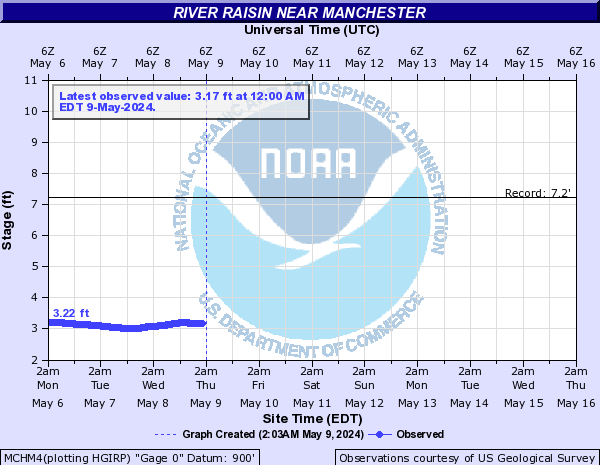
River Info - Manchester
|
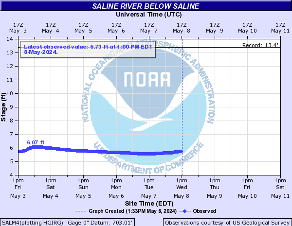
River Info - Saline
|
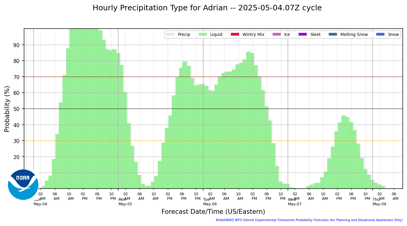
Hourly Precip Type
|
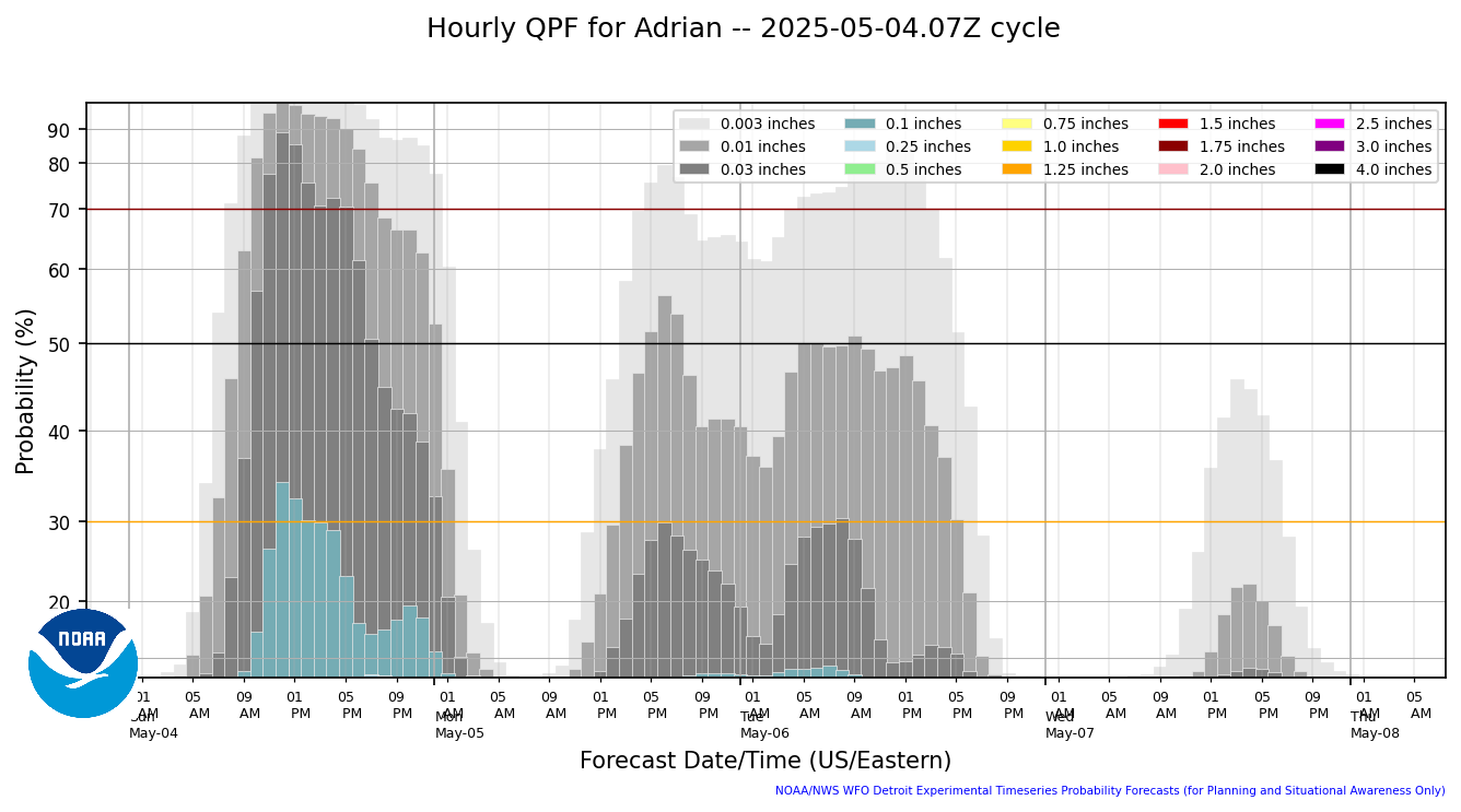
Hourly Precip Amount
|
6 Hourly Conditional Precip Amount
|
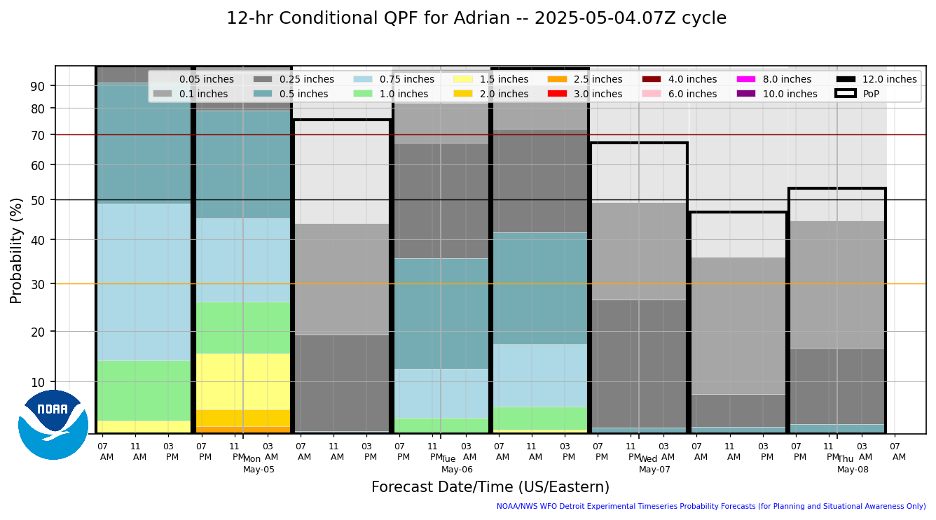
12 Hourly Conditional Precip Amount
|
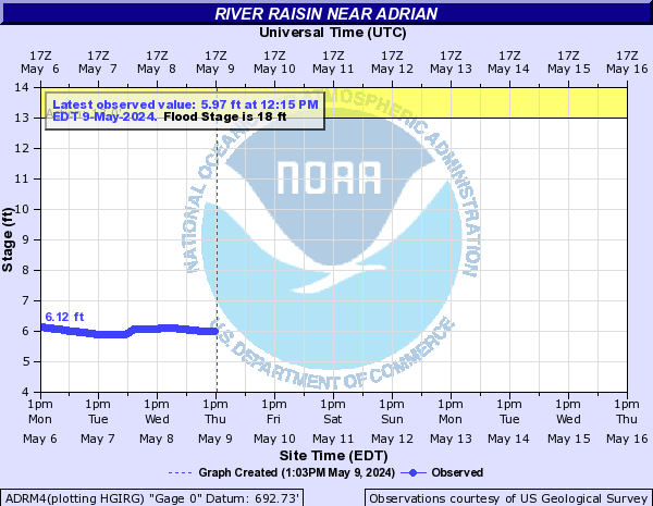
River Info - Adrian
|
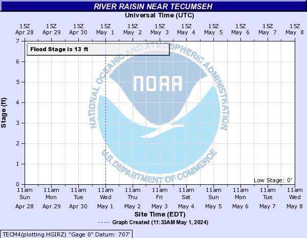
River Info - Tecumseh
|
River Info - Blissfield
|
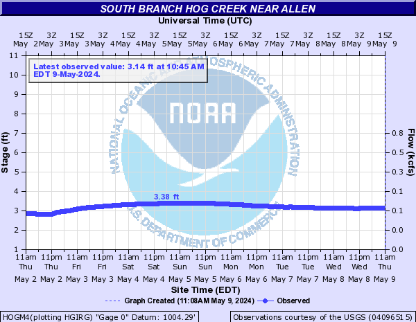
River Info - Allen
|
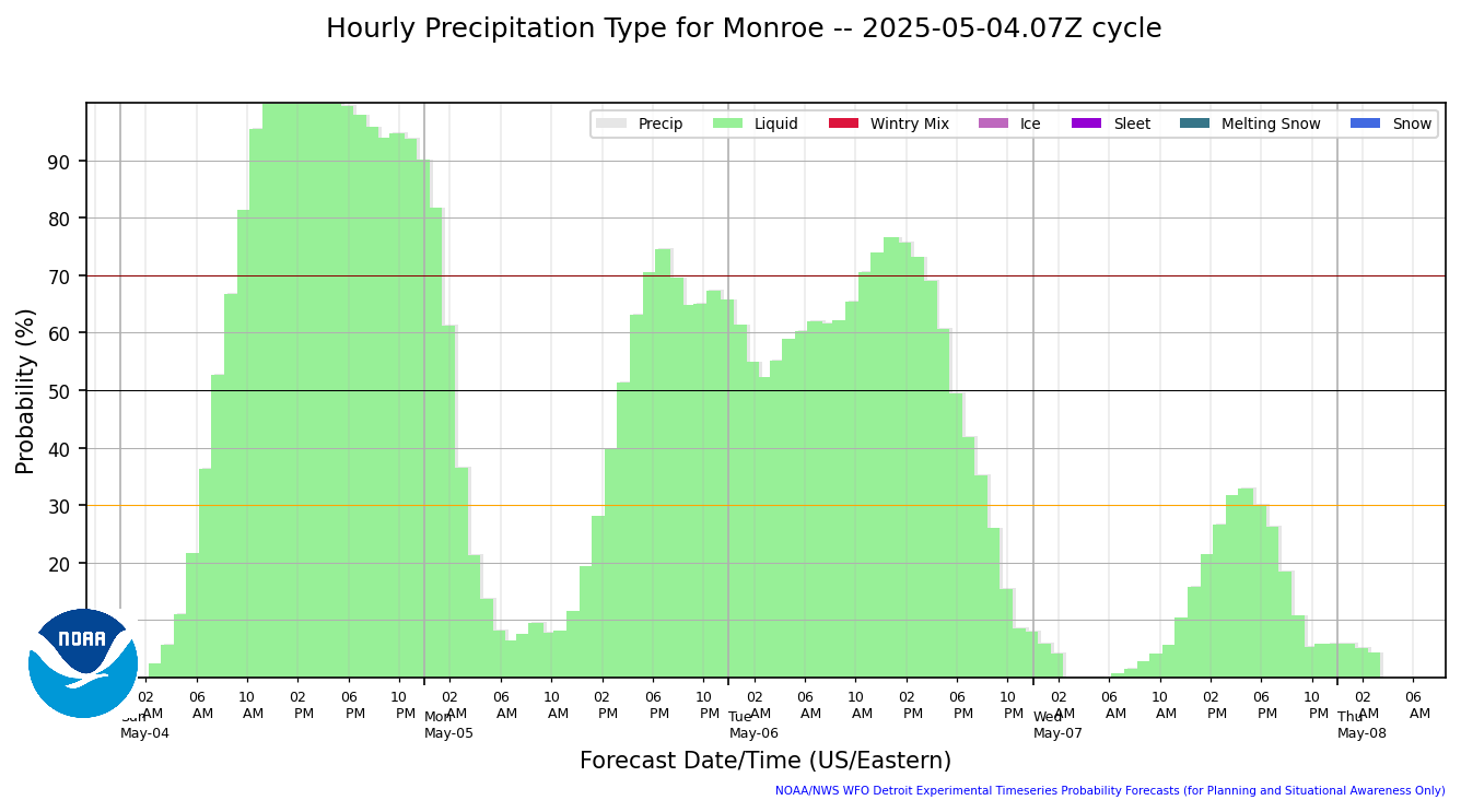
Hourly Precip Type
|
Hourly Precip Amount
|
6 Hourly Conditional Precip Amount
|
12 Hourly Conditional Precip Amount
|
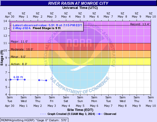
River Info - Monroe
|
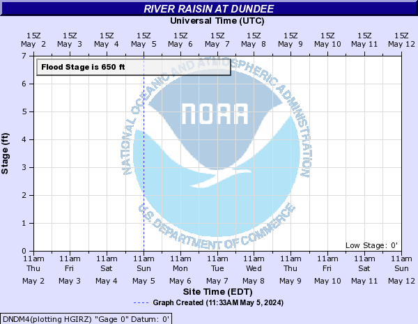
River Info - Dundee
|
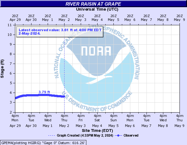
River Info - Grape
|


Prototype: Under Development: Not to be relied on for Operational Decision Making.