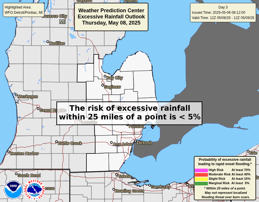
There are no hydrological concerns at the moment.
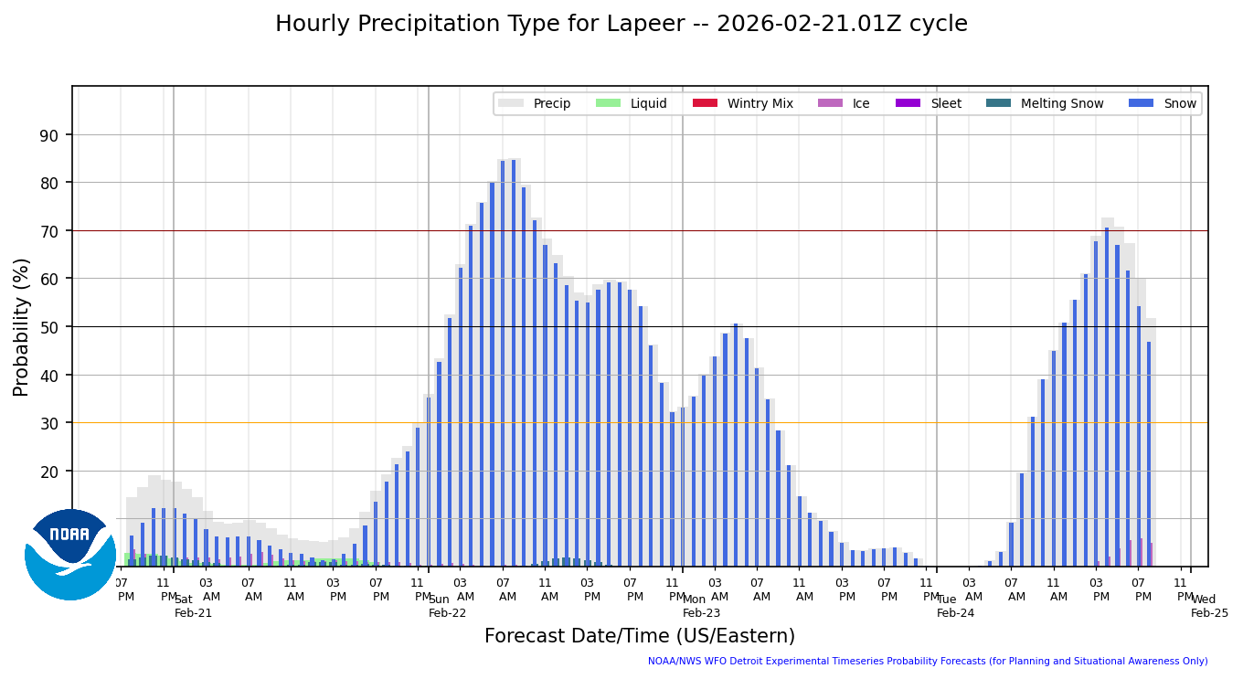
Hourly Precip Type
|
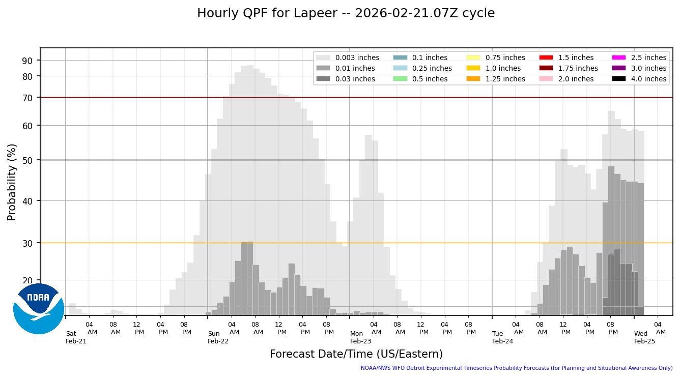
Hourly Precip Amount
|
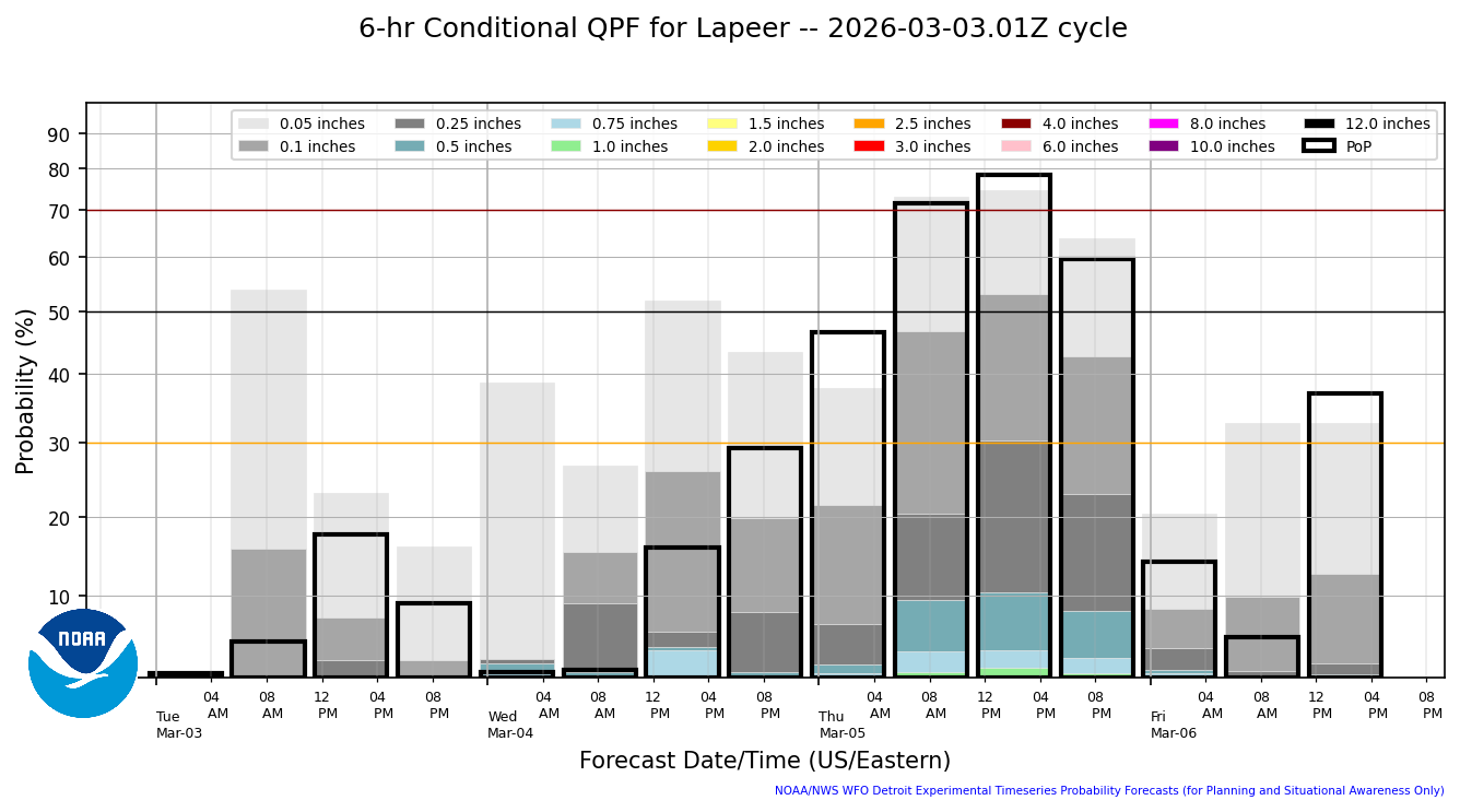
6 Hourly Conditional Precip Amount
|
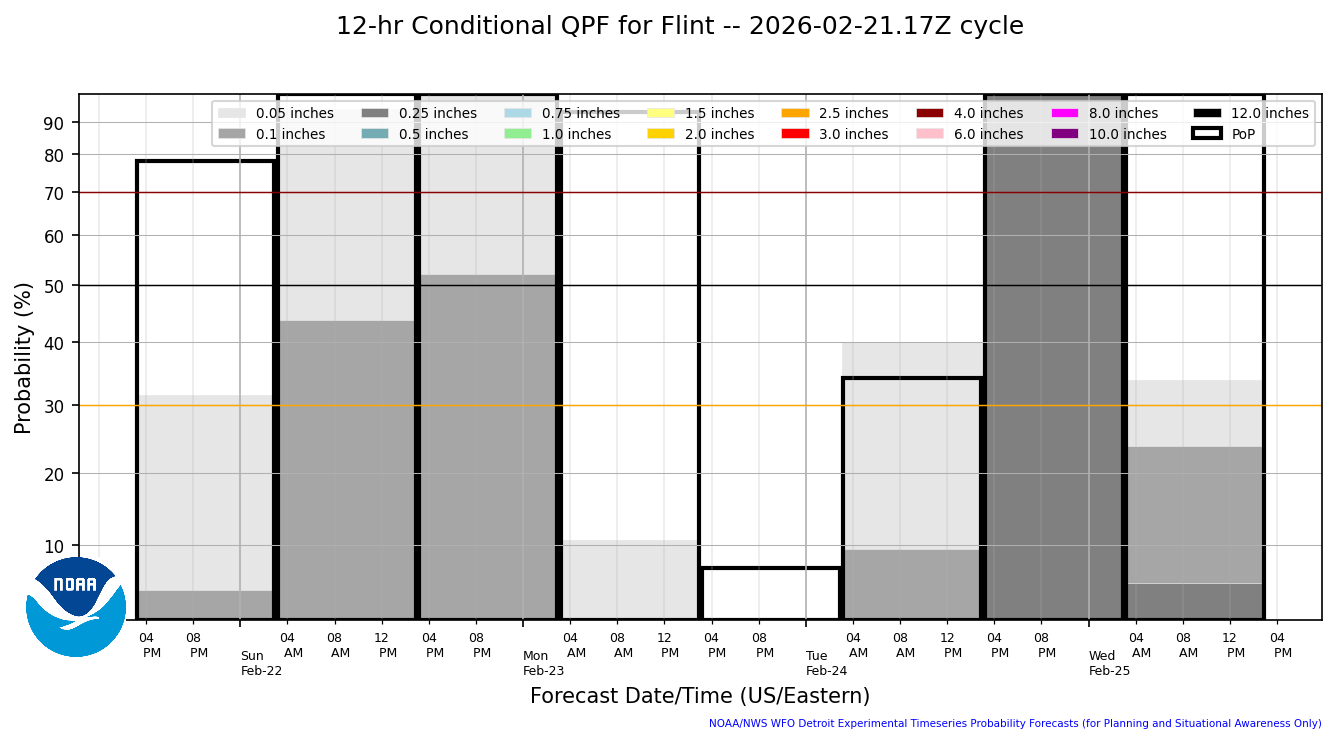
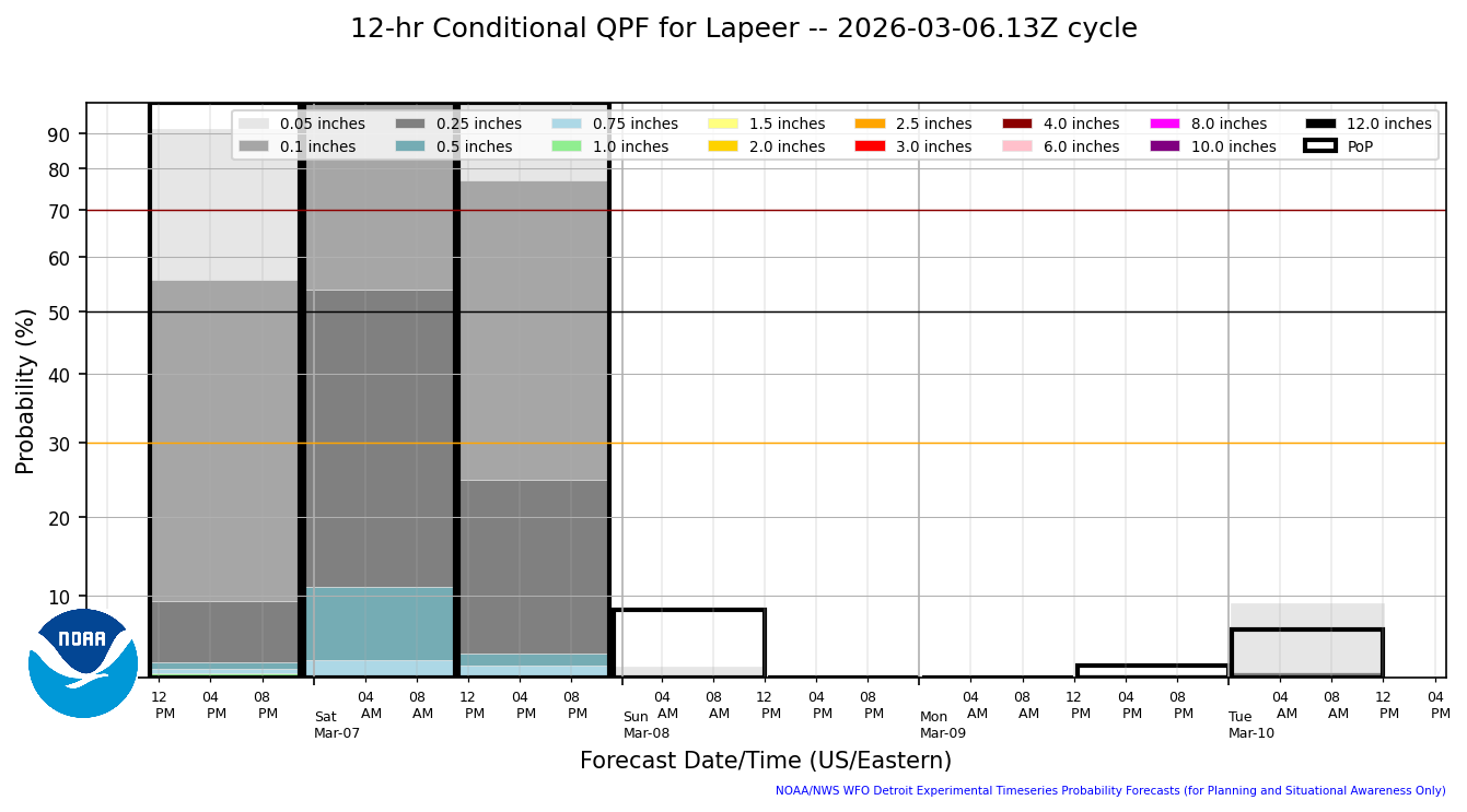
12 Hourly Conditional Precip Amount
|
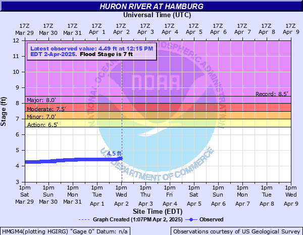
River Info - Hamburg
|
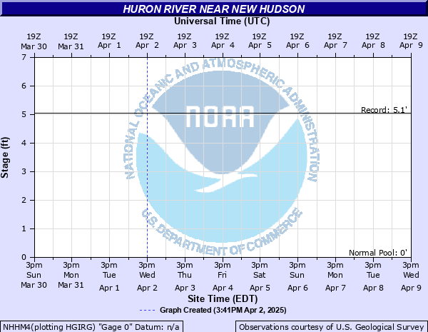
River Info - New Hudson
|
Hourly Precip Type
|
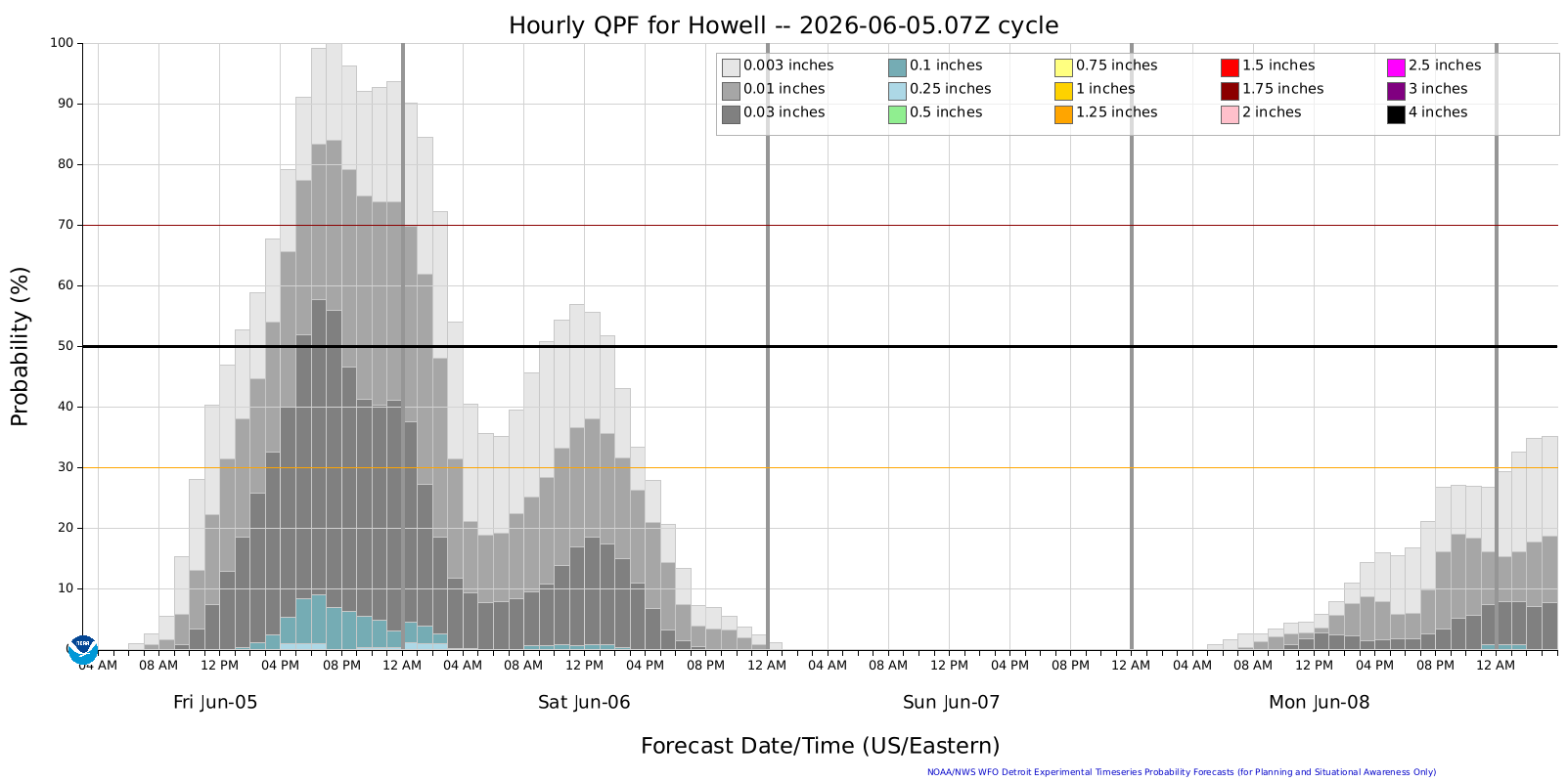
Hourly Precip Amount
|
6 Hourly Conditional Precip Amount
|
12 Hourly Conditional Precip Amount
|
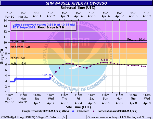
River Info - Owosso
|
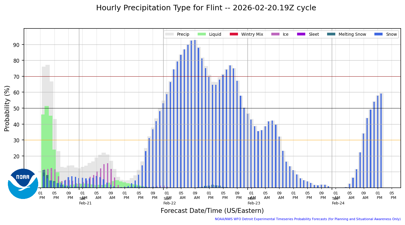
Hourly Precip Type
|
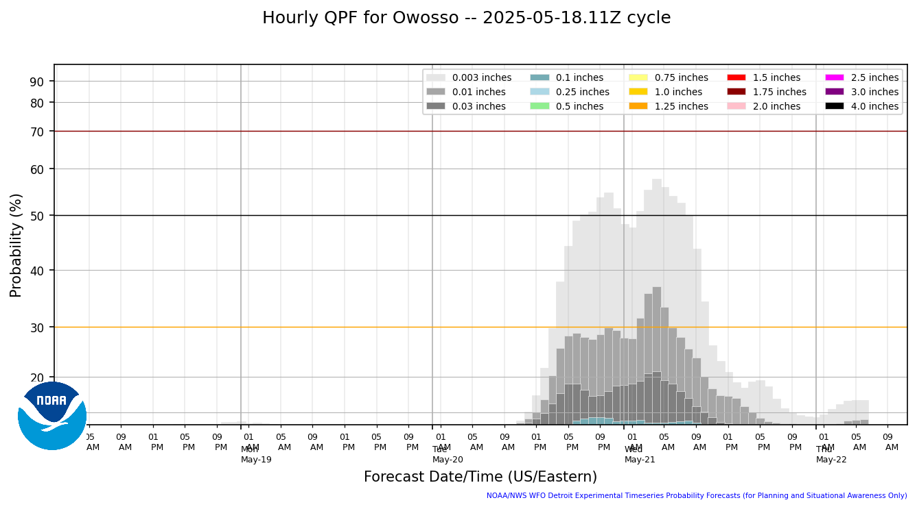
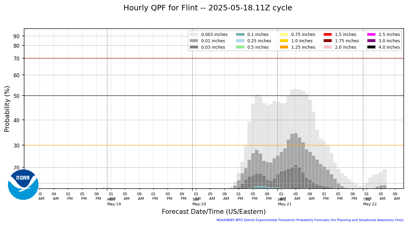
Hourly Precip Amount
|
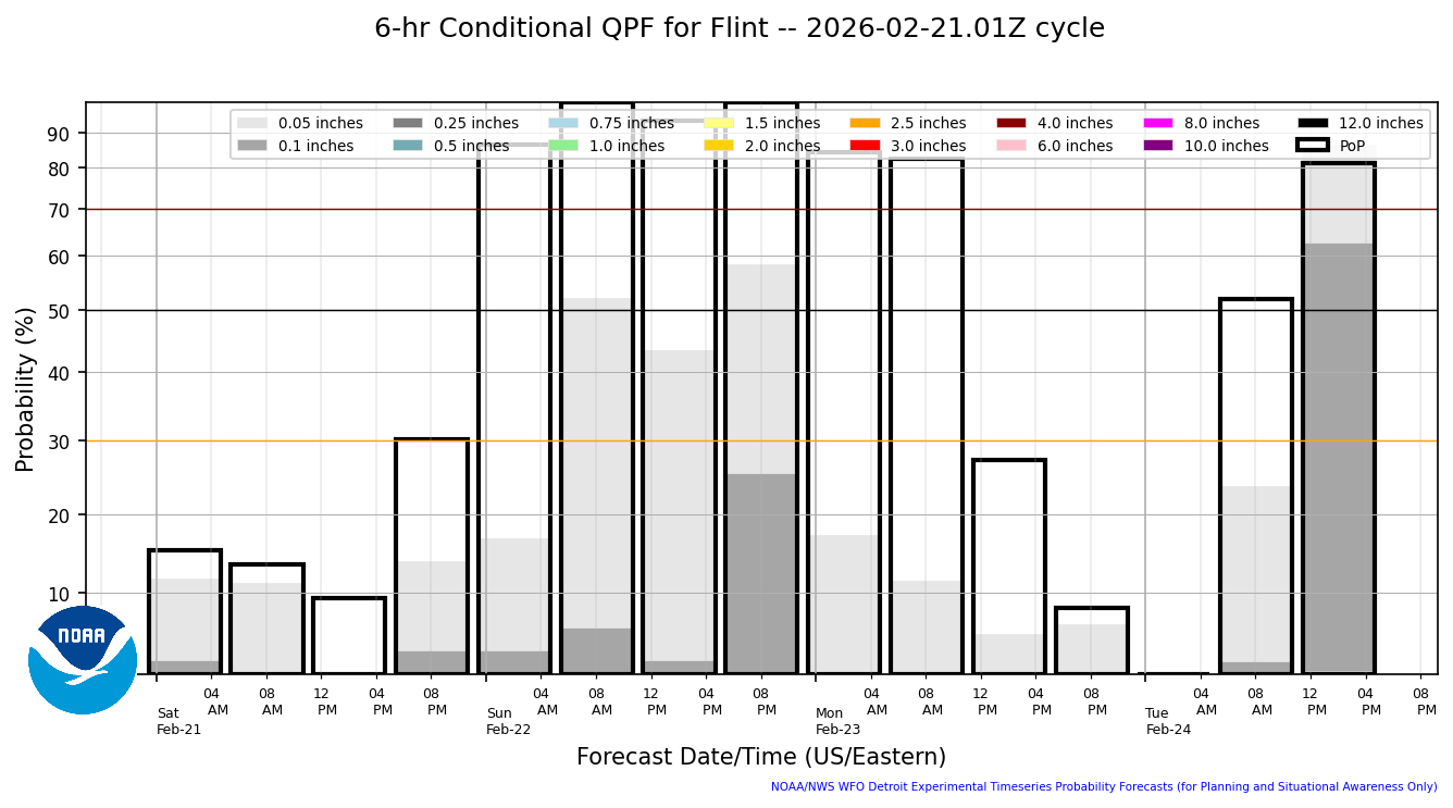
6 Hourly Conditional Precip Amount
|
12 Hourly Conditional Precip Amount
|
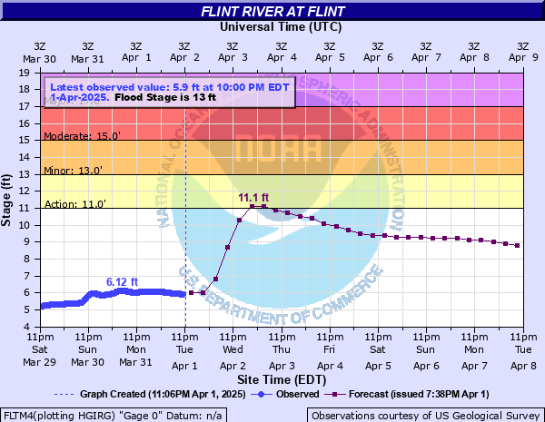
River Info - Flint
|
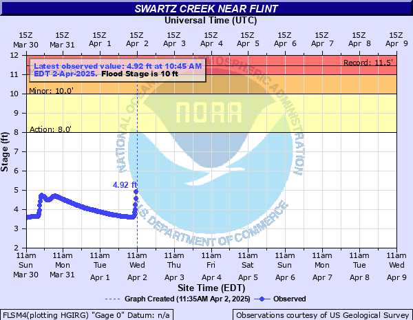
River Info - Swartz Creek
|
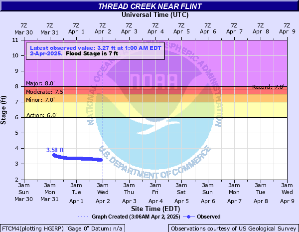
River Info - Thread Creek
|
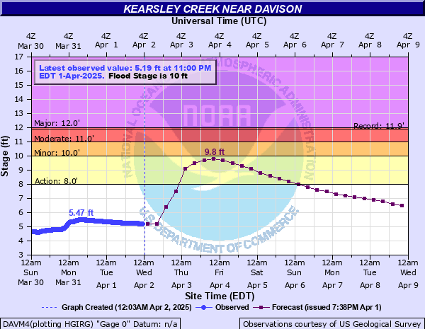
River Info - Kearsley Creek
|
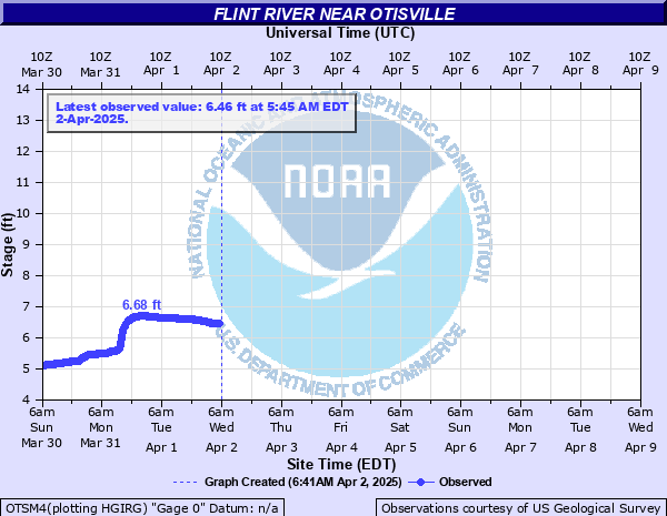
River Info - Otisville
|
Hourly Precip Type
|
Hourly Precip Amount
|
6 Hourly Conditional Precip Amount
|
12 Hourly Conditional Precip Amount
|
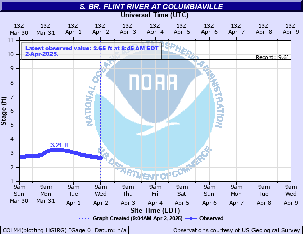
River Info - Columbiaville
|


Prototype: Under Development: Not to be relied on for Operational Decision Making.