Overview
On the late afternoon of June 15th, a localized area of low pressure coupled with favorable upper-level dynamics produced numerous showers and thunderstorms mainly south of I-96. The prevailing atmospheric conditions accelerated the intensification of the storms, producing several strong to severe thunderstorms. Hail, measuring between 1-2 inches, emerged as the primary severe weather threat, with several instances of wind damage associated with gusts around 60 mph. Notably, an EF1 tornado developed just west of Lake Erie. This tornado, which remained on the ground for 9 minutes, exhibited a maximum wind gust of 90 mph. In its wake, damage was reported which included multiple large fallen limbs and trees, along with damage to several residential properties.
Tornadoes:
|
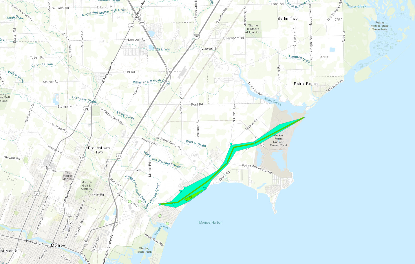
Tornado - Detroit Beach, MI
Track Map

|
||||||||||||||||
The Enhanced Fujita (EF) Scale classifies tornadoes into the following categories:
| EF0 Weak 65-85 mph |
EF1 Moderate 86-110 mph |
EF2 Significant 111-135 mph |
EF3 Severe 136-165 mph |
EF4 Extreme 166-200 mph |
EF5 Catastrophic 200+ mph |
 |
|||||
Photos
 |
 |
 |
|
|
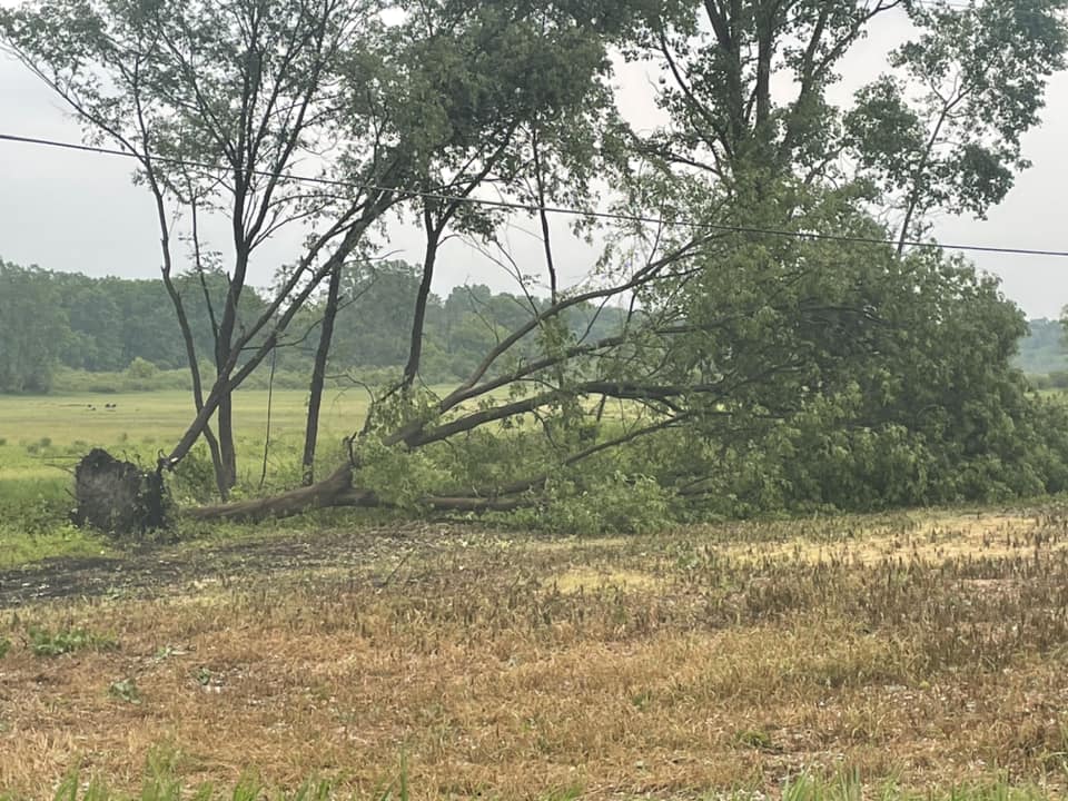
Thunderstorm Wind Damage in Pinkney Credit: Kyle Piers |
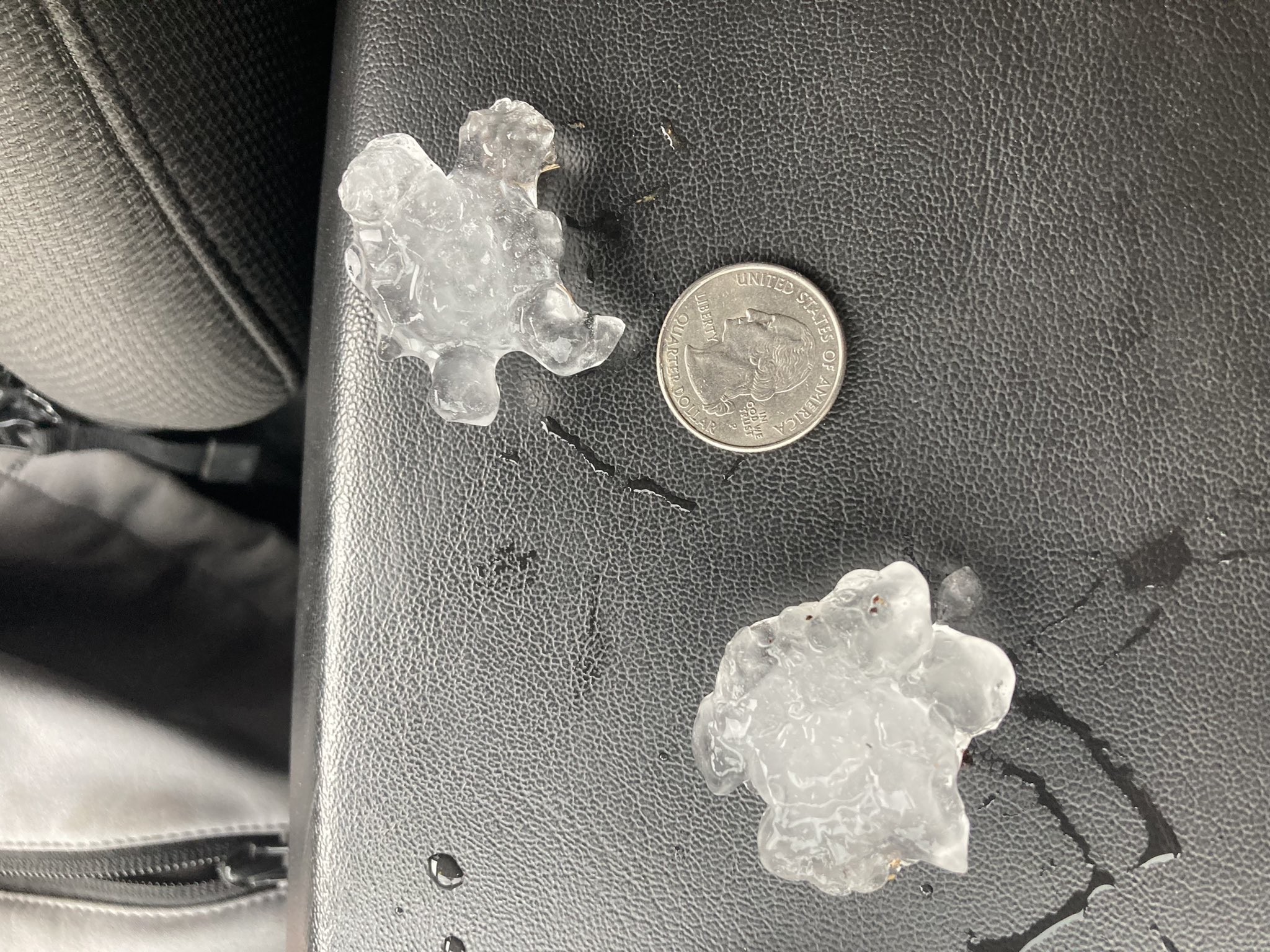
Hail in Salem Twp Credit: Drew Bummel |
Hail in New Boston Credit: Angie Huspen |
|
 |
 |
 |
|
|
Hail in Carleton Credit: Laura Gaynie |
Hail in Pinkney Credit: Matt Weber |
Hail in Pinkney Credit: Cindy Holmes |
Radar
Radar Imagery for SE MI
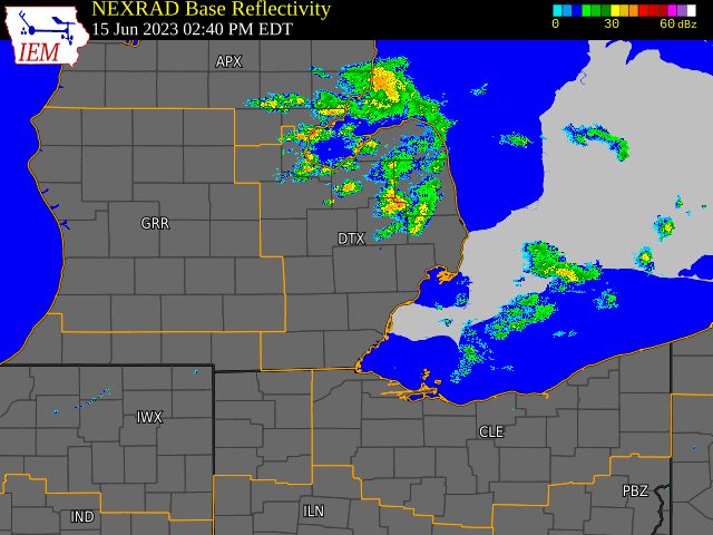

Radar loop courtesy of Iowa Environmental Mesonet (IEM)
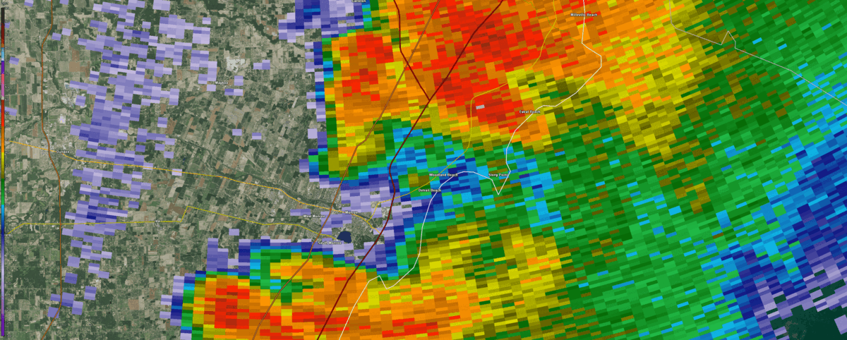
Figure 1. DTX base reflectivity between 2204 and 2220 UTC on 15 June 2023, centered on Detroit Beach, MI.

Figure 2. DTX base velocity between 2204 and 2220 UTC on 15 June 2023, centered on Detroit Beach, MI.
Environment
A localized area of low pressure (figure 1) enhanced surface moisture convergence (figure 2), aiding the development of late afternoon rain showers and thunderstorms across southern lower Michigan on June 15th. Supported by an approaching shortwave and adjacent left jet streak dynamics (figure 3), the thunderstorms rapidly intensified. The northern Metro region down to the Ohio border, situated within the warm sector of this system, capitalized on peak daytime heating. Surface-based CAPE values rose between 1000-2000 j/kg (figure 4), and low-level lapse rates increased between 7-8 C/km (figure 5), enhancing the storms buoyancy. A 700-500 mb wind maximum had swept across SE MI, lengthening the hodographs low and mid-levels which increased 0-6 km shear values to 40 knots (figure 6). Streamwise storm relative hodographs through 1-6 km (figure 7) facilitated the development of supercells, within which several 1-2 inch hail reports were observed across Monroe, Wayne, Washtenaw, and Livingston Counties. Easterly flow from Lake Erie and marine boundary dynamics then aided in tornadogenesis near and over Detroit Beach, lasting 9 minutes. This EF1 rated tornado, with estimated peak winds around 90 mph, primarily caused tree damage and damage to residential housing.
%20.jpg) |
%20.jpg) |
.jpg) |
| Figure 1: Surface Analysis, valid 2000 UTC 15 Jun 2023 | Figure 2: Surface Moisture Convergence, valid 2100 UTC 15 Jun 2023 | Figure 3: 300 mb height with divergence and wind, valid 2100 UTC 15 Jun 2023 |
.jpg) |
.jpg) |
.jpg) |
| Figure 4: Surface-Based Convective Available Potential Energy, valid 2100 UTC 15 Jun 2023 | Figure 5: 0-3km Lapse Rates, valid 2100 UTC 15 Jun 2023 | Figure 6: 0-6km Bulk Wind Shear, valid 2100 UTC 15 Jun 2023 |
.jpg) |
||
| Figure 7: 0-9km Storm Relative Hodographs, valid 2100 UTC 15 Jun 2023 |
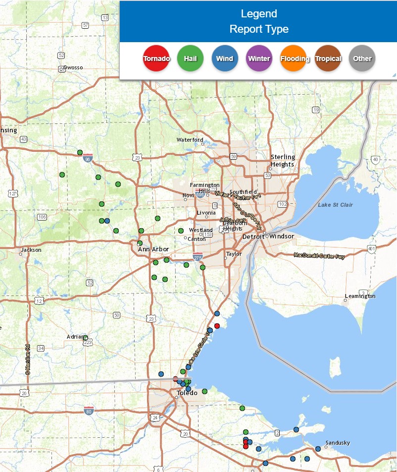
Storm Reports
|
|
|
Map of Local Storm Reports for June 15, 2023 |
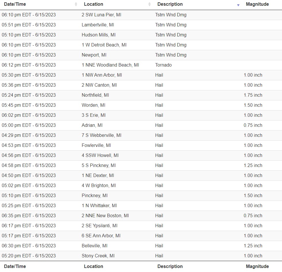 |
|
Local Storm Reports for June 15, 2023 |
 |
Media use of NWS Web News Stories is encouraged! Please acknowledge the NWS as the source of any news information accessed from this site. |
|