Overview
|
A large and deep low pressure system (for mid-May standards) over the Upper Mississippi River Valley spawned severe thunderstorms, including tornadoes. An intense line of thunderstorms tracked across Lake Michigan during the evening of May 15th. This line produced localized wind gusts of 55-75 MPH over southwest lower Michigan, along with several large hail reports (up to 1.75 inches) and several weak tornadoes. As the line moved into southeast Michigan just before midnight, the moderate instability from the daytime heating (max temps reached into lower 80s) began to wane, and the air mass near the surface began to stabilize. This caused the storms to slowly weaken as they tracked through southeast Michigan during the early morning hours of Friday (May 16th). Despite this, four tornadoes were able to develop across parts of Saginaw, Genesee, and Livingston counties, with isolated to scattered severe thunderstorms across the rest of the area. Over all, most of the Detroit Metro area was spared and saw limited wind damage, as DTE energy outages peaked just under 10,000 customers. |
Tornadoes
|
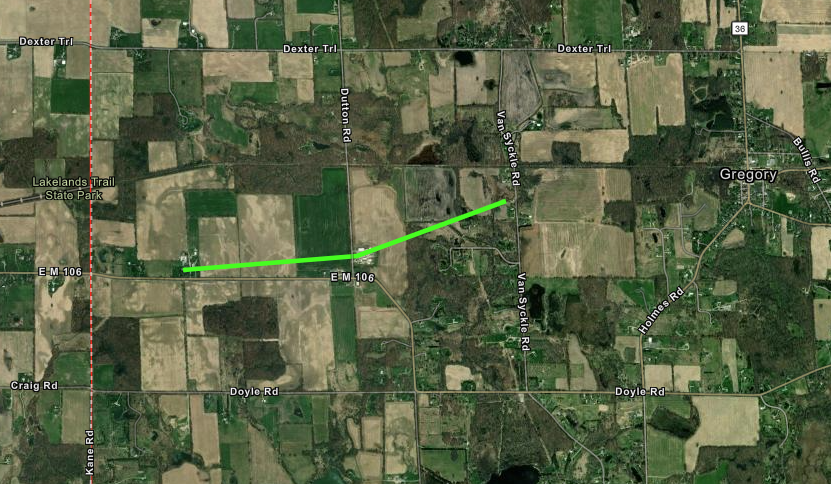
Tornado - Gregory, MI
Track Map

|
||||||||||||||||
|
Tornado - St. Charles, MI
Track Map
|
||||||||||||||||
|
Tornado - Layton Corners, MI
Track Map
|
||||||||||||||||
|
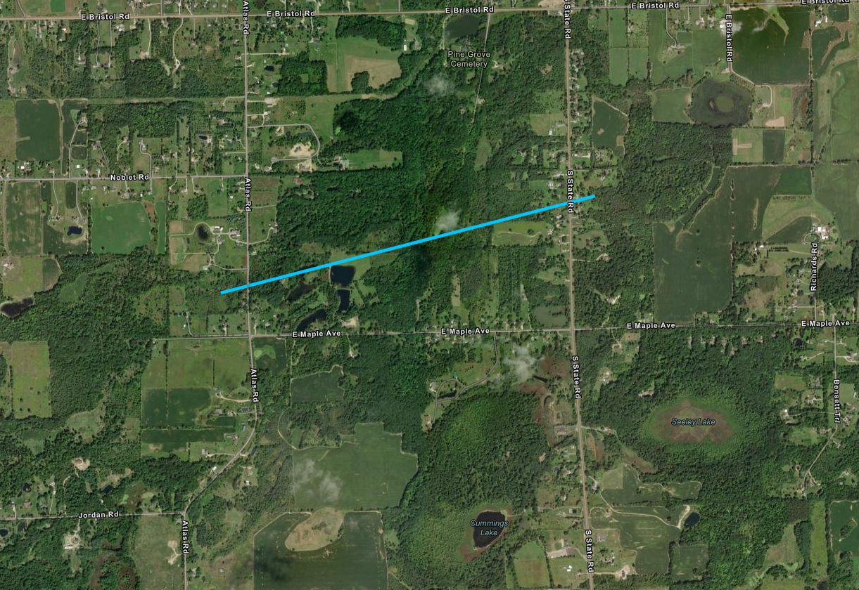
Tornado - Atlas Township, MI
Track Map
|
||||||||||||||||
The Enhanced Fujita (EF) Scale classifies tornadoes into the following categories:
| EF0 Weak 65-85 mph |
EF1 Moderate 86-110 mph |
EF2 Significant 111-135 mph |
EF3 Severe 136-165 mph |
EF4 Extreme 166-200 mph |
EF5 Catastrophic 200+ mph |
 |
|||||
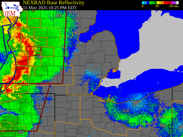
Radar
|
|
| Loop of NEXRAD Base Reflectivity Radar from 10:25pm May 15 to 2:30am, May 16, 2025 - courtesy Iowa Environmental Mesonet (IEM) |
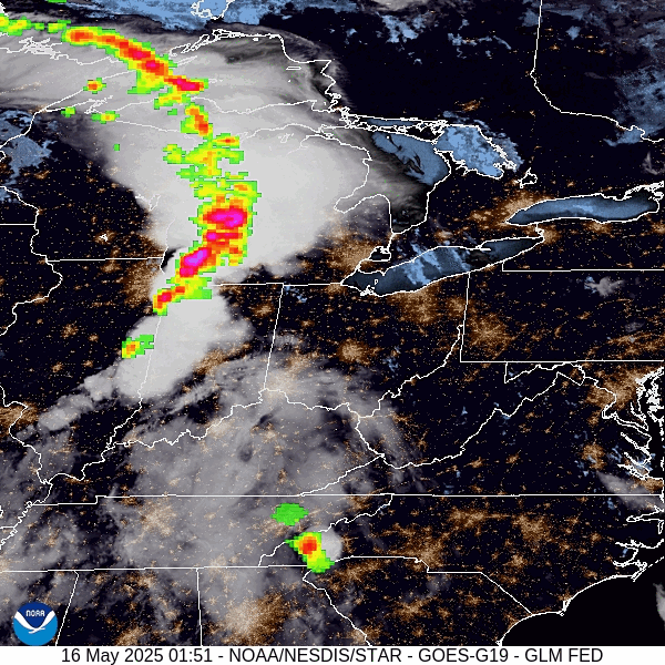
Satellite & Lightning
|
|
| Loop of GOES-East Geostationary Lightning Mapper - Lightning flash extent over GeoColor from 0151 UTC to 0551 UTC May 16, 2025 - courtesy NOAA GOES Imagery Viewer |
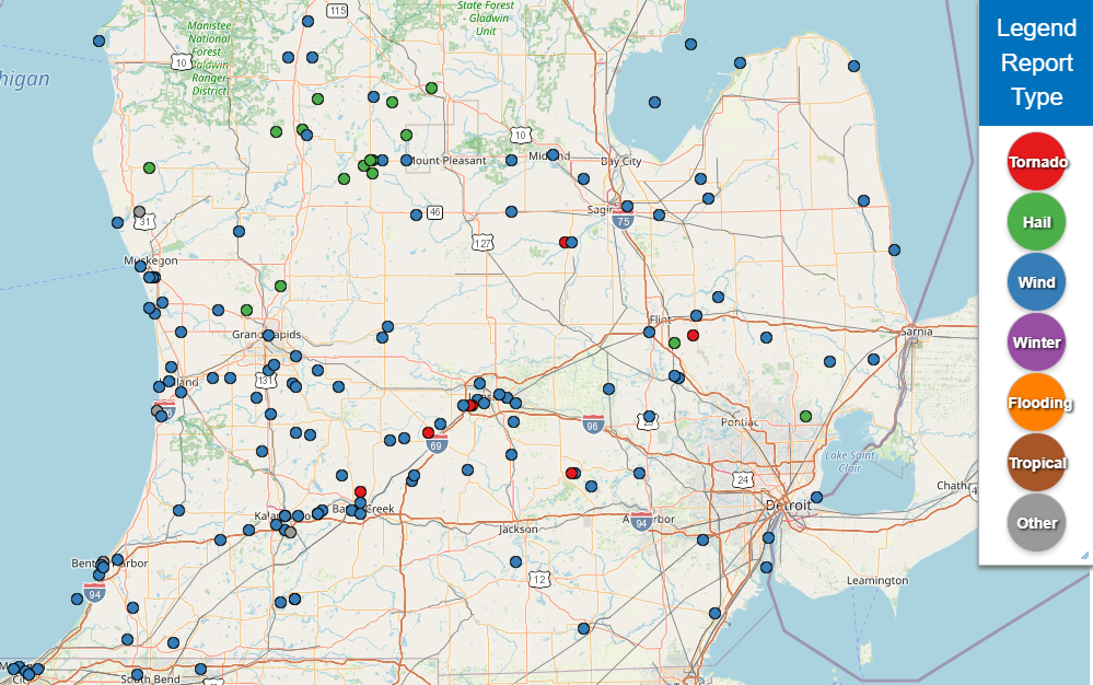
Storm Reports
|
|
| Lower Michigan Storm Reports for May 15 and 16, 2025 - courtesy Iowa Environmental Mesonet (IEM) Numbers denote hail size (inches) and measured wind gusts (mph) |
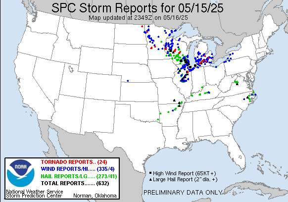 |
| National Storm Reports for May 15, 2025 |
Preliminary Local Storm Report...Summary
National Weather Service Detroit/Pontiac MI
939 AM EDT Fri May 16 2025

..TIME...   ...EVENT...      ...CITY LOCATION...     ...LAT.LON...
..DATE...   ....MAG....      ..COUNTY LOCATION..ST.. ...SOURCE....
            ..REMARKS..

1146 PM     Tstm Wnd Dmg     4 NW Gordonville        43.60N  84.44W
05/15/2025                   Midland            MI   911 Call Center

            report of trees and wires down

1202 AM     Tstm Wnd Dmg     Midland                 43.62N  84.23W
05/16/2025                   Midland            MI   911 Call Center

            report of trees and wires down
1203 AM     Tornado          3 W Gregory             42.45N  84.14W
05/16/2025                   Livingston         MI   NWS Storm Survey

            NWS damage survey confirmed a brief EF-1 tornado
            touched down between Stockbridge and Gregory being on
            the ground for a couple minutes before gusting out over
            Gregory.
1205 AM     Tornado          1 W St. Charles         43.30N  84.17W
05/16/2025                   Saginaw            MI   NWS Storm Survey

            NWS damage survey confirmed an EF-0 tornado touched
            down just west of St Charles and was on the ground for 5
            minutes before lifting in St Charles.
1205 AM     Tstm Wnd Dmg     2 W Gregory             42.45N  84.12W
05/16/2025                   Livingston         MI   Broadcast Media

            Trees down and a barn suffered damage, which included
            parts of the roof. Wind damage occured as prior
            confirmed tornado dissipated.

1210 AM     Tstm Wnd Dmg     Cohoctah                42.76N  83.95W
05/16/2025                   Livingston         MI   Broadcast Media

            Tree down on Byron Rd near Cohoctah.

1212 AM     Hail             S Grand Blanc           42.93N  83.62W
05/16/2025  M0.88 inch       Genesee            MI   Trained Spotter
1212 AM     Tstm Wnd Dmg     5 N New Lothrop         43.19N  83.97W
05/16/2025                   Saginaw            MI   Broadcast Media

            Photos of damage to a barn roof.

1213 AM     Tstm Wnd Gst     Tri Cities Intl Airport 43.53N  84.08W
05/16/2025  M49 mph          Saginaw            MI   ASOS

1218 AM     Tstm Wnd Dmg     Hamburg                 42.45N  83.80W
05/16/2025                   Livingston         MI   911 Call Center

            report of trees and wires down

1218 AM     Tstm Wnd Dmg     Saint Charles           43.30N  84.14W
05/16/2025                   Saginaw            MI   Broadcast Media

            Several Large Tree Limbs down.
1220 AM     Tstm Wnd Dmg     Hartland                42.66N  83.75W
05/16/2025                   Livingston         MI   911 Call Center

            Report of trees and wires down

1224 AM     Tstm Wnd Gst     Flint Bishop Intl Airpo 42.97N  83.75W
05/16/2025  M59 mph          Genesee            MI   ASOS

1227 AM     Tstm Wnd Dmg     1 E Holly               42.80N  83.60W
05/16/2025                   Oakland            MI   NWS Employee

            report of two large trees down
1227 AM     Tstm Wnd Dmg     1 N Holly               42.81N  83.62W
05/16/2025                   Oakland            MI   NWS Storm Survey

            A swath of uprooted trees and trees down from downtown
            Holly to Holly Village mobile home park. Peak winds
            estimated up to 70 mph.

1233 AM     Tstm Wnd Dmg     4 S Columbiaville       43.10N  83.40W
05/16/2025                   Lapeer             MI   Emergency Mngr

            photos of trees down and large branches

1235 AM     Tstm Wnd Gst     Saginaw Harry Browne Ai 43.43N  83.86W
05/16/2025  M48 mph          Saginaw            MI   AWOS
1235 AM     Tornado          2 N Atlas               42.96N  83.53W
05/16/2025                   Genesee            MI   NWS Storm Survey

            NWS damage survey confirmed an EF-0 tornado touched
            down northeast of Atlas and was on the ground 3 minutes
            before lifting north of Goodrich.

1237 AM     Tstm Wnd Dmg     1 E Davison             43.03N  83.51W
05/16/2025                   Genesee            MI   Trained Spotter

            Photo of tree down near USPS on E Flint St.

1245 AM     Hail             1 W Waldenburg          42.66N  82.96W
05/16/2025  M0.75 inch       Macomb             MI   Trained Spotter
1247 AM     Tstm Wnd Dmg     2 NE Lyndon Township    42.40N  84.04W
05/16/2025                   Washtenaw          MI   911 Call Center

            Sporadic isolated trees reported down across northwest
            Washtenaw County.
1252 AM     Tstm Wnd Dmg     2 W Dryden              42.95N  83.16W
05/16/2025                   Lapeer             MI   Trained Spotter

            Trees sheared and wires down.

1255 AM     Tstm Wnd Gst     Tuscola Area Airport    43.46N  83.45W
05/16/2025  M45 mph          Tuscola            MI   AWOS
0100 AM     Tstm Wnd Gst     3 E Fairgrove           43.53N 83.49W
05/16/2025  M54 MPH          Tuscola            MI   Mesonet

            Mesonet station MIFGV 3.1 SE Akron (MAWN).
0100 AM     Tstm Wnd Gst     4 S Reese               43.40N 83.70W
05/16/2025  M51 MPH          Tuscola            MI   Mesonet

            Mesonet station MIRVL 3.6 S Reese (MAWN).
0110 AM     Tstm Wnd Gst     3 SW Adrian             41.87N 84.08W
05/16/2025  M44 MPH          Lenawee            MI   AWOS

            AWOS station KADG 2 SW Adrian.
0110 AM     Tstm Wnd Dmg     3 NE Armada             42.86N  82.84W
05/16/2025                   Macomb             MI   911 Call Center

            Tree reported blown down.

0111 AM     Tstm Wnd Dmg     Belleville              42.20N  83.48W
05/16/2025                   Wayne              MI   Broadcast Media

            Large tree downed across roadway. Photo shared via
            social media.

0116 AM     Tstm Wnd Dmg     1 NW Rattle Run         42.87N  82.62W
05/16/2025                   St. Clair          MI   Trained Spotter

            Numerous large trees down near Mayer Rd and Rattle Run
            Rd.
0126 AM     Tstm Wnd Dmg     2 N Carsonville         43.45N  82.67W
05/16/2025                   Sanilac            MI   911 Call Center

            Trees and power lines reported down in Bridgehampton
            and Delaware Townships.
0127 AM     Tstm Wnd Gst     2 NW Monroe             41.93N 83.42W
05/16/2025  M43 MPH          Monroe             MI   AWOS

            AWOS station KTTF Monroe.

0135 AM     Tstm Wnd Dmg     Wyandotte               42.21N  83.15W
05/16/2025                   Wayne              MI   Broadcast Media

            Large tree limb downed. Photo shared via social media.
&&
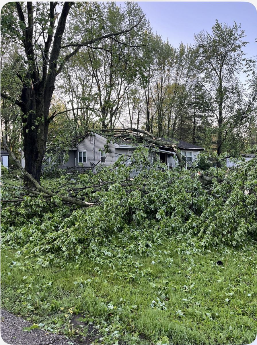
Photos & Video
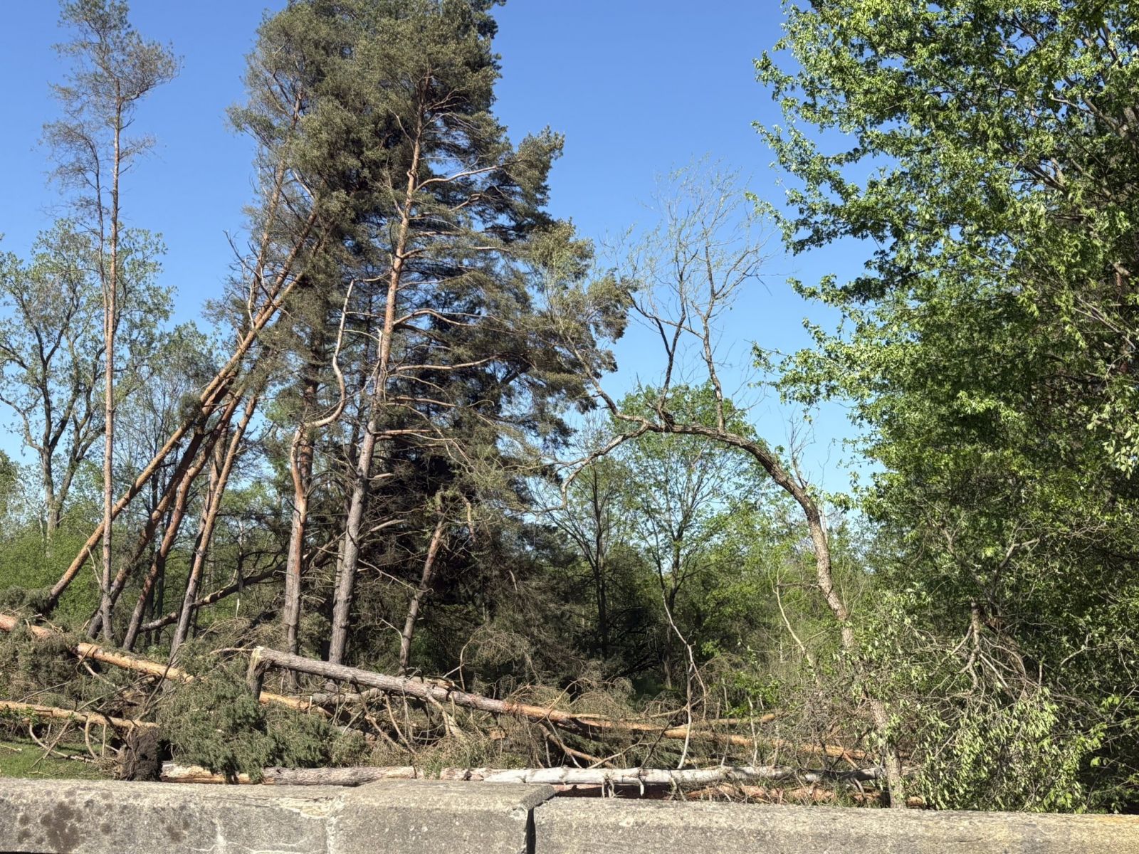 |
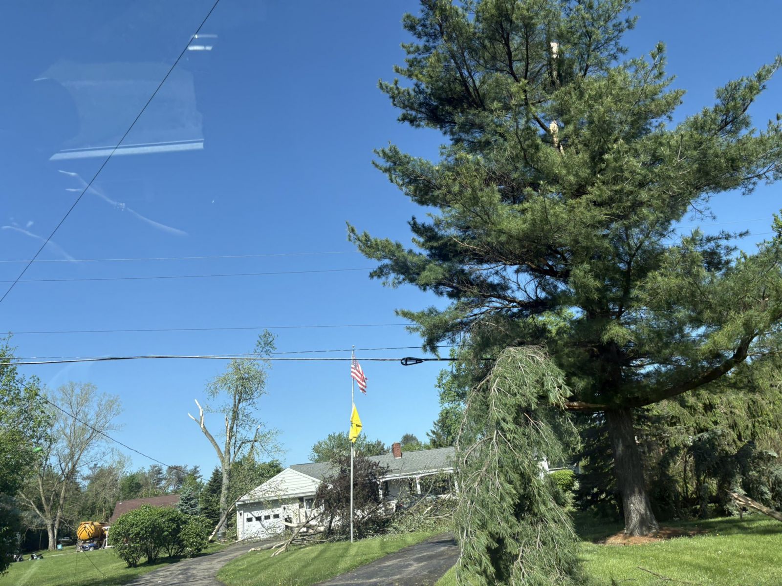 |
 |
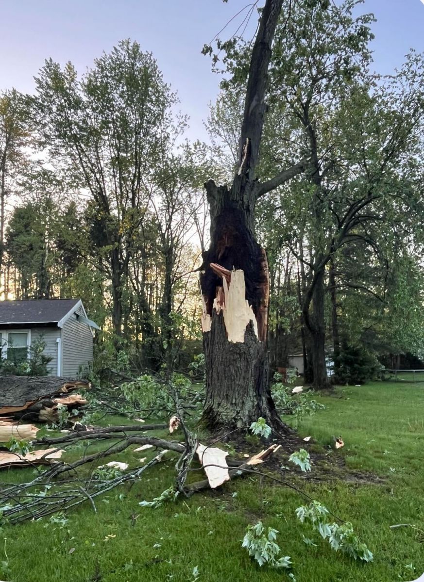 |
| Atlas Tornado Damage | Atlas Tornado Damage | St. Charles Damage (WNEM-TV) |
St. Charles Damage (WNEM-TV) |
Environment
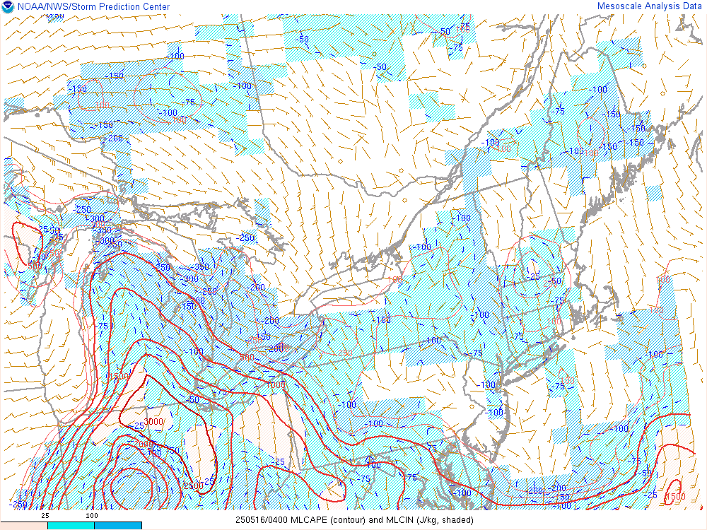
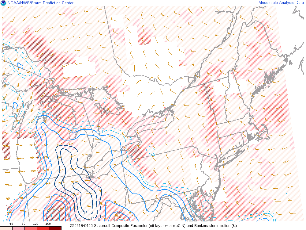
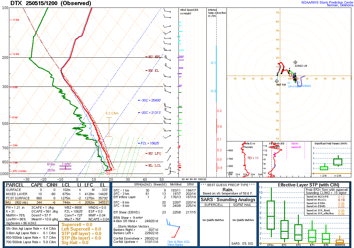
Note the good low level wind shear but increasing CIN and gradual loss of instability.
 |
 |
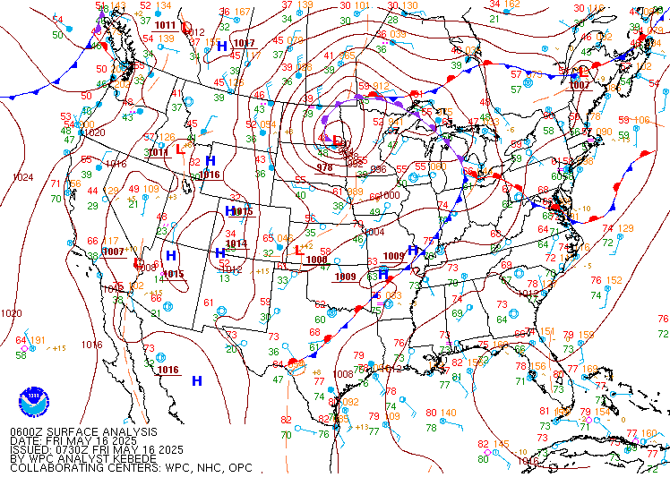 |
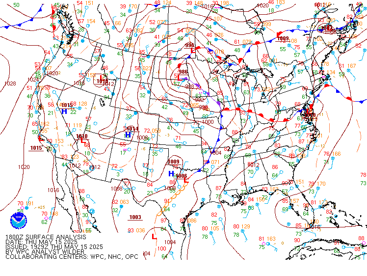
| Figure 1: WPC Surface Analysis, valid 18 UTC May 15, 2025 | Figure 2: WPC Surface Analysis, valid 00 UTC May 16, 2025 | Figure 3: WPC Surface Analysis, valid 06 UTC May 16, 2025 |
 |
 |
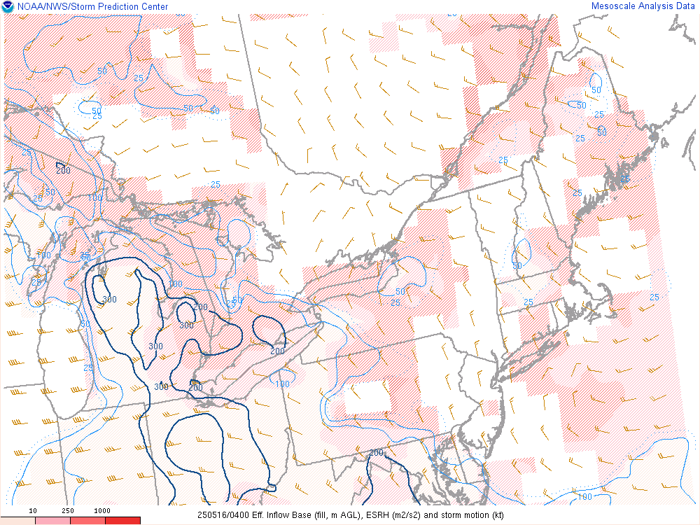 |
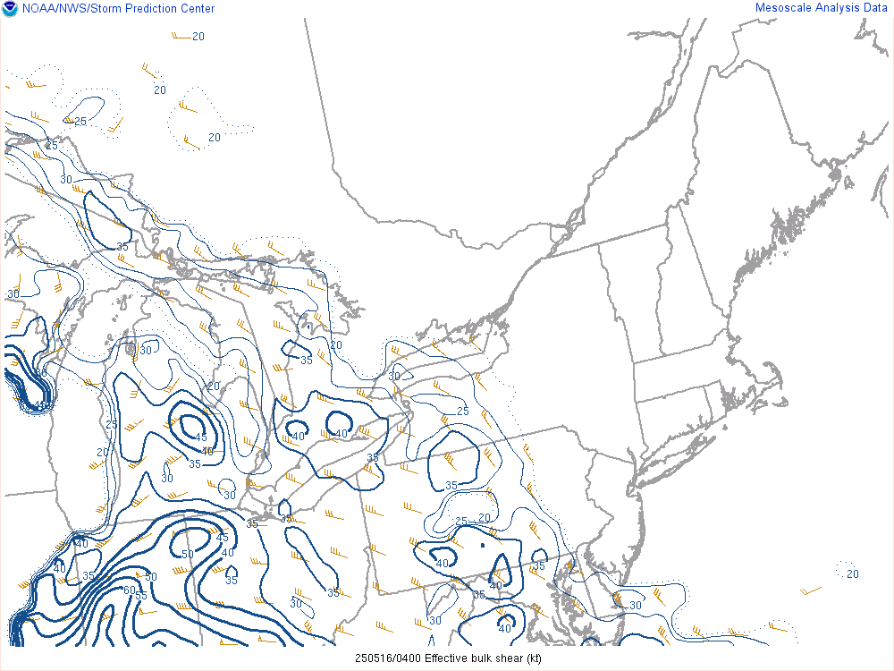
| Figure 4: Effective bulk wind shear, valid 04 UTC May 16, 2025 | Figure 5: Mixed-layer CAPE, valid 04 UTC May 16, 2025 | Figure 6: Effective storm-relative helicity, valid 04 UTC May 16, 2025 |
 |
 |
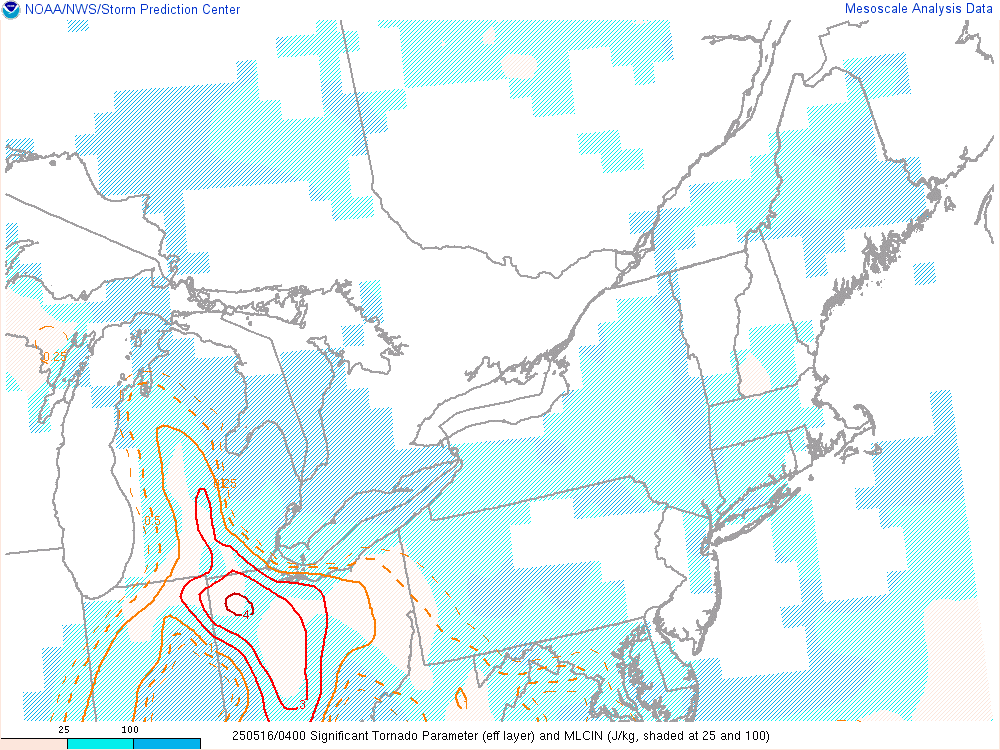 |
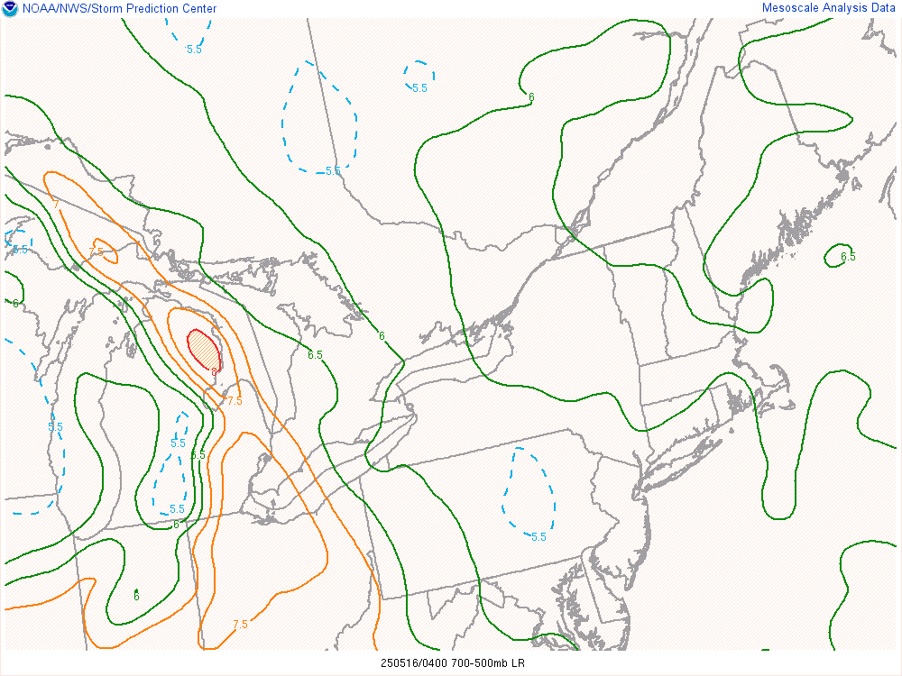
| Figure 7: Mid-level lapse rates, valid 04 UTC May 16, 2025 | Figure 8: Supercell Composite Parameter, valid 04 UTC May 16, 2025 | Figure 9: Effective Significant Tornado Parameter, valid 04 UTC May 16, 2025 |
 |
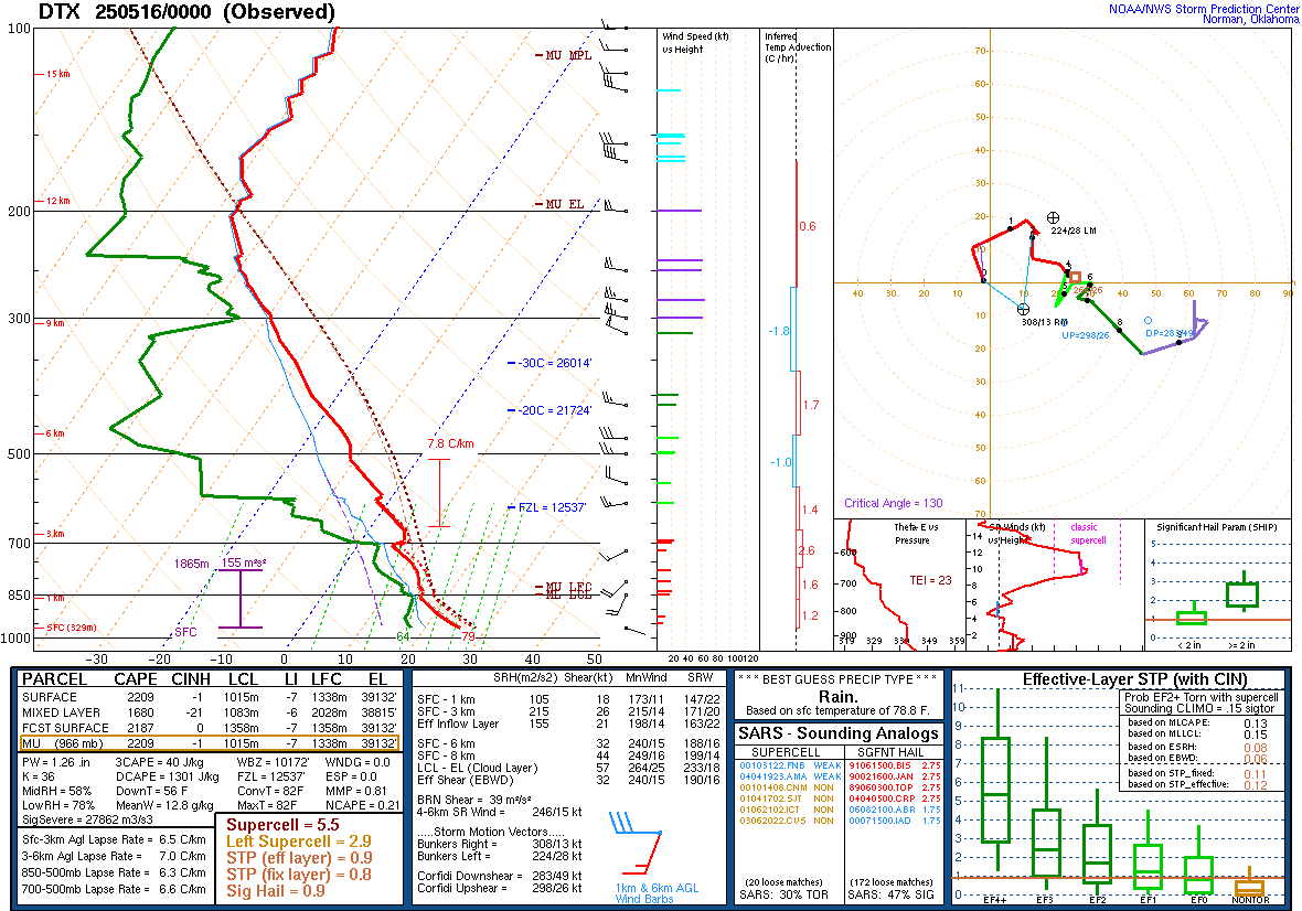 |
| Figure 10: DTX Sounding, valid 12 UTC May 15, 2025 | Figure 11: DTX Sounding, valid 00 UTC May 16, 2025 |
 |
 |
 |
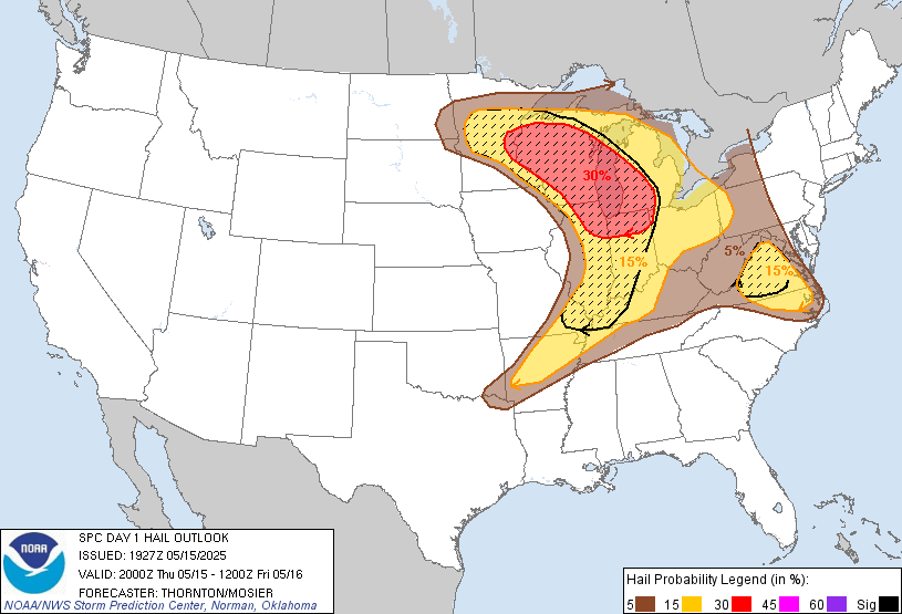 |
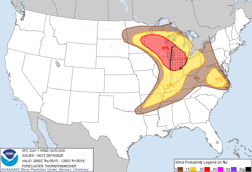
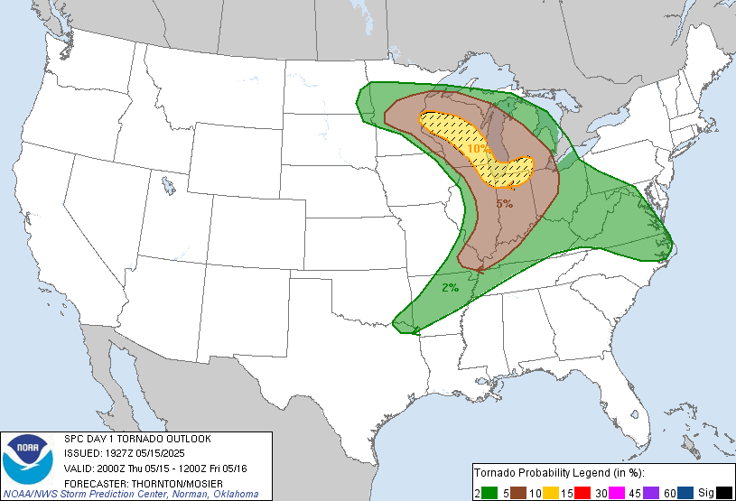
| Figure 12: SPC Categorical Outlook, valid 2000 UTC May 15, 2025 | Figure 13: SPC Probabilistic Damaging Wind Outlook, valid 2000 UTC May 15, 2025 | Figure 14: SPC Probabilistic Tornado Outlook, valid 2000 UTC May 15, 2025 | Figure 15: SPC Probabilistic Hail Outlook, valid 2000 UTC May 15, 2025 |
 |
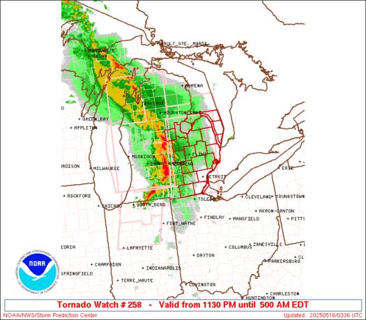 |
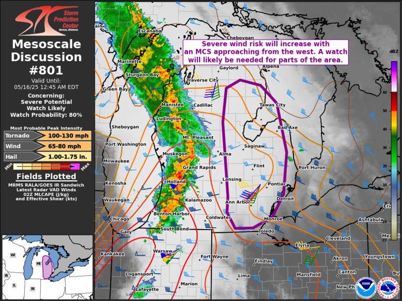
| Figure 16: SPC Mesoscale Discussion #801, valid 0247 UTC May 15, 2025 | Figure 17: Tornado Watch #258, valid 0330 UTC May 15, 2025 |
 |
Media use of NWS Web News Stories is encouraged! Please acknowledge the NWS as the source of any news information accessed from this site. |
|


/Track%20Map%20Coming%20Soon.jpg)