Overview
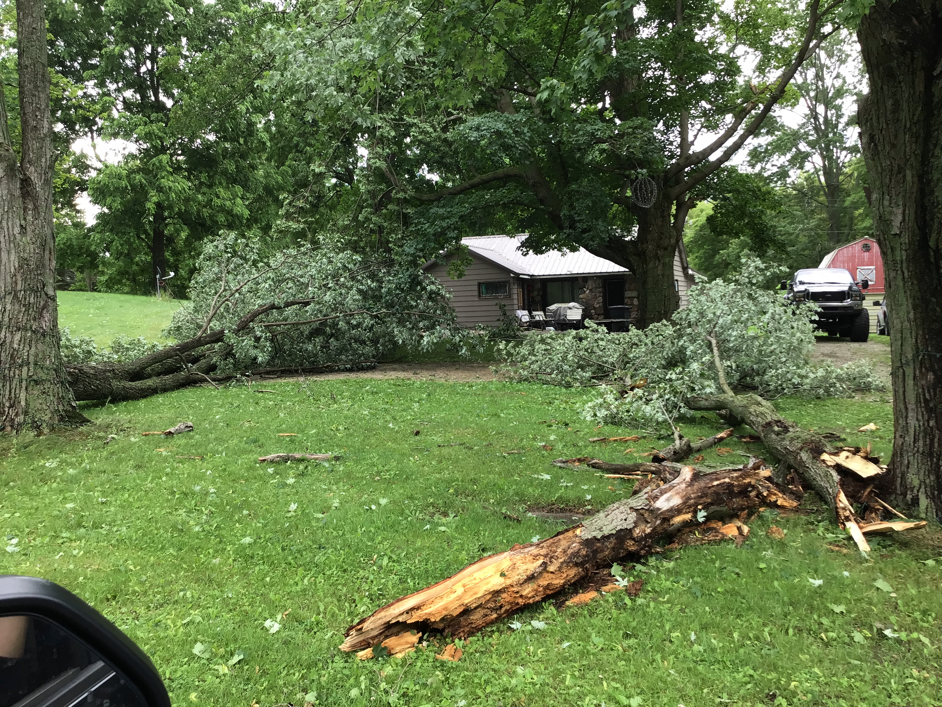
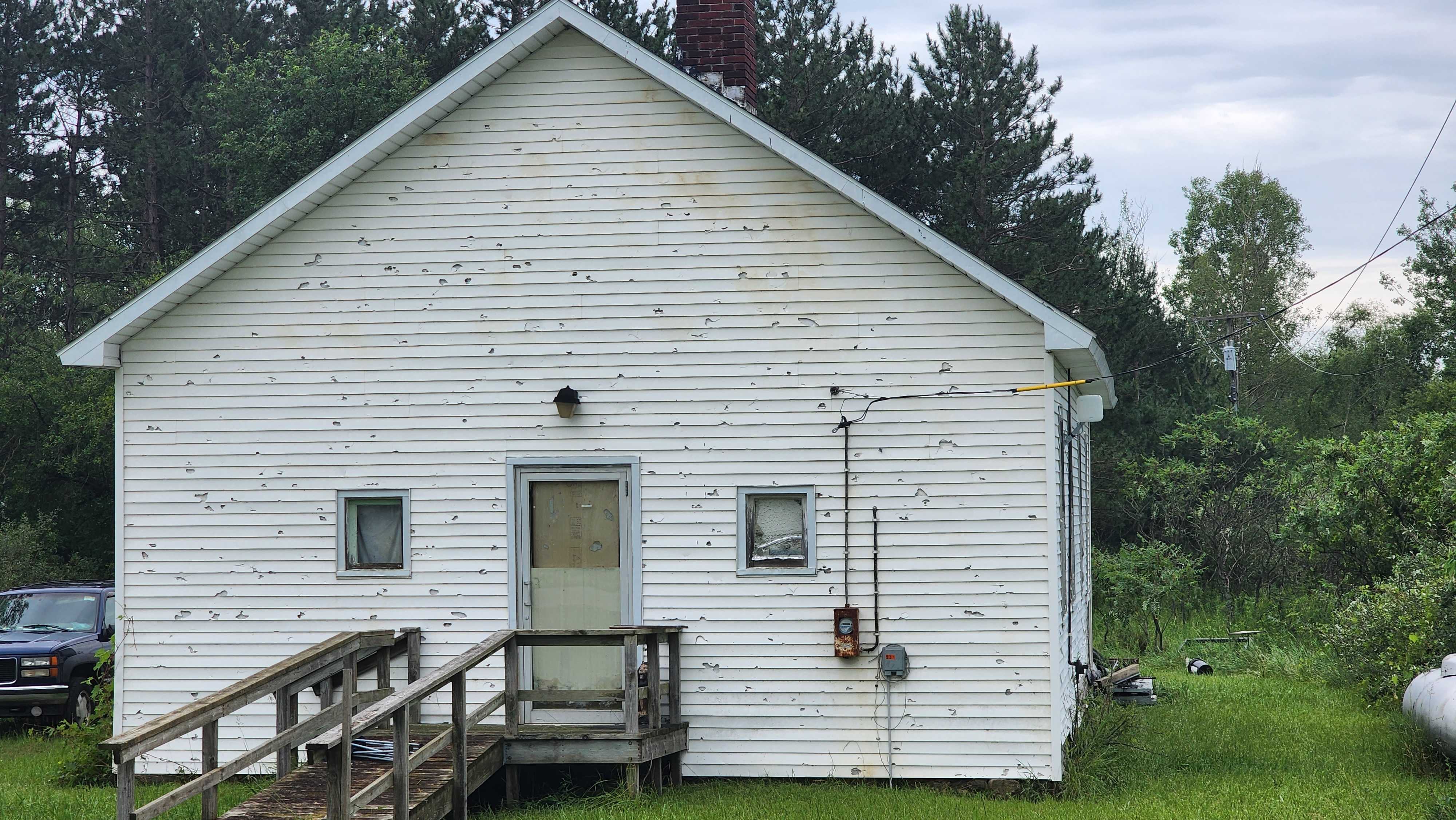
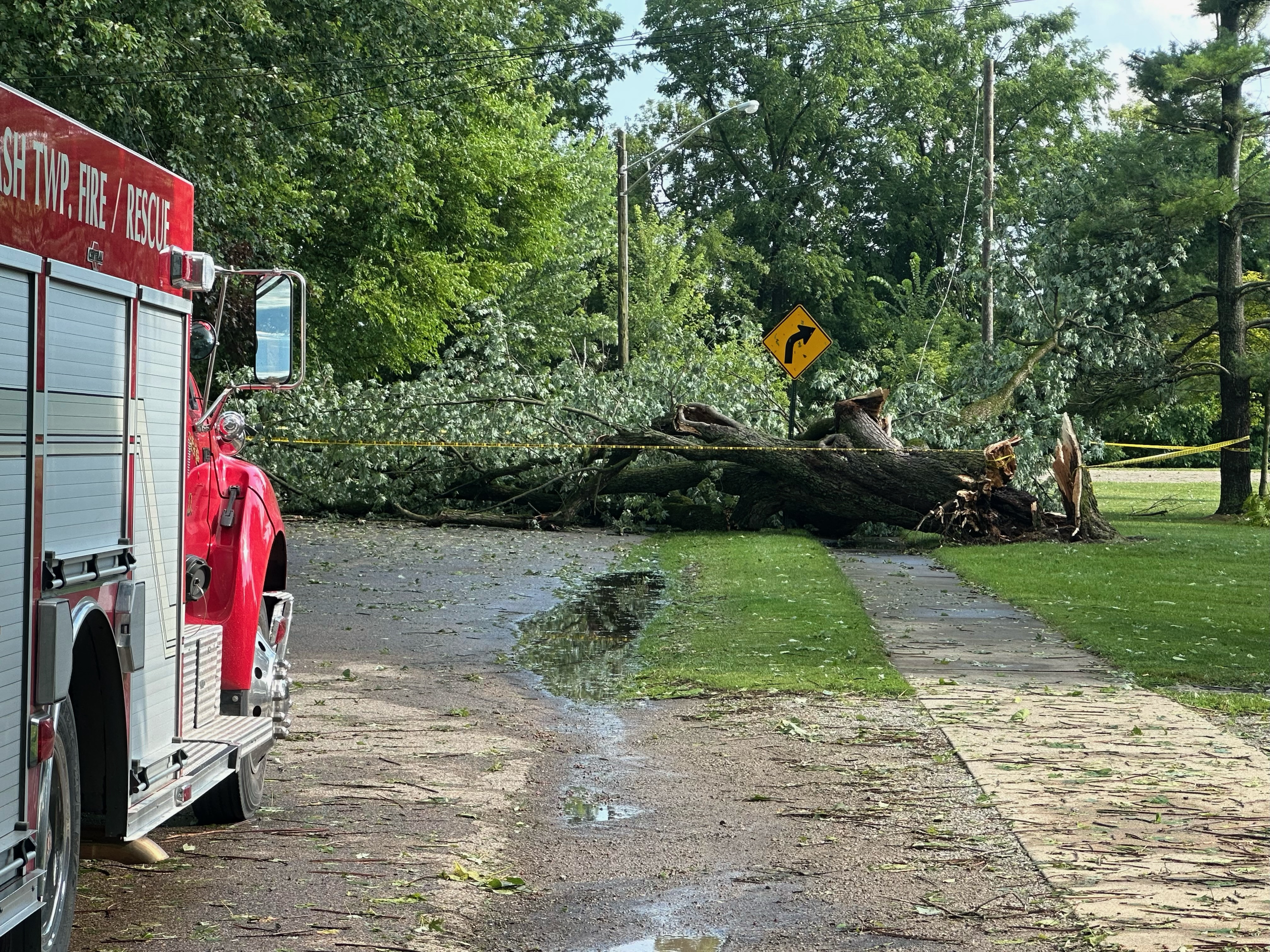
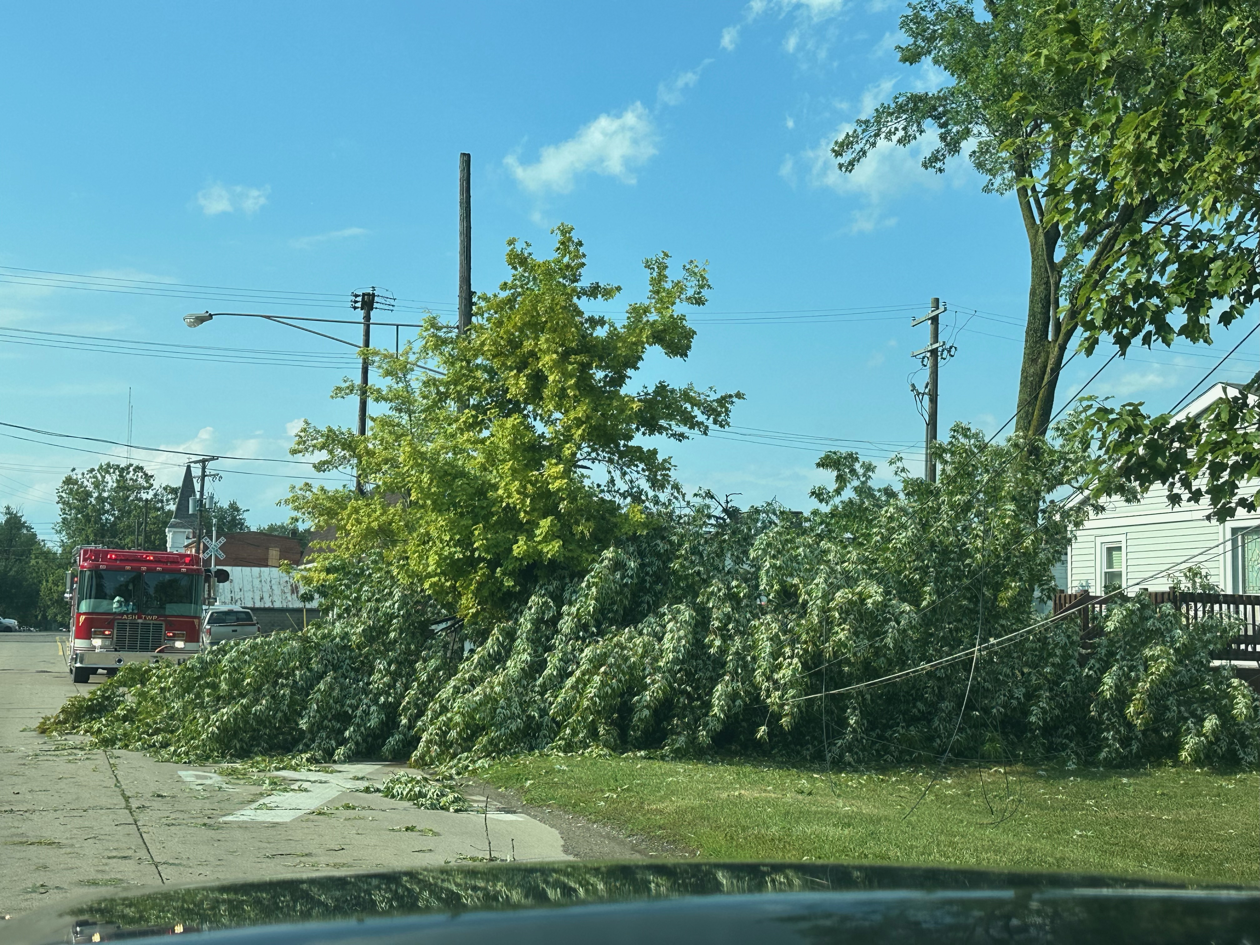
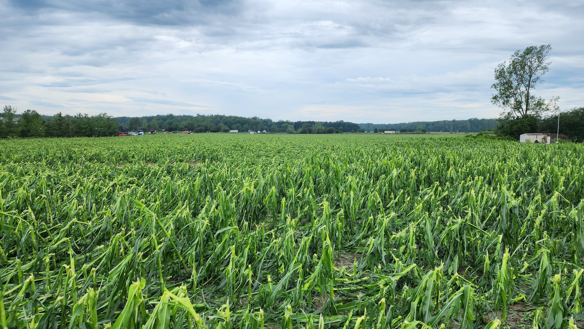
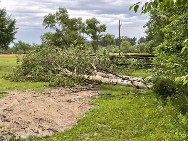
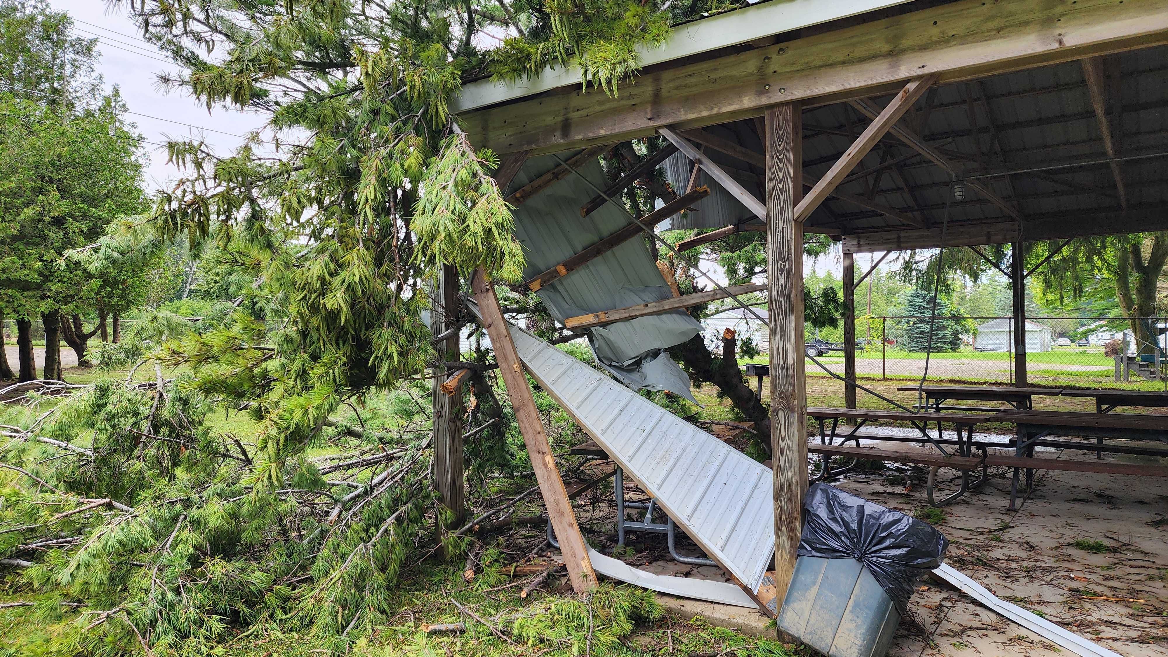
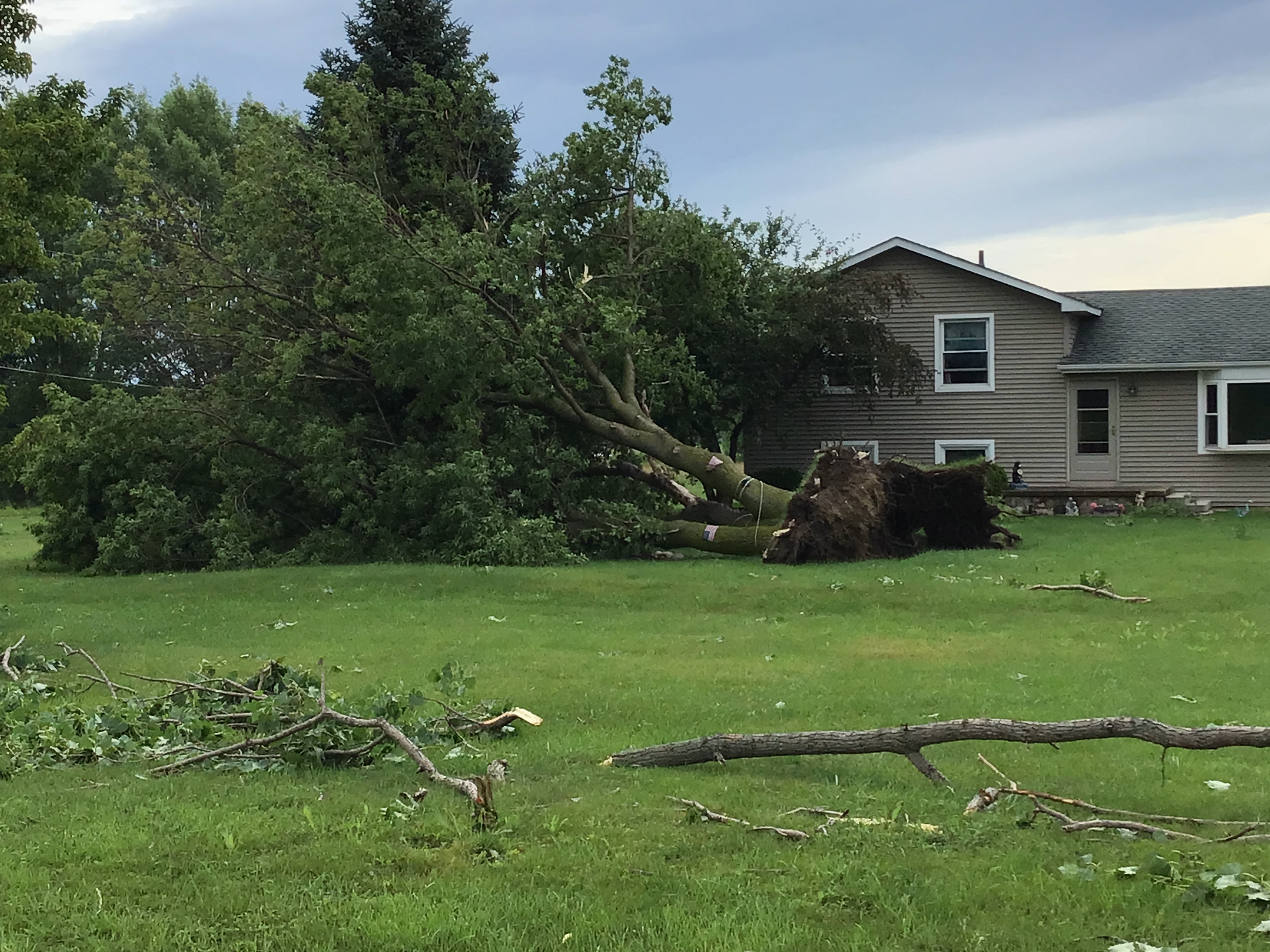
An outbreak of multicell clusters and supercells developed across Southeast Michigan on the afternoon of July 14, 2023. These storms produced areas of wind damage, large hail to golf ball size, heavy rain, and an EF0 tornado in Sanilac County before moving eastward into Canada and the lakes during the evening. Numerous trees were downed across the region, and in the Thumb there were several reports of destroyed corn and wheat fields as well as several homes with damage to siding due to wind-blown hail.
Tornadoes:
|
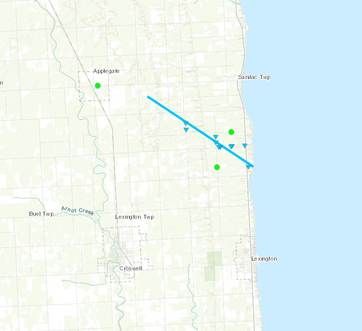
Tornado - Lexington, MI
Track Map

|
||||||||||||||||
The Enhanced Fujita (EF) Scale classifies tornadoes into the following categories:
| EF0 Weak 65-85 mph |
EF1 Moderate 86-110 mph |
EF2 Significant 111-135 mph |
EF3 Severe 136-165 mph |
EF4 Extreme 166-200 mph |
EF5 Catastrophic 200+ mph |
 |
|||||
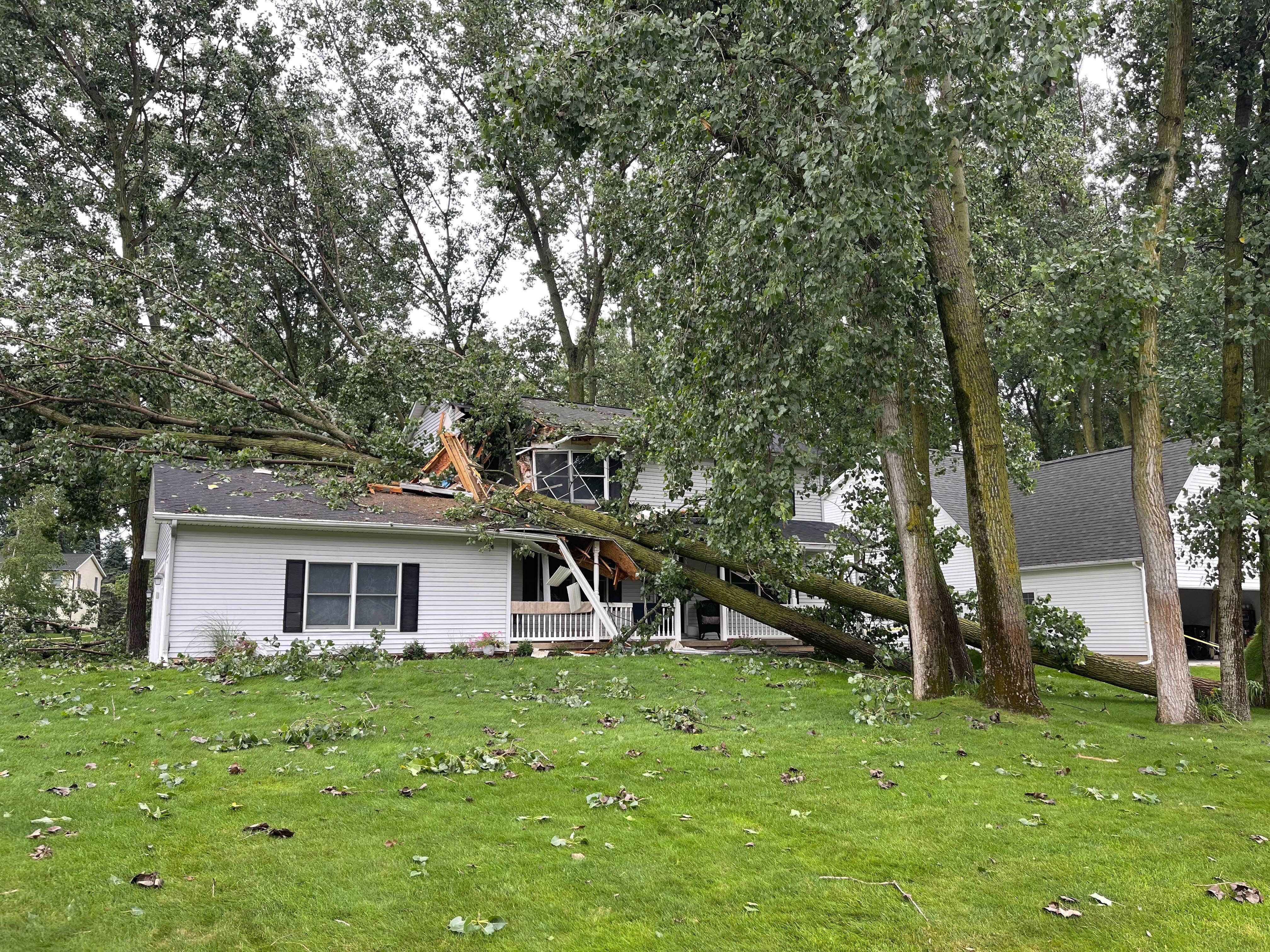
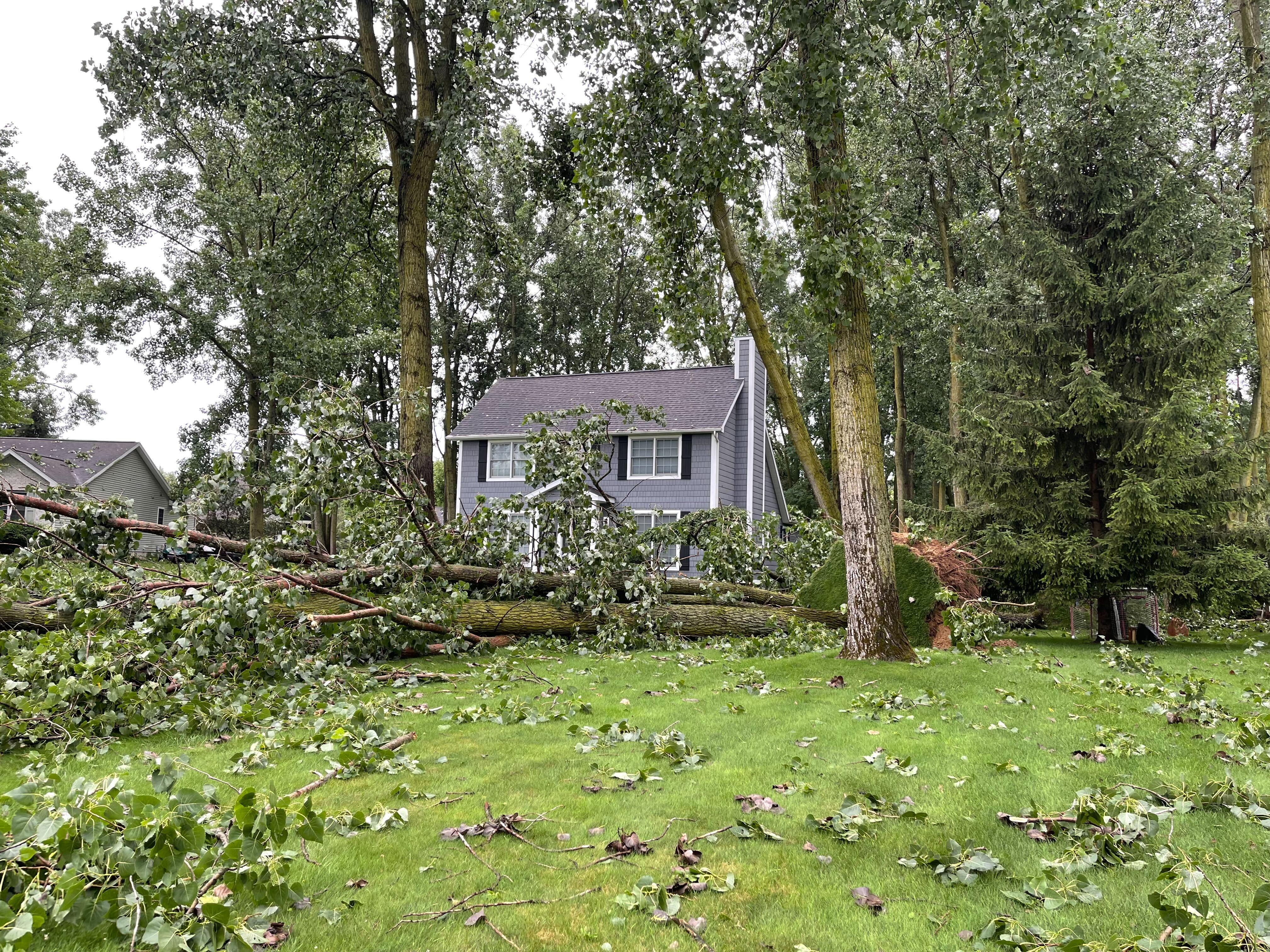
Photos
 |
 |
 |
|
Adrian Credit: Peter Ossman |
Adrian Credit: Peter Ossman |
Adrian Township Credit: Peter Ossman |
 |
 |
 |
|
Applegate Credit: NWS Storm Survey |
Applegate Credit: Kyle Gillett |
Carleton Credit: Michael LaBeau |
 |
 |
 |
|
Carleton Credit: Michael LaBeau |
Carsonville Credit: Kyle Gillett |
Croswell Credit: Mark Krzysiak |
 |
 |
 |
|
Deerfield Twp Credit: Jenna Gargalino Butler |
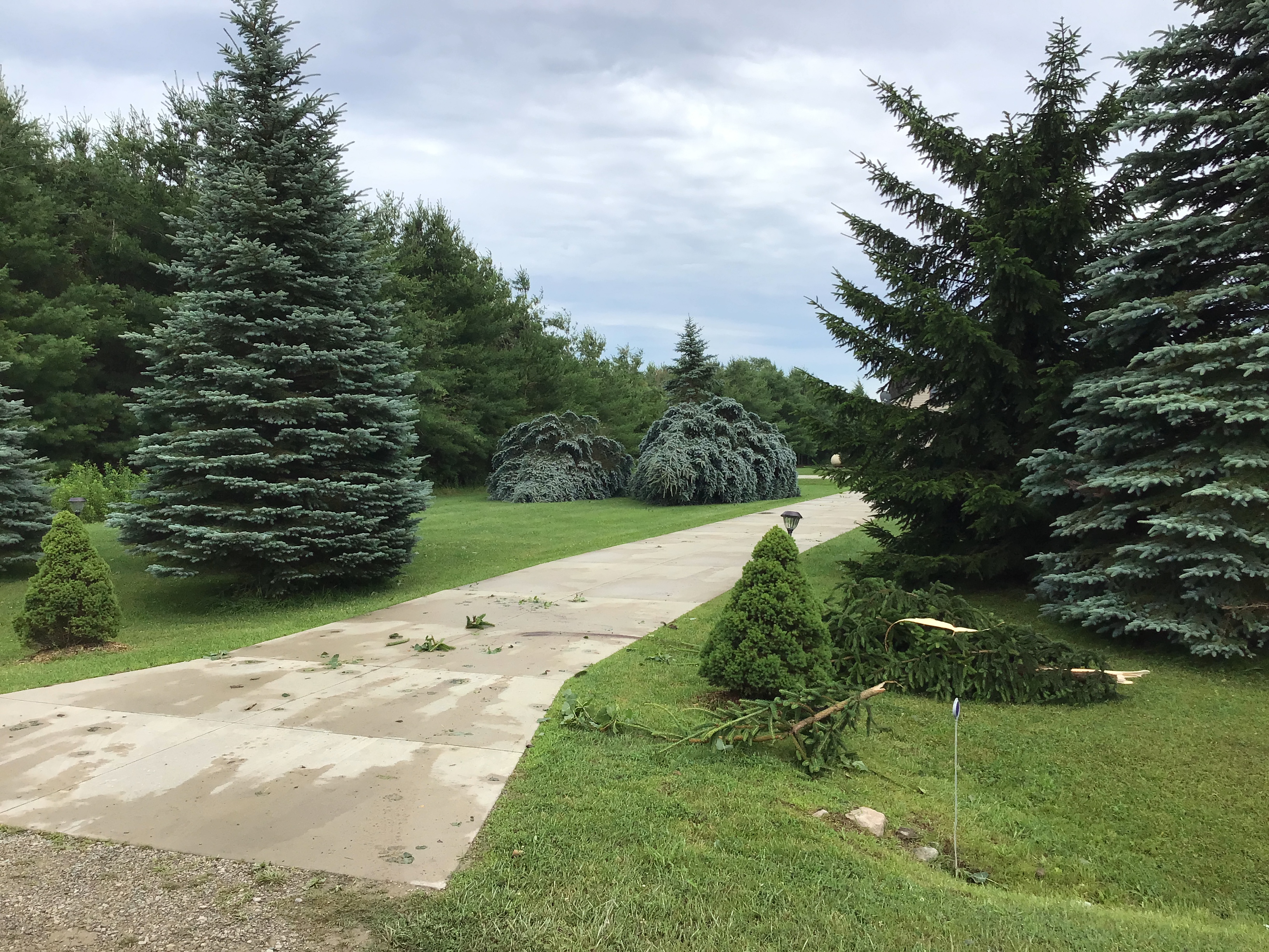
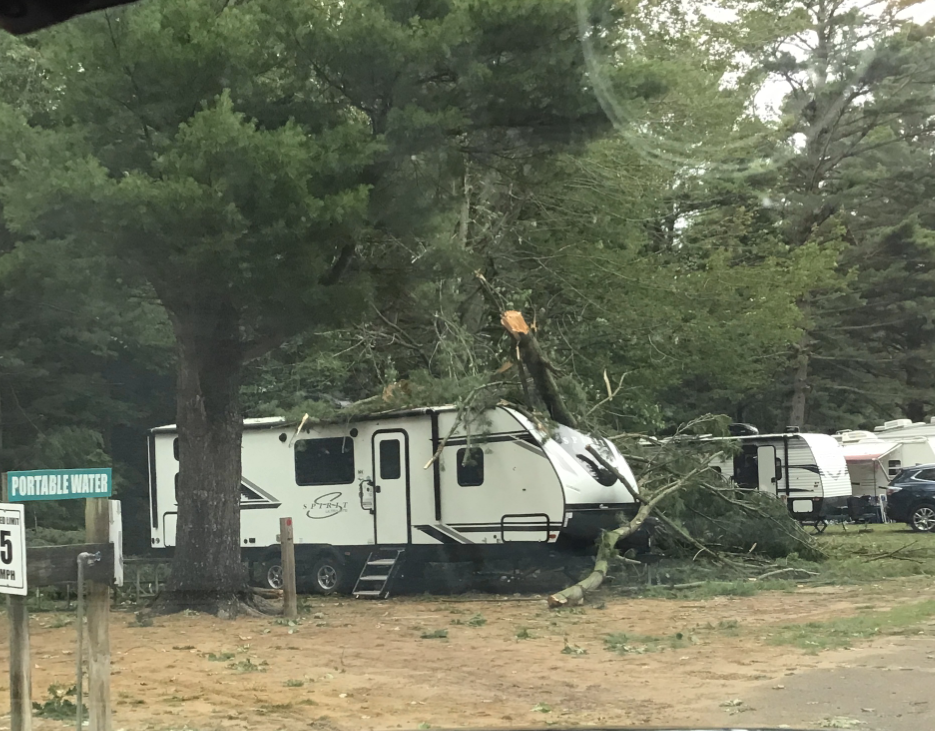
Lexington Credit: Kyle Gillett |
Lexington Credit: Kyle Gillett |
 |
 |
 |
|
Lexington Credit: NWS Storm Survey |
Lexington Credit: NWS Storm Survey |
Lexington Credit: NWS Storm Survey |
 |
|
|
|
Newport Credit: Michael LaBeau |
Pittsfield Township Credit: @redtn44 |
Radar
Radar Imagery for Southeast MI
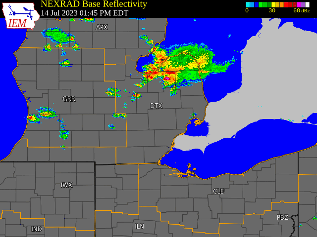
Radar loop courtesy of Iowa Environmental Mesonet (IEM)
Radar Imagery for Lexington EF-0 Tornado
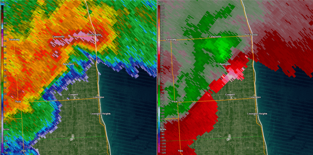
DTX base reflectivity (left) and base velocity (right) between 3:20 and 3:38pm on 14 July 2023, centered north of Lexington, MI.
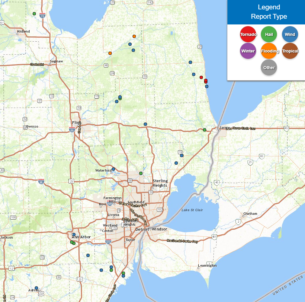
Storm Reports
|
|
|
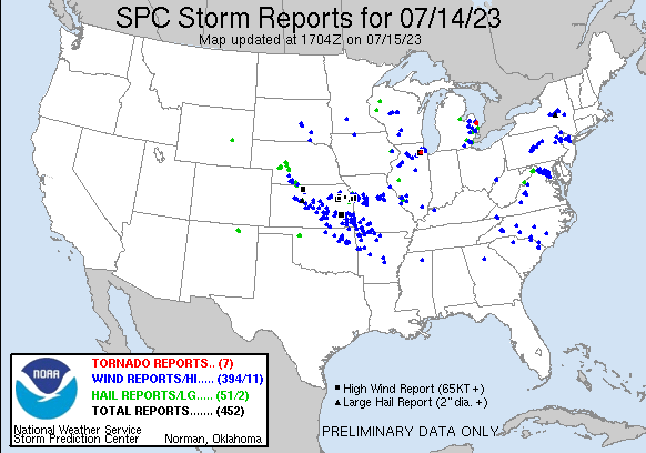
Map of Local Storm Reports July 14, 2023 |
Severe Weather Local Storm Reports:
Preliminary Local Storm Report...Summary
National Weather Service Detroit/Pontiac MI
758 PM EDT Fri Jul 14 2023

..TIME...   ...EVENT...      ...CITY LOCATION...     ...LAT.LON...
..DATE...   ....MAG....      ..COUNTY LOCATION..ST.. ...SOURCE....
            ..REMARKS..

0152 PM     Tstm Wnd Dmg     5 E Ellington           43.55N  83.22W
07/14/2023                   Tuscola            MI   911 Call Center

            Trees down. Time estimated by radar.

0157 PM     Tstm Wnd Dmg     Deford                  43.51N  83.19W
07/14/2023                   Tuscola            MI   911 Call Center

            Trees down. Time estimated by radar.

0300 PM     Rain             3 NE Ivanhoe            43.73N  83.05W
07/14/2023  M1.32 inch       Huron              MI   Trained Spotter

            3 hour rainfall total.

0306 PM     Tstm Wnd Dmg     4 E Columbiaville       43.17N  83.34W
07/14/2023                   Lapeer             MI   911 Call Center

            Trees down at intersection of Skelton and Miller Lake
            Roads. Time estimated by radar.

0307 PM     Tstm Wnd Dmg     5 SE Fostoria           43.20N  83.31W
07/14/2023                   Lapeer             MI   911 Call Center

            Trees down at intersection of M-24 and Burnside Road.
            Time estimated by radar.

0310 PM     Hail             5 NW Five Lakes         43.19N  83.31W
07/14/2023  E1.75 inch       Lapeer             MI   Public

            Golfball size hail reported.

0330 PM     Tornado          4 NNW Lexington         43.33N  82.57W
07/14/2023                   Sanilac            MI   Trained Spotter

            Possible tornado with large trees uprooted and trees
            blocking roads. Estimated winds at least 65-70 mph.

0333 PM     Tornado          3 N Lexington           43.31N  82.53W
07/14/2023                   Sanilac            MI   Trained Spotter

            Possible tornado with down trees and tree limbs, some
            trees stripped of bark. A large limb landed on a camper,
            although no injuries were reported. There is additional
            tree damage for at least a mile on M25/Lake Shore Road.

0333 PM     Tornado          2 N Lexington           43.30N  82.53W
07/14/2023                   Sanilac            MI   Public

            Possible tornado with many large trees down along M-25
            between Harrington Road and Aitken Road.

0335 PM     Tstm Wnd Dmg     S Applegate             43.35N  82.64W
07/14/2023                   Sanilac            MI   Trained Spotter

            Trees and powerlines reported down. Hail damage and
            shredded crops, size unknown.

0335 PM     Tstm Wnd Dmg     SE Carsonville          43.43N  82.67W
07/14/2023                   Sanilac            MI   Trained Spotter

            Wind-driven hail resulted in vinyl siding being
            completely punched in to at least one structure.

0338 PM     Tstm Wnd Dmg     Imlay City              43.02N  83.08W
07/14/2023                   Lapeer             MI   911 Call Center

            Trees down. Time estimated by radar.

0342 PM     Tstm Wnd Dmg     2 NNW Clintonville      42.72N  83.37W
07/14/2023                   Oakland            MI   NWS Employee

            Power line down resulted in a small fire. Nickel size
            hail also observed.

0346 PM     Hail             1 NNW Pittsfield        42.22N  83.73W
07/14/2023  M1.00 inch       Washtenaw          MI   Trained Spotter

0347 PM     Hail             2 NW Pittsfield         42.23N  83.75W
07/14/2023  M0.75 inch       Washtenaw          MI   Public

0350 PM     Flood            Caro                    43.49N  83.40W
07/14/2023                   Tuscola            MI   911 Call Center

            Water covering roadways across portions of town.

0350 PM     Flood            Cass City               43.60N  83.18W
07/14/2023                   Tuscola            MI   911 Call Center

            Water covering roadways across portions of town.

0350 PM     Tstm Wnd Gst     Ann Arbor               42.28N  83.73W
07/14/2023  M51 mph          Washtenaw          MI   ASOS

            Measured at KARB ASOS.

0357 PM     Tstm Wnd Gst     1 ESE Lexington         43.27N  82.52W
07/14/2023  M48 mph          LHZ443             MI   Mesonet

0406 PM     Hail             1 N Whittaker           42.14N  83.60W
07/14/2023  E1.25 inch       Washtenaw          MI   Trained Spotter

0406 PM     Tstm Wnd Dmg     1 N Whittaker           42.14N  83.60W
07/14/2023                   Washtenaw          MI   Trained Spotter

            Large tree and powerlines reported down.

0409 PM     Hail             1 N Whittaker           42.14N  83.60W
07/14/2023  M1.25 inch       Washtenaw          MI   Trained Spotter

0414 PM     Hail             Rochester               42.69N  83.12W
07/14/2023  M1.00 inch       Oakland            MI   Trained Spotter

0422 PM     Rain             Unionville              43.65N  83.47W
07/14/2023  M2.90 inch       Tuscola            MI   Trained Spotter

            5 hour rainfall total. Updated rainfall total.

0423 PM     Rain             6 E Unionville          43.65N  83.35W
07/14/2023  M2.60 inch       Tuscola            MI   Trained Spotter

            5 hour rainfall total.

0425 PM     Tstm Wnd Dmg     1 NNE Scofield          42.04N  83.48W
07/14/2023                   Monroe             MI   Trained Spotter

            Large tree branches down.

0430 PM     Hail             1 S Carleton            42.04N  83.39W
07/14/2023  M1.25 inch       Monroe             MI   Amateur Radio

0436 PM     Tstm Wnd Dmg     Carleton                42.06N  83.39W
07/14/2023                   Monroe             MI   Emergency Mngr

            Reports of downed trees and powerlines.

0440 PM     Hail             1 S Wadhams             42.98N  82.54W
07/14/2023  E1.00 inch       St. Clair          MI   Public

0446 PM     Hail             2 NE Newport            42.02N  83.28W
07/14/2023  M1.75 inch       Monroe             MI   Public

0450 PM     Tstm Wnd Gst     Oldport                 42.00N  83.28W
07/14/2023  M55 mph          Monroe             MI   Public

            Measured via Tempest Weather Station.

0520 PM     Hail             Crump                   43.75N  84.09W
07/14/2023  M1.00 inch       Bay                MI   Public

0557 PM     Tstm Wnd Dmg     2 N New Haven           42.76N  82.80W
07/14/2023                   Macomb             MI   911 Call Center

            Trees down. Time estimated by radar.

0558 PM     Tstm Wnd Dmg     Richmond                42.81N  82.75W
07/14/2023                   Macomb             MI   911 Call Center

            Wires down. Time estimated by radar.
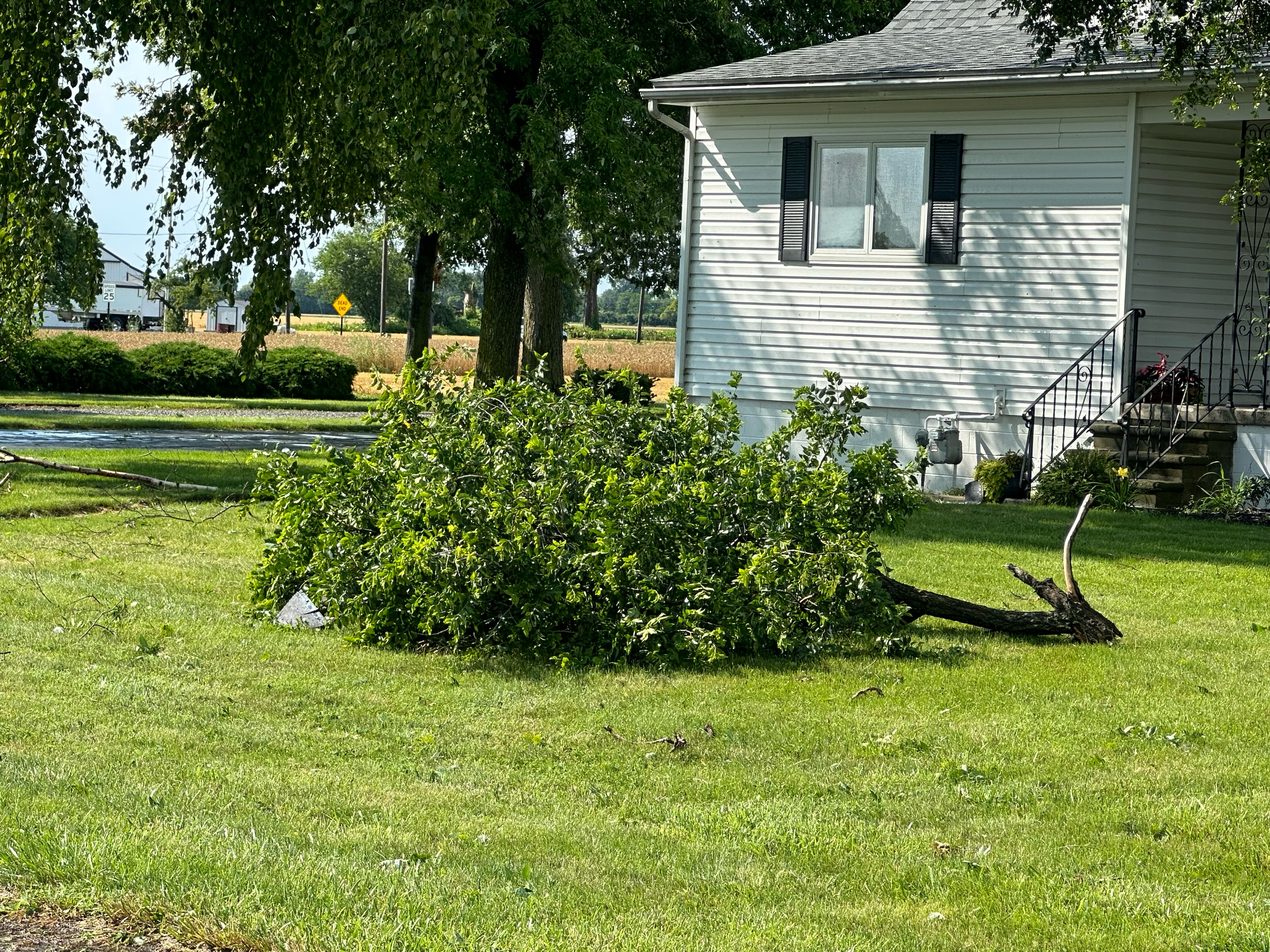
0930 PM     Tstm Wnd Dmg     2 NW Adrian             41.92N  84.07W
07/14/2023                   Lenawee            MI   Fire Dept/Rescue

            A couple of large trees were blown down. One tree fell
            onto a house and caused extensive roof damage.
0630 AM     Rain             Cass City               43.60N  83.18W
07/15/2023  M1.00 inch       Tuscola            MI   Co-Op Observer

            24 hour rainfall total.

0700 AM     Rain             2 NNW Rochester Hills   42.69N  83.17W
07/15/2023  M1.14 inch       Oakland            MI   CoCoRaHS

            24 hour rainfall total.

0700 AM     Rain             3 SE Northville         42.41N  83.45W
07/15/2023  M1.18 inch       Wayne              MI   CoCoRaHS

            24 hour rainfall total.

1100 AM     Rain             Decker                  43.46N  83.05W
07/15/2023  M1.10 inch       Sanilac            MI   Public

            24 hour rainfall total.
&&
 |
|
National Storm Reports for July 14, 2023 |
Environment
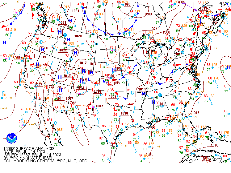
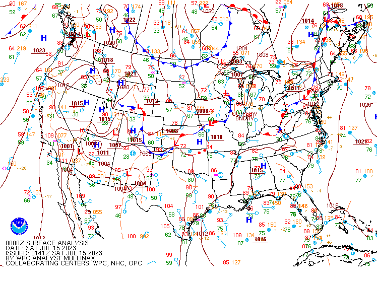
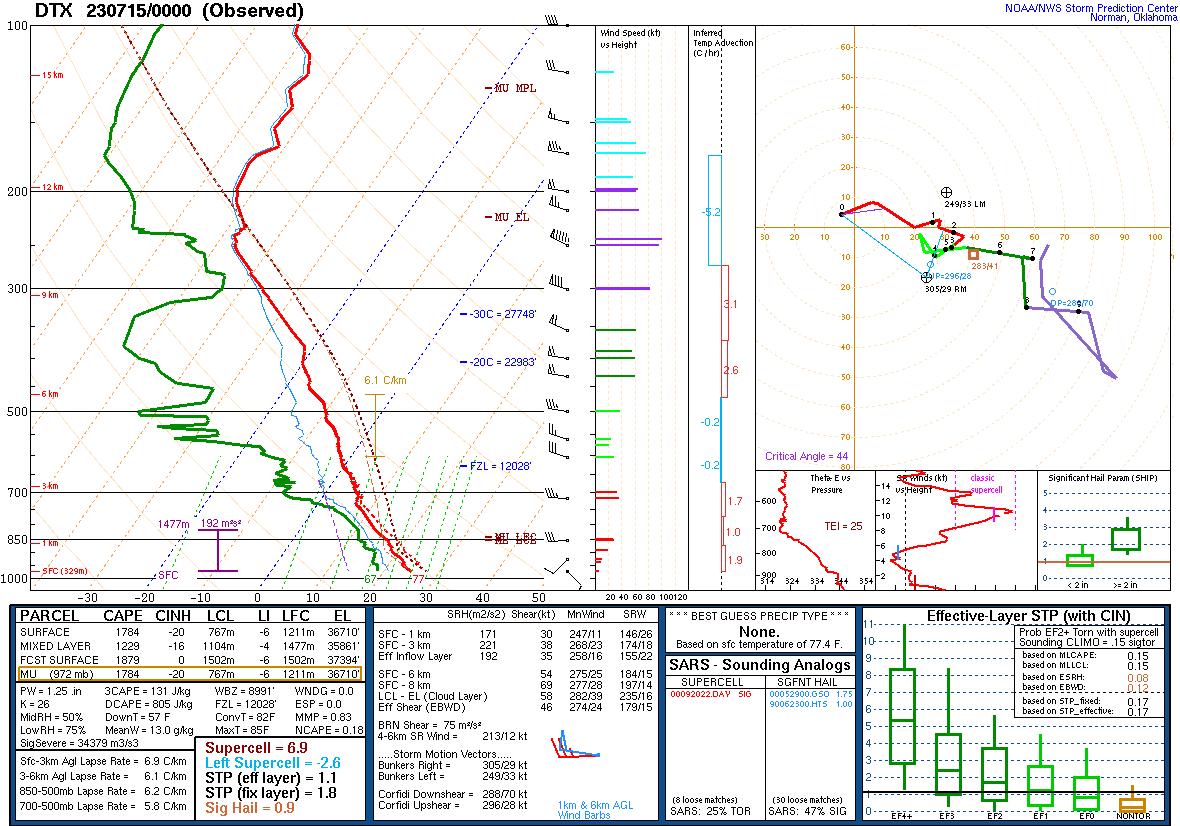
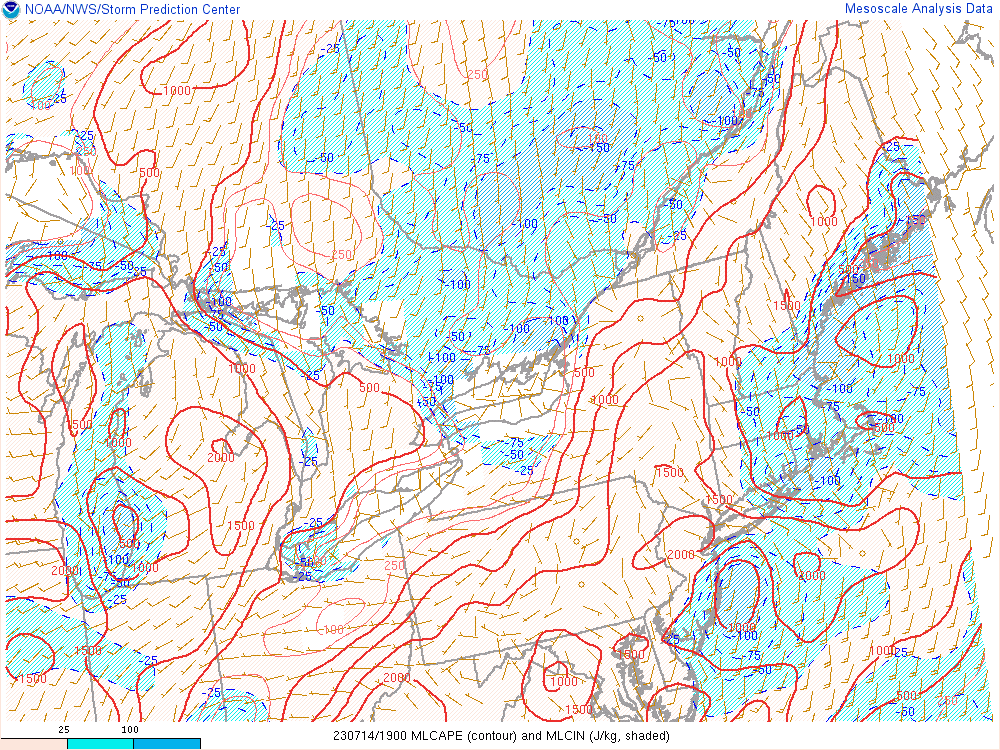
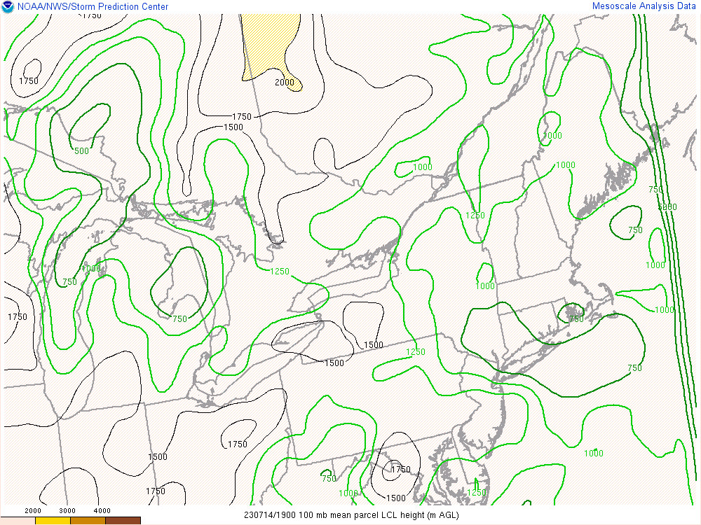
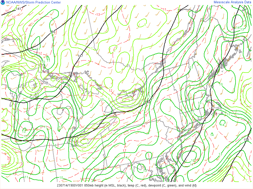
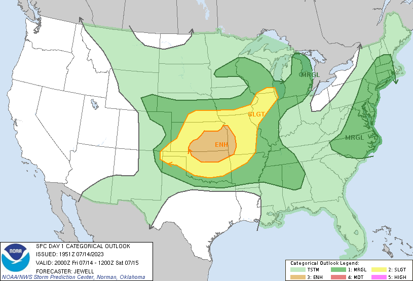
The pre-storm environment was characterized by increasing mid-level moisture along a 850-700mb theta-a gradient that drove early day elevated showers and storms across Mid-Michigan into Saginaw Bay. A weak mid-level disturbance at the nose of a 500mb jet streak brought increasing southwesterly surface wind that advected in higher surface dew points that increased to the upper 60s by the afternoon. The surface analysis (Figures 1 and 2) revealed a diffuse pressure pattern with no notable frontal forcing in the area. With the increasing moisture came increasing instability from west to east, with MLCAPE (Figure 5) building to over 1500 J/kg. Storms were able to initiate along this moisture/instability gradient with the help of a subtle surface trough providing convergence. Bulk 0-6km and effective wind shear (Figure 6) increased to 35-40 kt which was sufficient for strong multicell clusters and supercell storm modes through the event. The early afternoon supercell that tracked across Tuscola and Sanilac Counties encountered an environment marked by locally lower LCL heights (Figure 7) and stronger upper divergence (Figure 9) on the left exit region of the upper jet. This allowed the storm to strenghten to severe levels and it subsequently produced large, wind-driven hail across interior Sanilac County before it produced an EF0 near Applegate which tracked southeast toward Lexington before exiting over Lake Huron. Other supercells formed over Lapeer, Oakland, Livingston, and Washtenaw Counties. These supercells produced damaging wind gusts as they tracked across the area as well as hail up to golf ball size hail in Lapeer and Monroe Counties. The environment remained humid and unstable through the evening which allowed additional scattered storms to form across the southern forecast area. Areas around Adrian saw isolated downburst wind damage due to one of these storms.
 |
 |
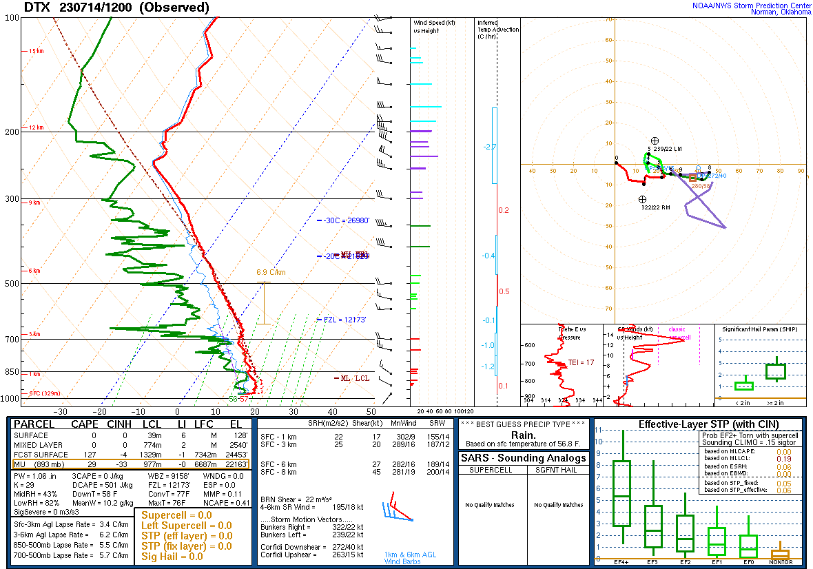 |
| Figure 1: WPC Surface Analysis, valid 1800 UTC 14 Jul 2023 | Figure 2: WPC Surface Analysis, valid 0000 UTC 15 Jul 2023 | Figure 3: DTX Sounding, valid 1200 UTC 14 Jul 2023 |
 |
 |
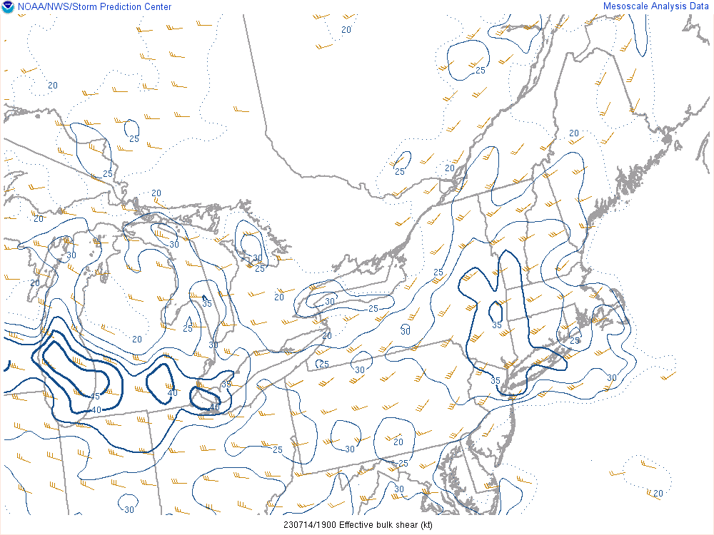 |
| Figure 4: DTX Sounding, valid 0000 UTC 15 Jul 2023 | Figure 5: Mixed-Layer CAPE, valid 1900 UTC 14 Jul 2023 | Figure 6: Effective Wind Shear, valid 1900 UTC 14 Jul 2023 |
 |
 |
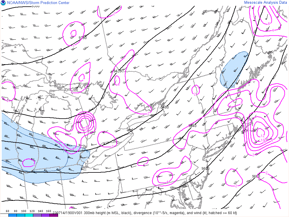 |
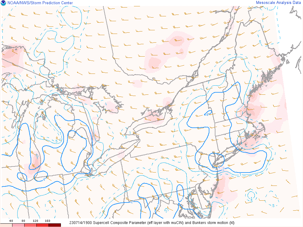
| Figure 7: Lifted Condensation Levels, valid 1900 UTC 14 Jul 2023 | Figure 8: Supercell Composite Parameter, valid 1900 UTC 14 Jul 2023 | Figure 9: 300mb Analysis, valid 1900 UTC 14 Jul 2023 |
 |
 |
|
| Figure 10: 850mb Analysis, valid 1900 UTC 14 Jul 2023 | Figure 11: SPC Day 1 Severe Weather Outlook, valid 2000 UTC 14 Jul 2023 |
 |
Media use of NWS Web News Stories is encouraged! Please acknowledge the NWS as the source of any news information accessed from this site. |
|