Overview
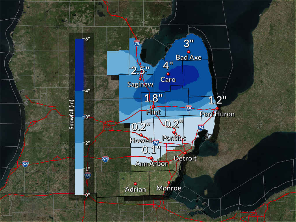
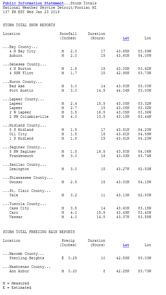
A Winter Weather Advisory was issued for all of southeast Michigan January 22nd and 23rd, 2019 for a mixed precipitation event. A low pressure system lifted northeastward across southern Michigan bringing a combination of snow, sleet, and freezing rain to the region. Precipitation began late Tuesday afternoon as mainly snow to the north of M59 and freezing rain to the south which continued into Tuesday night before warm air lifting northward with the system allowed for a changeover to all rain. The warm air took longer to reach locations north of M59 resulting in a few inches of snow accumulating before the changeover to rain occurred. Most locations south of M59 saw a coating of ice build up on roads and surfaces before temperatures warmed to above freezing after midnight. Rain came to an end Wednesday morning with temperatures rising to near 40F through the rest of the day. Overall, this advisory brought up to 4 inches of snow across portions of the Thumb, with lesser amounts combined with freezing rain and sleet elsewhere over a 14 to 17 hour period.
Snowfall Totals
This is a preliminary snowfall map and will be updated as needed with any additional measurements that get reported.
 |
Radar
|
|
|
Radar loop from late Tuesday afternoon through Wednesday morning (Loop courtesy of Iowa Environmental Mesonet) |
Storm Reports
Storm reports will be updated as new reports come in on Sunday morning.

 |
Media use of NWS Web News Stories is encouraged! Please acknowledge the NWS as the source of any news information accessed from this site. |
 |