February 20 - 21, 2014
Snow, Rain, and Wind Event
| Overview | Radar | Peak Wind Gusts | WWA Map | SPC Products | Additional Resources |
A powerful low pressure system developed and moved up from the southern plains and up through the Great Lakes region Thursday (Feb 20) and Friday (Feb 21). This strong system brought thunderstorms, tornadoes, hail, snow, winds, and dense fog to many parts of the Midwest. Southeast Michigan saw a transition in precipitation types throughout the day on Thursday, followed by advisory criteria wind gusts on Friday. Heavy snow moved across the area early Thursday bringing a quick 1-2 inches of snow across southern parts of the county warning area (CWA). Thundersnow was also reported in some of the more intense snowfall. As warm air began filtering into the area ahead of an approaching cold front; snow changed over to all rain resulting in some areas receiving over an inch of rain. As the low pressure system moved off to the northeast, winds behind the departing system steadily increased with winds peaking during the day on Friday. Wind gusts up to 50 mph were reported across the area.
Back to top
|
|
 |
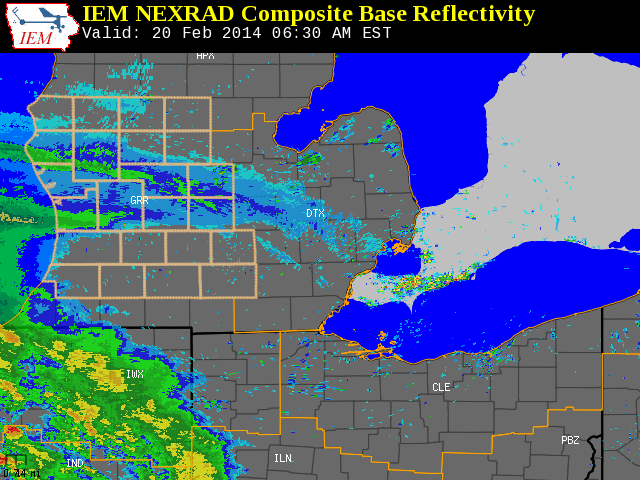
| Radar loop courtesy of Iowa Environmental Mesonet (IEM). |
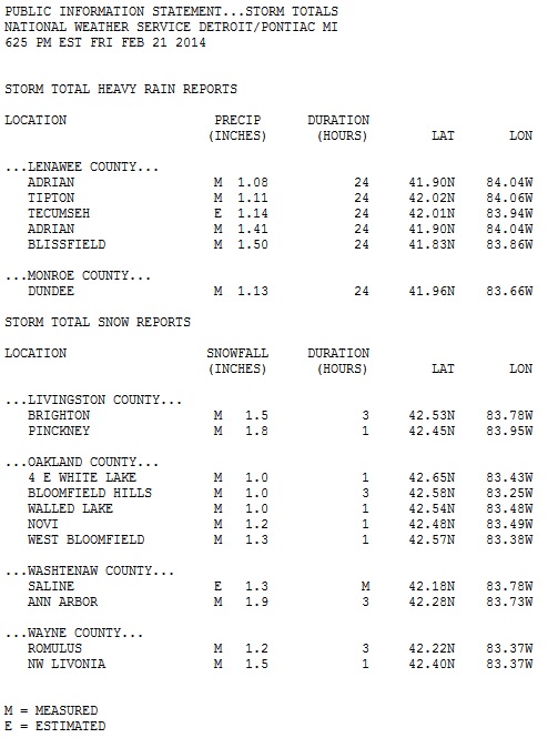
Note: LSRs are from Thursday, February 20 through Friday, February 21.
Back to top
Peak Wind Gusts (February 21, 2014)
Back to top
Watch, Warning, and Advisory Map (WWA) (Click on thumbnail for bigger image)
 |
| Image above depicts the watches, warnings, and advisories that were in effect on February 20, 2014 (5:17PM EST). Notice the blizzard and winter storm warnings across Minnesota and Wisconsin, the tornado and severe thunderstorm watches and warnings extending from Illinois down through the Mississippi River Valley, to the widespread area of wind advisories. |
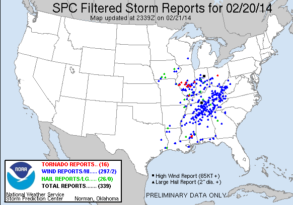
Storm Prediction Center (SPC) Products (More details can be found by clicking on the images)
Summaries from other NWS offices:


