| Overview | Radar | SPC Products |
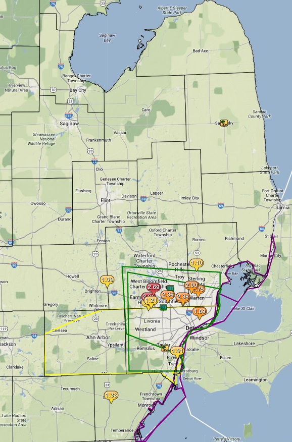
A surface cold front moved through the area on Friday, bringing areas of thunderstorms to parts of southeast Michigan. Main threats associated with the storms were heavy rains and winds; with some locations receiving over 2 inches of rain. This resulted in areas of flooding, along with downed trees and power lines. Storms started to develop across the Saginaw Valley late Friday afternoon ahead of the front. As the cold front slowly shifted southeast, more storms developed across extreme parts of southeast Michigan, including metro Detroit.
Back to top
Radar loop courtesy of Iowa Environmental Mesonet (IEM)
|
|||
|
|
|
|
|
|
|
|
|
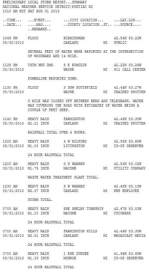
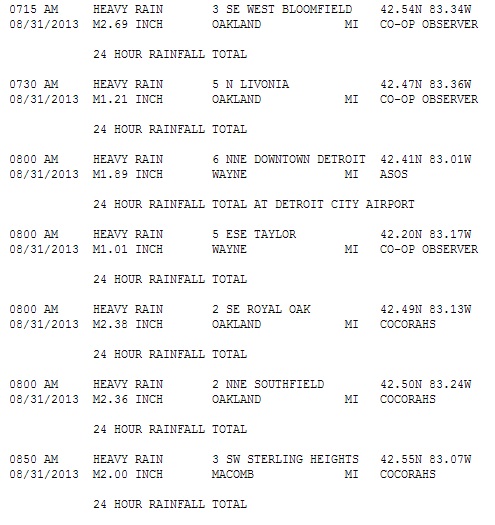
More local storm report details can be found here or by clicking on the above image. |
Back to top
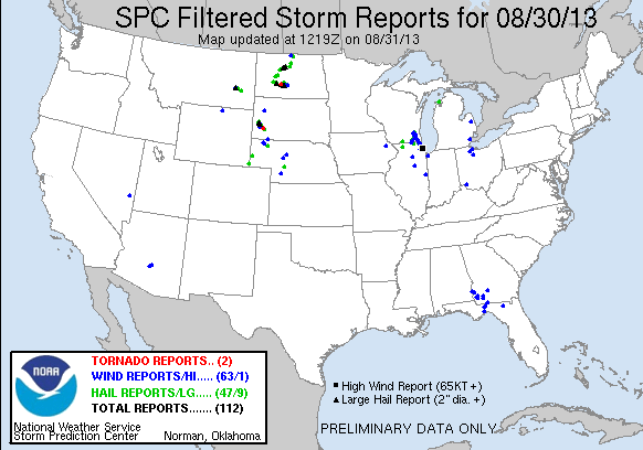
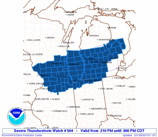
SPC Products (More details can be found by clicking on the images)
Storm Prediction Center (SPC) products include watches that were issued and mesoscale discussions (MCDs).
 |
 |
 |