| Overview | Radar | Photos |
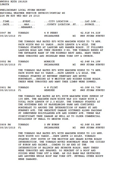
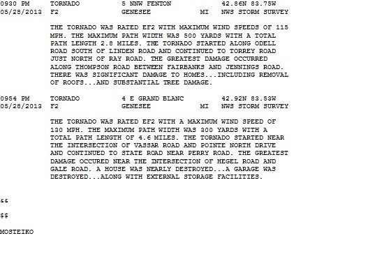
Several thunderstorms Tuesday afternoon and evening spawned six tornadoes during the evening hours between 8:30 to 10:30 pm. Peak daytime heating led to a high amount of instability and a nearby warm front aided in storm development and wind shear. Strong storms occurring north of I-94 and along and south of I-69 produced several tornadoes and widespread wind damage. There were several reports of downed or uprooted trees and significant damage to homes and local businesses. The National Weather Service sent 3 Survey Teams out to assess the tornado damage and assign EF Ratings.
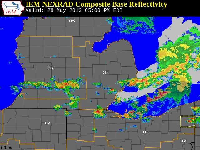
Radar loop courtesy of Iowa Environmental Mesonet (IEM)
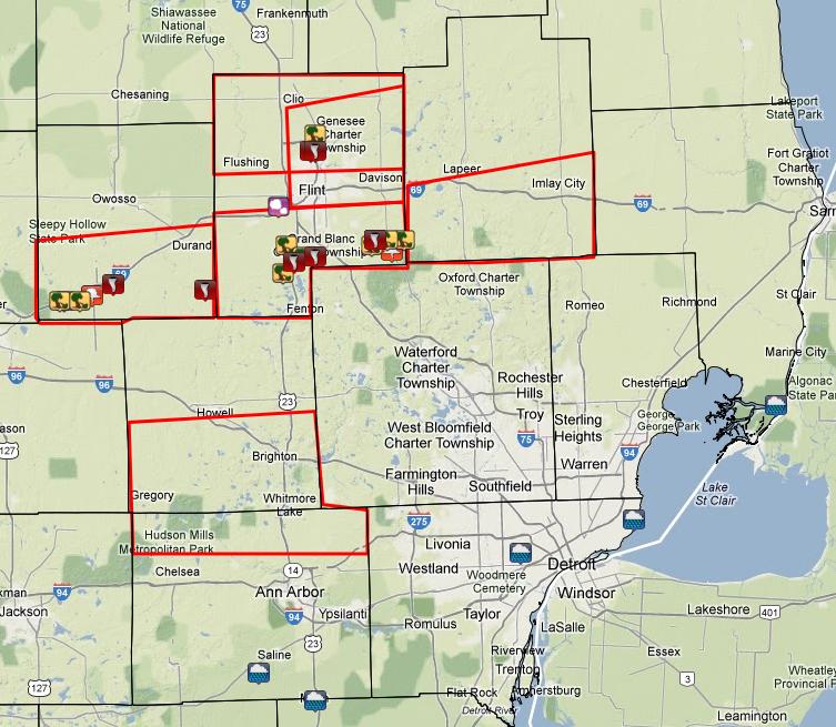
Red Boxes are tornado warnings and local storm reports are plotted on the image above.
 |
|
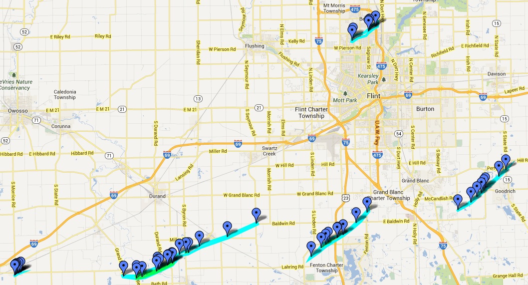
Above image displays the May 28, 2013 tornado damage tracks. Interactive Google map, including points, can be found by either clicking on the image or here. |
Photos (Additional photos can be found by clicking on the interactive damage survey map above or here)
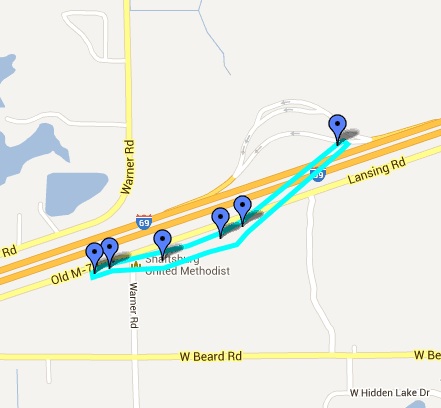
| Perry EF0 Tornado |
 |
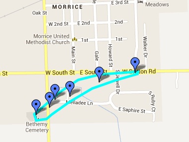
| Morrice EF0 Tornado |
 |
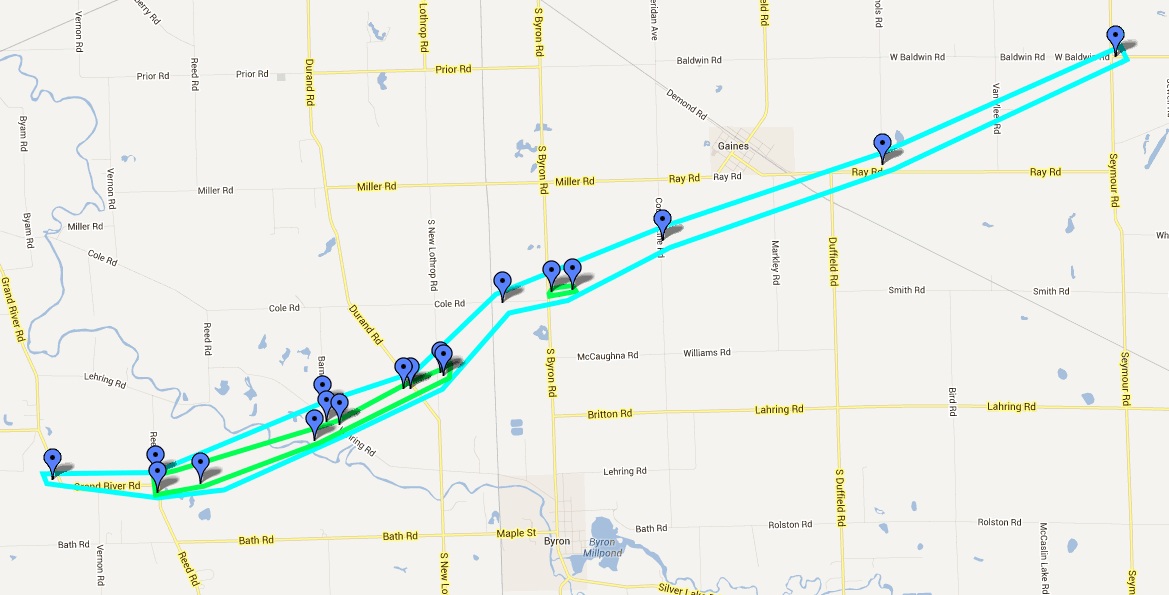
| Byron EF1 Tornado |
 |
 |
|
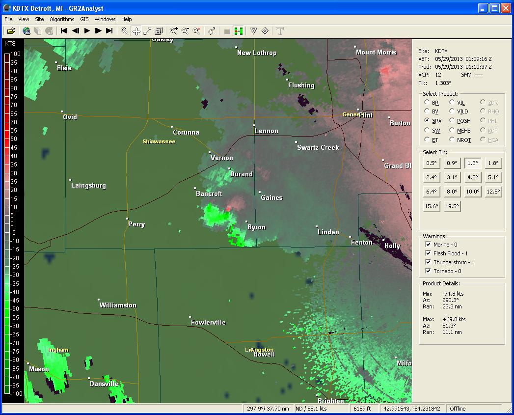
Velocity data showing circulation to the northwest of Byron around 9:10pm. (Green= winds going towards the radar; Red= winds going away from the radar) |
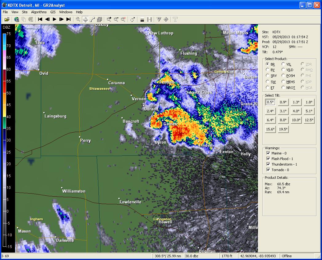 |
| Reflectivity data showing storm to the north of Byron around 9:18pm. |
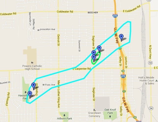
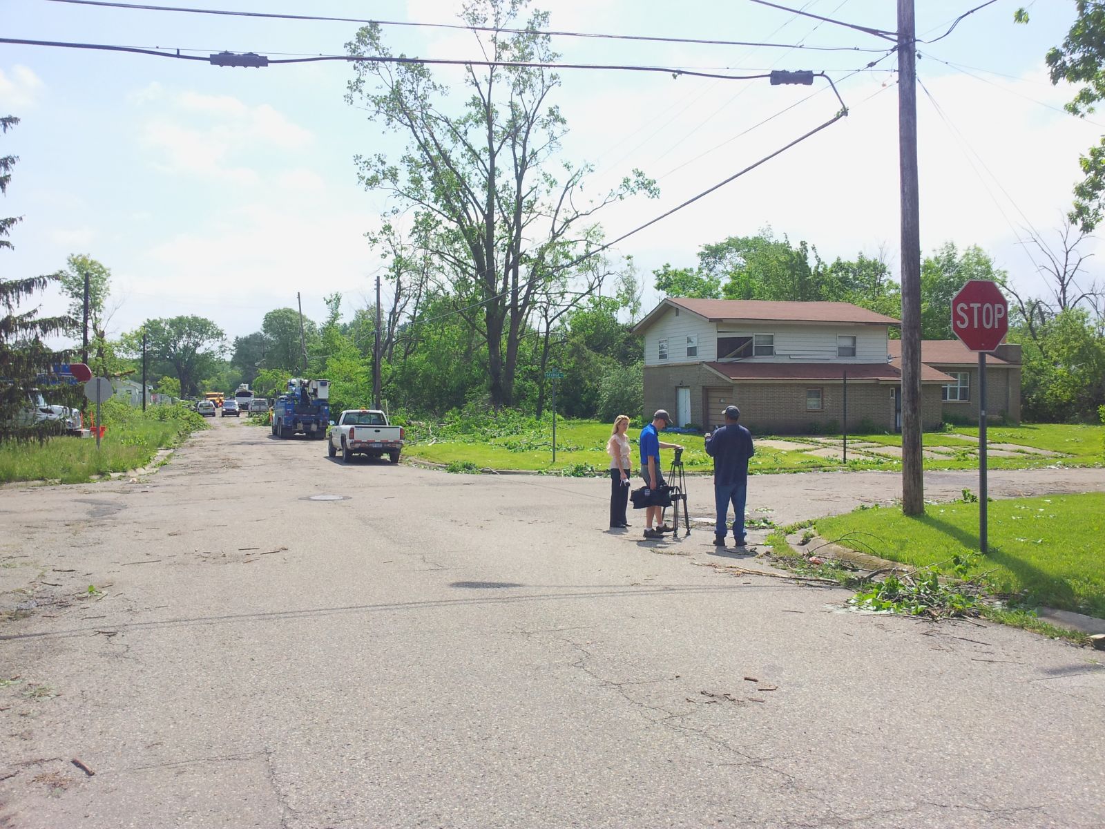
| Beecher EF1 Tornado |
 |
|
|
|
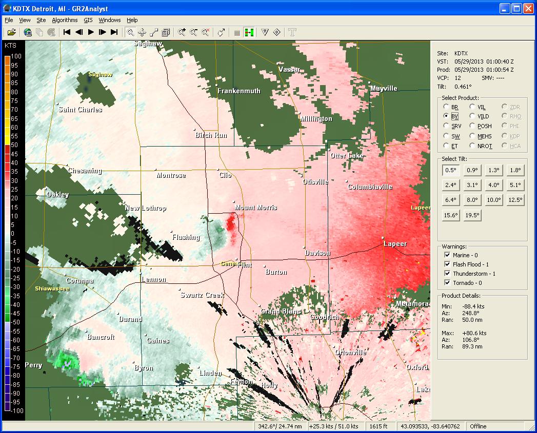
Velocity data showing circulation to the southwest of Mt. Morris around 9:01pm. (Green= winds going towards the radar; Red= winds going away from the radar) |
| (Click on thumbnail for bigger image) | |
 |
|
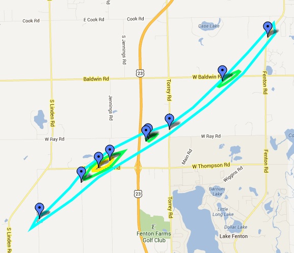
| Fenton EF2 Tornado |
 |
| (Click on thumbnail for bigger image) | |
|
|
|
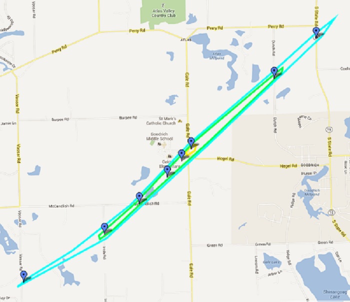
| Goodrich EF2 Tornado |
 |
 |
| (Click on thumbnail for bigger image) |