Will the Wet Conditions of June and Early July Persist Right Through the End of August?
Summer 2008 Outlook UPDATE For Southeast Lower Michigan
By: Bill Deedler, Weather Historian National Weather Service - White Lake Mi
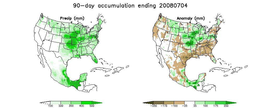
The early part of the summer has certainly had its share of rainfall and severe weather resulting from numerous outbreaks of thuderstorms. Almost all of Southeast Lower Michigan has received above to well above normal rainfall into early July as a result of this activity. While the increase in severe weather was expected this summer:
Severe Weather:
It is expected that the severe weather pattern is shifting north and thus, so will the risk of more storm activity this summer. Just because the season has been fairly quiet doesn’t mean it will remain that way.
The widespread heavy rain was not:
Rainfall:
Overall rainfall will average below normal (with some local amounts near normal) in the summer convective rains. General consensus leans toward a drier than normal summer (particularly if the expected upper ridge develops during the summer).
Therefore, we’ll update the summer outlook in regards to the precipitation. Plain and simple, the convergence zone expected over the Great Lakes stated in the earlier outlook to bring in the severe weather, has also brought in more widespread heavy rains than forecast through early July. Therefore, it seems logical to jack up the summer precipitation forecast to vary from near normal to above. If the strong jet and convergence pattern holds up the remainder of the summer (it is expected to weaken with time), most areas will see above normal rain.
While on the subject of rainfall, let’s revisit the Summer Analogue Precipitation Chart
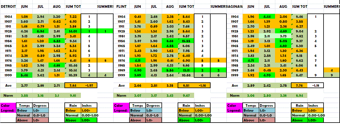
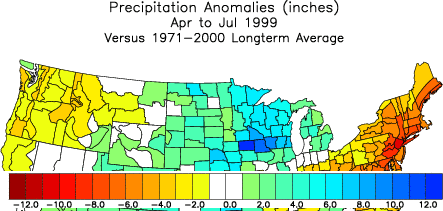
As you can see by the analogue years, many summers indeed contained dry to normal conditions as a dominate precipitation feature. Only a couple of years came in wet at Detroit and Flint (and even those were in different years) but as of early July, our best analogue year is 1999. Check out all the extremely heavy rainfall that fell over the Upper Midwest also that year. The patterns are very similar across the Upper Midwest and Great Lakes. The main difference between the two years lies further south where the heavier rains extend down into the Lower Midwest and Upper Ohio Valley.
Early April – Early July 2008
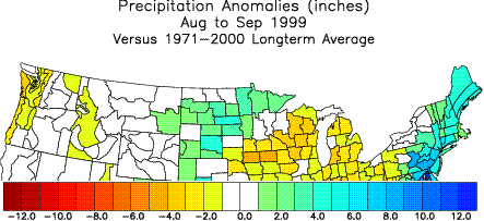
What happened the rest of the summer into fall (Aug-Sep) in 1999? The pattern then is like the one still expected with the rains letting up some. Even though no two years are ever exactly alike, let’s hope history repeats itself at least for the folks in the drenched Midwest to give them some relief.
Since summer rain amounts are so variable in the first place (because of their convective nature), it is one of the most difficult to forecast on a broad scale (not to mention out for three months). And strictly speaking, many summers go by with rainfall totals ranging from below normal to above (or even well above) because of just one or two storms that were big dumpers.
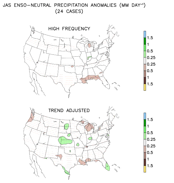
In addition, on a larger scale, summertime rainfall patterns exhibited during El Nino’s, La Nina’s and Neutral Phases vary somewhat. It is likely that the weak Neutral Phase downwind effects have already started across the Midwest and Great Lakes. Check out the above normal rainfall areas concentrated over the Midwest and pockets over the Ohio Valley in these trend adjusted 25 events for Neutral Summers.
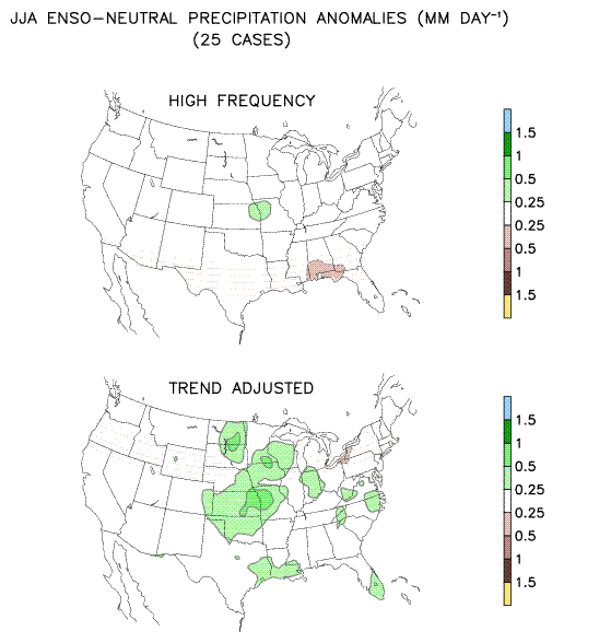
Looking out later this summer and early autumn reflects (trend adjusted, again) somewhat drier (normal or below) conditions over much of the same region (especially if the upper ridge builds over the eastern half of the country). This too gives some support to a drier scenario later this summer mentioned in our Summer Outlook and the “1999 scenario” just mentioned.