Overview
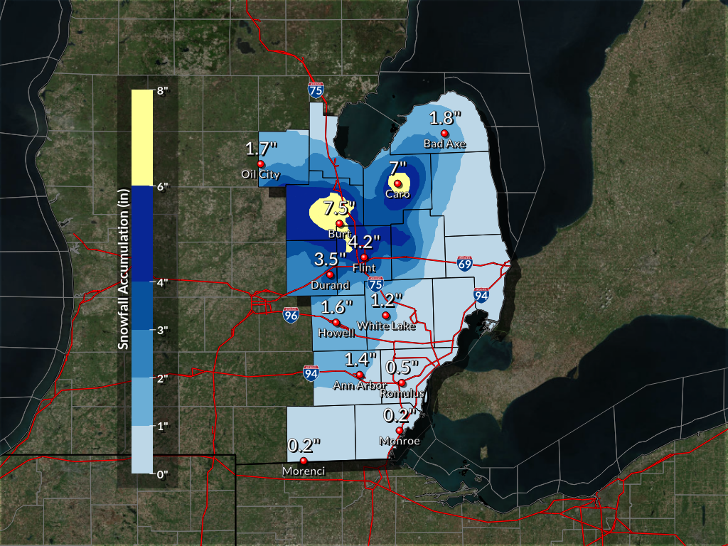
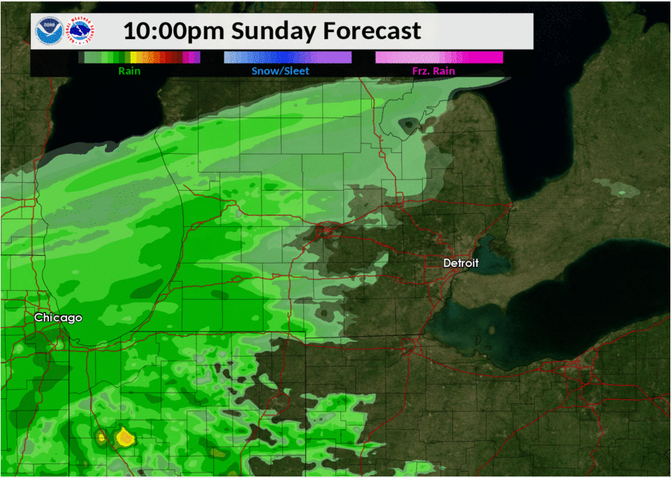
A low pressure system moved up across the southern Great Lakes region Sunday night and into Monday. This system had substantial impacts across the central Plains as it dumped more than a foot of snow in places across Iowa and Illinois. This system also brought blizzard conditions to these areas as well. The system weakened as it moved over Michigan, but not before bringing snow and rain with some areas in Southeast Michigan seeing around 7 inches of snow. Snowfall diminished by the mid afternoon on Monday. While some locations measured around 7 inches, locations in Sanilac, St. Clair, and Macomb only saw a trace of snow or no snow at all.
Flint did break their daily snowfall record for November 26th with 4.2 inches! This breaks the previous record of 3.6 inches set back in 1972.
Snowfall Totals
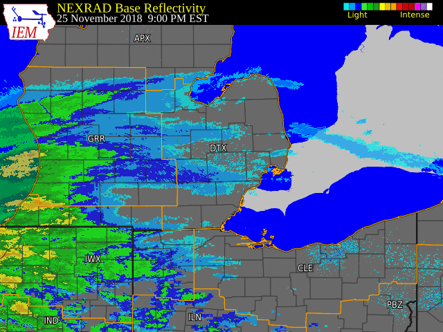
Radar:
 |
 |
|
Radar loop from Sunday night into Monday. (Loop courtesy of Iowa Environmental Mesonet) |
Radar loop from Sunday night into Monday showing the transition from rain to snow. |
Storm Reports
Local Storm Reports can also be seen on the Iowa Environmental Mesonet page here.
Public Information Statement...Storm Totals
National Weather Service Detroit/Pontiac MI
542 PM EST Mon Nov 26 2018


STORM TOTAL SNOW REPORTS

Location                  Snowfall     Duration
                          (Inches)      (Hours)        Lat       Lon

...Bay County...
   Auburn                  E   2.5            6     43.60N    84.08W

...Genesee County...
   2 SE Grand Blanc        M   2.1           12     42.91N    83.59W
   Flint                   M   4.2           12     43.02N    83.69W
   Flushing                M   6.0           12     43.06N    83.84W

...Huron County...
   5 NNW Filion            M   1.4            7     43.96N    83.04W
   Bad Axe                 M   1.8            9     43.80N    83.00W

...Lapeer County...
   Lapeer                  M   2.0            8     43.05N    83.32W
   Columbiaville           M   3.0            4     43.16N    83.41W
   2 NW Columbiaville      M   5.0            8     43.18N    83.44W

...Lenawee County...
   Morenci                 M   0.2            1     41.72N    84.22W

...Livingston County...
   Howell                  M   1.6            6     42.61N    83.94W

...Midland County...
   Oil City                E   1.7          6.5     43.61N    84.59W
   1 S Midland             M   2.0            7     43.61N    84.23W

...Monroe County...
   Monroe                  M   0.2            2     41.92N    83.39W

...Oakland County...
   4 E White Lake          M   1.2           12     42.65N    83.43W
   Holly                   M   3.5           12     42.80N    83.62W

...Saginaw County...
   Oakley                  M   4.5           13     43.14N    84.17W
   Birch Run               M   5.0           12     43.25N    83.79W
   3 NW Saginaw            M   6.0           16     43.45N    83.99W
   Bridgeport              M   6.0           12     43.38N    83.88W
   Burt                    M   7.5           14     43.24N    83.91W

...Shiawassee County...
   Durand                  M   1.7            4     42.91N    83.99W
   Corunna                 M   2.4            3     42.98N    84.12W
   6 WNW Durand            M   3.5            7     42.95N    84.10W
   New Lothrop             M   4.8           13     43.12N    83.97W

...Tuscola County...
   Vassar                  M   3.5            7     43.37N    83.58W
   Caro                    M   7.0           10     43.49N    83.40W

...Washtenaw County...
   3 SE Ann Arbor          M   1.0           12     42.24N    83.69W
   4 ENE Ann Arbor         M   1.4           12     42.30N    83.66W

...Wayne County...
   Romulus                 M   0.5            6     42.22N    83.37W


M = Measured
E = Estimated
 |
Media use of NWS Web News Stories is encouraged! Please acknowledge the NWS as the source of any news information accessed from this site. |
|

