Detroit/Pontiac, MI
Weather Forecast Office
Overview
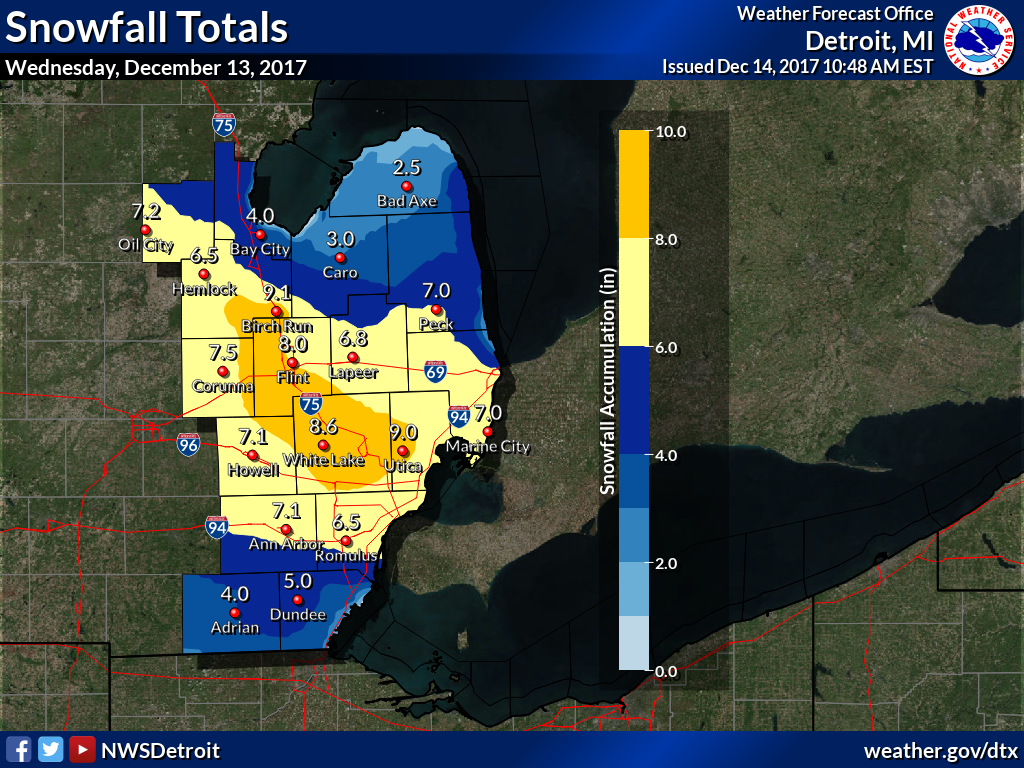
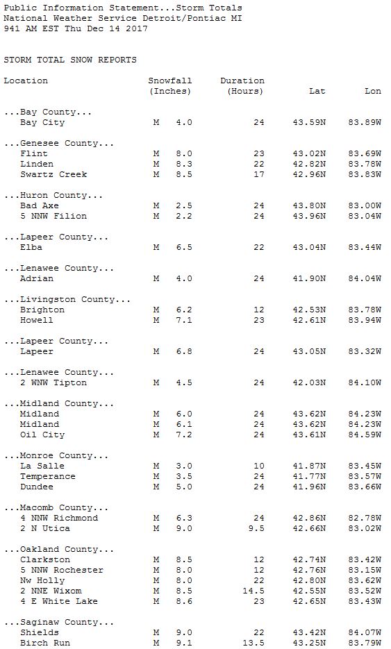
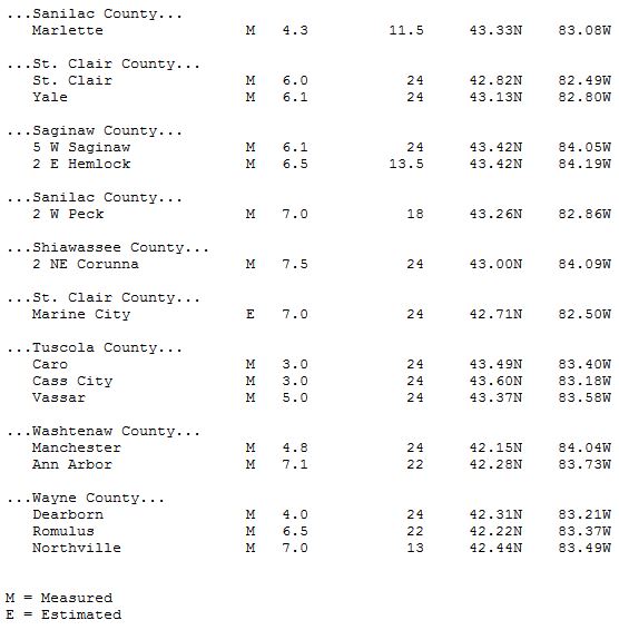
A strong clipper system moved southeast across the Great Lakes region on Wednesday, bringing upwards of 9 inches to some locations. Snowfall totals ranged between 3 and just over 9 inches across portions of Southeast Michigan. A winter storm warning went into effect at 10 AM Wednesday morning and lasted through midnight. Travel was significantly impacted as the heaviest snows fell during the evening rush hour.
Snowfall Map
|
|
|
Total amount of snow that fell across Southeast Michigan on Wednesday, December 13th. |
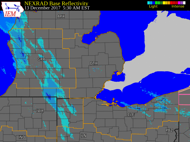
Radar:
 |
 |
|
| Radar loop courtesy of Iowa Environmental Mesonet |
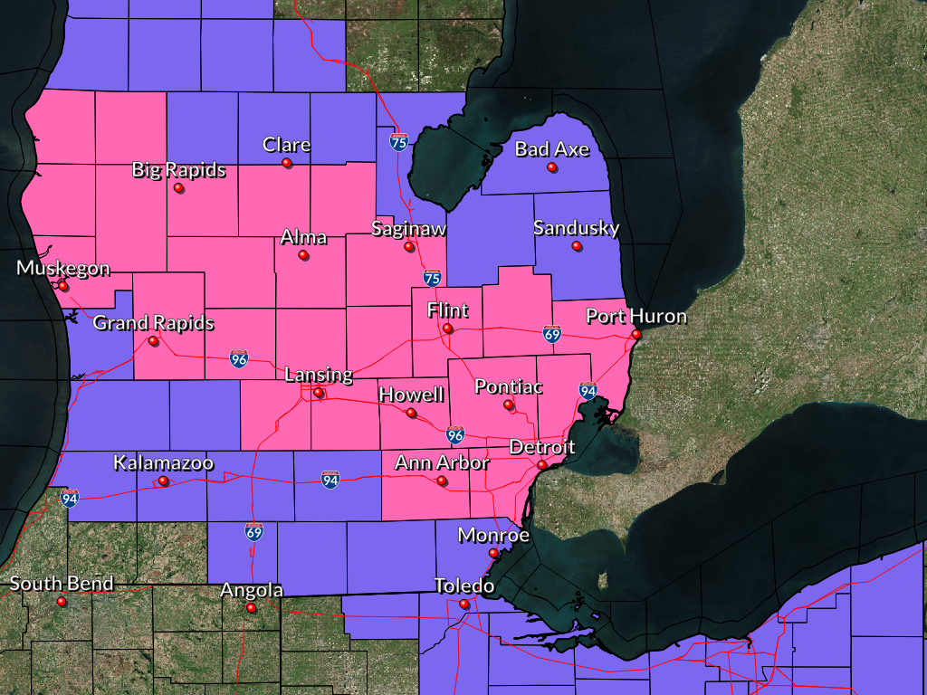
Map depicting the watches and warnings that were in effect on Wednesday, December 13th. |
Storm Reports
 |
Media use of NWS Web News Stories is encouraged! Please acknowledge the NWS as the source of any news information accessed from this site. |
|
Weather Forecasts
Fire Weather
Snowfall Forecast
Marine Forecast
Beach Forecast
Aviation
Digital Forecast Graphics
Current Weather Conditions
Local Observations
Today's Weather History
Observed Snowfall
Regional Radar Mosaic
Past Weather Records
Climate records by month
Additional Daily Climate Data
Top 20 Lists
Breakdown by Decade
Largest Snowstorms
Season Snowfall Maps
Year To Date Plots
Severe Weather
Daily Plots
Annual Plots
Event Summaries
US Dept of Commerce
National Oceanic and Atmospheric Administration
National Weather Service
Detroit/Pontiac, MI
9200 White Lake Road
White Lake, MI 48386
248-620-9804
Comments? Questions? Please Contact Us.