Detroit/Pontiac, MI
Weather Forecast Office
Overview
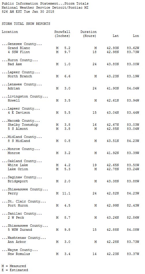
A low pressure system moving across the region on Monday, January 29th, brought heavy snow to parts of Southeast Michigan. The snow began around midnight and lasted through most of the day. Frontogenetic forcing led to a heavy snow band along the I-69 corridor from Lansing up through Flint. These areas received upwards of 8 inches, with a report coming out of the Lansing area of 11 inches! This snow made the morning commute challenging, with impacts lasting into the evening commute.Snowfall Map
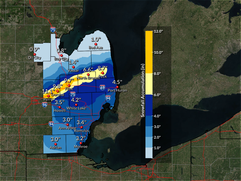 |
| Monday, January 29, 2018 Total Snowfall Amounts |
Radar:
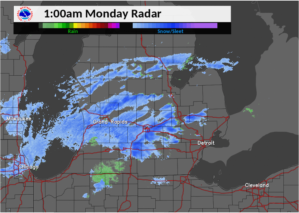
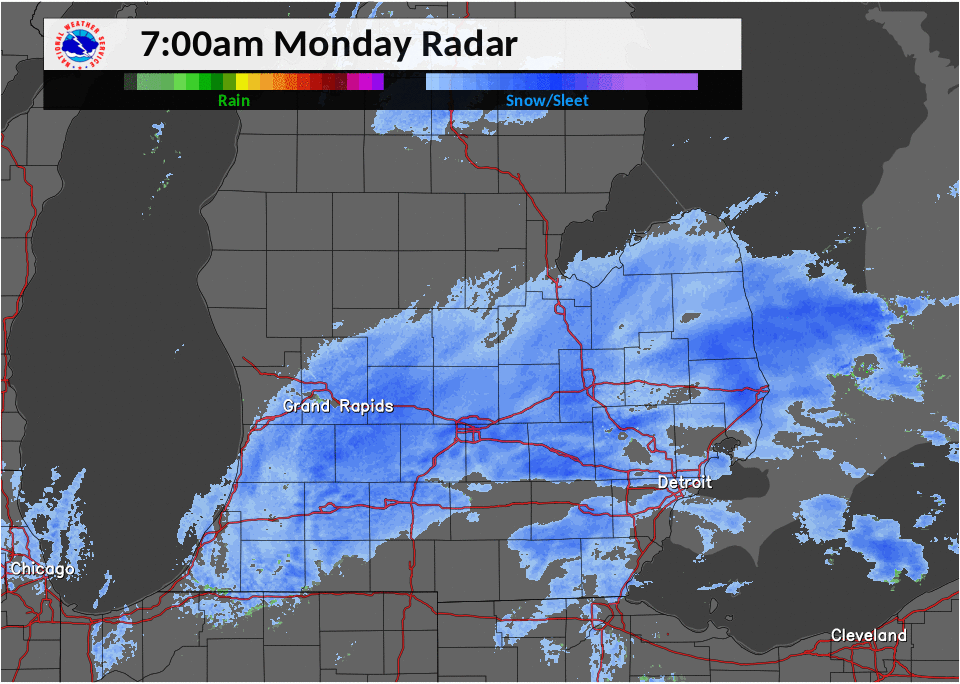
Monday's radar loop starting at 1 AM and lasting through 7 PM:
 |
 |
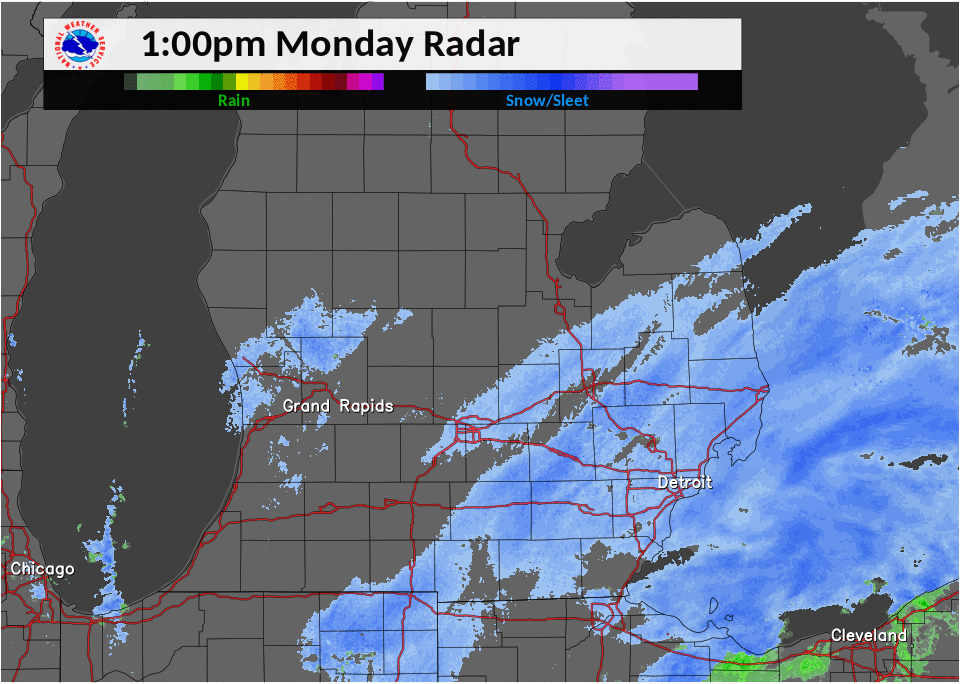 |
| 1 AM - 7 AM Radar Loop | 7 AM - 1 PM Radar Loop | 1 PM - 7 PM Radar Loop |
Storm Reports
All storm reports from the event can be found on the Iowa Environmental Mesonet (IEM) here.
 |
Media use of NWS Web News Stories is encouraged! Please acknowledge the NWS as the source of any news information accessed from this site. |
|
Weather Forecasts
Fire Weather
Snowfall Forecast
Marine Forecast
Beach Forecast
Aviation
Digital Forecast Graphics
Current Weather Conditions
Local Observations
Today's Weather History
Observed Snowfall
Regional Radar Mosaic
Past Weather Records
Climate records by month
Additional Daily Climate Data
Top 20 Lists
Breakdown by Decade
Largest Snowstorms
Season Snowfall Maps
Year To Date Plots
Severe Weather
Daily Plots
Annual Plots
Event Summaries
US Dept of Commerce
National Oceanic and Atmospheric Administration
National Weather Service
Detroit/Pontiac, MI
9200 White Lake Road
White Lake, MI 48386
248-620-9804
Comments? Questions? Please Contact Us.

