Flash flooding threatens areas from the Tennessee Valley to the Carolinas as storms repeat along a stalled front. Monsoonal storms may trigger flooding in the Southwest. Dangerous heat expands across the Desert Southwest, Plains, mid-Mississippi Valley and Southern Tier. Critical fire weather for interior Pacific Northwest. Cooler, drier air brings brief relief to the Great Lakes and Northeast. Read More >
November 11-12 Accumulating Snow, Lake Effect Snow, and Record-Breaking Cold
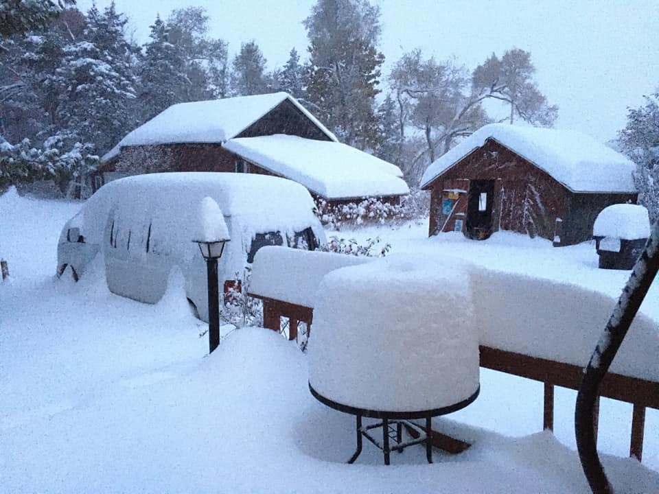 |
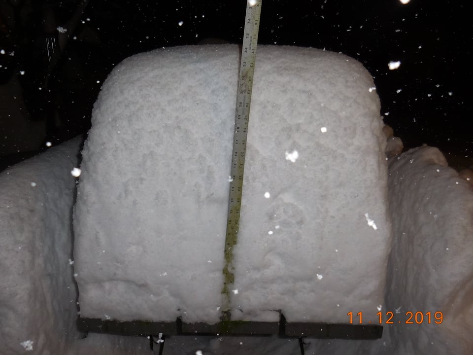
| Heavy snow that fell in Grand Junction - Photo courtesy of Clay Greiffendorf |
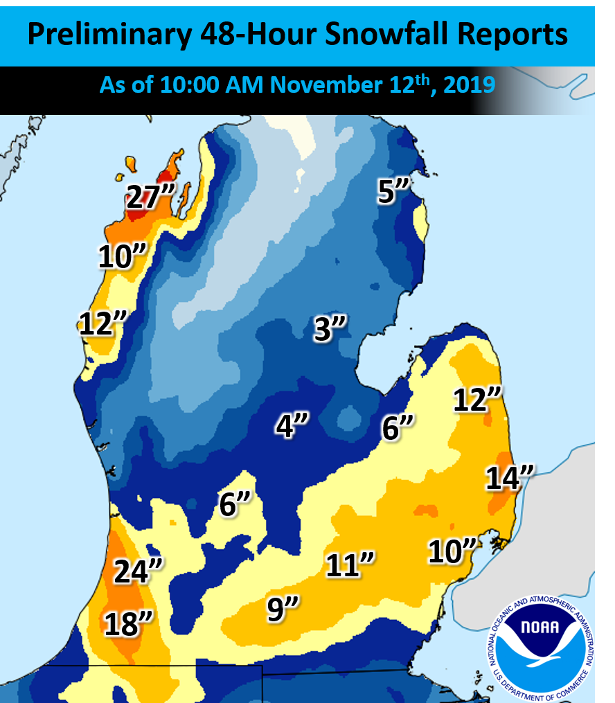
An early season snowstorm and lake effect snow event impacted the western Great Lakes from Monday, November 11th to Tuesday, November 12th. Snow accumulations of 3-8" were common along the I-96 and I-94 corridors with totals measured in feet in the lake effect snow belts. Record-breaking cold temperatures followed on Tuesday enabling wind chills to drop into the single digits. While such snow totals and cold temperatures are not uncommon in Michigan during the winter months, experiencing such conditions in early November is unusual.
Web Stories Created by Neighboring NWS Offices:
Snow:
The heavy snow came in two waves:
During the early morning hours of Monday, 11/11, light snow started falling across Lower Michigan. The snow picked up in intensity during the Monday morning commute leading to slippery conditions and numerous car accidents. Two bands of heavier snow developed in the wide region of snow, the first over I-96 and second over I-94. Snow removal efforts were difficult in the heavier bands as snowfall rates exceed 1 inch per hour. Snow started to taper during the evening hours, with the highest snow totals along I-94 mainly east of Kalamazoo and near Jackson. A daily snowfall record was set in Lansing, Michigan, where 5.6 inches of snow fell (beating the previous record of 2.8 inches set back in 1933).
An intense band of lake effect snow then developed after sunset Monday and lasted into Tuesday morning and blasted parts of the Upper Peninsula, Leelanau Peninsula, and parts of western and southwestern Lower Michigan. As the snow band had connections to Lake Nipigon in Canada and Lake Superior, snowfall rates of 2 inches per were common leading to impressive snow totals in a short period of time. Some locations picked up 12 to 18 inches in just 12 hours! Lake effect snow continued into the daylight hours Tuesday and finally weakened by Tuesday afternoon. Combined 48-hour snowfall totals of 1-2 feet were reported in the hardest-hit areas.
Selected Storm Total Snow Reports

Location                     Amount

Bangor                       24.0 in
Grand Junction               22.0 in
3 SE Glenn                   22.0 in
3 ENE Keeler                 18.3 in
Decatur 7.0 WNW              16.5 in
1 ESE Pulaski                13.4 in
2 SE Scottville              12.0 in
Castle Park                  11.6 in
Hanover 3.8 W                11.0 in
1 NNE Grass Lake             10.0 in
Bloomingdale                  9.8 in
Paw Paw 2.0 NE                9.6 in
Napoleon                      9.0 in
Grass Lake                    9.0 in
Jackson                       8.0 in
Homer                         8.0 in
2 NNE Macatawa                7.7 in
Castle Park                   7.7 in
Grandville 1.3 WSW            7.0 in
Haslett                       7.0 in
2 NE Bath                     7.0 in
Grandville                    6.6 in
Spring Arbor                  6.5 in
Mason 5.8 ENE                 6.5 in
Perrinton                     6.5 in
1 S Hastings                  6.5 in
Wayland 2.0 W                 6.5 in
Plainwell 0.5 WSW             6.4 in
Okemos                        6.0 in
East Grand Rapids 0.7 SSW     5.8 in
1 ENE Rives Junction          5.8 in
NWS Grand Rapids              5.8 in
3 W Portage                   5.7 in
Fenwick 3.3 E                 5.5 in
Grand Rapids 2.5 ENE          5.5 in
4 ENE Ada                     5.5 in
Laingsburg 5.0 SW             5.5 in
Saint Johns                   5.5 in
4 NNE Brownlee Park           5.5 in
Battle Creek                  5.5 in
3 ENE Kentwood                5.4 in
2 W Ada                       5.3 in
1 SSW East Grand Rapids       5.1 in
Saranac 2.6 NE                5.1 in
1 NNE Greenville              5.0 in
Cooper                        5.0 in
Otsego                        5.0 in
Western Michigan University   4.9 in
4 SSE Cannonsburg             4.8 in

Observations are collected from a variety
of sources with varying equipment and
exposures. We thank all volunteer weather
observers for their dedication. Not all
data listed are considered official.
|
|
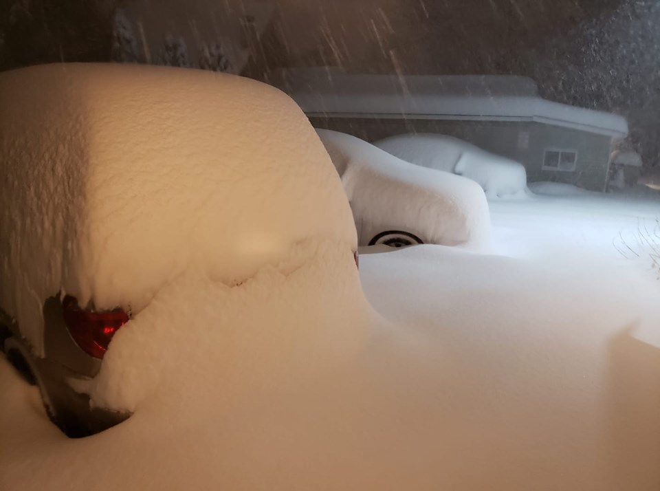
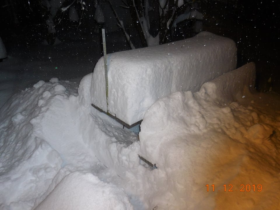
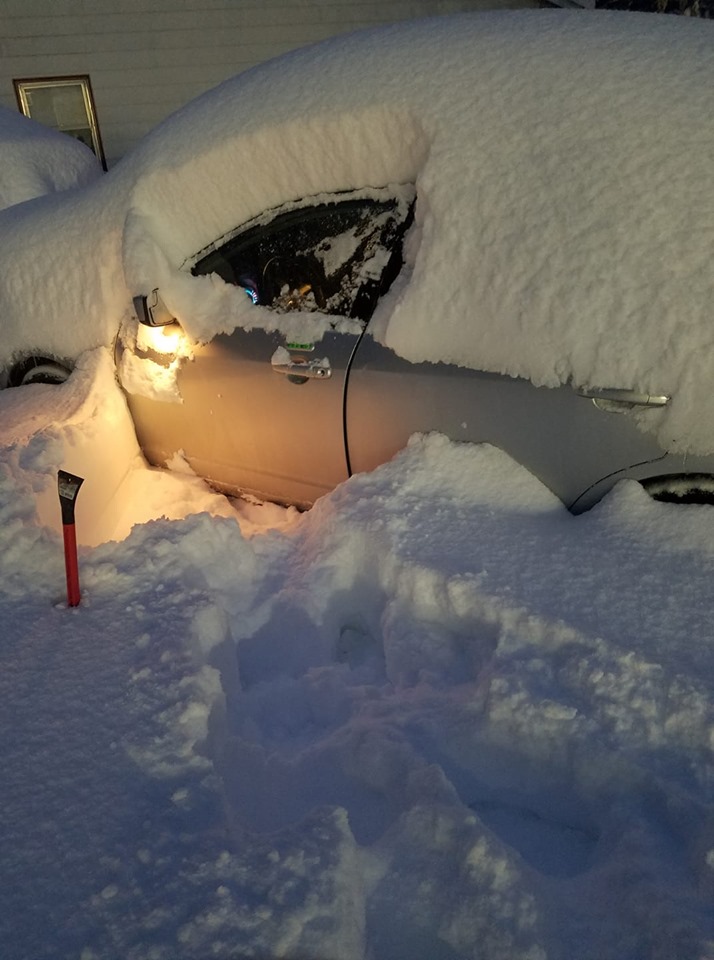
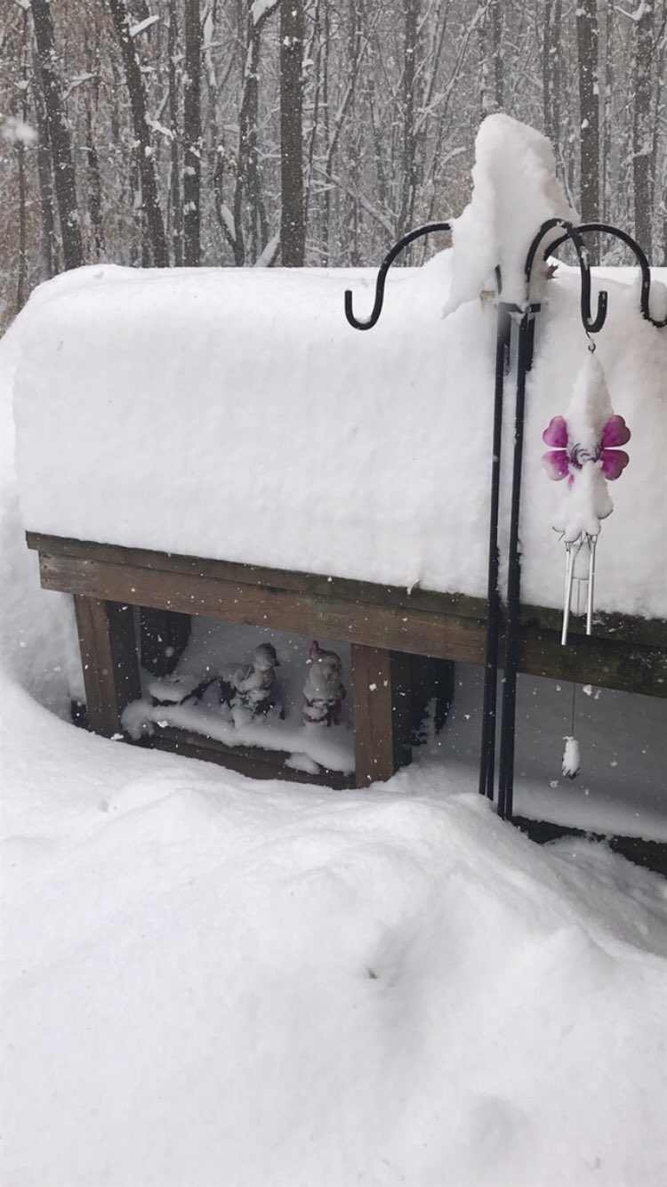
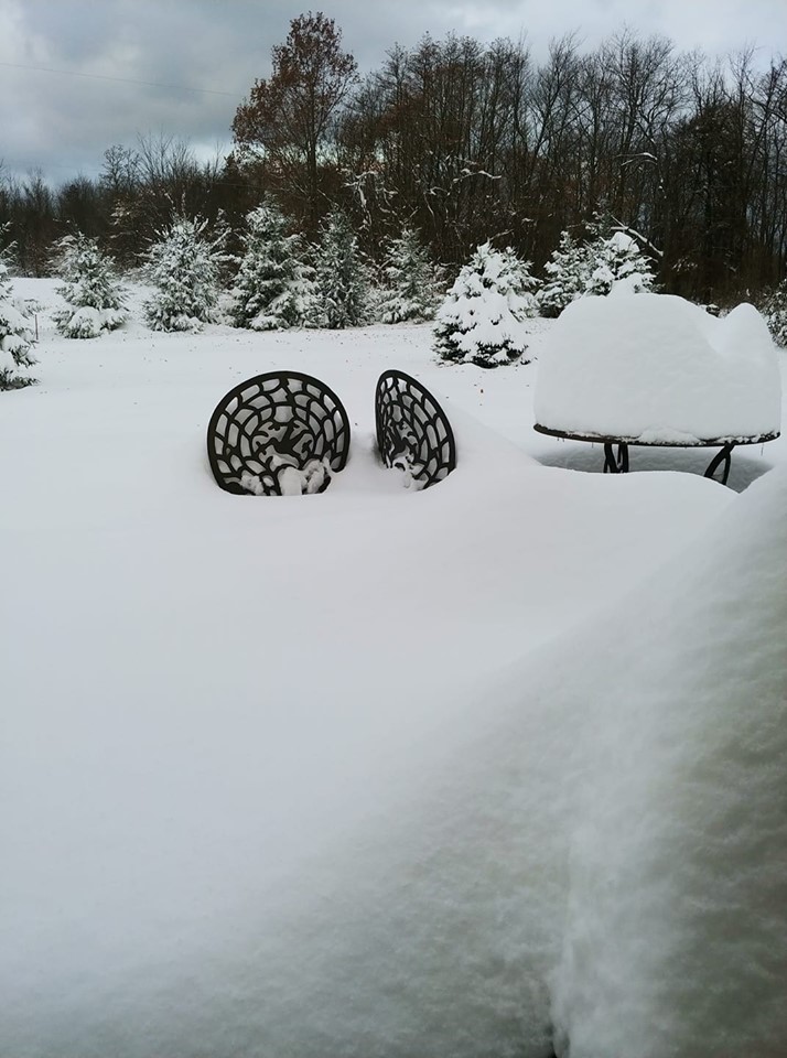
Check out some pictures of the hefty snow accumulations shared to our social media pages:
 |
 |
 |
| Bangor - Shared by Greg Blackwell | Bangor - Shared by Greg Myrkle | Bangor - Shared by Greg Myrkle |
 |
 |
 |
| Bangor - Shared by Stephen Crockett | Grand Junction - Shared by Crystal Gunnett | Saugatuck Area - Shared by Kayla Kristine O'Guin |
Cold:
Temperatures Monday through Wednesday were more akin to January than November, with highs in the 20s and lows in the single digits to teens. High temperatures on Tuesday were the coldest on record in Grand Rapids, Lansing, Muskegon, and Kalamazoo with the low Wednesday morning coldest on record in Kalamazoo (daily records). Check out the low temperatures Wednesday morning, the coldest morning, and broken records below:
Wednesday Morning Low Temperatures

Location                   Temperature

Leota                         -3 F
Grass Lake                    -2 F
1.8 N Sylvester               -1 F
Fulton                         1 F
6.4 S Breckenridge             1 F
Hersey                         2 F
3.3 NE Holt                    2 F
1.3 W Entrican                 3 F
Alma                           3 F
Stanton                        3 F
Okemos                         4 F
Evart                          5 F
Okemos                         5 F
Charlotte Fitch Beach Arpt     5 F
Mason Jewett Arpt              5 F
Ag Mesonet                     6 F
Battle Creek                   6 F
Big Rapids Water Works         6 F
Spring Arbor                   6 F
Saint Louis                    6 F
6.9 S Battle Creek             7 F
Breckenridge                   7 F
Shepherd                       7 F
Mount Pleasant                 7 F
Big Rapids Roben-hood Arpt     7 F
Jackson                        8 F
Haslett                        8 F
0.5 NE Eaton Rapids            8 F
Lawton                         8 F
Battle Creek                   8 F
Lansing                        8 F
Mt Pleasant Muni Arpt          8 F
Ionia County Arpt              8 F
Williamston                    8 F
Marshall Brooks Field          9 F
1.5 SW Kent City               9 F
Waverly                        9 F
Cedar Springs                 10 F
Rockford                      10 F
Lansing                       10 F
Mount Pleasant                10 F
1.6 NE Hartford               10 F
Saranac                       10 F

Observations are collected from a variety
of sources with varying equipment and
exposures. We thank all volunteer weather
observers for their dedication. Not all
data listed are considered official.
|
Broken Temperature Records:
Tuesday, November 12th, 2019
Wednesday, November 13th 2019
|
 |
Media use of NWS Web News Stories is encouraged! Please acknowledge the NWS as the source of any news information accessed from this site. |
|